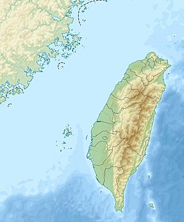
Coordinates: 23°45′33″N120°37′06″E / 23.75911°N 120.618355°E

A geographic coordinate system is a coordinate system that enables every location on Earth to be specified by a set of numbers, letters or symbols. The coordinates are often chosen such that one of the numbers represents a vertical position and two or three of the numbers represent a horizontal position; alternatively, a geographic position may be expressed in a combined three-dimensional Cartesian vector. A common choice of coordinates is latitude, longitude and elevation. To specify a location on a plane requires a map projection.
Contents
- History
- Geography
- Administrative divisions
- Tourist attractions
- Transportation
- References
- External links
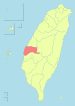
| Linnei Township 林內鄉 | |
|---|---|
| Rural township | |
 | |
 Linnei Township in Yunlin County | |
| Location | Yunlin County, Taiwan |
| Area | |
| • Total | 38 km2 (15 sq mi) |
| Population (July 2018) | |
| • Total | 18,242 |
| • Density | 480/km2 (1,200/sq mi) |
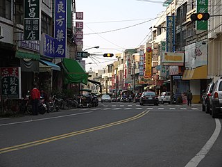
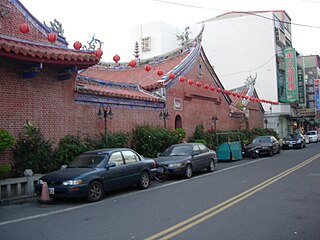
Linnei Township (Chinese :林內鄉; pinyin :Línnèi Xiāng) is a rural township in Yunlin County, Taiwan. It is the second smallest township in Yunlin County after Baozhong Township.

Chinese is a group of related, but in many cases not mutually intelligible, language varieties, forming the Sinitic branch of the Sino-Tibetan language family. Chinese is spoken by the ethnic Chinese majority and many minority ethnic groups in China. About 1.2 billion people speak some form of Chinese as their first language.
Hanyu Pinyin, often abbreviated to pinyin, is the official romanization system for Standard Chinese in mainland China and to some extent in Taiwan. It is often used to teach Standard Mandarin Chinese, which is normally written using Chinese characters. The system includes four diacritics denoting tones. Pinyin without tone marks is used to spell Chinese names and words in languages written with the Latin alphabet, and also in certain computer input methods to enter Chinese characters.
Townships are the third-level administrative subdivisions of counties of Taiwan, along with county-controlled cities. After World War II, the townships were established from the following conversions on the Japanese administrative divisions: