List of Canadian municipalities having experienced population decreases

Last updated

The following table is a list of Canadian municipalities with a peak population of 5,000 or more which have experienced a population decline of 5% or more. [1] [2] [3] [4] [5] [6] [7] [8] [9] The three columns to the left of "Notes" will only be filled in if the 2011 population is not the lowest since the peak population.

MunicipalityProvince/territoryPeak population (year) 2011 population Decline from peakPercent decline from peakLowest population after peak (year)Decline from peakPercent decline from peakNotes
Amherst [4] [10] [11] [12] [13] [14] Nova Scotia 10,788 (1961)9,7171,0719,470 (2001)1,3182.2% increase from 2006.
Baie-Comeau [15] [16] [17] [18] Québec 26,861 (1981)22,1134,748The 1981 population figure has been adjusted to reflect current municipal boundaries.
Cape Breton Nova Scotia 131,507 (1961)97,39834,109Prior to August 1, 1995, the municipality was called Cape Breton County and was divided into several smaller municipalities.
Channel-Port aux Basques [4] [19] [20] [21] [22] Newfoundland and Labrador 6,105 (1981)4,1701,935
Corner Brook Newfoundland and Labrador 26,309 (1971)19,8866,423
Crowsnest Pass Alberta 7,306 (1981) [23] 5,565 [24] 1,741
Dawson City Yukon 9,142 (1901) [25] 1,3197,823615 (1911)8,527
Elliot Lake Ontario 16,723 (1981)11,3485,375
Flin Flon Manitoba/Saskatchewan 11,104 (1961)5,5925,512Population figures are the totals of the Manitoba and Saskatchewan portions of the city.
Happy Valley-Goose Bay Newfoundland and Labrador 8,655 (1996)7,5521,103
Hearst [26] [27] Ontario 6,079 (1991)5,090989
Iroquois Falls Ontario 5,999 (1991)4,5951,404
Kapuskasing Ontario 12,834 (1971)8,1964,638
Kirkland Lake Ontario 13,599 (1971)8,493 [28] 5,1068,248 (2006)5,3513.0% increase from 2006.
Kitimat [29] [30] [31] British Columbia 11,305 (1991)8,3352,970
Labrador City Newfoundland and Labrador 11,538 (1981)7,3674,1717,240 (2006)4,2981.8% increase from 2006.
Marystown [4] [32] [33] [34] Newfoundland and Labrador 6,742 (1996)5,5061,2365,436 (2006)1,3061.3% increase from 2006.
Melville Saskatchewan 5,123 (1986) [35] 4,517 [36] 6064,149 (2006) [36] 9748.9% increase from 2006.
Placentia [12] [37] [38] [39] Newfoundland and Labrador 5,515 (1991)3,6431,872
Prince Rupert [40] British Columbia 16,714 (1996)12,5084,206
Saint John New Brunswick 89,039 (1971)70,06318,97668,043 (2006)20,9963% increase from 2006.
Springhill [41] [42] [43] [44] [45] Nova Scotia 7,170 (1941)3,8683,302
Stephenville [32] [46] [47] Newfoundland and Labrador 7,764 (1996)6,7191,0456,588 (2006)1,1762% increase from 2006.
The Pas [48] [49] [50] Manitoba 6,166 (1991)5,513653
Thompson Manitoba 19,001 (1971)12,8296,172
Wabana [4] [11] [32] [51] [52] Newfoundland and Labrador 8,026 (1961)2,3465,680
Yarmouth [41] [42] [43] [44] [45] Nova Scotia 8,636 (1961)6,7611,875

See also

Related Research Articles

<span class="mw-page-title-main">Brooks, Alberta</span> City in Alberta, Canada

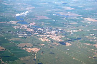
Brooks is a city in southeast Alberta, Canada in the County of Newell. It is on Highway 1 and the Canadian Pacific Kansas City railway, approximately 186 km (116 mi) southeast of Calgary, and 110 km (68 mi) northwest of Medicine Hat. The city has an elevation of 760 m (2,490 ft).

<span class="mw-page-title-main">Cold Lake, Alberta</span> City in Alberta, Canada

Cold Lake is a city in east-central Alberta, Canada and is named after the lake nearby. Canadian Forces Base Cold Lake is situated within the city's outer limits.

<span class="mw-page-title-main">Sexsmith, Alberta</span> Town in Alberta, Canada

Sexsmith is a town in northern Alberta, it is on Highway 2, 20 kilometres (12 mi) north of Grande Prairie.

<span class="mw-page-title-main">Strathmore, Alberta</span> Town in Alberta, Canada

Strathmore is a town located in southern Alberta, Canada that is surrounded by Wheatland County. It is along the Trans-Canada Highway approximately 50 kilometres (30 mi) east of Calgary.

<span class="mw-page-title-main">Beaumont, Alberta</span> City in Alberta, Canada

Beaumont is a city adjacent to Leduc County within the Edmonton Metropolitan Region of Alberta, Canada. It is at the intersection of Highway 625 and Highway 814, adjacent to the City of Edmonton and 6.0 kilometres (3.7 mi) northeast of the City of Leduc. The Nisku Industrial Park and the Edmonton International Airport are 4.0 kilometres (2.5 mi) to the west and 8.0 kilometres (5.0 mi) to the southwest respectively.

<span class="mw-page-title-main">Falher</span> Town in Alberta, Canada

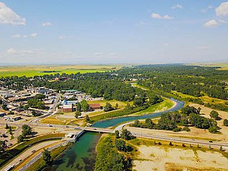
Falher is a town in the Peace Country area of Alberta, Canada. It is located in the Municipal District of Smoky River No. 130, along Highway 49. Falher is one of the earliest agricultural communities in the Peace River Country, and still acts as the commercial center of the surrounding Smoky River Region, with which it shares much of its history. Falher is notable for its sizable francophone population, having the highest percentage of French speakers of any municipality in Western Canada, with 52% able to speak the language as of 2021.

<span class="mw-page-title-main">High River</span> Town in Alberta, Canada

High River is a town within the Calgary Metropolitan Region of Alberta, Canada. It is approximately 68 kilometres (42 mi) south of Calgary, at the junction of Alberta Highways 2 and 23. High River had a population of 14,324 in 2021.

<span class="mw-page-title-main">Wembley, Alberta</span> Town in Alberta, Canada

Wembley is a town in northern Alberta, Canada. It is approximately 23 km (14 mi) west of Grande Prairie at the junction of Highway 43 and Highway 724.

<span class="mw-page-title-main">Nahanni Butte</span> Place in Northwest Territories, Canada

Nahanni Butte is a "Designated Authority" in the Dehcho Region of the Northwest Territories, Canada. The community is located at the confluence of the Liard and South Nahanni Rivers in the southwestern part of the NWT.

<span class="mw-page-title-main">Jean Marie River</span> Place in Northwest Territories, Canada

Jean Marie River is a "Designated Authority" in the Dehcho Region of the Northwest Territories, Canada. The community is located on the Jean Marie River where it joins the Mackenzie River. The community has a small airport, Jean Marie River Airport, and is accessible by charter aircraft throughout the year and by the all-season JMR Access Road 27 km (17 mi) from the Mackenzie Highway.

<span class="mw-page-title-main">Gamèti</span> Community in Northwest Territories, Canada

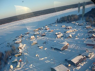
Gamètì, officially the Tłı̨chǫ Community Government of Gamètì is a community in the North Slave Region of the Northwest Territories, Canada. Gamètì, according to the Prince of Wales Northern Heritage Centre means "rabbit-net lake". 'Gah means 'rabbit', and "mi" means net, "tì" means lake, or water. It is one of the four Tłı̨chǫ communities which form part of the Tlicho Government.

Kakisa is a "Designated Authority" in the South Slave Region of the Northwest Territories, Canada. The community is located on Kakisa Lake, and is southeast of Fort Providence. Originally located at Tathlina Lake, the community moved, in 1962, to the present location in order to be closer to the Mackenzie Highway and is linked by a 13 km (8.1 mi) all-weather road.

O'Leary is a village located in Prince County, Prince Edward Island. Its population in the 2021 Canadian Census was 876 people. O'Leary was incorporated as a village in 1951.

Breadalbane is a municipality that holds community status in Prince Edward Island, Canada. Located in Queens County, Prince Edward Island, its population as of 2021 is 170.

<span class="mw-page-title-main">Morell, Prince Edward Island</span> Rural municipality in Prince Edward Island, Canada

Morell is a rural municipality in Prince Edward Island, Canada. It is located in Kings County east of Bristol.

<span class="mw-page-title-main">Demographics of Alberta</span>

Alberta has experienced a relatively high rate of growth in recent years, due in large part to its economy. Between 2003 and 2004, the province saw high birthrates, relatively high immigration, and a high rate of interprovincial migration when compared to other provinces. Approximately 81% of the population live in urban areas and only about 19% live in rural areas. The Calgary–Edmonton Corridor is the most urbanized area in Alberta and is one of Canada's four most urban regions. Many of Alberta's cities and towns have also experienced high rates of growth in recent history. From a population of 73,022 in 1901, Alberta has grown to 4,262,635 in 2021 and in the process has gone from less than 1.5% of Canada's population to 11.5%. It is the fourth most populated province in Canada. Between the 2016 and 2021 censuses, the Alberta population grew by 4.8%.

<span class="mw-page-title-main">Demographics of Nova Scotia</span> Demographics of region

Nova Scotia is a Canadian province located on the country's southeastern coast. It is the most populous province in Atlantic Canada, and its capital, Halifax, is a major economic centre of the region. Geographically, Nova Scotia is the second smallest province in Canada, with an area of 52,824.71 km2 (20,395.73 sq mi). As of 2021, it has a population of 969,383 people.

Yukon is the westernmost of Canada's three northern territories. Its capital is Whitehorse. People from Yukon are known as Yukoners. Unlike in other Canadian provinces and territories, Statistics Canada uses the entire territory as a single at-large census division.

According to the 2021 census, the City of Edmonton had a population of 1,010,899 residents, compared to 4,262,635 for all of Alberta, Canada. The total population of the Edmonton census metropolitan area (CMA) was 1,418,118, making it the sixth-largest CMA in Canada.

<span class="mw-page-title-main">Demographics of Calgary</span>

In the 2021 Census, the City of Calgary had a population of 1,306,784 residents, representing 30.7% of the 4,262,635 residents in all of Alberta, and 3.5% compared to a population of 36,991,981 in all of Canada. The total population of the Calgary census metropolitan area (CMA) was 1,481,806. Calgary is the largest city in Alberta, and the third-largest municipality and fifth-largest metropolitan area in Canada, as of 2021.

References

  1. , Canada Year Book 1932
  2. , Canada Year Book 1955
  3. , Canada Year Book 1957-58
  4. 1 2 3 4 5 , Canada Year Book 1967
  5. Archived 2013-01-15 at archive.today , E-STAT - Search Censuses
  6. , 1996 Census of Canada: Electronic Area Profiles
  7. , Census Subdivisions (CSD) - Municipalities, 2001 and 1996 Censuses - 100% Data
  8. , Census subdivisions (CSDs) — Municipalities
  9. , Population and Dwelling Count Highlight Tables, 2011 Census
  10. 104.pdf Archived 2016-04-23 at the Wayback Machine , Canada Year Book 1932
  11. 1 2 140.pdf Archived 2016-01-14 at the Wayback Machine , Canada Year Book 1955
  12. 1 2 , 1996 Census of Canada: Electronic Area Profiles
  13. Archived 2016-03-04 at the Wayback Machine , Community Profiles from the 2006 Census, Statistics Canada
  14. , Census Profile - Census Subdivision
  15. Statistics Canada: 1981, 1986, 1991, 1996, 2001, 2006, 2011 census
  16. http://www66.statcan.gc.ca/eng/acyb_c1955-eng.aspx?opt=/eng/1955/195501670141_p. 141.pdf
  17. "Canada Year Book (CYB) Historical Collection" (PDF). 2008-03-31.
  18. "Server Message Page Template | Modèle de page de message de serveur". Archived from the original on 2013-03-07. Retrieved 2013-03-07., E-STAT Table
  19. 140.pdf, Canada Year Book 1955
  20. , Canada 1996 Census
  21. , Canada 2006 Census
  22. , Canada 2011 Census
  23. "Table 4: Population and Total Occupied Dwellings, for Census Divisions and Subdivisions, 1976 and 1981". 1981 Census of Canada. Vol. II: Provincial series, Population, Geographic distributions (Alberta). Ottawa: Statistics Canada. 1982. pp. 4–5. ISBN   0-660-51095-2.
  24. "Population and dwelling counts, for Canada, provinces and territories, and census subdivisions (municipalities), 2011 and 2006 censuses". Statistics Canada. 2012-02-08. Retrieved 2012-06-28.
  25. "Table V. Population of Cities and Towns having over 5,000 inhabitants in 1901, compared with 1871-81-91". Fourth Census of Canada, 1901. Ottawa: Government of Canada. 1903. p. 22.
  26. 143.pdf, Canada Year Book 1955
  27. 191.pdf, Canada Year Book 1967
  28. "Corrections and updates: Population and dwelling count amendments, 2011 Census". Statistics Canada. February 14, 2013. Retrieved February 15, 2013.
  29. , 2011 Census
  30. Archived 2016-01-12 at the Wayback Machine , 2001 Census
  31. , 1996 Census
  32. 1 2 3 , 1996 Census of Canada: Electronic Area Profiles
  33. , Population and dwelling counts, for Canada, provinces and territories, and census subdivisions
  34. , Population and dwelling counts, for Canada, provinces and territories, and census subdivisions
  35. "Search Censuses". Statistics Canada. July 4, 2012. Archived from the original on January 15, 2013. Retrieved December 19, 2012.
  36. 1 2 "Population and dwelling counts, for Canada, provinces and territories, and census subdivisions (municipalities), 2011 and 2006 censuses (Saskatchewan)". Statistics Canada. May 28, 2012. Retrieved December 11, 2012.
  37. , The Placentia Area Blog: Population Changes
  38. Archived 2013-08-01 at the Wayback Machine , Population and dwelling counts, for Canada, provinces and territories, and census subdivisions
  39. Archived 2013-08-01 at the Wayback Machine , Population and dwelling counts, for Canada, provinces and territories, and census subdivisions
  40. [ permanent dead link ], A Demographic Profile of Prince Rupert
  41. 1 2 , Censuses 1871-1931
  42. 1 2 , Census 1941-1951
  43. 1 2 , Census 1961
  44. 1 2 , Censuses 1981-2001
  45. 1 2 , Census 2006
  46. , Community Profiles from the 2006 Census, Statistics Canada - Census Subdivision
  47. , Population and dwelling counts, for Canada, provinces and territories, and census subdivisions (municipalities), 2011 and 2006
  48. , Canada 1996 Census
  49. Pas&SearchType=Begins&SearchPR=01&B1=All&Custom=, Canada 2006 Census
  50. , Canada 2011 Census
  51. , Population and dwelling counts, for Canada, provinces and territories, and census subdivisions
  52. , Population and dwelling counts, for Canada, provinces and territories, and census subdivisions