Lake Tahoe inflow streams contribute 310,000 acre-feet (0.38 km3) of the 530,000 acre-feet (0.65 km3) of water that flows through Lake Tahoe every year. [2] The list, below, groups rivers and creeks that flow into the lake by their locations on the north, east, south and west shores, in a clockwise order. Sub-tributaries are listed under the tributaries they feed, sorted by the elevation of the confluence so that tributaries entering nearest Lake Tahoe appear first.
Contents
| Name of stream | Washo name [3] | Course | Average flow [2] |
|---|---|---|---|
| North shore | |||
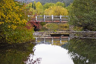
| Burton Creek | flows through and namesake of Burton Creek State Park [4] | ||
| Dollar Creek | diphEkhwo'tha | flows into Lake Tahoe at Dollar Point, California | |
| Watson Creek | from near Mount Watson and Watson Lake, flows into Lake Tahoe at Ridgewood, near Carnelian Bay, California | ||
| Carnelian Canyon | a short unnamed creek flows down Carnelian Canyon to Lake Tahoe at Carnelian Bay | ||
| Tahoe Vista | Snow creek flows through Tahoe Vista to Lake Tahoe at Moon Dune Beach | ||
| Griff Creek | flows from Martis Peak to Kings Beach [5] | ||
| Incline Creek | maʔgóyola | flows through Diamond Peak Ski Resort to Crystal Bay, Lake Tahoe at Incline Village | 4,740 acre-feet per year (0.19 m3/s) |
| East shore | |||
| Burke Creek | flows from Genoa Peak to Stateline, Nevada | ||
| Glenbrook Creek | dawmalá:dɨp | 890 acre-feet per year (0.03 m3/s) | |
| Lincoln Creek | flows from Genoa Peak to Cave Rock | ||
| Logan House Creek | 300 acre-feet per year (0.01 m3/s) | ||
| McFaul Creek | flows into Lake Tahoe at Zephyr Cove, Nevada | ||
| Mill Creek | flows into Lake Tahoe past the Ponderosa Ranch | ||
| Edgewood Creek | ʔlá:m wát'a | Namesake for Edgewood Golf Course | 2,300 acre-feet per year (0.09 m3/s) |
| Marlette Creek | pagác'ima | heads on Marlette Lake and runs west to Lake Tahoe [6] | 1,740 acre-feet per year (0.07 m3/s) |
| North Canyon Creek | flows into Lake Tahoe at Deadman's Point in Glenbrook, Nevada | ||
| Secret Harbor Creek | |||
| Third Creek | 5,630 acre-feet per year (0.22 m3/s) | ||
| Tunnel Creek | flows into Lake Tahoe near Hidden Beach | ||
| South shore | |||
| Trout Creek | originates south of Freel Peak in the Carson Range to South Lake Tahoe [7] | 25,770 acre-feet per year (1.01 m3/s) | |
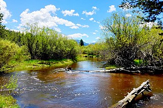
| Upper Truckee River | flows from Red Lake Peak to South Lake Tahoe [8] | 71,311 acre-feet per year (2.79 m3/s) | |
| Taylor Creek | dawgašašíwa | heads in Fallen Leaf Lake and enters lake west of Camp Richardson [9] | 30,910 acre-feet per year (1.21 m3/s) |
| Tallac Creek | debelelélek | starts on Mount Tallac and flows north to Lake Tahoe [10] | |
| Cascade Creek | headwaters at near Kalmia Lake and flows into Lake Cascade then into Lake Tahoe | ||
| Eagle Creek | headwaters at Dicks Peak and flows down Eagle Canyon into Emerald Bay and Lake Tahoe | ||
| West shore | |||
| Rubicon Creek | headwaters at Rubicon Peak to the North and Jakes Peak to the South, and flows into Lake Tahoe near D.L. Bliss State Park | ||
| General Creek | dukMéʔem | headwaters at Peak 8721 and flow into Lake Tahoe | 11,800 acre-feet per year (0.46 m3/s) |
| Meeks Creek | headwaters at Rubicon Lake and flows to D.L. Bliss State Park | ||
| McKinney Creek | šuʔwélɨk | headwaters at Lily Lake; flows through McKinney Lake and into Lake Tahoe at Chambers Landing at the south end of McKinney Bay | |
| Quail Creek | headwaters at Quail Lake and flows into Lake Tahoe | ||
| Homewood Creek | dúku dawot'o | headwaters at Peak 8416 and flows into Lake Tahoe | |
| Madden Creek | headwaters at Ellis Peak and flows into Lake Tahoe | ||
| Blackwood Creek | dogásliʔ | headwaters at Peak 8652 and flow down into Lake Tahoe | 26,280 acre-feet per year (1.03 m3/s) |
| Ward Creek | dagásliʔ | headwaters at Peak 8521 and flow down Ward canyon into Lake Tahoe | 18,390 acre-feet per year (0.72 m3/s) |