Caguas, founded in 1775, is a city and municipality of Puerto Rico located in the Central Mountain Range of Puerto Rico, south of San Juan and Trujillo Alto, west of Gurabo and San Lorenzo, and east of Aguas Buenas, Cidra, and Cayey.

Salinas is a municipality in the southern part of Puerto Rico located in the southern coast of the island, south of Aibonito and Cayey; southeast of Coamo, east of Santa Isabel; and west of Guayama. Salinas is spread over 5 barrios and Salinas Pueblo.
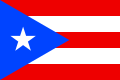
"La Borinqueña" is the official anthem of Puerto Rico.

Peñuelas is a municipality in Puerto Rico located in the southern coast of the island, south of Adjuntas, east of Guayanilla, west of Ponce and north of the Caribbean Sea. Peñuelas is spread over 12 barrios and Peñuelas Pueblo. It is part of the Yauco Metropolitan Statistical Area. Peñuelas is known as "La Capital del Güiro" and "El Valle de los Flamboyanes". In 2010, Peñuelas had a population of 24,282.

Lajas is a municipality of Puerto Rico located in southwestern Puerto Rico, on the southern coast of the island, bordering the Caribbean Sea, south of San Germán and Sabana Grande; east of Cabo Rojo; and west of Guánica. Lajas is spread over 11 barrios plus Lajas Pueblo. It is part of the San Germán-Cabo Rojo Metropolitan Statistical Area.

Canóvanas is a municipality in Puerto Rico, located in the northeastern region, north of Juncos and Las Piedras; south of Loíza; east of Carolina; and west of Río Grande. Canóvanas is spread over 6 barrios and Canóvanas Pueblo. It is part of the San Juan-Caguas-Guaynabo Metropolitan Statistical Area.

Ceiba is both a small town and municipality in northeast Puerto Rico. It is named after the famous Ceiba tree. Ceiba is located in the north-east coast of the island, bordering the Atlantic Ocean, south of Fajardo, north of Naguabo and southeast of Río Grande. Located about one hour's driving distance from San Juan, Ceiba is spread over 7 barrios and Ceiba Pueblo. It is part of the Fajardo Metropolitan Statistical Area.

Gurabo is a municipality in eastern Puerto Rico. It is located in the central eastern region, north of San Lorenzo; south of Trujillo Alto; east of Caguas; and west of Carolina and Juncos. Gurabo is spread over 9 barrios and Gurabo Pueblo. It is part of the San Juan-Caguas-Guaynabo Metropolitan Statistical Area.

Cabo Rojo is a municipality situated on the southwest coast of Puerto Rico and forms part of the San Germán–Cabo Rojo metropolitan area as well as the larger Mayagüez–San Germán–Cabo Rojo Combined Statistical Area.
Aguada is a municipality of Puerto Rico, located in the western coastal valley region bordering the Atlantic Ocean, east of Rincón, west of Aguadilla and Moca; and north of Añasco and Mayagüez. It is part of the Aguadilla-Isabela-San Sebastián Metropolitan Statistical Area. Aguada's population is spread over 17 barrios and Aguada Pueblo.
Añasco, named after one of its settlers, Don Luis de Añasco, is a municipality of Puerto Rico located on the west coast of the island bordering the Mona Passage to the west, north of Mayagüez, and Las Marias; south of Rincón, Aguada, and Moca and west of San Sebastián and Las Marias. It is part of the Aguadilla-Isabela-San Sebastián Metropolitan Statistical Area.

Florida is a municipality of Puerto Rico located north of Ciales, south of Barceloneta, east of Arecibo, and west of Manatí. Florida is not like other municipalities of Puerto Rico with multiple subdivisions called barrios. It has one barrio called Florida Adentro and two other subdivisions: Florida Zona Urbana and Pajonal comunidad. It is part of the San Juan-Caguas-Guaynabo Metropolitan Statistical Area.

Las Marías is a municipality of Puerto Rico located north of Maricao; southeast of Añasco; south of San Sebastián; east of Mayagüez; and west of Lares. Las Marías is spread over 13 barrios and Las Marías Pueblo.
Luquillo is a municipality of Puerto Rico located in the northeast coast, northwest of Fajardo; and east of Rio Grande. Luquillo is spread over 5 barrios and Luquillo Pueblo. It is part of the Fajardo Metropolitan Statistical Area.

Manatí is a city and municipality of Puerto Rico on the northern coast, north of Morovis and Ciales; east of Florida and Barceloneta; and west of Vega Baja. Manatí is spread over 8 barrios and Manatí barrio-pueblo. It is part of the San Juan-Caguas-Guaynabo Metropolitan Statistical Area.

Morovis is a municipality of Puerto Rico located in the central region of the island, north of Orocovis, south of Manatí, Vega Baja and Vega Alta; east of Ciales, and west of Corozal. Morovis is spread over 13 barrios and Morovis Pueblo. It is part of the San Juan-Caguas-Guaynabo Metropolitan Statistical Area.

Naguabo is a municipality in Puerto Rico located in the east coast of the island, north of Humacao; south of Río Grande and Ceiba; and east of Las Piedras. Naguabo is spread over 8 barrios and Naguabo Pueblo. It is part of the San Juan-Caguas-Guaynabo Metropolitan Statistical Area.

Patillas is a municipality of Puerto Rico located in the southeastern coast, south of San Lorenzo; west of Yabucoa and Maunabo; and east of Guayama and Arroyo. It is spread over 15 barrios and Patillas Pueblo. It is part of the Guayama Metropolitan Statistical Area.

Trujillo Alto is a municipality of Puerto Rico located in the Northern Coastal Plain and in the karst zone, north of Caguas, and Gurabo; southeast of San Juan, and west of Carolina. Trujillo Alto is part of the San Juan Metropolitan Area, which includes the municipalities of Bayamón, Guaynabo, Cataño, and Toa Baja. The city is spread over 6 barrios and Trujillo Alto barrio-pueblo. It is part of the San Juan-Caguas-Guaynabo Metropolitan Statistical Area.

Thespesia grandiflora is a tree in the family Malvaceae of the rosids clade. Its common name is maga. This tree is widely distributed throughout Puerto Rico where it is endemic. Although originally endemic to the humid mountains of limestone in the western and north-central portions of the Island, today it grows everywhere in Puerto Rico due to its extensive cultivation. It is also grown as an ornamental tree in Florida, Hawaii, Honduras and in various Caribbean islands. The maga is mostly used as an ornamental plant, but like the related Thespesia populnea its wood is also valued for its durable timber. The flower was declared the national symbol of Puerto Rico on August 7 2019.