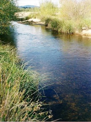
The Brisbane River is the longest river in South East Queensland, Australia, and flows through the city of Brisbane, before emptying into Moreton Bay on the Coral Sea. John Oxley, the first European to explore the river, named it after the Governor of New South Wales, Sir Thomas Brisbane in 1823. The penal colony of Moreton Bay later adopted the same name, eventually becoming the present city of Brisbane. The river is a tidal estuary and the water is brackish from its mouth through the majority of the Brisbane metropolitan area westward to the Mount Crosby Weir. The river is wide and navigable throughout the Brisbane metropolitan area.

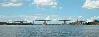
The Sir Leo Hielscher Bridges, formerly and still collectively referred to as the Gateway Bridge, are a pair of twin road bridges that carry the Gateway Motorway (M1) over the Brisbane River, skirting the eastern suburbs of the city of Brisbane. The western bridge carries traffic to the north and the eastern bridge carries traffic to the south. They are the most eastern crossings of the Brisbane River and the closest to Moreton Bay, crossing at the Quarries Reach and linking the suburbs of Eagle Farm and Murarrie. The original western bridge was opened on 11 January 1986 and cost A$92 million to build. The duplicate bridge was opened in May 2010, and cost $350 million.

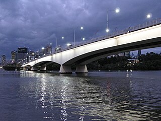
The Captain Cook Bridge is a road bridge that carries the Pacific Motorway across the Brisbane River in Brisbane, in the state of Queensland, Australia. It was built exclusively for vehicular traffic and was completed in late 1972. The bridge had its naming ceremony on 13 December 1972, with it opening in January/February 1973. Shortly before it was opened to vehicular traffic, a once only pedestrian walk event across the bridge was held on 21 January 1973, organised by the Rotary Club of Stones Corner. The bridge crosses at the South Brisbane Reach of the river, linking Gardens Point in the Brisbane central business district on the north side to Kangaroo Point and South Brisbane on the southside.

The Victoria Bridge is a bus and pedestrian bridge over the Brisbane River. The current bridge, opened in 1969, is the third permanent crossing erected at this location. Since 24 January 2021, the bridge has been closed to general traffic, and now carries buses, pedestrians and cyclists only.

The William Jolly Bridge is a heritage-listed road bridge over the Brisbane River between North Quay in the Brisbane central business district and Grey Street in South Brisbane, within City of Brisbane, Queensland, Australia. It was designed by Harding Frew and built from 1928 to 1932 by MR Hornibrook.

The Walter Taylor Bridge is a heritage-listed suspension bridge crossing the Brisbane River between Indooroopilly and Chelmer in Brisbane, Queensland, Australia. It is shared by motor traffic and pedestrians and is the only habitable bridge in the Southern Hemisphere. It was originally known as the Indooroopilly Toll Bridge. The bridge footpath will be closed from 26 August to 30 September 2024 general maintenance.

The Merivale Bridge is a double track railway bridge crossing the Brisbane River. It crosses the Milton Reach of the river, located in between the Go Between Bridge and the William Jolly Bridge. Exclusively a railway crossing, it is located between the stations of South Brisbane and Roma Street, linking the northern and southern elements of the Queensland Rail City network. The Merivale Bridge is the only inner-city rail crossing in Brisbane. By 2016 it was expected to be over capacity, leading the Queensland Government to announce the Cross River Rail project.

Albert Bridge is a heritage-listed railway bridge of steel truss design crossing the Brisbane River between Indooroopilly and Chelmer in the City of Brisbane, Queensland, Australia. It was designed by Henry Charles Stanley and built from 1894 to 1895 by John McCormick & Son as a replacement for an earlier bridge lost to flooding in 1893. Both bridges were named in honour of the Prince of Wales, Prince Albert. It was added to the Queensland Heritage Register on 21 October 1992.

Brisbane is the capital and largest city of the state of Queensland and the third-most populous city in Australia and Oceania, with a population over 2.7 million. Brisbane lies at the centre of South East Queensland, an urban agglomeration with a population of approximately 4 million which includes several other regional centres and cities. The central business district is situated within a peninsula of the Brisbane River about 15 km (9 mi) from its mouth at Moreton Bay. Brisbane is located in the hilly floodplain of the Brisbane River Valley between Moreton Island and the Taylor and D'Aguilar mountain ranges. It sprawls across several local government areas, most centrally the City of Brisbane. The demonym of Brisbane is Brisbanite.

The Shoalhaven River is a perennial river that rises from the Southern Tablelands and flows into an open mature wave dominated barrier estuary near Nowra on the South Coast of New South Wales, Australia.
The Brisbane River, running through Brisbane, Queensland, Australia, is crossed by seventeen major bridges, from the Sir Leo Hielscher Bridges downstream to the Centenary upstream. The river meanders through an urban area that comprises 2,562,000 people.
Green Bridge may refer to:

Brisbane City is the central suburb and central business district of Brisbane, the state capital of Queensland, Australia. It is also colloquially referred to as the "Brisbane CBD", "the city", or simply "town". The CBD is located on a point on the northern bank of the Brisbane River, historically known as Meanjin, Mianjin or Meeanjin in the local Yuggera dialect. The triangular-shaped peninsula is bounded by the median of the Brisbane River to the east, south and west. The point, known at its tip as Gardens Point, slopes upward to the north-west where the city is bounded by parkland and the inner city suburb of Spring Hill to the north. The CBD is bounded to the north-east by the suburb of Fortitude Valley. To the west the CBD is bounded by Milton, Petrie Terrace, and Kelvin Grove.

The South Coast railway line was a railway from Brisbane, the capital city of Queensland, Australia. The route via the South Coast to Tweed Heads on the border of Queensland and New South Wales. The line operated from 1889 to 1964. Between 1903 and 1961 steam trains ran from Beenleigh to the NSW border. The Gold Coast railway line re-opened in 1996 along a modified alignment in the north and a new route south but does not extend as far south yet as the South Coast line.

Chuwar is a town and suburb of Ipswich in the City of Ipswich and a locality of the City of Brisbane in South East Queensland, Australia. In the 2021 census, the suburb of Chuwar had a population of 2,178 people.

The Breakfast Creek is a small urban stream that is a tributary of the Brisbane River, located in suburban Brisbane in the South East region of Queensland, Australia.

Banks Creek is a rural locality split between the City of Brisbane and Somerset Region in Queensland, Australia. The locality is also split for the purposes of state and federal elections. In the 2021 census, Banks Creek had a population of 11 people.

The Kangaroo Point Bridge is a pedestrian and cyclist bridge across the Brisbane River in Brisbane, Australia. The bridge connects the suburb of Kangaroo Point with the Brisbane CBD.

Sadliers Crossing Railway Bridge is a heritage-listed railway bridge at over Bremer River between Tallon Street, Sadliers Crossing and Dixon Street, Wulkuraka, Queensland, Australia on the Main Line (this section is now the Ipswich and Rosewood railway line. It was added to the Queensland Heritage Register on 13 November 2008.