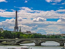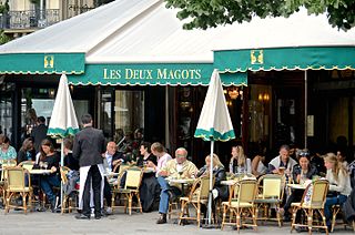
The 6th arrondissement of Paris is one of the 20 arrondissements of the capital city of France. In spoken French, it is referred to as le sixième.
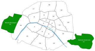
The Rive Gauche is the southern bank of the river Seine in Paris. Here the river flows roughly westward, cutting the city in two parts. When facing downstream, the southern bank is to the left, and the northern bank is to the right.
Historical quarters of Paris are areas of Paris, France that have retained an older character, usually identifiable by commercial or cultural activity and often named for a neighborhood landmark. These sections often are not referenced on modern-day maps of Paris, crossing current arrondissements.

The Pont de Bir-Hakeim, formerly the Pont de Passy, is an arch bridge that crosses the Seine in Paris. It connects the 15th and 16th arrondissement, passing through the Île aux Cygnes. The bridge, made of steel, was constructed between 1903 and 1905, in replacement of a footbridge that had been erected in 1878. The bridge has two levels: one for motor vehicles and pedestrians, the other being a viaduct built above the first one, through which passes Line 6 of the Paris Métro. The bridge is 237 metres (777 ft) long and 24.7 metres (81 ft) wide. The part crossing the Grand Bras of the Seine is slightly longer than the one crossing the Petit Bras.

The Pont de Sully is a bridge across the Seine in Paris, France.

The Île Louviers is a former island in the Seine in the centre of Paris, just upstream of the present Île Saint-Louis and of a similar size. Never built up, it was connected with the north bank of the river in 1843. Just before it ceased to be an island it had a surface area of 33,638m². In modern Paris the former island lies between the quai Henri IV and the boulevard Morland.
The Pont Notre-Dame is a bridge that crosses the Seine in Paris, France linking the quai de Gesvres on the Rive Droite with the quai de la Corse on the Île de la Cité. The bridge is noted for being the "most ancient" in Paris, in the sense that, while the oldest bridge in Paris that is in its original state is undoubtedly the Pont Neuf, a bridge in some form has existed at the site of the Pont Notre-Dame since antiquity; nonetheless, it has been destroyed and reconstructed numerous times, a fact referred to in the Latin inscription on it to honor its Italian architect, Fra Giovanni Giocondo. The bridge once was lined with approximately sixty houses, the weight of which caused a collapse in 1499.

The passerelle Léopold-Sédar-Senghor, formerly known as passerelle Solférino, is a footbridge over the River Seine in the 7th arrondissement of Paris. It is served by the Metro station Assemblée Nationale.

The Pont de la Concorde is an arch bridge across the Seine in Paris connecting the Quai des Tuileries at the Place de la Concorde and the Quai d'Orsay. It has formerly been known as the "Pont Louis XVI", "Pont de la Révolution", "Pont de la Concorde", "Pont Louis XVI" again during the Bourbon Restoration (1814); in 1830, its name was changed again to Pont de la Concorde, the name it has retained to this day. It is served by the Metro stations Assemblée nationale and Concorde.

The Passerelle Simone-de-Beauvoir is a bridge solely for pedestrians and cyclists across the Seine River in Paris. It is the 37th bridge on the Seine in Paris. It is located between the bridges of Pont de Bercy and Pont de Tolbiac and links up the 12th and 13th arrondissements of Paris. Its nearest Paris Metro station is Quai de la Gare.
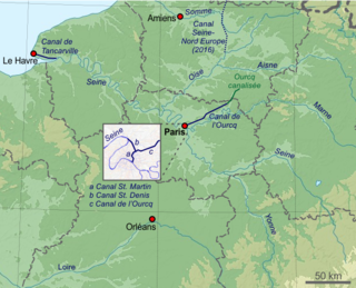
The Canal Saint-Denis is a canal in Paris, France that is 6.6 kilometres (4.1 mi) in length. The canal connects the Canal de l'Ourcq, at a point north-northwest of the Bassin de la Villette in the 19th arrondissement, with the suburban municipalities of Saint-Denis and Aubervilliers in the department of Seine-Saint-Denis. There are seven locks along the canal's route, and, near Saint-Denis, the canal discharges into the Seine.

The Île des Cygnes or Île Maquerelle was an island on the river Seine in Paris. It was in the north-west part of the 7th arrondissement, between rue de l'Université and the Seine, the Invalides and the Champ de Mars. The Musée du quai Branly is located on it.

The Bassin de la Villette is the largest artificial lake in Paris. It was filled with water on 2 December 1808. Located in the 19th arrondissement of the capital, it links the Canal de l'Ourcq to the Canal Saint-Martin, and it represents one of the elements of the Réseau des Canaux Parisiens, a public-works authority operated by the city. The other components of the network are the Canal de l'Ourcq, the Canal Saint-Denis, the Canal Saint-Martin, and the Bassin de l'Arsenal. Together, these canals and basins extend roughly 130 kilometres (81 mi).

The city walls of Paris refers to the city walls that surrounded Paris, France, as it grew from ancient times until the 20th century, built primarily to defend the city but also for administrative reasons. Several successive city walls were built over the centuries, either adding to existing walls or replacing demolished ones, through 1846, when construction of the Thiers wall was completed.
This article presents the main landmarks in the city of Paris within administrative limits, divided by its 20 arrondissements. Landmarks located in the suburbs of Paris, outside of its administrative limits, while within the metropolitan area are not included in this article.

Auguste André Coussillan was a French historian specialising in the history of Paris. Under the pen-name Jacques Hillairet he wrote two major reference works on the subject in the 1950s - Connaissance du vieux Paris and Dictionnaire historique des rues de Paris.
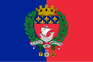
The following outline is provided as an overview of and topical guide to Paris:
