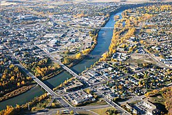
Crossing Carries Location Notes Coordinates Red Deer River mountain bridges [ 1] [ 2] Ya Ha Tinda Road & Unmarked roads Ya Ha Tinda area There are many small unnamed/unmarked bridges over the river in this area. 51°N 115°W / 51°N 115°W / 51; -115 Gravel highway bridge [ 3] Hwy 734 west of Red Deer Forestry Airport 51°39′26″N 115°17′13″W / 51.65722°N 115.28694°W / 51.65722; -115.28694 Sundre Bridge [ 4] Hwy 27 Sundre 51°47′46″N 114°38′7″W / 51.79611°N 114.63528°W / 51.79611; -114.63528 Garrington Bridge [ 5] Hwy 587 northwest of Garrington Replaced after 2013 Alberta floods [ 6] 51°56′35″N 114°29′0″W / 51.94306°N 114.48333°W / 51.94306; -114.48333 Dickson Dam [ 7] Township Road 360 east of Dickson Hydroelectric Dam creating Gleniffer Lake 52°3′15″N 114°12′46″W / 52.05417°N 114.21278°W / 52.05417; -114.21278 Innisfail Bridge [ 8] Hwy 54 northwest of Innisfail 52°4′9″N 113°59′5″W / 52.06917°N 113.98472°W / 52.06917; -113.98472 Penhold Bridge [ 9] Hwy 592 west of Penhold 52°8′38″N 113°58′5″W / 52.14389°N 113.96806°W / 52.14389; -113.96806 Railway bridge [ 10] Canadian Pacific Railway western Red Deer 52°16′4″N 113°51′50″W / 52.26778°N 113.86389°W / 52.26778; -113.86389 Freeway bridge [ 11] Hwy 2 western Red Deer 4 lanes (2 bridges side-by-side) 52°16′6″N 113°51′46″W / 52.26833°N 113.86278°W / 52.26833; -113.86278 Riverlands Pedestrian Bridge [ 12] Pedestrians and cyclists Red Deer: Heritage Ranch 52°15′46″N 113°51′1″W / 52.26278°N 113.85028°W / 52.26278; -113.85028 Temporary crossing [ 13] Construction crews, extension of Fountain Drive. Red Deer: Great Chief Park A temporary bridge and causeway was constructed over the river so that construction crews can access the other side. 52°15′46″N 113°50′14″W / 52.26278°N 113.83722°W / 52.26278; -113.83722 Taylor Bridge [ 14] Taylor Drive Red Deer: near Bower Ponds 4 lanes (separate bridges) 52°16′13″N 113°49′28″W / 52.27028°N 113.82444°W / 52.27028; -113.82444 Old Red Deer Canadian Pacific Railway Bridge [ 15] Pedestrians and cyclists Red Deer: near Riverside Industrial Park Built in 1890 or 1891. Formerly a Canadian Pacific Railway Bridge (closed in 1991 and reopened in 1992). Replaced an old bridge. 52°16′32″N 113°49′1″W / 52.27556°N 113.81694°W / 52.27556; -113.81694 Southbound Gaetz Ave Bridge [ 16] 50 Ave (Gaetz Ave, Hwy 2A ) Red Deer: downtown 3 lanes southbound 52°16′36″N 113°48′50″W / 52.27667°N 113.81389°W / 52.27667; -113.81389 Northbound Gaetz Ave Bridge [ 17] 49 Ave (Gaetz Ave, Hwy 2A) Red Deer: downtown 3 lanes northbound 52°16′38″N 113°48′42″W / 52.27722°N 113.81167°W / 52.27722; -113.81167 67 Street Bridge [ 18] 67 Street (Hwy 11 ) Red Deer: Gaetz Lake Sanctuary 4 lanes (separate bridges) 52°17′16″N 113°47′49″W / 52.28778°N 113.79694°W / 52.28778; -113.79694 River Bend Pedestrian Bridge [ 19] Pedestrians and cyclists Red Deer: River Bend Golf Course 52°18′56″N 113°47′20″W / 52.31556°N 113.78889°W / 52.31556; -113.78889 Joffre Bridge [ 20] Hwy 11 southwest of NOVA Chemicals Joffre site Replaces old bridge 52°16′10″N 113°35′32″W / 52.26944°N 113.59222°W / 52.26944; -113.59222 Ardley Railway Trestle [ 21] Canadian National Railway southwest of Heatburg Previously owned by the Grand Trunk Pacific Railway . Replaced an old bridge 52°18′12″N 113°14′57″W / 52.30333°N 113.24917°W / 52.30333; -113.24917 Content Bridge [ 22] Hwy 21 southwest of Nevis 52°18′20″N 113°4′32″W / 52.30556°N 113.07556°W / 52.30556; -113.07556 McKenzie Crossing [ 23] Hwy 590 west of Big Valley 1 lane wooden deck 52°1′31″N 112°56′53″W / 52.02528°N 112.94806°W / 52.02528; -112.94806 Tolman Bridge [ 24] Hwy 585 Tolman 52°50′17″N 113°1′0″W / 52.83806°N 113.01667°W / 52.83806; -113.01667 Morrin Bridge [ 25] Hwy 27 west of Morrin 51°39′2″N 111°54′11″W / 51.65056°N 111.90306°W / 51.65056; -111.90306 Bleriot Ferry [ 26] Hwy 838 west of Munson 13 car capacity 51°34′22″N 112°53′6″W / 51.57278°N 112.88500°W / 51.57278; -112.88500 Gordon Taylor Bridge [ 27] Hwy 9 & Hwy 56 Drumheller 51°28′3″N 112°42′43″W / 51.46750°N 112.71194°W / 51.46750; -112.71194 Rosedale Bridge [ 28] Roper Road Rosedale 1 lane wooden deck 51°25′16″N 112°37′44″W / 51.42111°N 112.62889°W / 51.42111; -112.62889 Star Mine Suspension Bridge [ 29] Pedestrians eastern Rosedale A suspension bridge 51°25′12″N 112°36′52″W / 51.42000°N 112.61444°W / 51.42000; -112.61444 Highway bridge [ 30] Hwy 10 between Cambria and Eladesor 51°23′55″N 112°35′27″W / 51.39861°N 112.59083°W / 51.39861; -112.59083 Highway bridge [ 31] Hwy 10 & Hwy 569 north of Western Monarch 51°19′55″N 112°28′48″W / 51.33194°N 112.48000°W / 51.33194; -112.48000 Dorothy Ferry Bridge [ 32] Hwy 848 near Dorothy 1 lane wooden deck. This crossing was previously a ferry. 51°16′49″N 112°19′52″W / 51.28028°N 112.33111°W / 51.28028; -112.33111 Finnegan Ferry [ 33] Hwy 862 near Finnegan 13 car capacity 51°7′31″N 112°5′11″W / 51.12528°N 112.08639°W / 51.12528; -112.08639 Emerson Bridge [ 34] Hwy 36 north of Duchess 50°55′6″N 111°53′52″W / 50.91833°N 111.89778°W / 50.91833; -111.89778 Steveville Bridge [ 35] Hwy 876 near Steveville 50°50′18″N 111°36′54″W / 50.83833°N 111.61500°W / 50.83833; -111.61500 Jenner Bridge [ 36] Hwy 884 southeast of Howie wooden deck. Formerly a ferry. 50°50′17″N 111°10′36″W / 50.83806°N 111.17667°W / 50.83806; -111.17667 Gravel highway bridge [ 37] Hwy 886 north of Buffalo 1 lane wooden deck. 50°50′17″N 111°10′36″W / 50.83806°N 111.17667°W / 50.83806; -111.17667 Highway bridge [ 38] Hwy 41 northeast of Sharrow 50°56′2″N 110°9′1″W / 50.93389°N 110.15028°W / 50.93389; -110.15028 Empress Bridge [ 39] Hwy 899 near Empress 50°57′53″N 110°1′42″W / 50.96472°N 110.02833°W / 50.96472; -110.02833 


