
Sacramento is the capital city of the U.S. state of California and the seat of Sacramento County. Located at the confluence of the Sacramento and American Rivers in Northern California's Sacramento Valley, Sacramento's 2020 population of 524,943 makes it the fourth-most populous city in Northern California, sixth-most populous city in the state, and the ninth-most populous state capital in the United States. Sacramento is the seat of the California Legislature and the Governor of California.

The Sacramento River is the principal river of Northern California in the United States and is the largest river in California. Rising in the Klamath Mountains, the river flows south for 400 miles (640 km) before reaching the Sacramento–San Joaquin River Delta and San Francisco Bay. The river drains about 26,500 square miles (69,000 km2) in 19 California counties, mostly within the fertile agricultural region bounded by the Coast Ranges and Sierra Nevada known as the Sacramento Valley, but also extending as far as the volcanic plateaus of Northeastern California. Historically, its watershed has reached as far north as south-central Oregon where the now, primarily, endorheic (closed) Goose Lake rarely experiences southerly outflow into the Pit River, the most northerly tributary of the Sacramento.

Interstate 5 (I-5) is the main north–south Interstate Highway on the West Coast of the United States, running largely parallel to the Pacific Coast of the contiguous U.S. from Mexico to Canada. It travels through the states of California, Oregon, and Washington, serving several large cities on the West Coast, including San Diego, Los Angeles, Sacramento, Portland, and Seattle. It is the only continuous Interstate highway to touch both the Mexican and Canadian borders. Upon crossing the Mexican border at its southern terminus, the highway continues to Tijuana, Baja California, as Mexican Federal Highway 1 (Fed. 1). Upon crossing the Canadian border at its northern terminus, it continues to Vancouver as British Columbia Highway 99 (BC 99).

The Central Valley is a broad, elongated, flat valley that dominates the interior of California. It is 40–60 mi (60–100 km) wide and runs approximately 450 mi (720 km) from north-northwest to south-southeast, inland from and parallel to the Pacific coast of the state. It covers approximately 18,000 sq mi (47,000 km2), about 11% of California's land area. The valley is bounded by the Coast Ranges to the west and the Sierra Nevada to the east.
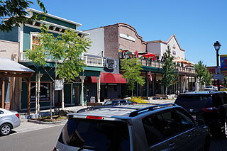
Folsom is a city in Sacramento County, California, United States. The population was 80,454 at the 2020 census.
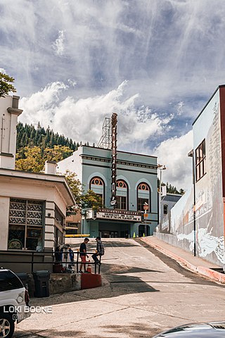
Dunsmuir is a city in Siskiyou County, northern California. It is on the upper Sacramento River. Its population is 1,707 as of the 2020 census, up from 1,650 from the 2010 census.
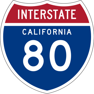
Interstate 80 (I-80) is a transcontinental Interstate Highway in the United States, stretching from San Francisco, California, to Teaneck, New Jersey. The segment of I-80 in California runs east from San Francisco across the San Francisco–Oakland Bay Bridge to Oakland, where it turns north and crosses the Carquinez Bridge before turning back northeast through the Sacramento Valley. I-80 then traverses the Sierra Nevada, cresting at Donner Summit, before crossing into the state of Nevada within the Truckee River Canyon. The speed limit is at most 65 mph (105 km/h) along the entire route instead of the state's maximum of 70 mph (110 km/h) as most of the route is in either urban areas or mountainous terrain. I-80 has portions designated as the Eastshore Freeway and Alan S. Hart Freeway.

U.S. Route 50 (US 50) is a transcontinental United States Numbered Highway, stretching from West Sacramento, California, in the west to Ocean City, Maryland, in the east. The California portion of US 50 runs east from Interstate 80 (I-80) in West Sacramento to the Nevada state line in South Lake Tahoe. A portion in Sacramento also has the unsigned designation of Interstate 305. The western half of the highway in California is a four-or-more-lane divided highway, mostly built to freeway standards, and known as the El Dorado Freeway outside of downtown Sacramento. US 50 continues as an undivided highway with one eastbound lane and two westbound lanes until the route reaches the canyon of the South Fork American River at Riverton. The remainder of the highway, which climbs along and out of the canyon, then over the Sierra Nevada at Echo Summit and into the Lake Tahoe Basin, is primarily a two-lane road.

The Tower Bridge is a vertical lift bridge across the Sacramento River, linking West Sacramento in Yolo County to the west, with the capital of California, Sacramento, in Sacramento County to the east. It has also been known as M Street Bridge. It was previously a part of U.S. Route 40 until that highway was truncated to east of Salt Lake City as well as US Route 99W, which served the western portion of the Sacramento Valley from Sacramento to Red Bluff. The bridge is maintained by the California Department of Transportation as part of State Route 275 and connects West Capitol Avenue and Tower Bridge Gateway in West Sacramento with the Capitol Mall in Sacramento.
TYLin is a global, multi-disciplinary infrastructure services firm. Headquartered in San Francisco, TYLin established its business in the design of long-span bridges and specialty structures.
The Rulo Bridge is the name for the bridge that crosses Missouri River on U.S. Route 159 (US 159) from the village of Rulo in Richardson County, Nebraska, to Holt County, Missouri, west of Big Lake.

Interstate 5 (I-5) is a major north–south route of the Interstate Highway System in the United States, running largely parallel to the Pacific Coast between the Mexican border and the Canadian border. The segment of I-5 in California runs across the length of the state from the Mexican border at the San Ysidro Port of Entry in the San Ysidro neighborhood of San Diego to the Oregon state line south of the Medford-Ashland metropolitan area. It is the longest interstate in California at 796.77 miles (1,282.28 km), and accounts for more than half of I-5's total length of 1,381.29 miles (2,222.97 km). It is also the second longest stretch of Interstate Highway with a single designation within a single state after I-10 in Texas.

The Atchafalaya Basin Bridge, also known as the Louisiana Airborne Memorial Bridge, is a pair of parallel bridges in the U.S. state of Louisiana between Baton Rouge and Lafayette which carries Interstate 10 over the Atchafalaya Basin. With a total length of 96,095 feet, it is the third longest bridge in the US, the second longest on the interstate system, and 14th-longest in the world by total length.
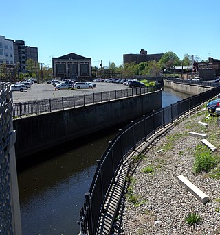
The Elizabeth River runs through Essex and Union counties, New Jersey in the United States for 11.9 miles (19.2 km) before draining into the Arthur Kill.

U.S. Route 99 (US 99) was the main north–south United States Numbered Highway on the West Coast of the United States until 1964, running from Calexico, California, on the Mexican border to Blaine, Washington, on the Canadian border. Known also as the "Golden State Highway" and "The Main Street of California", US 99 was an important route in California throughout much of the 1930s as a route for Dust Bowl immigrant farm workers to traverse the state. It was assigned in 1926 and existed until it was replaced for the most part by Interstate 5 (I-5). A large section in the Central Valley is now California State Route 99 (SR 99).
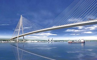
The Gordie Howe International Bridge, known during development as the Detroit River International Crossing and the New International Trade Crossing, is a cable-stayed international bridge across the Detroit River, currently under construction. The crossing will connect Detroit, Michigan, United States of America, and Windsor, Ontario, Canada, by linking Interstate 75 in Michigan with Highway 401 in Ontario. The bridge will provide uninterrupted freeway traffic flow, as opposed to the current configuration with the nearby Ambassador Bridge that connects to city streets on the Ontario side. The bridge is named after Canadian ice hockey player Gordie Howe, whose celebrated career included 25 years with the Detroit Red Wings, and who died two years before construction began.
