This article needs additional citations for verification .(January 2009) |
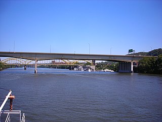
This is a list of bridges and other crossings of the Youghiogheny River starting from its mouth in McKeesport, Pennsylvania upstream.
This article needs additional citations for verification .(January 2009) |
This is a list of bridges and other crossings of the Youghiogheny River starting from its mouth in McKeesport, Pennsylvania upstream.

Route 12 is a state highway located in Hunterdon County, New Jersey, United States. It runs 11.69 mi (18.81 km) from the Uhlerstown–Frenchtown Bridge at the Delaware River border with Pennsylvania in Frenchtown east to an intersection with U.S. Route 202 and Route 31 at the Flemington Circle in Flemington. The route is mostly a two-lane undivided road that passes through rural areas of woodland and farmland. It intersects Route 29 and County Route 513 in Frenchtown, CR 519 in Kingwood Township, CR 579 on the border of Delaware Township and Raritan Township, and CR 523 in Raritan Township.

Pennsylvania Route 179 and Route 179 is an 8.7-mile (14.00 km) state highway in Bucks County, Pennsylvania and Hunterdon County, New Jersey, United States, running along an old alignment of U.S. Route 202 from west of New Hope, Pennsylvania northeast through Lambertville, New Jersey to Ringoes, where it ends at an intersection with US 202 and Route 31. Past this intersection, the road continues east as County Route 514. It is two-lane, undivided highway for most of its length with the exception of a four-lane stretch in Lambertville. The route crosses the Delaware River on the New Hope-Lambertville Bridge, where the designation changes from PA 179 to Route 179.

A swing bridge is a movable bridge that has as its primary structural support a vertical locating pin and support ring, usually at or near to its center of gravity, about which the swing span can then pivot horizontally as shown in the animated illustration to the right. Small swing bridges as found over canals may be pivoted only at one end, opening as would a gate, but require substantial underground structure to support the pivot.

Interstate 676 (I-676) is an Interstate Highway that serves as a major thoroughfare through Center City, Philadelphia, where it is known as the Vine Street Expressway, and Camden, New Jersey, where it is known as the northern segment of the North–South Freeway, as well as the Martin Luther King Jr. Memorial Highway in honor of civil rights leader Martin Luther King Jr. Its western terminus is at I-76 in Philadelphia near the Philadelphia Museum of Art and Fairmount Park. From there, it heads east and is then routed on surface streets near Franklin Square and Independence National Historical Park, home of the Liberty Bell, before crossing the Delaware River on the Benjamin Franklin Bridge. On the New Jersey side of the bridge, the highway heads south to its southern terminus at I-76 in Gloucester City near the Walt Whitman Bridge. Between the western terminus and downtown Camden, I-676 is concurrent with U.S. Route 30 (US 30).

Pennsylvania Route 329 is a Pennsylvania state highway that runs for 12.9 miles (20.8 km) through Lehigh and Northampton counties in the Lehigh Valley region of the state. It runs from PA 873 in the North Whitehall Township village of Neffs east to PA 248 and PA 987 in Bath. The route is a two-lane undivided road that runs through a mix of rural and developed areas to the north of the cities of Allentown and Bethlehem, serving the communities of Balliettsville, Egypt, Cementon, and Northampton. PA 329 intersects PA 145 near Egypt and runs concurrent with PA 987 between East Allen Township and the eastern terminus in Bath.
Pennsylvania Route 32 is a scenic two-lane highway that runs along the west side of the Delaware River in Bucks County, Pennsylvania. It runs from U.S. Route 1 in Falls Township outside of Morrisville northwest to PA 611 in the village of Kintnersville in Nockamixon Township. PA 32 passes through Washington Crossing Historic Park, a Revolutionary War-themed historical park on the site of George Washington's crossing on the night of December 25–26, 1776. It also passes through the boroughs of Morrisville, Yardley, and New Hope.
The Veterans Bridge is a steel and welded girder bridge that carries Interstate 579 over the Allegheny River in Pittsburgh, Pennsylvania. Completed in 1988 it cost $420 million. It opened on November 11, 1988 complete with 107th National Guard howitzers firing ceremoniously from the deck, as the last link in I-579. The bridge, 1,050 feet (320 m) in length, has a main span of 410 feet (120 m) and is 51 feet (16 m) above the water. The roadway atop the structure is seven lanes wide, with six lanes dedicated to northbound and southbound traffic and one lane designed for reversible High Occupancy Vehicle (HOV-2) movements.
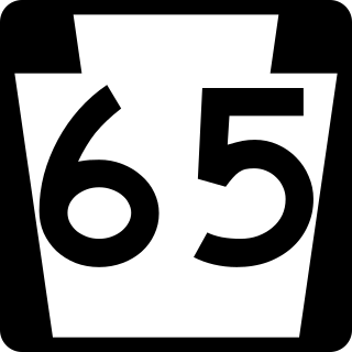
Pennsylvania Route 65, is a major 51-mile-long (82 km) state highway located in western Pennsylvania, United States. The route, traveling north–south from the Interstate 279/U.S. Route 19 Truck concurrency in Pittsburgh north to the PA 108/PA 168 concurrency in New Castle, connects downtown Pittsburgh to the northwestern portion of the Pittsburgh Metropolitan Area. PA 65 is similar in its purpose to PA 18 and PA 51, both of which run parallel to PA 65 at one point or another; however, the three routes pass through different cities for most of their respective alignments.

Pennsylvania Route 532 is a 19.1-mile-long (30.7 km) state route located in the Philadelphia, Pennsylvania area. The route runs from an intersection with U.S. Route 1 in Northeast Philadelphia north to an intersection with PA 32 in Washington Crossing near the Washington Crossing Bridge over the Delaware River. The route passes through developed areas in Northeast Philadelphia before heading north through suburban Bucks County, serving Feasterville, Holland, and Newtown before coming to Washington Crossing.
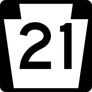
Pennsylvania Route 21 is a 50.75-mile (81.67 km) long east–west state highway in the US state of Pennsylvania. The western terminus of the route is at the West Virginia state line in Richhill Township, where PA 21 continues into West Virginia as West Virginia Route 891. The eastern terminus is at U.S. Route 40 Business in Uniontown. The route is known as the Roy E. Furman Highway for most of its length. PA 21 serves Waynesburg and Masontown along the way.
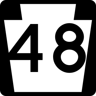
Pennsylvania Route 48 is an 18.9-mile-long (30.4 km) state highway located in the Pittsburgh, Pennsylvania area. The route is predominantly a two-lane highway as it runs through McKeesport and other suburbs. The entire routing of PA 48 is part of the Orange Belt, both reaching their southern termini at Pennsylvania Route 51, southeast of Elizabeth. Until 1998, the northern terminus of PA 48 was at the intersection of Old Haymaker and Center Roads, about 1/2 mile from its current terminus at U.S. Route 22 Business in Monroeville.

State Route 1002(SR 1002), locally known as Tilghman Street and Union Boulevard, is a major 13.8 mi (22.2 km) long east–west road in the Lehigh Valley area of the U.S. state of Pennsylvania. The majority of the roadway is the former alignment of U.S. Route 22, maintained by the Pennsylvania Department of Transportation as a Quadrant Route, and is not signed except on small white segment markers.
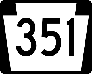
Pennsylvania Route 351 is a 17.2-mile-long (27.7 km) state highway located in Lawrence and Beaver counties in Pennsylvania. The western terminus is at the Ohio border in Little Beaver Township. The eastern terminus is at PA 65/PA 288 in Ellwood City. It is famous for its spotting of Raymond Robinson who would go on nighttime walks on the route making him an Urban legend.
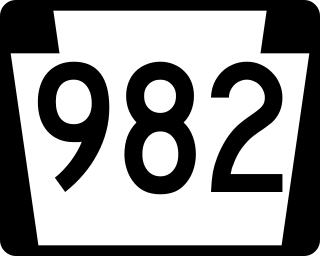
Pennsylvania Route 982 is a state highway which runs 32.15 miles across Fayette and Westmoreland counties, in southwestern Pennsylvania. The highway begins at U.S. Route 119 in Moyer, Pennsylvania, and runs northward into Westmoreland County, passing through the towns of Youngstown, Latrobe, and Derry before ending at US 22/US 119 near Blairsville.

U.S. Route 62 is a signed north-south U.S. Highway in Pennsylvania, which runs diagonally southwest-northeast through the industrial northwestern part of the state. Although initial portions of the route opened in 1926 in other areas of the country, US 62 was not designated in the commonwealth until 1932. The highway connects the small cities of Sharon, Franklin, Oil City, and Warren to larger markets, such as Youngstown, Ohio and Buffalo, New York.

At least 13 special routes of U.S. Route 11 and at least one of U.S. Route 11E have existed.

The Straight Street Bridge is a vehicular bridge over the Passaic River in Paterson, New Jersey, that is listed on the National Register of Historic Places.

The Raritan River Bridge is a rail bridge over the Raritan River, in New Brunswick and Highland Park in Middlesex County, New Jersey, U.S. The arch bridge carries the Northeast Corridor (NEC) at MP 30.92. It used by Amtrak, including Northeast Regional service, and New Jersey Transit's Northeast Corridor Line. It also crosses over New Jersey Route 18 and the East Coast Greenway.
{{cite web}}: |last= has generic name (help)