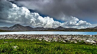
Gilgit is a city in Pakistani-administered Gilgit–Baltistan in the disputed Kashmir region. It is the capital of the Gilgit-Baltistan region. The city is located in a broad valley near the confluence of the Gilgit and the Hunza rivers. It is a major tourist destination in Pakistan, serving as a hub for trekking and mountaineering expeditions in the Karakoram mountain range.

Skardu is a city located in Pakistan-administered Gilgit-Baltistan in the disputed Kashmir region. Skardu serves as the capital of Skardu District and the Baltistan Division. It is situated at an average elevation of nearly 2,500 metres above sea level in the Skardu Valley, at the confluence of the Indus and Shigar rivers. The city is an important gateway to the eight-thousanders of the nearby Karakoram mountain range. The Indus River running through the region separates the Karakoram from the Ladakh Range.

Chilas is a city in Pakistani-administered Gilgit–Baltistan in the disputed Kashmir region. It is the divisional capital of Diamer Division and is located on the Indus River. It is part of the Silk Road, connected by the Karakoram Highway and N-90 National Highway to Islamabad and Peshawar in the southwest, via Hazara and Malakand divisions of Khyber Pakhtunkhwa. To the north, Chilas connects to the cities of Tashkurgan and Kashgar in Xinjiang, China, via Gilgit, Aliabad, Sust, and the Khunjerab Pass.
Diamer District, also spelled Diamir District,) is a district in the Gilgit-Baltistan region administered by Pakistan. The headquarters of the district is the town of Chilas. The district is bounded on the north by the Tangir and the Gilgit districts, on the east by the Astore District, on the south by the Mansehra district of Pakistan's Khyber Pakhtunkhwa Province and the Neelum District of Pakistan controlled Kashmir, and on the west by the Upper Kohistan District of Khyber Pakhtunkhwa Province. The Karakoram Highway passes through Diamer District.
Tourism in Pakistan is a growing industry. In 2010, Lonely Planet termed Pakistan "tourism's 'next big thing'". The country is geographically and ethnically diverse, and has a number of historical and cultural heritage sites. Condé Nast Traveller ranked Pakistan The Best Holiday Destination for 2020 and also declared it the third-highest potential adventure destination in the world for 2020. As security in the country improves, tourism increases; in two years, it has increased by more than 300%.

Gilgit-Baltistan, formerly known as the Northern Areas, is a region administered by Pakistan as an administrative territory and consists of the northern portion of the larger Kashmir region, which has been the subject of a dispute between India and Pakistan since 1947 and between India and China since 1959. It borders Azad Kashmir to the south, the province of Khyber Pakhtunkhwa to the west, the Wakhan Corridor of Afghanistan to the north, the Xinjiang region of China to the east and northeast, and the Indian-administered union territories of Jammu and Kashmir and Ladakh to the southeast.
Gilgit-Baltistan is an administrative territory of Pakistan that borders the province of Khyber Pakhtunkhwa to the west, Azad Kashmir to the southwest, Wakhan Corridor of Afghanistan to the northwest, the Xinjiang Uyghur Autonomous Region of China to the north, and the Indian-administered region of Jammu and Kashmir to the south and south-east.
Pakistan's cultural heritage includes archaeological sites, stupas, forts, shrines, tombs, buildings, residences, monuments, and places of worship. Until the passing of the Eighteenth Amendment to the Constitution of Pakistan, some sites were under the federal government while others were in the provincial domain.

The 2013 Nanga Parbat massacre was a terrorist attack that took place on the night of 22 June 2013 in Gilgit–Baltistan, Pakistan. About 16 terrorists, reportedly dressed in Gilgit−Baltistan Scouts uniforms, stormed a high-altitude mountaineering base camp and killed 11 people; 10 climbers and one local tourist guide. The climbers were from various countries, including Ukraine, China, Slovakia, Lithuania and Nepal. A Chinese citizen managed to escape the assailants, and a member of the group from Latvia happened to be outside the camp during the attack. The attack took place at a base camp on Nanga Parbat, the ninth-highest mountain on Earth. The mountain is popular among trekkers and mountaineers, and is typically toured from June to August because of the ideal weather conditions during these months.
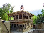
Noorpur Stupas is an archaeological site in Gilgit, Gilgit-Baltistan, Pakistan.

Mughal Minar is an archaeological site in Gilgit, Gilgit-Baltistan, Pakistan. It previously served as a Stupa.

Kargah Buddha is an archaeological site located about 6 miles (9.7 km) outside of Gilgit, Gilgit−Baltistan, Pakistan. It is a carved image of a large standing Buddha, some 50 ft (15 m) high, in the cliff-face in Kargah Nala. The carving, which is in a style also found in Baltistan, is estimated to date back to the 7th century.

Keno Daas (rock carvings) is an archaeological site in Gilgit, Gilgit-Baltistan, Pakistan. These are the important rock carvings, and are located just outside Gilgit, towards Hunza Valley.
Danyor Rock Inscriptions is an archaeological site in Danyor, Gilgit-Baltistan. It is a gigantic boulder bearing inscriptions from the 7th and 8th centuries A.D.

The Gilgit−Baltistan Scouts, are a federal paramilitary force in Pakistan, tasked with law enforcement in the nominally autonomous territory of Gilgit-Baltistan and border guard duties. The force was formed in 2003 under the control of the Interior Ministry of Pakistan, but it claims a tradition dating back to the Gilgit Scouts formed during the British Raj era. However, the earlier Scouts unit is now a full infantry regiment of the Pakistan Army (see Northern Light Infantry Regiment, which mostly operates in the same region as the current Scouts.