
During its history, the city of Blois included various bridges, mainly over the Loire river, but also over the Cosson river, one of its tributaries.
During its history, the city of Blois included various bridges, mainly over the Loire river, but also over the Cosson river, one of its tributaries.
As early as the Roman Empire, between AD 20 and 300, a permanent river crossing system was built downstream of the medieval bridge and the current Jacques-Gabriel Bridge. This rather rudimentary system consisted of various submersible artificial islands aligned diagonally and alternating with flooded passages, known as dike (duits in French). Such a dike bridge seems to have been built and used to make it possible to link the two banks on which two independent villages developed: Castrum Blesense on the right bank [1] and Vienna on a river island at the other side. [2]
Between the 1st and 2nd centuries, a first proper bridge was also built to join the two banks. Also known as Gallo-Roman bridge, it was located further downstream from the present-day Jacques-Gabriel Bridge, between the former Hall of Louis XII (now Maison de la BD, on the right bank) and Rue Munier (in Vienne). It was a mainly wooden bridge, whose the foundations are visible when the river experiments drought flow. The piles, all squared, come from oak trees and form 9 “clouds” , thus testifying to a bridge with 9 pillars.
The dating of the remains was estimated by carbon-14 analysis and dendrochronology techniques. [3]
A second bridge, in wood and stone, is first mentioned from 1089 onwards in a document in which the newly Count Stephen attests to the ownership of two mills built on the bridge and owned by the abbot of Pontlevoy. [4] In 2003, French National Institute for Preventive Archaeological Research (INRAP) confirmed by radiocarbon dating that the oaks used for the foundations of this structure dated from somewhen between 998 and 1159. It would thus seem that its construction was ordered and financed by Count Stephen's grandfather, Count Odo II, who was on the initiative of the Medieval Bridge of Tours construction between 1034 and 1037.
The medieval bridge of Blois was located 70m downstream from the modern Jacques-Gabriel Bridge. The foundations of most of its 19 stone pillars are also visible when the river's water lever is low. These are responsible for the water backwash downstream of the modern bridge.
In the Middle Ages, the river was more heavily developed: on the bridge, there were also houses, towers (including a gate-tower on the fortified right bank), a chapel as well as stairs to a submersible dike, on which there were 5 water mills, fisheries and a small port. This dike, also visible when the water level is low, originally crossed the river from the bridge to St Nicolas Church, and was then reinforced and extended in the 13th century to the level of La Creusille Harbor in order to divert the river's flow to the right bank. [5]
Very early on, Counts of Blois understood the geostrategic importance of this bridge, hence the presence of a gate-tower at the entrance to the town, thus introducing a toll tax on all new entrants. At the time, it was the only bridge over the Loire river for many miles, which explains why so many activities were concentrated on it.

Eventually, on the night during February 6 and 7, 1716, the bridge collapsed under the pressure of a violent ice jam break-up on the river. [6] One year later, the construction of the Jacques-Gabriel Bridge began, and lasted until 1724. [7]

So-called Chartrain bridges provided a means of crossing a wet, flood-prone area between the steam bed of the Loire river and the Cosson river, between Vienne island and Vineuil (on the East of Vienne), on the left bank. [8] From their construction in 1201 [9] until the 18th century, the fastest road from Chartres to Bourges passed over these bridges, but they are probably incorrectly called “Chartrain”, as they were originally described as “chastré bridges” (ponts chastrés in French), to indicate a sort of overpass.
Indeed, until the construction in 1717 of a levee in the extension of La Creusille Harbor, La Bouillie area was a wetland subject to flooding in the event of flooding, but sometimes considered to be a secondary constant steam bed of the Loire river. [10] After that year, the area was drained, roads were built to connect the former river island to the villages on the left bank, and the bridges fell into disuse. The Chartrain bridges remain as a small tarmac road.
Since 2006, the infrastructure has been classified as a historical monument. [11]
Just like the precedent ones, the St Michel bridges enabled it to be reached Vienne but from Saint-Gervais-la-Forêt, on the West. Built and used over the same period, and starting from the present rue des Métairies, this elevated road gave access to the lower part of St-Gervais. [12]
However, unlike the Chartrain bridges, there are very few remains of the St Michel bridges. After the successive 100-year floods of the 19th century, the bridges were badly damaged and required extensive work. Almost the entire structure was razed in 1867 and then destroyed in 1885 to allow for the construction of the current extension of the rue des Métairies. The present mill bridge over the Cosson was built in 1868 on the remains of the old bridges. Today, all that remains of the St Michel bridges are 6 stone pillars in the middle of a pond, located between the levee and the auberge espagnole (local hotel). [13]

Orléans is a city in north-central France, about 120 kilometres southwest of Paris. It is the prefecture of the department of Loiret and of the region of Centre-Val de Loire.

Blois is a commune and the capital city of Loir-et-Cher department, in Centre-Val de Loire, France, on the banks of the lower Loire river between Orléans and Tours.

The Pont Saint-Bénézet, also known as the Pont d'Avignon, was a medieval bridge across the Rhône in the town of Avignon, in southern France. Only four arches survive.

Auray is a commune in the Morbihan department, administrative region of Brittany, northwestern France.

The County of Blois was a feudal principality centred on Blois, south of Paris, France. It was created just after king Clovis I conquered Roman Gaul around AD 500. Between the 8th and the 13th centuries, it was amongst the most powerful vassal counties within the Kingdom of France, after having succeeded in surrounding the Capetian dynasty's lands of France since Blois annexed the Champagne.

Montsoreau is a commune of the Loire Valley in the Maine-et-Loire department in western France on the Loire, 160 km (99 mi) from the Atlantic coast and 250 km (160 mi) from Paris. The village is listed among The Most Beautiful Villages of France and is part of the Loire Valley UNESCO World Heritage Site.

The arrondissement of Blois is an arrondissement (district) of France, located in the Loir-et-Cher department, Centre-Val de Loire. It has 93 communes. Its population is 150,805 (2016), and its area is 1,950.2 km2 (753.0 sq mi).

The Petit Pont is an arch bridge crossing the River Seine in Paris, built in 1853, although a structure has crossed the river at this point since antiquity. The present bridge is a single stone arch linking the 4th arrondissement and the Île de la Cité, with the 5th arrondissement, between quai de Montebello and quai Saint-Michel. The Petit Pont is notable for having been destroyed at least thirteen times since its original inception during Gallo-Roman times to the mid-19th century.

Pont Saint-Michel is a bridge linking the Place Saint-Michel on the left bank of the river Seine to the Île de la Cité. It was named after the nearby chapel of Saint-Michel. It is near Sainte Chapelle and the Palais de Justice. The present 62-metre-long bridge dates to 1857.

Alloue is a commune in the Charente department in the Nouvelle-Aquitaine region of southwestern France.

La Ferté-Saint-Cyr is a commune near Blois, in the Loir-et-Cher department in Centre-Val de Loire, France.

The city walls of Paris refers to the city walls that surrounded Paris, France, as it grew from ancient times until the 20th century, built primarily to defend the city but also for administrative reasons. Several successive city walls were built over the centuries, either adding to existing walls or replacing demolished ones, through 1846, when construction of the Thiers wall was completed.

The railway from Paris to Bordeaux is an important French 584-kilometre long railway line, that connects Paris to the southwestern port city Bordeaux via Orléans and Tours. The railway was opened in several stages between 1840 and 1853, when the section from Poitiers to Angoulême was finished. The opening of the LGV Atlantique high speed line from Paris to Tours in 1989 has decreased the importance of this section of the line for passenger traffic; the opening of the LGV Sud Europe Atlantique in 2017 has seen all long distance passenger trains migrating to that line and leaving space for more regional and local trains, as well as freight trains.

The Loire is the longest river in France and the 171st longest in the world. With a length of 1,006 kilometres (625 mi), it drains 117,054 km2 (45,195 sq mi), more than a fifth of France's land, while its average discharge is only half that of the Rhône.

La Creusille is a harbor on the left bank of the Loire river, located in the southern part of Blois, France.
Blois-Vienne, or merely Vienne for locals, is the common name given to the southern part of Blois, central France, separated from the rest of the city by the natural border of the Loire river. It corresponds to the subdistricts of St Saturnin, La Creusille, Les Métairies and La Vaquerie, but also include the hamlets of Bas-Rivière and Béjun, although these ones are now administratively attached to the neighboring commune of Chailles. In other words, it is now the left bank of the Loire in Blois.
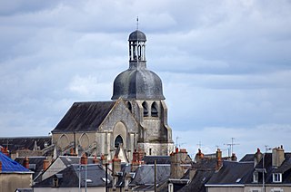
Blois-Vienne Church is a Roman Catholic church located on the left bank of the Loire river in the city of Blois, France.

The Jacques-Gabriel Bridge spans the Loire river in Blois, France, since the beginning of the 18th century. With a total length of 283m, it is made up of 11 arches, and is the last arch bridge on the river that is pointed. Since its construction, the edifice holds the name of the architect who designed it, Jacques Gabriel. The bridge was partially destroyed three times: in 1870, 1940 and 1944. It is now crossed by the Route Nationale 156.