List of heritage houses in Sydney

Last updated

Vaucluse House Vaucluse House (eastern tower).jpg
Vaucluse House

This is a list of heritage houses in Sydney , New South Wales, Australia. The following houses are listed on the Commonwealth Heritage List, the New South Wales State Heritage Register, [1] various local government heritage registers, and/or the (now defunct) Register of the National Estate. [2]

Contents

HouseBuiltVicinityHeritage register(s)Notes
CHL NSW
SHR
Local
government
RNE
(defunct register)
Elizabeth Farm 1790s Parramatta 1 [3]
Experiment Farm Cottage 1790s Harris Park
Old Government House 1790sParramatta
The Dairy Cottage1798Parramatta
Vaucluse House 1839 Vaucluse 955 [4]
Cadmans Cottage 1810s The Rocks
Juniper Hall 1820s Paddington
Toxteth Park 1820s Glebe
Glover cottages 1820s Millers Point
Camden Park 1830s Camden
Elizabeth Bay House 1830s Elizabeth Bay
Government House 1830s Sydney 18721866; 102246 [5] [6] [7]
Lindesay 1830s Darling Point
Newington House 1830s Silverwater
Rose Bay Cottage 1830s Rose Bay
Admiralty House 1840s Kirribilli 105399 [8] [9]
Darling House 1840sMillers Point
Carthona 1840sDarling Point
The Hermitage 1840s Ryde
Richmond Villa 1840sMillers Point
Willandra 1840sRyde
Bronte House 1845 Bronte 55 Waverley 2467 [10] [11] [12]
Emu Hall 1850s Emu Plains
Bishopscourt 1850sDarling Point
Fairfax House 1850s Bellevue Hill
Greycliffe House 1850sVaucluse
Kirribilli House 1850sKirribilli
Stead House 1850s Marrickville
Strickland House 1850sVaucluse
Gladswood House 1860s Double Bay
Reussdale 1860sGlebe
Tresco 1860s Elizabeth Bay
Fernleigh Castle 1870s Rose Bay
The Swifts 1870sDarling Point1462577 [13] [14]
The Hermitage 1870sVaucluse
Ventnor 1870s Randwick
The Abbey 1880s Annandale
Cloncorrick 1880sDarling Point
Caerleon 1880sBellevue Hill
Highroyd 1880sAnnandale
Rona 1880sBellevue Hill
St Helens Park House 1880s St Helens Park
Woollahra House 1880s Point Piper
Bellevue 1890sGlebe
Berith Park c.1909 Wahroonga Ku-ring-gai [15]
The Crossways 1900s Centennial Park
Eryldene 1910s Gordon
Highbury 1910sCentennial Park
Boomerang 1920sElizabeth Bay
Rovello 1930sBellevue Hill
Rose Seidler House 1940sWahroonga
Harry and Penelope Seidler House 1960s Killara
Woolley House 1960s Mosman

See also

Related Research Articles

<span class="mw-page-title-main">Darlinghurst, New South Wales</span> Suburb of Sydney, New South Wales, Australia

Darlinghurst is an inner-city, eastern suburb of Sydney, New South Wales, Australia. Darlinghurst is located immediately east of the Sydney central business district (CBD) and Hyde Park, within the local government area of the City of Sydney. It is often colloquially referred to as "Darlo".
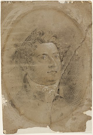
<span class="mw-page-title-main">Francis Greenway</span> Architect

Francis Howard Greenway was an English-born architect who was transported to Australia as a convict for the crime of forgery. In New South Wales he worked for the Governor, Lachlan Macquarie, as Australia's first government architect. He became widely known and admired for his work displayed in buildings such as St Matthew's Church, St James' Church and Hyde Park Barracks.

<span class="mw-page-title-main">Pitt Street</span> Street in Sydney, Australia

Pitt Street is a major street in the Sydney central business district in New South Wales, Australia. The street runs through the entire city centre from Circular Quay in the north to Waterloo, although today's street is in two disjointed sections after a substantial stretch of it was removed to make way for Sydney's Central railway station. Pitt Street is well known for the pedestrian only retail centre of Pitt Street Mall, a section of the street which runs from King Street to Market Street.

John Verge (1782–1861) was an English architect, builder, pioneer settler in the Colony of New South Wales, who migrated to Australia and pursued his career there. Verge was one of the earliest and the most important architect of the Greek Revival in Australia. He also brought more comprehensive range of Regency style than any contemporary architects. His design indicates the increasing of sophistication compared to previous architect's design.

<span class="mw-page-title-main">Camden Council (New South Wales)</span> Local government area in New South Wales, Australia

Camden Council is a local government area in the Macarthur region of Sydney, in the state of New South Wales, Australia. The area is located south west of the Sydney central business district and comprises 201 square kilometres (78 sq mi) with an estimated population at the 2021 census of 119,325. The Mayor of Camden is Cr. Therese Fedeli, a member of the Liberal Party.
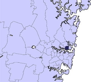
<span class="mw-page-title-main">North Sydney Council</span> Local government area in New South Wales, Australia

North Sydney Council is a local government area on the Lower North Shore of Sydney, New South Wales, Australia, established on 29 July 1890 through the amalgamation of three boroughs.

<span class="mw-page-title-main">City of Penrith</span> Local government area in New South Wales, Australia

The City of Penrith is a local government area in the state of New South Wales, Australia. The seat of the city is located in Penrith, located about 50 kilometres (31 mi) west of Sydney's central business district. It occupies part of the traditional lands of the Darug people. First incorporated as a municipality on 12 May 1871, on 1 January 1949, the municipalities of Penrith, St Marys and Castlereagh and part of the Nepean Shire amalgamated to form a new Municipality of Penrith. Penrith was declared a City on 21 October 1959, and expanded westwards to include Emu Plains and Emu Heights, formerly part of the City of Blue Mountains, on 25 October 1963. As at the 2016 census the City of Penrith had an estimated population of 196,066.
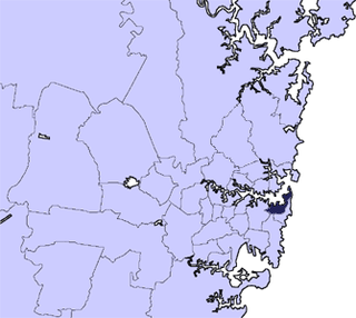
<span class="mw-page-title-main">Municipality of Woollahra</span> Local government area in New South Wales, Australia

Woollahra Municipal Council is a local government area in the eastern suburbs of Sydney, in the state of New South Wales, Australia. Woollahra is bounded by Sydney Harbour in the north, Waverley Council in the east, Randwick City in the south and the City of Sydney in the west.

<span class="mw-page-title-main">Millers Point, New South Wales</span> Suburb of Sydney, New South Wales

Millers Point is an inner-city suburb of Sydney, in the state of New South Wales, Australia. It is on the north-western edge of the Sydney central business district, adjacent to The Rocks and is part of the local government area of the City of Sydney.
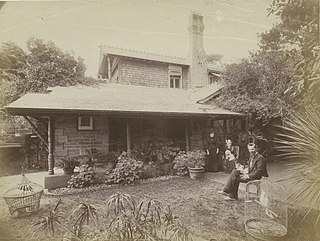
<span class="mw-page-title-main">John Horbury Hunt</span> Australian architect

John Horbury Hunt, often referred to as Horbury Hunt, was a Canadian-born Australian architect who worked in Sydney and rural New South Wales from 1863.

Courthouses in New South Wales were designed by the Colonial Architect, later known as the Government Architect of New South Wales, Australia.

<span class="mw-page-title-main">Walter Liberty Vernon</span>

Colonel Walter Liberty Vernon was an English architect who migrated to Australia and pursued his career as an architect in Sydney, New South Wales. In his role as the New South Wales Government Architect he is noted for designing multiple government buildings, many of which are extant with listings on national and state heritage registers.

<span class="mw-page-title-main">Gladesville Mental Hospital</span> Former psychiatric hospital in Sydney, New South Wales, Australia

The Gladesville Mental Hospital, formerly known as the Tarban Creek Lunatic Asylum, was a psychiatric hospital established in 1838 in the Sydney suburb of Gladesville. The hospital officially closed in 1993, with the last inpatient services ceasing in 1997.

<span class="mw-page-title-main">Mortimer Lewis</span>

Mortimer William Lewis was an English-born architect, surveyor and public servant who migrated to Australia and became Colonial Architect in the colony of New South Wales from 1835 to 1849. Lewis was responsible for designing and overseeing many government buildings in Sydney and rural New South Wales, many of which are heritage listed.
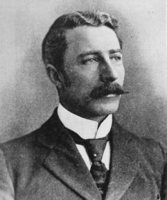
<span class="mw-page-title-main">George McRae</span>

George McRae was a Scottish architect who migrated to Australia and pursued his career in Sydney, where he became Government Architect of New South Wales and designed some of Sydney's best-known buildings, including completion of the Sydney Town Hall, the Queen Victoria Building, and the lower entrance to Taronga Zoo.

<span class="mw-page-title-main">Bridge Street, Sydney</span> Street in Sydney, Australia

Bridge Street is a street in the central business district of Sydney in New South Wales, Australia. Bridge Street runs for 500 metres (1,600 ft) in a west–east direction with traffic flowing in both directions. It is situated in the northern portion of the central business district. The western terminus of Bridge Street is at George Street, with the eastern terminus at Macquarie Street, adjacent to the Chief Secretary's Building. From west to east, Bridge Street crosses Pitt and Phillip streets.

<span class="mw-page-title-main">Sussex Street, Sydney</span> Street in Sydney, Australia

Sussex Street is a street in the central business district of Sydney in New South Wales, Australia. It runs north-south along the western side of the city, between Hickson Road and Hay Street. It is in the local government area of the City of Sydney. The street is 1.7 kilometres (1.1 mi) long. It was named in honour of Prince Augustus Frederick, Duke of Sussex, the sixth son of King George III.

References

  1. HRNSW = Listed on the Heritage Register of New South Wales. See Main page, Heritage Listings and Search for NSW Heritage
  2. RNE = Listed on the (now defunct) Register of the National Estate. See Register of the National Estate and The Register of the National Estate: Who, What, Where?
  3. "Elizabeth Farm". New South Wales State Heritage Register . Department of Planning and Environment. H00001. Retrieved 1 June 2018. CC-BY icon.svg Text is licensed by State of New South Wales (Department of Planning and Environment) under CC-BY 4.0 licence .
  4. "Vaucluse House". New South Wales State Heritage Register . Department of Planning and Environment. H00955. Retrieved 2 June 2018. CC-BY icon.svg Text is licensed by State of New South Wales (Department of Planning and Environment) under CC-BY 4.0 licence .
  5. "Government House, Movable Heritage Collection and Gardens". New South Wales State Heritage Register . Department of Planning and Environment. H01872. Retrieved 14 October 2018. CC-BY icon.svg Text is licensed by State of New South Wales (Department of Planning and Environment) under CC-BY 4.0 licence .
  6. "Government House, Conservatorium Rd, Sydney, NSW, Australia (Place ID 1866)". Australian Heritage Database . Australian Government . Retrieved 30 October 2017.
  7. "Government House, Associated Buildings and Garden, Conservatorium Rd, Sydney, NSW, Australia (Place ID 102246)". Australian Heritage Database . Australian Government . Retrieved 30 October 2017.
  8. "Admiralty House Garden and Fortifications (CHL) (Place ID 105399)". Australian Heritage Database . Australian Government . Retrieved 12 October 2017.
  9. "Admiralty House Garden and Fortifications (Place ID 102281)". Australian Heritage Database . Australian Government . Retrieved 12 October 2017.
  10. "Bronte House". New South Wales State Heritage Register . Department of Planning and Environment. H00055. Retrieved 1 June 2018. CC-BY icon.svg Text is licensed by State of New South Wales (Department of Planning and Environment) under CC-BY 4.0 licence .
  11. "Bronte House". New South Wales State Heritage Register . Department of Planning and Environment . Retrieved 22 November 2017. CC-BY icon.svg Text is licensed by State of New South Wales (Department of Planning and Environment) under CC-BY 4.0 licence .
  12. "Bronte House and surrounds (Place ID 2467)". Australian Heritage Database . Australian Government. 21 March 1978. Retrieved 22 November 2017.
  13. "Swifts". New South Wales State Heritage Register . Department of Planning and Environment. H00146. Retrieved 1 June 2018. CC-BY icon.svg Text is licensed by State of New South Wales (Department of Planning and Environment) under CC-BY 4.0 licence .
  14. "The Swifts, 68 Darling Point Rd, Darling Point, NSW, Australia (Place ID 2577)". Australian Heritage Database . Australian Government . Retrieved 12 August 2018.
  15. "Heritage items". KU-RING-GAI LOCAL ENVIRONMENTAL PLAN 2015 - SCHEDULE 5. AustLII. 2015. Retrieved 12 May 2019.