List of highest points in Washington by county

Last updated

This is a list of highest points in the U.S. state of Washington, in alphabetical order by county.

Contents

CountyNameHeight
feet / m
ProminenceRangeNotes
Adams Karakul Hills 2,100 feet (640 m)190 feet (58 m)North Columbia Plateau
Asotin Ray Ridge 6,180 feet (1,880 m)60 feet (18 m) Blue Mountains
Benton Lookout Summit 3,629 feet (1,106 m)1,849 feet (564 m) Rattlesnake Hills
Chelan Bonanza Peak 9,511 feet (2,899 m)3,711 feet (1,131 m) North Cascades
Clallam Gray Wolf Ridge 7,218 feet (2,200 m)818 feet (249 m) Olympic Mountains
Clark Sturgeon Rock-West Ridge4,080 feet (1,240 m)0 feet (0 m) South Washington Cascades
Columbia Oregon Butte 6,387 feet (1,947 m)2,407 feet (734 m) Blue Mountains
Cowlitz Goat Mountain in Mount St. Helens National Volcanic Monument 4,965 feet (1,513 m)2,005 feet (611 m) South Washington Cascades
Douglas Badger Mountain 4,254 feet (1,297 m)2,674 feet (815 m)North Columbia Plateau
Ferry Copper Butte 7,140 feet (2,180 m)4,740 feet (1,440 m) Monashee Mountains
Franklin Franklin County High Point1,640 feet (500 m)541 feet (165 m)North Columbia Plateau
Garfield Diamond Peak 6,379 feet (1,944 m)779 feet (237 m) Blue Mountains Mount Misery, the county's second-highest point, is 13 feet lower and about a kilometer away. [1]
Grant Beezley Hills 2,899 feet (884 m)749 feet (228 m)North Columbia Plateau
Grays Harbor Shoulder of Wynoochee Point 4,880 feet (1,490 m)0 feet (0 m) Satsop Hills The actual Grays Harbor County high point is less than 100 meters away from 4,949-foot (1,508 m) Wynoochee Point, which lies in Mason County. [2]
Island Camano Island High Point580 feet (180 m)580 feet (180 m)
Jefferson Mount Olympus 7,969 feet (2,429 m)7,838 feet (2,389 m) Olympic Mountains Ultra prominent
King Mount Daniel 7,960 feet (2,430 m)3,480 feet (1,060 m) South Washington Cascades
Kitsap Gold Mountain 1,761 feet (537 m)1,521 feet (464 m) Blue Hills
Kittitas Mount Daniel 7,960 feet (2,430 m)3,480 feet (1,060 m) South Washington Cascades
Klickitat Indian Rock5,845 feet (1,782 m)2,565 feet (782 m)North Columbia Plateau
Lewis Big Horn 8,000 feet (2,400 m)240 feet (73 m) South Washington Cascades
Lincoln Lilienthal Mountain 3,568 feet (1,088 m)1,268 feet (386 m)North Columbia Plateau
Mason Mount Stone 6,612 feet (2,015 m)2,132 feet (650 m) Olympic Mountains
Okanogan North Gardner Mountain 8,956 feet (2,730 m)3,996 feet (1,218 m) North Cascades
Pacific Pacific County High Point3,000 feet (910 m)1,480 feet (450 m) Willapa Hills
Pend Oreille Gypsy Peak 7,320 feet (2,230 m)1,720 feet (520 m) Selkirk Mountains
Pierce Mount Rainier 14,411 feet (4,392 m)13,210 feet (4,030 m) South Washington Cascades Ultra prominent
Highest point in Washington state
San Juan Mount Constitution 2,407 feet (734 m)2,407 feet (734 m)The second highest mountain on an ocean island in the contiguous 48 states
Skagit Mount Buckner 9,114 feet (2,778 m)3,034 feet (925 m) North Cascades
Skamania Mount Adams-West Slope8,920 feet (2,720 m)0 feet (0 m) South Washington Cascades Prior to its 1980 eruption, Mount St. Helens was 9,677 feet (2,950 m)
Snohomish Glacier Peak 10,520 feet (3,210 m)7,498 feet (2,285 m) North Cascades Ultra prominent
Spokane Mount Spokane 5,883 feet (1,793 m)3,503 feet (1,068 m) Selkirk Mountains
Stevens Abercrombie Mountain 7,308 feet (2,227 m)5,168 feet (1,575 m) Selkirk Mountains Ultra prominent
Thurston Quiemuth Peak 2,922 feet (891 m)762 feet (232 m) South Washington Cascades
Wahkiakum Huckleberry Ridge 2,673 feet (815 m)393 feet (120 m) Willapa Hills
Walla Walla Lewis Peak 4,888 feet (1,490 m)168 feet (51 m) Blue Mountains
Whatcom Mount Baker 10,781 feet (3,286 m)8,812 feet (2,686 m) North Cascades Ultra prominent
Whitman Tekoa Mountain 4,009 feet (1,222 m)1,089 feet (332 m)North Columbia Plateau
Yakima Mount Adams 12,276 feet (3,742 m)8,116 feet (2,474 m) South Washington Cascades Ultra prominent

Related Research Articles

<span class="mw-page-title-main">Shenandoah Mountain</span>

Shenandoah Mountain is a mountain ridge approximately 73 miles (117 km) long in Virginia and West Virginia. The steep, narrow, sandstone-capped ridge extends from northern Bath County, Virginia to southern Hardy County, West Virginia. Along the way, its crest defines the borders between Highland and Augusta counties, Virginia, and between Pendleton County, West Virginia, and Rockingham County, Virginia. Its high point is 4397’/1340 m Reddish Knob along the Virginia/West Virginia border.

<span class="mw-page-title-main">Mount Jefferson (Nevada)</span> Mountain in Nevada, United States

Mount Jefferson is the highest mountain in both the Toquima Range and Nye County in Nevada, United States. It is the sixth highest mountain in the state. As the high point of a range which is well separated from other ranges by low basins, Mount Jefferson has a high topographic prominence of 5,861 feet (1,786 m). This makes it the most prominent peak in Nye County and the third most prominent peak in Nevada. For similar reasons, it is also the highest mountain for over 90 miles in all directions. It is located about 50 miles (80 km) northeast of the county seat of Tonopah within the Alta Toquima Wilderness of the Humboldt-Toiyabe National Forest, near the smaller towns of Carvers and Round Mountain. Three distinct summits are located on a broad area of subalpine tundra: North Summit rises to 11,820 feet (3,603 m), Middle Summit to 11,692 feet (3,564 m), and South Summit to 11,949 feet (3,642 m). During the Pleistocene, alpine glaciers eroded several cirques east of the summit plateau.

Mount Union is a mountain located in the Prescott National Forest in central Yavapai County, Arizona. The mountain's summit is the highest point of the Bradshaw Mountains, and of Yavapai County. Mount Union is flanked to the northeast by Mount Davis. A lookout tower built by the CCC is on top of Mount Union, and exceeds 8,000 foot elevation. A service road for the communication towers allows easy access to the summit of Mount Union. However, the road goes through private property and is closed to motorized vehicles. Walk to the top for great 360 degree views.

<span class="mw-page-title-main">Twin Sisters Peaks</span> Mountain in Colorado, United States

The Twin Sisters Peaks are mountains in Colorado, located in the Front Range in Larimer County, Colorado, straddling Rocky Mountain National Park and Roosevelt National Forest.

<span class="mw-page-title-main">Signal Peak (Utah)</span> Mountain in the American state of Utah

Signal Peak, with an elevation of 10,369 feet (3,160 m), is the highest peak in the Pine Valley Mountains and in Washington County in southwestern Utah, United States. Signal Peak is located north of the city of St. George and south of the community of Pine Valley in the Dixie National Forest. The summit is the highest point in the Pine Valley Mountain Wilderness.
<span class="mw-page-title-main">Mount Stone</span> Mountain in Washington (state), United States

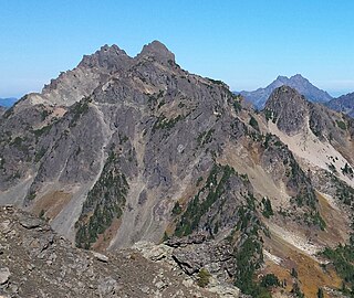
Mount Stone is a 6,612-foot (2,015 m) peak in the Olympic Mountains. It is the highest point in Mason County, Washington and exceeds 2,000 feet (610 m) in prominence.

<span class="mw-page-title-main">Mount Audubon</span> Mountain in the state of Colorado

Mount Audubon is a high mountain summit of the Indian Peaks in the northern Front Range of the Rocky Mountains of North America. The 13,229-foot (4,032 m) thirteener is located in the Indian Peaks Wilderness of Roosevelt National Forest, 5.6 miles (9.0 km) west-northwest of the Town of Ward in Boulder County, Colorado, United States. The mountain was named in honor of John James Audubon.

<span class="mw-page-title-main">Dyer Mountain</span> Mountain in Colorado, United States

Dyer Mountain is a high mountain summit in the Mosquito Range of the Rocky Mountains of North America. The 13,862-foot (4,225 m) thirteener is located 5.9 miles (9.5 km) east of the City of Leadville, Colorado, United States, on the drainage divide separating Lake County from Park County. The mountain was named in honor of frontier preacher John Lewis Dyer.

<span class="mw-page-title-main">Star Peak (Nevada)</span> Mountain in Nevada, United States

Star Peak is both the highest and most topographically prominent mountain in both the Humboldt Range and Pershing County in Nevada, United States. It is the sixth-most topographically prominent peak in Nevada. The peak is on public land administered by the Bureau of Land Management and has no access restrictions.

Hills in the Puget Lowland, between the Cascades and the Olympic Mountains, including the entire Seattle metropolitan area, are generally between 350–450 feet (110–140 m) and rarely more than 500 feet (150 m) above sea level. Hills are often notable geologically and for social reasons, such as the seven hills of Seattle.

Virgil Mountain is a mountain in the central part of the state of New York. It is located east-southeast of Virgil in Cortland County. It is the highest point in Cortland County and is ranked 28 of 62 on the list of New York county high points.

Frost Hill is a mountain in the Finger Lakes Region of New York. It is located west of Bristol Springs in Ontario County. At an elevation of 2,284 feet (696 m), the mountain is the highest point in Ontario County. It is about 1.25 miles (2.01 km) southwest of the 2,150-foot (660 m) Worden Hill, where Bristol Mountain Ski Resort is.

<span class="mw-page-title-main">Huntersfield Mountain</span> Mountain in New York, United States

Huntersfield Mountain is a mountain located in the Catskill Mountains of New York north-northwest of Ashland. Ashland Pinnacle is located east, and Tower Mountain is located south-southeast of Huntersfield Mountain. It is the highest point in Schoharie County and it is ranked 9 of 62 on the list of New York County High Points.

<span class="mw-page-title-main">Lookout Summit</span> Mountain in Washington (state), United States

Lookout Summit—officially listed as "Lookout" in the Geographic Names Information System—is the highest point in Benton County, in the U.S. state of Washington. The mountain is also the highest point in the Rattlesnake Hills, with an elevation 98 ft (30 m) higher than the neighboring, more-well-known Rattlesnake Mountain—which is the second highest peak in the range.

References

  1. Garfield County WA Peaks List, Lists of John, John Kirk (2020)
  2. Slayden, Greg (2004), Grays Harbor County High Point, peakbagger.com, 1053, retrieved 2014-11-03

Sources