List of highways in San Antonio

Last updated

Interstate 37 from the top of the Tower of the Americas in San Antonio, Texas Interstate 37 from the Tower of the Americas IMG 4598.JPG
Interstate 37 from the top of the Tower of the Americas in San Antonio, Texas

This is a list of highways in San Antonio in the U.S. state of Texas, consisting of Interstates, U.S. highways, state highways, state highway loops and spurs maintained by the Texas Department of Transportation (TxDOT) in the San Antonio metropolitan area, consisting of Bexar County and its seven surrounding counties. They range from multi-lane freeways that provide high-volume corridors to 2-lane roads. In addition to the four Interstates, which must be freeways per the Interstate Highway standards, US 90, US 281, SH 151, and the northern part of Loop 1604 are also freeways in San Antonio. There are also a couple instances where other highways run concurrently with the aforementioned freeways; US 87 and SH 16 run concurrently with I-10 and I-410 respectively.

Contents

San Antonio's freeway system is built in resemblance of a hub and spoke system, with Downtown San Antonio at the center. I-10, I-35, and I-37 combine to form a nine-mile Central Loop around Downtown. I-410 and Loop 1604 are the other two urban loops around the city. Connecting all three loops are the city's radial freeways—for example, I-10 West (towards El Paso) serves the northwest side of the city.

Interstates

HighwayLocationLengthDescriptionDate establishedNotes
I-10 (TX).svg I-10 [lower-alpha 1] Bexar, Guadalupe and Kendall Counties108 mi (174 km) [1] Known as the Robert F. McDermott Freeway on the northwest side from Loop 1604 to I-35 (northwest corner of Downtown), this section was formerly called the Northwest Expressway. Concurrency with US 87 starting in Comfort, TX. Some landmarks along this section include the Dominion, Six Flags Fiesta Texas, University of Texas at San Antonio campus, USAA, South Texas Medical Center, and Crossroads Mall. Also has a double-decked section for three miles between Fredericksburg Rd. and Downtown San Antonio. Covers the western border of Downtown in concurrency with I-35. Covers the southern border of Downtown in concurrency with US 90. Known as the Jose Lopez Freeway from I-35 (Downtown) to I-410 on the east side. Goes to El Paso to the northwest and to Houston to the east, acting as a hurricane evacuation route coming west.1959 [2]
I-35 (TX).svg I-35 [lower-alpha 1] Atascosa, Bexar, Comal, Guadalupe and Medina Counties79 mi (127 km) [3] Known as the Pan Am Expressway from I-410 on the southside to Loop 1604 on the northside. This is the only radial freeway in San Antonio that does not have a name change. Serves the northeast and southwest sides of the city. Covers the northern and western borders of Downtown San Antonio. Has double-decked sections and a concurrency with I-10/US 87 through Downtown. Concurrency with I-410 on the Windcrest-San Antonio city line. Some landmarks along this route include South Park Mall, University of Texas at San Antonio Downtown Campus, Market Square, Splashtown, Fort Sam Houston, and AT&T Center. Goes to Laredo to the southwest and to Austin, Waco, and Dallas–Fort Worth to the northeast.1959 [4]
I-37 (TX).svg I-37 [lower-alpha 1] Atascosa and Bexar Counties59 mi (95 km) [5] Known as the Lucian Adams Freeway from I-410 to I-10 (southeast corner of Downtown). Covers the eastern border of Downtown in concurrency with US 281, where it is known as the William J. Bordelon Freeway. Some landmarks include Brooks City Base, several missions (San Juan Capistrano, San Jose, and Concepcion), Paseo del Rio (Riverwalk), Alamo, Alamodome, Tower of the Americas, Institute of Texan Cultures, Historic Sunset Station, and San Antonio Museum of Art. Goes to Corpus Christi to the southeast, and is used as a hurricane evacuation route coming north.1959 [6]
I-410 (TX).svg I-410 Bexar County49.488 mi (79.643 km)A loop route of I-10 around San Antonio. It is identified as Connally Loop in honor of former Texas governor John B. Connally At the northern end of I-410 is Uptown San Antonio. Northern arc from US-90 to I-35 covers heavily urbanized areas. Landmarks in the Northern half include Southwest Research Institute, Ingram Park Mall, Crossroads Mall, North Star Mall, San Antonio International Airport, and Fort Sam Houston. Briefly covers northeastern part of San Antonio in concurrency with I-35. Southern arc from I-35 to US-90 is more rural. Landmarks in the Southern half include the Brooks City Base, Mission San Juan Capistrano, Mission Espada, Palo Alto College, and Texas A&M University—San Antonio. The freeway is suitable for hazardous cargo transportation through the area.1959 [7]

U.S. highways

HighwayLocationLengthDescriptionDate establishedNotes
US 87.svg US 87 [lower-alpha 1] Bexar, Kendall and Wilson Counties109 mi (175 km) [8] US 87 is concurrent with I-10 for most of its travel through San Antonio. From I-10 to the highway's exit from the city, it is known as Roland Avenue (briefly) and then as Rigsby Avenue. Goes to Victoria to the east-southeast.1935 [9]
US 90.svg US 90 [lower-alpha 1] Bexar, Guadalupe and Medina Counties109 mi (175 km) [10] Known as the Cleto Rodriguez Freeway on the west side of the city, from Loop 1604 to I-10/35, at the southwest corner of Downtown. After this, the highway is concurrent with I-10 to Seguin. On the west side, some landmarks include Lackland Air Force Base and Kelly U.S.A. (formerly Kelly Air Force Base). Goes to Castroville, Uvalde, and Del Rio to the west, a few of many towns.1927 [11]
US 181.svg US 181 [lower-alpha 1] Bexar and Wilson CountiesIntersects with I-37 south of the city and runs southeast from there. Follows a similar route as I-37 to Corpus Christi. Is used as a hurricane evacuation route.1927 [12]
US 281.svg US 281 [lower-alpha 1] Atascosa, Bexar and Comal CountiesKnown as the Walter W. McAllister Freeway from I-35 (northeast corner of Downtown) to Spur 537. Also known as San Pedro Avenue from Spur 537 to Sonterra Boulevard. Concurrency with I-37 in Downtown, lasting until I-410, where it heads west in a brief concurrency. It heads south afterwards, out of the city. Known for its beautiful setting as it winds around San Antonio landmarks such as Brackenridge Park, Trinity University, Alamo Stadium, Sunken Gardens Amphitheatre, University of the Incarnate Word, Olmos Basin Park, San Antonio International Airport, Broadway, Historic Pearl Brewery, and Stone Oak. Goes through the Texas Hill Country to nearby Bulverde, Spring Branch, Canyon Lake and Johnson City in the north and to Pleasanton, another concurrency with I-37, Three Rivers, and ultimately the Rio Grande Valley to the south. Construction of a limited-access freeway north of Loop 1604 is underway, planned to be fully completed sometime in the mid-2020s.1935 [13]

State highways

HighwayLocationLengthDescriptionDate establishedNotes
Texas 16.svg SH 16 [lower-alpha 1] Atascosa, Bandera, Bexar and Medina CountiesSH 16 is known as Palo Alto Road from the Bexar-Atascosa County Line to I-410. SH 16 shares an overlap with I-410 for about 20 miles. It is known locally as Bandera Road from I-410 to the Bexar-Medina County Line. The highway visits Leon Valley and Helotes before entering the Hill Country. It is locally known as Palo Alto Road south from I-410 to the Bexar-Atascosa County Line.1926 [14]
Texas 130.svg SH 130 [lower-alpha 1] Bexar, and Guadalupe CountiesSH 130 is concurrent with I-410 at its southern terminus at I-35, and eventually US 281. It joins the I-10/US 90 concurrency on the east side of the city, and runs concurrent with I-10 until Exit 614, about 4 miles east of Seguin, where it becomes a limited access freeway. Heading towards Austin, it has the highest speed limit of any limited access tollway in the United States at 85 mph. It can be considered a bypass of the entire I-35 corridor, running from Southern San Antonio to Georgetown.2011

(San Antonio Designation)

Texas 151.svg SH 151 Bexar County10.667 mi (17.167 km)Known as the Raymond E. Stotzer Jr. Freeway, SH 151 is a state highway that runs from Loop 1604 to US 90 in San Antonio. SH 151 is a limited access freeway for its entire length, however at Loop 1604 heading West a traffic light controls the junction to turn onto Loop 1604 South. The routing of the freeway was first conceived in 1983 and construction was conducted in phases through the 1980s and 1990s until completion in 2004. The freeway provides access to the western part of San Antonio, the Sea World theme park, Chase, and the future site of a Microsoft data center. In 2017, an interchange between Loop 1604 and East SH 151 was completed, providing non-stop flow to the latter, and pushing back the western terminus to the connecting Alamo Ranch Parkway.1984 [15]
Texas 211.svg SH 211 Bexar and Medina Counties11.184 mi (17.999 km)Known as Texas Research Parkway, there is a gap in the highway between FM 471 and FM 1957. This was originally going to be the outer loop for San Antonio, replacing Loop 1604 and I-410. Its northernmost terminus is with SH 16 near the Bexar-Medina County Line, and its southernmost terminus is with US 90 about 4 miles outside of Loop 1604 1986 [16]
Texas 218.svg SH 218 Bexar County3.985 mi (6.413 km)Known as Pat Booker Road its entire length. Serves as a connecter road from I-35 to FM 78 at Randolph Air Force Base.1936 [17]

State highway loops and spurs

HighwayLocationLengthDescriptionDate establishedNotes
Texas Loop 13.svg Loop 13 Bexar County 21.684 mi (34.897 km)A partial loop route around the city of San Antonio. Prior to I-410, Loop 13 served as the primary loop for the city. Loop 13 follows Military Drive from US 90 through the south side of the city. It then follows W.W. White road after it turns to the north through the east side of San Antonio before ending at I-410. The road is still a major arterial for the city, providing access to Lackland Air Force Base, Kelly USA, and Brooks City-Base. [18]
Texas Spur 53.svg Spur 53 Bexar County1.576 mi (2.536 km)Known as UTSA Boulevard. Serves as a connecter route from the southern entrance of the University of Texas at San Antonio to I-10. It was planned to be expanded, but plans were cancelled in 2014 as its designation was removed, and control of the road was returned to the City of San Antonio in 20191980 [19]
Texas Spur 66.svg Spur 66 Bexar County1.5 miles (2.4 km)Known as Lone Star Pass. Connects Watson Road to SH 16. Its designation was removed in 2014, and control returned to the City of San Antonio in 2019.2003 [20]
Texas Loop 106.svg Loop 106 Bexar County1.760 mi (2.832 km)An old alignment of US 87 through Sayers.1981 [21]
Texas Loop 107.svg Loop 107 Bexar County1.335 mi (2.148 km)An old alignment of US 87 through Lone Oak.1981 [22]
Texas Spur 117.svg Spur 117 Bexar County0.546 mi (0.879 km)A short spur route that connects I-410 and Loop 13 in San Antonio. The spur follows W.W. White Road from I-410 on the southeast side of San Antonio towards the northwest ending at Loop 13.1980 [23]
Texas Spur 122.svg Spur 122 Bexar County5.664 mi (9.115 km)A spur route that follows a former route of US 181 in San Antonio. Spur 122 follows Presa Street from US 181 near the city limits on the southeast side of San Antonio towards the northwest ending at Loop 13 just east of the San Antonio River. The spur provides access to Mission San Francisco de la Espada and other parks along the banks of the San Antonio River.1964 [24]
Texas Loop 345.svg Loop 345 Bexar County8.238 mi (13.258 km)Also known to the locals as Fredericksburg Road, it is a loop route that follows a former route of US 87 in San Antonio and Balcones Heights. Loop 345 follows the northern section of Fredericksburg Road, from I-410 near Balcones Heights towards the northwest, ending at a point on I-10 near the USAA headquarters. The road is still a major arterial for the city, providing access to USAA as well as to the South Texas Medical Center. Designation of Loop 345 originally started northwest of Downtown, at another point along I-10, however control of the section inside I-410 was returned to the City of San Antonio in 2014, and the remaining designation was renamed as Spur 345.1962 [25]
Texas Loop 353.svg Loop 353 Bexar County7.875 mi (12.674 km)A loop route that follows a former route of US 81 in San Antonio. Loop 353 follows New Laredo Highway from I-35 on the southwest side of San Antonio towards the northeast and follows Nogalitos Street before ending at another point on I-35 just southwest of Downtown San Antonio. The road is still a major arterial for the city, providing access to Kelly USA.1961 [26]
Texas Loop 368.svg Loop 368 Bexar County8.115 mi (13.060 km)A loop route that follows a former route of US 81 in San Antonio. Loop 368 follows Broadway Street from I-35 northeast of Downtown San Antonio towards the northeast and follows Austin Highway before ending near the interchange of I-35 and I-410 in Fratt. The road is still a major arterial for the city, providing access to Brackenridge Park, the San Antonio Zoo and the University of the Incarnate Word, all of which are in the city's Brackenridge Park District.1962 [27]
Texas Spur 371.svg Spur 371 Bexar County1.778 mi (2.861 km)A limited-access spur route in San Antonio. Spur 371 follows General Hudnell Drive from the former Kelly Air Force Base to US 90 southwest of Downtown San Antonio. The highway provides access to the Kelly USA industrial park.1962 [28]
Texas Spur 421.svg Spur 421 Bexar County6.013 mi (9.677 km)A connecter route from I-410/SH 16 to I-10. Known as Bandera Road and Culebra Road.1965 [29]
Texas Spur 422.svg Spur 422 Bexar County1.66 mi (2.67 km)Connecter road for SH 16. Runs from I-410 to I-35 on the southside. Although it is not a limited access freeway, it is known as the Poteet-Jourdanton Freeway.1965 [30]
Texas Spur 536.svg Spur 536 Bexar County7.035 mi (11.322 km)An old alignment of US 281. Runs from I-410 on the southside to I-10/35 in Downtown. Known as Roosevelt Avenue and Alamo Street.1978 [31]
Texas Spur 537.svg Spur 537 Bexar County1.548 mi (2.491 km)An old alignment of US 281 on the northside, near the San Antonio Int'l Airport. It runs from I-410 to US 281 and is currently known as San Pedro Avenue. Control was returned to the City of San Antonio in 2014.1978 [32]
Texas PA 1502.svg PA 1502 Bexar County9.7 mi (15.611 km)A project that was only completed by 2015, Wurzbach Parkway connects the northeast and northwest sides of San Antonio. The route passes the San Antonio Int'l Airport, Morgan's Wonderland, and McAllister Park.2015
Texas Loop 1604.svg Loop 1604 Bexar County94.387 mi (151.901 km)The current outer loop for San Antonio. Mainly known as the Charles W. Anderson Loop. Also known as Rockport Road, MacDonia-Somerset Road, Addicks-Kenuper Road, and St. Hedwig Road. Prior to August 2016, the northern section between Braun Road and FM 78 is a limited access freeway. In August 2016 however, a portion of 1604, between Braun Road and SH 151 was rebuilt as a limited access freeway, to ease traffic flow and conditions of the surrounding areas, with plans to extend limited access to U.S. 90. This extension of the limited access freeway to U.S. 90 was completed in early 2020.1977 [33]

Former

See also

Notes

  1. 1 2 3 4 5 6 7 8 9 Has a portion outside the metropolitan area, mileage and date established are only for portions within the metropolitan area.

Related Research Articles

Interstate 27 (I-27) is an Interstate Highway, entirely in the US state of Texas, running north from Lubbock to I-40 in Amarillo. These two cities are the only control cities on I-27; other cities and towns served by I-27 include New Deal, Abernathy, Hale Center, Plainview, Kress, Tulia, Happy, and Canyon. In Amarillo, I-27 is commonly known as the Canyon Expressway, although it is also called Canyon Drive on its access roads. I-27 was officially designated the Marshall Formby Memorial Highway after former attorney and Texas State Senator Marshall Formby in 2005. The entire length of I-27 replaced U.S. Route 87 (US 87) for through traffic.

Interstate 37 Interstate in South Texas

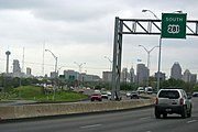
Interstate 37 (I-37) is a 143-mile (230 km) Interstate Highway located within the southern portion of the US state of Texas. The highway was first designated in 1959 as a route between Corpus Christi and San Antonio. Construction in the urban areas of Corpus Christi and San Antonio began in the 1960s, and the segments of the Interstate Highway in rural areas were completed by the 1980s. Prior to I-37, the route between Corpus Christi and San Antonio was served by a combination of State Highway 9 (SH 9) from Corpus Christi to Three Rivers and U.S. Highway 281 (US 281) from Three Rivers to San Antonio. As a result of the construction of I-37, SH 9 was removed from the State Highway System.

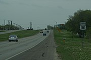
U.S. Highway 181 is a south–north U.S. Highway located entirely in the state of Texas. Both termini are at Interstate 37, the road that it mainly parallels to the east. US 181 begins in Corpus Christi, Texas at mile marker 0 to the south, through south-central Texas to just south of San Antonio to the north, for a total length of 137 miles (220 km).

U.S. Route 290 is an east–west U.S. Highway located entirely within the state of Texas. Its western terminus is at Interstate 10 southeast of Segovia, and its eastern terminus is at Interstate 610 in northwest Houston. It is the main highway between Houston and Austin and is a cutoff for travelers wanting to bypass San Antonio on Interstate 10. Throughout its length west of Austin, US 290 cuts across mountainous hills comprising the Texas Hill Country and the Edwards Plateau; between Austin and Houston, the highway then travels through gradually hilly grasslands and pine forests comprising the Gulf Coastal Plains.

Texas State Highway 46 State highway in Texas

State Highway 46 is a 71.4-mile (114.9 km) state highway in the U.S. state of Texas that runs from SH 16 east of Bandera to the intersection of SH 123 and SH 123 Business just south of Seguin.

Texas state highways are a network of highways owned and maintained by the U.S. state of Texas. The Texas Department of Transportation (TxDOT) is the state agency responsible for the day-to-day operations and maintenance of the system. Texas has the largest state highway system, followed closely by North Carolina's state highway system. In addition to the nationally numbered Interstate Highways and U.S. Highways, the highway system consists of a main network of state highways, loops, spurs, and beltways that provide local access to the other highways. The system also includes a large network of farm to market roads that connect rural areas of the state with urban areas and the rest of the state highway system. The state also owns and maintains some park and recreational roads located near and within state and national parks, as well as recreational areas. All state highways, regardless of classification, are paved roads. The Old San Antonio Road, also known as the El Camino Real, is the oldest highway in the United States, first being blazed in 1691. The length of the highways varies from US 83's 893.4 miles (1,437.8 km) inside the state borders to Spur 200 at just 0.05 miles long.

Loop 1604, also known as the Charles W. Anderson Loop, is an outer highway loop that encircles San Antonio, Texas, spanning approximately 95.6 miles (153.9 km). What began as a two-lane highway has been upgraded to a four-lane freeway along its northern stretches from US Hwy 90 on the West to Kitty Hawk Rd on the East. Loop 1604 is named for former Bexar County Judge Charles W. Anderson, who died from cancer in 1964 after serving for 25 years on the bench.

Texas State Highway 81 State highway in Texas

State Highway 81 is a Texas state highway that runs from Hillsboro to Grandview. It was designated in 1991 to replace U.S. Highway 81, which was decommissioned south of Fort Worth.

U.S. Route 281 (US 281) is a United States Numbered Highway that runs from the Mexican border in the Rio Grande Valley to the Canadian border near Dunseith, North Dakota. In the state of Texas, the highway is a major south–north corridor, connecting Brownsville to the Oklahoma state line at the Red River in Burkburnett. Several segments of U.S. 281 are concurrent with Interstate routes, including I-69C in the Rio Grande Valley, I-37 in San Antonio, and I-44 north of Wichita Falls.

Spur 345 is a 4.538-mile-long (7.303 km) loop route through the city of San Antonio in the U.S. state of Texas. It follows a former route of U.S. Highway 87 (US 87), which it now separates from, about 4.5-mile (7.242 km) north of Balcones Heights on the outskirts of San Antonio, on the way into that city. The road is a major arterial for San Antonio and a main route into Balcones Heights, providing access to the United Services Automobile Association (USAA) headquarters as well as to the South Texas Medical Center.

Loop 353 is a 7.875-mile-long (12.674 km) loop route in the U.S. state of Texas that follows a former route of U.S. Highway 81 (US 81) in San Antonio. Loop 353 follows New Laredo Highway from Interstate 35 (I-35) on the southwest side of San Antonio towards the northeast and follows Nogalitos Street before ending at another point on I-35 just southwest of Downtown San Antonio. The road is still a major arterial for the city, providing access to Kelly USA.

Spur 117 is a 0.546-mile-long (879 m) spur route in the U.S. state of Texas that connects Interstate 410 (I-410) and Loop 13 in San Antonio in Bexar County. The road is maintained by the Texas Department of Transportation (TxDOT). The spur was designated in 1980 and follows W.W. White Road from I-410 on the southeast side of San Antonio towards the northwest ending at Loop 13.

All of the business loops within Texas are maintained by the Texas Department of Transportation (TxDOT). Interstate 20 (I-20) has fifteen business loops in the state, all located in western Texas. Along I-20, TxDOT identifies each business route as Business Interstate 20 followed by an alphabetic suffix. Along Texas Interstates, the alphabetic suffixes on business route names ascend eastward and northward. There are gaps in the alphabetic values to allow for future system expansion. The alphabetic naming suffixes are included as small letters on the bottom of route shields.

State Highway Spur 536 is a state highway spur in San Antonio, Texas.

State Highway Spur 422 is a state highway spur in San Antonio, Texas. It is known locally as the Poteet-Jourdanton Freeway.

State Highway Spur 421 is a state highway spur in the San Antonio, Texas, USA metropolitan area.

Farm to Market Road 471 is an FM highway in the San Antonio area of Texas. The highway is known as Culebra Road within Bexar County.

References

  1. Google (February 22, 2008). "Overview Map of I-10 in the San Antonio MSA" (Map). Google Maps . Google. Retrieved February 22, 2008.
  2. Transportation Planning and Programming Division (n.d.). "Interstate Highway No. 10". Highway Designation Files. Texas Department of Transportation . Retrieved February 21, 2008.
  3. Google (February 22, 2008). "Overview Map of I-35 in the San Antonio MSA" (Map). Google Maps. Google. Retrieved February 22, 2008.
  4. Transportation Planning and Programming Division (n.d.). "Interstate Highway No. 35". Highway Designation Files. Texas Department of Transportation. Retrieved February 21, 2008.
  5. Google (February 22, 2008). "Overview Map of I-37 in the San Antonio MSA" (Map). Google Maps. Google. Retrieved February 22, 2008.
  6. Transportation Planning and Programming Division (n.d.). "Interstate Highway No. 37". Highway Designation Files. Texas Department of Transportation. Retrieved February 21, 2008.
  7. Transportation Planning and Programming Division (n.d.). "Interstate Highway No. 410". Highway Designation Files. Texas Department of Transportation. Retrieved February 21, 2008.
  8. Google (February 22, 2008). "Overview Map of US 87 in the San Antonio MSA" (Map). Google Maps. Google. Retrieved February 22, 2008.
  9. Transportation Planning and Programming Division (n.d.). "U.S. Highway No. 87". Highway Designation Files. Texas Department of Transportation. Retrieved February 22, 2008.
  10. Google (February 22, 2008). "Overview map of US 90 in the San Antonio MSA" (Map). Google Maps. Google. Retrieved February 22, 2008.
  11. Transportation Planning and Programming Division (n.d.). "U.S. Highway No. 90". Highway Designation Files. Texas Department of Transportation. Retrieved February 22, 2008.
  12. Transportation Planning and Programming Division (n.d.). "U.S. Highway No. 181". Highway Designation Files. Texas Department of Transportation. Retrieved February 22, 2008.
  13. Transportation Planning and Programming Division (n.d.). "U.S. Highway No. 281". Highway Designation Files. Texas Department of Transportation. Retrieved February 22, 2008.
  14. Transportation Planning and Programming Division (n.d.). "State Highway No. 16". Highway Designation Files. Texas Department of Transportation. Retrieved February 22, 2008.
  15. Transportation Planning and Programming Division (n.d.). "State Highway No. 151". Highway Designation Files. Texas Department of Transportation. Retrieved February 22, 2008.
  16. Transportation Planning and Programming Division (n.d.). "State Highway No. 211". Highway Designation Files. Texas Department of Transportation. Retrieved February 22, 2008.
  17. Transportation Planning and Programming Division (n.d.). "State Highway No. 218". Highway Designation Files. Texas Department of Transportation. Retrieved February 22, 2008.
  18. Transportation Planning and Programming Division (n.d.). "State Highway Loop No. 13". Highway Designation Files. Texas Department of Transportation. Retrieved February 22, 2008.
  19. Transportation Planning and Programming Division (n.d.). "State Highway Spur No. 53". Highway Designation Files. Texas Department of Transportation. Retrieved February 22, 2008.
  20. Transportation Planning and Programming Division (n.d.). "State Highway Spur No. 66". Highway Designation Files. Texas Department of Transportation. Retrieved February 22, 2008.
  21. Transportation Planning and Programming Division (n.d.). "State Highway Spur No. 106". Highway Designation Files. Texas Department of Transportation. Retrieved February 22, 2008.
  22. Transportation Planning and Programming Division (n.d.). "State Highway Loop No. 107". Highway Designation Files. Texas Department of Transportation. Retrieved February 22, 2008.
  23. Transportation Planning and Programming Division (n.d.). "State Highway Spur No. 117". Highway Designation Files. Texas Department of Transportation. Retrieved February 22, 2008.
  24. Transportation Planning and Programming Division (n.d.). "State Highway Spur No. 122". Highway Designation Files. Texas Department of Transportation. Retrieved February 22, 2008.
  25. Transportation Planning and Programming Division (n.d.). "State Highway Loop No. 345". Highway Designation Files. Texas Department of Transportation. Retrieved February 22, 2008.
  26. Transportation Planning and Programming Division (n.d.). "State Highway Loop No. 353". Highway Designation Files. Texas Department of Transportation. Retrieved February 22, 2008.
  27. Transportation Planning and Programming Division (n.d.). "State Highway Loop No. 368". Highway Designation Files. Texas Department of Transportation. Retrieved February 22, 2008.
  28. Transportation Planning and Programming Division (n.d.). "State Highway Spur No. 371". Highway Designation Files. Texas Department of Transportation. Retrieved February 22, 2008.
  29. Transportation Planning and Programming Division (n.d.). "State Highway Spur No. 421". Highway Designation Files. Texas Department of Transportation. Retrieved February 22, 2008.
  30. Transportation Planning and Programming Division (n.d.). "State Highway Spur No. 422". Highway Designation Files. Texas Department of Transportation. Retrieved February 22, 2008.
  31. Transportation Planning and Programming Division (n.d.). "State Highway Spur No. 536". Highway Designation Files. Texas Department of Transportation. Retrieved February 22, 2008.
  32. Transportation Planning and Programming Division (n.d.). "State Highway Spur No. 537". Highway Designation Files. Texas Department of Transportation. Retrieved February 22, 2008.
  33. Transportation Planning and Programming Division (n.d.). "State Highway Loop No. 1604". Highway Designation Files. Texas Department of Transportation. Retrieved February 22, 2008.