State Highways in Webb County, Texas | |
---|---|
Statistics | |
Linear Length | 435 miles (700.1 km) [1] |
Lane Length | 1,110 miles (1,786.4 km) [2] |
Population (2006) | 250,304 |
The following is a list of all state highways in Webb County, Texas, maintained by the Texas Department of Transportation. All state highways in Texas are paved. In the future Webb County will be the United States terminus of the North American Supercorridor (NASCO), [3] Interstate 69, [4] and The Ports to Plains Trade Corridor. [5] The Texas Department of Transportation Laredo District is preparing for future growth by turning Loop 20 into a freeway by building overpasses at major intersections and on / off ramps. [6] The Webb County - City of Laredo Regional Mobility Authority has responsibility for a comprehensive transport system in the region.
Route Name | Direction | Termini | Junctions | Length [7] | Population Area | Remarks |
---|---|---|---|---|---|---|
I-35 BL [8] | South North | Gateway to the Americas International Bridge I-35 | I-35 US 83 | 3.4 miles (5.5 km) | Laredo | |
I-35 [9] | South North | Juarez-Lincoln International Bridge La Salle County | US 83 Spur 400 UR 1472 I-69W US 59 LP 20 SH 255 | 37.5 miles (60.4 km) | Laredo Botines Webb | Texas Travel Center 27°45′34″N99°26′14″W / 27.759583°N 99.437186°W ICE Checkpoint 27°54′18″N99°23′38″W / 27.905138°N 99.3938577°W |
I-69W [10] | South North | World Trade International Bridge I-35 (current) Duval County (future) | UR 1472 I-35 US 83 LP 20 (future) FM 2895 (future) FM 2050 (future) | 1.4 miles (2.3 km) are complete from World Trade International Bridge to I-35/US 83; under construction from I-35/US 83 to Duval County | Laredo Las Lomas (future) | Co-signed with both US 59 and LP 20 from World Trade International Bridge to I-35/US 83; will be co-signed with LP 20 from I-35/US 83 to the junctions of Bus. US 59, LP 20, and US 59 in the future; will be co-signed with US 59 from I-35/US 83 to Duval County in the future; known locally as Bob Bullock Loop from World Trade International Bridge to I-35/US 83 |
Route Name | Direction | Termini | Junctions | Length [7] | Population Area | Remarks |
---|---|---|---|---|---|---|
US 59 Bus. [11] | East West | US 59 I-35 | US 59(Future I-69W) LP 20 I-35 US 83 | Laredo | Known locally as Saunders Street | |
US 59 [12] | East West | Duval County World Trade International Bridge | FM 2050 FM 2895 I-69W (temporary) LP 20 I-35 US 83 UR 1472 | 49.4 miles (79.5 km) | Laredo Las Lomas | ICE Checkpoint 27°46′27″N98°50′44″W / 27.774241°N 98.84551°W Co-signed with I-69W from I-35/US 83 to World Trade International Bridge; co-signed with LP 20 from the junction of Bus. US 59 and LP 20 to World Trade International Bridge; will be co-signed with I-69W from Duval County to I-35/US 83 in the future; known locally as Bob Bullock Loop from the junction of Bus. US 59 and LP 20 to World Trade International Bridge; known locally as Lloyd Bentsen Highway from Duval County to the junction of Bus. US 59 and LP 20 |
US 83 [13] | South North | Zapata County Dimmit County | LP 20 SH 359 I-35 Spur 400 UR 1472 I-69W US 59 SH 255 SH 44 | 66 miles (106.2 km) | El Cenizo Rio Bravo La Presa Laredo Botines | ICE Checkpoint 28°00′20″N99°32′04″W / 28.005693°N 99.534465°W |
Route Name | Direction | Termini | Junctions | Length [7] | Population Area | Remarks |
---|---|---|---|---|---|---|
SH 44 [14] | East West | Duval County US 83 | US 83 | 40 miles (64.4 km) | None | |
SH 255 [15] | East West | I-35 Colombia-Solidarity Bridge | I-35 US 83 UR 1472 | 21.508 miles (34.6 km) | Laredo | 27°44′08″N99°41′03″W / 27.735608°N 99.684188°W |
SH 359 [16] | East West | Duval County US 83 | US 83 LP 20 FM 2895 FM 649 FM 2050 | 50 miles (80.5 km) | Bruni Oilton Aguilares Laredo Ranchettes Larga Vista | ICE Checkpoint 27°26′36″N98°53′14″W / 27.443402°N 98.887349°W |
Route Name | Direction | Termini | Junctions | Length [7] | Population Area | Remarks |
---|---|---|---|---|---|---|
Loop 20 [17] | South North & East West | US 83 World Trade International Bridge | US 83 SH 359 Spur 400 US 59(Future I-69W) I-35 UR 1472 | 16.6 miles (26.7 km) | Laredo | Co-signed with I-69W from I-35/US 83 to World Trade International Bridge; co-signed with US 59 from the junction of Bus. US 59 and US 59 to World Trade International Bridge; known locally as Bob Bullock Loop |
Spur 260 [18] | South North | US 83 LP 20 | US 83 SH 359 LP 20 | 11.43 miles (18.4 km) | Laredo | Under construction 50% complete; designation not yet official |
Spur 400 [19] | East West | LP 20 I-35 | LP 20 I-35 | 1.174 miles (1.9 km) | Laredo |
Route Name | Direction | Termini | Junctions | Length [7] | Population Area | Remarks |
---|---|---|---|---|---|---|
FM 649 [20] | South North | Zapata County SH 359 | SH 359 | 15 miles (24.1 km) | Mirando City | |
FM 1472 [21] | South North | I-35 A point 14.7 miles (23.7 km) northwest of SH 255 | I-35 US 83 I-69W US 59 LP 20 FM 3338 SH 255 | 33.425 miles (53.8 km) | Laredo | Urban Road 1472 |
FM 2050 [22] | South North | Bruni, Texas US 59 | SH 359 US 59(Future I-69W) | 24.572 miles (39.5 km) | Bruni | |
FM 2895 [23] | South North | Aguilares, Texas US 59 | SH 359 US 59(Future I-69W) | 17.44 miles (28.1 km) | Aguilares | |
FM 3338 [24] | South North | FM 1472 SH 255 | UR 1472 SH 255 | 7.831 miles (12.6 km) | Laredo Ranchos Penitas West | |
Route Name | Direction | Termini | Junctions | Length [7] | Population Area | Remarks |
---|---|---|---|---|---|---|
SH 2 [25] | South North | Laredo, Texas La Salle County | none | 37.5 miles (60.4 km) | Laredo Webb | Replaced by US 81 |
SH 4 [26] | South North | Zapata County Dimmit County | none | 66 miles (106.2 km) | Laredo Webb | Replaced by US 83 |
US 81 [27] | South North | Laredo, Texas La Salle County | none | 37.5 miles (60.4 km) | Laredo Webb | Replaced by I-35 |
US 83 Bus. [28] | South North | Gateway to the Americas Int'l Bridge I-35 | I-35 US 83 | 3.4 miles (5.5 km) | Laredo | Replaced by BSI-35 |
US 96 [29] | East West | Duval County Laredo | none | 49.4 miles (79.5 km) | Las Lomas Laredo | Replaced by US 59 |
SH 202 [30] | East West | Duval County Laredo | none | 49.4 miles (79.5 km) | Las Lomas Laredo | Replaced by US 96 |
Loop 420 [31] | South North | Gateway to the Americas Int'l Bridge I-35 | I-35 US 83 | 3.4 miles (5.5 km) | Laredo | Replaced by US 83 Bus. |
FM 863 [32] | East West | Duval County US 83 | US 83 | 40 miles (64.4 km) | None | Replaced by SH 44 |
FM 3464 [33] | East West | I-35 UR 1472 | I-35 UR 1472 | 1.594 miles (2.6 km) | Laredo | Replaced by LP 20 |
Texas state highways are a network of highways owned and maintained by the U.S. state of Texas. The Texas Department of Transportation (TxDOT) is the state agency responsible for the day-to-day operations and maintenance of the system. Texas has the largest state highway system, followed closely by North Carolina's state highway system. In addition to the nationally numbered Interstate Highways and U.S. Highways, the highway system consists of a main network of state highways, loops, spurs, and beltways that provide local access to the other highways. The system also includes a large network of farm to market roads that connect rural areas of the state with urban areas and the rest of the state highway system. The state also owns and maintains some park and recreational roads located near and within state and national parks, as well as recreational areas. All state highways, regardless of classification, are paved roads. The Old San Antonio Road, also known as the El Camino Real, is the oldest highway in the United States, first being blazed in 1691. The length of the highways varies from US 83's 893.4 miles (1,437.8 km) inside the state borders to Spur 200 at just 0.05 miles long.
State Highway 44 (SH 44) is a Texas state highway that runs from west of Encinal to Corpus Christi, Texas. This highway is also known as the Cesar Chavez Memorial Highway outside the city limits of Robstown, Banquete, Agua Dulce, Alice, and Corpus Christi in Nueces and Jim Hogg counties.
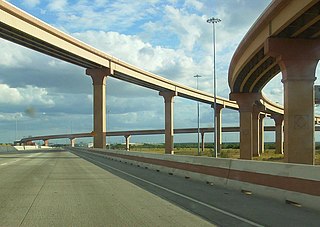
State Highway 255 is a Texas state highway that allows international traffic to bypass Laredo. Located in Webb County, the highway provides a connection between the Colombia Solidarity International Bridge to Interstate 35 at exit #24. The route opened in 2000 as the Camino Colombia Toll Road, and was one of the few operating toll roads in the United States to have gone through the legal process of foreclosure. The toll designation was removed from the route in 2017.
Loop 20, also known as the Bob Bullock Loop and Cuatro Vientos Road, is a highway loop that runs to the north and east of the city of Laredo, Texas. Loop 20 extends from the World Trade International Bridge at its northern point to Mangana-Hein Road at its southern point. The current route varies in construction from a 2-lane road to a freeway with frontage roads.
Farm to Market Road 1472 (FM 1472) is a farm-to-market road in the U.S. state of Texas that connects the industrial area of Laredo to the Laredo–Colombia Solidarity International Bridge, and then runs roughly parallel to the Rio Grande into rural Webb County. In the urban sections of Laredo, it is a six-lane route known locally as Mines Road.
There are fourteen business routes of Interstate 35 (I-35): nine are in Texas, two are in Iowa, and three are in Minnesota.