Texas State Highway 359

Last updated

Texas 359.svg

State Highway 359

Texas State Highway 359
SH 359, highlighted in red
Route information
Maintained by TxDOT
Length135.233 mi [1]  (217.636 km)
Existed1954–present
Major junctions
West endUS 83.svg US 83 at Laredo
Major intersectionsI-37.svg I-37 at Mathis
East endUS 181.svg US 181 at Skidmore
Location
Country United States
State Texas
Highway system
Texas 358.svg SH 358 Texas 360.svg SH 360

State Highway 359 (SH 359) is a state highway that runs from Skidmore in southeastern Texas, near Corpus Christi, southwest and west to Laredo at the international border with Mexico.

Contents

History

The 359 route designation was first used on May 15, 1946, for a short stretch of highway in Coleman from US 84 west to Commercial Avenue and south along Commercial Avenue to US 67 (now SH 206), with a spur northward along Commercial Avenue to Coleman, but this designation was cancelled and replaced with Texas State Highway Loop 175 on June 17, 1947. The current State Highway 359 was designated on August 24, 1954, along the old US 59 route from Beeville to Laredo. SH 359 covered essentially its present-day route, plus a co-routing with US 181 from Skidmore to Beeville. On January 22, 1958, SH 359 was rerouted on Front Street rather than Main Street in Alice. On August 23, 1960, the dual designation with US 181 from Skidmore to Beeville was removed, which made Skidmore the eastern terminus of SH 359.

Route description

The highway's eastern terminus is the intersection with US 181 at Skidmore. The route runs southwest through Tynan to an intersection with Interstate 37 at Mathis. The route continues in a southwest direction past Lake Corpus Christi through Sandia, Orange Grove and Alfred until it reaches Alice, where it is briefly co-routed with SH 44.

The route then diverges from SH 44 at San Diego and continues southwest through Benavides and Realitos to a junction with SH 16 at Hebbronville. Here the route takes a more western direction and runs through Bruni and Oilton before its final junction with US 83 at Laredo on the Mexican border. Counties traversed by the route include Bee, San Patricio, Jim Wells, Duval, Jim Hogg and Webb. The highway is paved throughout and multi-lane for portions of the route. With the exception of its western terminus at Laredo, most of the terrain covered by the highway is sparsely populated and rural. [2]

Business routes

SH 359 has one business route.

Mathis business loop

Business plate.svg

Texas 359-B.svg

Business State Highway 359-B

Location Mathis
Existed1990–present
Texas Loop 198.svg

Business State Highway 359-B (Bus. SH 359-B), formerly Loop 198, is a business loop in Mathis. The route was bypassed in 1947 by US 59 and SH 9 and redesignated Loop 198. Loop 198 was redesignated as Business SH 359-B on June 21, 1990. [3]

Major intersections

CountyLocationmikmDestinationsNotes
Webb Laredo Houston Street (I-35 Bus. south) / Santa Ursula Avenue - International Bridge No. 1, International Bridge No. 2
North plate blue.svg
I-35.svg
North plate.svg
US 83.svg
To plate blue.svg
I-69W.svg
To plate.svg
US 59.svg
I-35 north / US 83 north (San Dario Avenue) to I-69W  / US 59  San Antonio, Houston, Carrizo Springs
South plate.svg
US 83.svg
US 83 south / Arkansas Avenue Zapata
Interchange; east end of US 83 overlap
Texas Loop 20.svgSouth plate.svg
Texas Spur 260.svg
Loop 20 (Bob Bullock Loop) / Spur 260 south (Jaime Zapata Memorial Highway) Zapata, Texas A&M International University, Lake Casa Blanca International State Park, Laredo Entertainment Center
Interchange
North plate.svg
Texas FM 2895.svg
FM 2895 north Aguilares
South plate.svg
Texas FM 649.svg
FM 649 south Mirando City
Bruni North plate.svg
Texas FM 2050.svg
FM 2050 north Freer
Duval
No major junctions
Jim Hogg Hebbronville North plate.svg
Texas 16.svg
SH 16 north (Smith Street) Freer
West end of SH 16 overlap
South plate.svg
Texas 16.svg
East plate.svg
Texas 285.svg
To plate.svg
Texas FM 1017.svg
SH 16 south / SH 285 east (Smith Street) to FM 1017  Falfurrias, Zapata
East end of SH 16 overlap
Duval Realitos East plate.svg
Texas FM 716.svg
FM 716 east (Corkill Street) Concepcion
Benavides West plate.svg
Texas FM 2295.svg
To plate.svg
Texas 16.svg
FM 2295 west to SH 16
West end of FM 2295 overlap
North plate.svg
Texas 339.svg
SH 339 north (Texas Boulevard) Freer
West end of SH 339 overlap
South plate.svg
Texas 339.svg
North plate.svg
Texas FM 3196.svg
SH 339 south / FM 3196 north (Humble Street) La Rosita, Falfurrias
East end of SH 339 overlap
East plate.svg
Texas FM 2295.svg
FM 2295 east Kingsville
East end of FM 2295 overlap
San Diego South plate.svg
Texas FM 1329.svg
FM 1329 south Falfurrias
West plate.svg
Texas 44.svg
SH 44 west Freer, Laredo
West end of SH 44 overlap
see SH 44
Jim Wells East plate.svg
Texas 44.svg
SH 44 east Agua Dulce, Corpus Christi
Interchange; east end of SH 44 overlap
West plate.svg
Texas FM 3376.svg
FM 3376 west
East plate.svg
Texas FM 1539.svg
FM 1539 east
Texas FM 2044.svg FM 2044
Orange Grove Texas FM 624.svg FM 624  Corpus Christi
Casa Blanca North plate.svg
Texas FM 534.svg
FM 534 north
Sandia South plate.svg
Texas FM 70.svg
FM 70 south
East plate.svg
Texas FM 1540.svg
FM 1540 east
San Patricio North plate.svg
Texas Park Road 25.svg
PR 25 north Lake Corpus Christi State Recreational Area
Mathis East plate.svg
Business plate.svg
Texas 359.svg
South plate.svg
Texas FM 666.svg
Bus. SH 359 east / FM 666 south (San Patricio Street) San Patricio
East plate.svg
Texas Spur 459.svg
To plate blue.svg
South plate blue.svg
I-37.svg
Spur 459 east to I-37 south Corpus Christi
West plate.svg
Business plate.svg
Texas 359.svg
Bus. SH 359 west
North plate.svg
Texas FM 3024.svg
FM 3024 north
I-37.svg I-37  San Antonio, Corpus Christi I-37 exit 36
Bee Tynan South plate.svg
Texas FM 796.svg
FM 796 south
West end of FM 796 overlap
North plate.svg
Texas FM 796.svg
FM 796 north
East end of FM 796 overlap
Skidmore US 181.svg US 181  Skidmore, Sinton
1.000 mi = 1.609 km; 1.000 km = 0.621 mi

Related Research Articles

<span class="mw-page-title-main">Interstate 37</span> Interstate Highway in South Texas

Interstate 37 (I-37) is a 143-mile (230 km) Interstate Highway located within the southern portion of the US state of Texas. The highway was first designated in 1959 as a route between Corpus Christi and San Antonio. Construction in the urban areas of Corpus Christi and San Antonio began in the 1960s, and the segments of the Interstate Highway in rural areas were completed by the 1980s. Prior to I-37, the route between Corpus Christi and San Antonio was served by a combination of State Highway 9 (SH 9) from Corpus Christi to Three Rivers and US Highway 281 (US 281) from Three Rivers to San Antonio. As a result of the construction of I-37, SH 9 was removed from the State Highway System.

<span class="mw-page-title-main">U.S. Route 181</span> Highway in Texas, United States

U.S. Highway 181 is a south–north U.S. Highway located entirely in the state of Texas. Both termini are at Interstate 37, the road that it mainly parallels to the east. US 181 begins in Corpus Christi, Texas at mile marker 0 to the south, through south-central Texas to just south of San Antonio to the north, for a total length of 137 miles (220 km).

<span class="mw-page-title-main">U.S. Route 96</span>

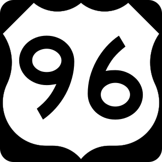
U.S. Highway 96 (US 96) is a north–south United States Numbered Highway that runs for about 117.11 miles (188.47 km) entirely in the U.S state of Texas. Its number is a violation of the standard numbering convention, as even-numbered two-digit highways are east–west routes by rule. As of 2004, the highway's southern terminus is in Port Arthur at an intersection with State Highway 87 (SH 87). Its northern terminus is in Tenaha at an intersection with US 59 /(Future I-369) and US 84.

<span class="mw-page-title-main">Texas State Highway 35</span> State highway in Texas

State Highway 35 is a state highway in the U.S. state of Texas, maintained by the Texas Department of Transportation (TxDOT). It runs primarily south–north, paralleling the Gulf of Mexico for much of its length, from a junction with Interstate 37 in Corpus Christi to Interstate 45 in southeastern Houston.

<span class="mw-page-title-main">Texas State Highway 6</span> State highway in Texas

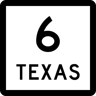
State Highway 6 (SH 6) runs from the Red River, the Texas–Oklahoma state line, to northwest of Galveston, where it is known as the Old Galveston Highway. In Sugar Land and Missouri City, it is known as Alvin-Sugarland Road and runs perpendicular to Interstate 69/U.S. Highway 59 (I-69/US 59). In the Houston area, it runs north to Farm to Market Road 1960 (FM 1960), then northwest along US 290 to Hempstead, and south to Westheimer Road and Addicks, and is known as Addicks Satsuma Road. In the Bryan–College Station area, it is known as the Earl Rudder Freeway. In Hearne, it is known as Market Street. In Calvert, it is known as Main Street. For most of its length, SH 6 is not a limited-access road. In 1997, the Texas Legislature designated SH 6 as the Texas Korean War Veterans Memorial Highway.

<span class="mw-page-title-main">Texas State Highway 9</span> Highway and former highway in Texas

State Highway 9 (SH 9) is a highway near Copperas Cove, Texas. It connects Interstate 14 (I-14), U.S. Route 190 (US 190), and U.S. Highway 190 Business outside of Copperas Cove to Farm to Market Road 116 (FM 116) on the north side of Copperas Cove. The highway opened on February 20, 2014 with a ribbon cutting at 2:00 p.m.

<span class="mw-page-title-main">Texas State Highway 12</span> Highway in Texas

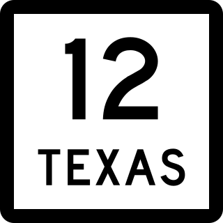
State Highway 12 (SH 12) is an west–east state highway in the U.S. state of Texas that runs from Interstate 10 (I-10) in Vidor to the Louisiana state line at Deweyville. The route was designated on August 27, 1959, as a renumbering of SH 235 to match the numbering of Louisiana Highway 12 (LA 12), with which it connects.

<span class="mw-page-title-main">Texas State Highway 289</span> Highway in Texas

State Highway 289, known for most of its length as Preston Road, is a north–south Texas state highway. It begins at the intersection of Preston Road and Loop 12/Northwest Highway in Dallas. The Preston Road designation comes from the fact that the highway generally follows the course of an older road known as the Preston Trail, which ran to the town of Preston [Bend]. Preston is now submerged by Lake Texoma. The road is known as Preston all the way north through the remainder of the Dallas-Fort Worth Metroplex to a junction with State Highway 56 west of Sherman, near the Oklahoma state line. Preston Road passes through many of the fast-growing northern Dallas suburbs, including Frisco and Plano, as well as Prosper and Celina, with many new housing developments being built along Preston.

<span class="mw-page-title-main">Texas State Highway 44</span> State highway in Texas

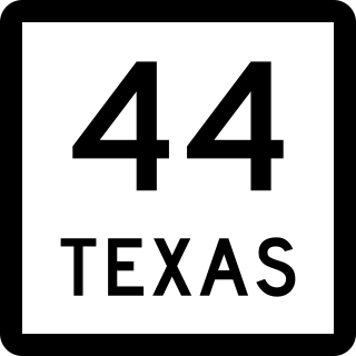
State Highway 44 (SH 44) is a Texas state highway that runs from west of Encinal to Corpus Christi, Texas. This highway is also known as the Cesar Chavez Memorial Highway outside the city limits of Robstown, Banquete, Agua Dulce, Alice, and Corpus Christi in Nueces and Jim Hogg counties.

<span class="mw-page-title-main">Texas State Highway 349</span> Highway in Texas

State Highway 349 is a 194.43-mile-long (312.90 km) state highway in the western part of Texas, United States.

<span class="mw-page-title-main">U.S. Route 59 in Texas</span> Section of U.S. Numbered Highway in Texas, United States

U.S. Highway 59 (US 59) in the U.S. state of Texas is named the Lloyd Bentsen Highway, after Lloyd Bentsen, former U.S. senator from Texas. In northern Houston, US 59, co-signed with Interstate 69 (I-69), is the Eastex Freeway. To the south, which is also co-signed with I-69, it is the Southwest Freeway. The stretch of the Southwest Freeway just west of The Loop was formerly one of the busiest freeways in North America, with a peak AADT of 371,000 in 1998.

<span class="mw-page-title-main">Business routes of Interstate 35</span>

Interstate business routes are roads connecting a central or commercial district of a city or town with an Interstate bypass. These roads typically follow along local streets often along a former U.S. Route or state highway that had been replaced by an Interstate. Interstate business route reassurance markers are signed as either loops or spurs using a green shield shaped sign and numbered like the shield of the parent Interstate highway.

<span class="mw-page-title-main">Texas State Highway Spur 260</span> State highway in Texas

State Highway Spur 260 (Spur 260), also known as Jaime Zapata Memorial Highway, is a state highway in southeastern Laredo, Texas, connecting U.S. Highway 83 (US 83) and State Highway 359 (SH 359). The route was designated in 2008 but continued to be signed as part of State Highway Loop 20 (Loop 20) until the opening of Cuatro Vientos Road in July 2011, when the Loop 20 designation was shifted to the new route. The contemporary Spur 260 constitutes the original extent of Loop 20, as originally designated in 1939.

References

  1. Transportation Planning and Programming Division (n.d.). "State Highway No. 359". Highway Designation Files. Texas Department of Transportation . Retrieved 2006-12-23.
  2. Google (2008-03-08). "overview map of SH 359" (Map). Google Maps . Google. Retrieved 2008-03-08.
  3. Transportation Planning and Programming Division (n.d.). "Business State Highway No. 359-B". Highway Designation Files. Texas Department of Transportation.