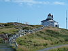
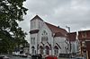
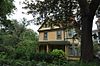
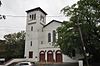
Name Address Coordinates IDF IDP IDM Image Anderson House St. John's , NL 47°34′22″N 52°41′48″W / 47.5729°N 52.6968°W / 47.5729; -52.6968 (Anderson House ) 2242 Angel House Registered Heritage Structure St. John's , NL 47°33′13″N 52°43′17″W / 47.5537°N 52.7214°W / 47.5537; -52.7214 (Angel House Registered Heritage Structure ) 2333 6127 Anglican Cathedral Parish House St. John's , NL 47°33′57″N 52°42′31″W / 47.5659°N 52.7085°W / 47.5659; -52.7085 (Anglican Cathedral Parish House ) 2429 Apothecary Hall St. John's , NL 47°33′22″N 52°42′51″W / 47.5561°N 52.7142°W / 47.5561; -52.7142 (Apothecary Hall ) 2304 Bannerman House St. John's , NL 47°34′23″N 52°42′36″W / 47.573°N 52.7101°W / 47.573; -52.7101 (Bannerman House ) 2618 8062 008 Barnes Road St. John's , NL 47°34′07″N 52°42′34″W / 47.5687°N 52.7094°W / 47.5687; -52.7094 (8 Barnes Road ) 5468 010 Barnes Road St. John's , NL 47°34′07″N 52°42′34″W / 47.5687°N 52.7094°W / 47.5687; -52.7094 (10 Barnes Road ) 3298 Bartra St. John's , NL 47°34′26″N 52°42′26″W / 47.574°N 52.7071°W / 47.574; -52.7071 (Bartra ) 2711 10390 Basilica of St. John the Baptist National Historic Site of Canada St. John's , NL 47°34′02″N 52°42′33″W / 47.5673°N 52.7093°W / 47.5673; -52.7093 (Basilica of St. John the Baptist National Historic Site of Canada ) 4139 3056 10491 Basilica Cathedral of St. John the Baptist Entrance Archway Municipal Heritage Building St. John's , NL 47°34′02″N 52°42′34″W / 47.5672°N 52.7094°W / 47.5672; -52.7094 (Basilica Cathedral of St. John the Baptist Entrance Archway Municipal Heritage Building ) 5867 Benevolent Irish Society (BIS) Building St. John's , NL 47°34′01″N 52°42′34″W / 47.5669°N 52.7094°W / 47.5669; -52.7094 (Benevolent Irish Society (BIS) Building ) 3303 Bishop Feild College St. John's , NL 47°35′39″N 52°42′22″W / 47.5941°N 52.706°W / 47.5941; -52.706 (Bishop Feild College ) 2243 5272 Bishop's Library St. John's , NL 47°34′02″N 52°42′44″W / 47.5672°N 52.7121°W / 47.5672; -52.7121 (Bishop's Library ) 2188 Bishop's Palace St. John's , NL 47°34′03″N 52°42′44″W / 47.5675°N 52.7121°W / 47.5675; -52.7121 (Bishop's Palace ) 2289 Building 202 St. John's , NL 47°34′56″N 52°41′45″W / 47.5823°N 52.6957°W / 47.5823; -52.6957 (Building 202 ) 11364 Building 204 St. John's , NL 47°34′58″N 52°41′39″W / 47.5828°N 52.6942°W / 47.5828; -52.6942 (Building 204 ) 11365 Building 205 St. John's , NL 47°35′06″N 52°41′39″W / 47.585°N 52.6943°W / 47.585; -52.6943 (Building 205 ) 11437 Building 206 St. John's , NL 47°35′00″N 52°41′44″W / 47.5832°N 52.6955°W / 47.5832; -52.6955 (Building 206 ) 11438 Building 207 St. John's , NL 47°35′00″N 52°41′39″W / 47.5834°N 52.6943°W / 47.5834; -52.6943 (Building 207 ) 11439 Building 308 St. John's , NL 47°35′06″N 52°41′39″W / 47.585°N 52.6943°W / 47.585; -52.6943 (Building 308 ) 7451 Building 309 St. John's , NL 47°35′06″N 52°41′39″W / 47.585°N 52.6943°W / 47.585; -52.6943 (Building 309 ) 7452 Building 311 St. John's , NL 47°35′06″N 52°41′54″W / 47.5849°N 52.6983°W / 47.5849; -52.6983 (Building 311 ) 11443 Building 312 St. John's , NL 47°35′06″N 52°41′50″W / 47.585°N 52.6972°W / 47.585; -52.6972 (Building 312 ) 11445 Building 313 St. John's , NL 47°35′05″N 52°41′58″W / 47.5847°N 52.6995°W / 47.5847; -52.6995 (Building 313 ) 11446 Building 314 St. John's , NL 47°35′06″N 52°41′39″W / 47.585°N 52.6943°W / 47.585; -52.6943 (Building 314 ) 11448 Building 401 St. John's , NL 47°35′07″N 52°41′46″W / 47.5852°N 52.6962°W / 47.5852; -52.6962 (Building 401 ) 11366 Building 402 St. John's , NL 47°35′07″N 52°41′46″W / 47.5854°N 52.696°W / 47.5854; -52.696 (Building 402 ) 11368 Building 403 St. John's , NL 47°35′09″N 52°41′47″W / 47.5857°N 52.6963°W / 47.5857; -52.6963 (Building 403 ) 11373 Building 404 St. John's , NL 47°35′09″N 52°41′48″W / 47.5859°N 52.6967°W / 47.5859; -52.6967 (Building 404 ) 11376 Building 405 St. John's , NL 47°35′07″N 52°41′48″W / 47.5854°N 52.6968°W / 47.5854; -52.6968 (Building 405 ) 11378 Building 406 St. John's , NL 47°35′08″N 52°41′50″W / 47.5855°N 52.6972°W / 47.5855; -52.6972 (Building 406 ) 11380 Building 407 St. John's , NL 47°35′06″N 52°41′39″W / 47.585°N 52.6943°W / 47.585; -52.6943 (Building 407 ) 7492 Building 408 St. John's , NL 47°35′06″N 52°41′39″W / 47.585°N 52.6943°W / 47.585; -52.6943 (Building 408 ) 7493 Building 409 St. John's , NL 47°35′10″N 52°41′52″W / 47.586°N 52.6977°W / 47.586; -52.6977 (Building 409 ) 11423 Building 410 St. John's , NL 47°35′09″N 52°41′54″W / 47.5858°N 52.6982°W / 47.5858; -52.6982 (Building 410 ) 11426 Building 501 St. John's , NL 47°35′06″N 52°41′44″W / 47.5851°N 52.6955°W / 47.5851; -52.6955 (Building 501 ) 11427 Building 507 St. John's , NL 47°35′10″N 52°41′42″W / 47.5862°N 52.6951°W / 47.5862; -52.6951 (Building 507 ) 11431 Building 508 St. John's , NL 47°35′09″N 52°41′42″W / 47.5857°N 52.695°W / 47.5857; -52.695 (Building 508 ) 11432 Building 509 St. John's , NL 47°35′07″N 52°41′42″W / 47.5852°N 52.6949°W / 47.5852; -52.6949 (Building 509 ) 11433 Building 511 St. John's , NL 47°35′09″N 52°41′40″W / 47.5858°N 52.6945°W / 47.5858; -52.6945 (Building 511 ) 11434 Building 512 St. John's , NL 47°35′11″N 52°41′40″W / 47.5863°N 52.6945°W / 47.5863; -52.6945 (Building 512 ) 11436 Building 517 St. John's , NL 47°35′12″N 52°41′37″W / 47.5867°N 52.6937°W / 47.5867; -52.6937 (Building 517 ) 11491 Building 806 St. John's , NL 47°35′12″N 52°41′20″W / 47.5868°N 52.6888°W / 47.5868; -52.6888 (Building 806 ) 11381 Cabot Tower St. John's , NL 47°34′23″N 52°40′58″W / 47.573°N 52.6829°W / 47.573; -52.6829 (Cabot Tower ) 2974 Canada House Municipal Heritage Building St. John's , NL 47°34′19″N 52°42′48″W / 47.572°N 52.7132°W / 47.572; -52.7132 (Canada House Municipal Heritage Building ) 10609 Cape Spear Lighthouse St. John's , NL 47°31′20″N 52°37′29″W / 47.5223°N 52.6247°W / 47.5223; -52.6247 (Cape Spear Lighthouse ) 2885 7404 20775 Chapel Hill Condominiums St. John's , NL 47°34′03″N 52°42′30″W / 47.5676°N 52.7082°W / 47.5676; -52.7082 (Chapel Hill Condominiums ) 3302 24 Circular Road Municipal Heritage Building St. John's , NL 47°34′27″N 52°42′24″W / 47.5741°N 52.7066°W / 47.5741; -52.7066 (24 Circular Road Municipal Heritage Building ) 10389 Cochrane Street United Church St. John's , NL 47°34′10″N 52°42′10″W / 47.5694°N 52.7027°W / 47.5694; -52.7027 (Cochrane Street United Church ) 3054 5346 028 Cochrane Street St. John's , NL 47°34′10″N 52°42′10″W / 47.5694°N 52.7027°W / 47.5694; -52.7027 (28 Cochrane Street ) 2278 10409 Colonial Building St. John's , NL 47°34′15″N 52°42′23″W / 47.5709°N 52.7065°W / 47.5709; -52.7065 (Colonial Building ) 3063 Commercial Cable Company Building St. John's , NL 47°34′00″N 52°42′14″W / 47.5666°N 52.704°W / 47.5666; -52.704 (Commercial Cable Company Building ) 2112 Christ Church / Quidi Vidi Church National Historic Site of Canada St. John's , NL 47°34′58″N 52°41′33″W / 47.5828°N 52.6924°W / 47.5828; -52.6924 (Christ Church / Quidi Vidi Church National Historic Site of Canada ) 11958 5274 Church of England Institute CEI Club St. John's , NL 47°33′09″N 52°43′17″W / 47.5526°N 52.7215°W / 47.5526; -52.7215 (Church of England Institute CEI Club ) 2087 034 Circular Road Municipal Heritage Building St. John's , NL 47°34′25″N 52°42′29″W / 47.5737°N 52.708°W / 47.5737; -52.708 (34 Circular Road Municipal Heritage Building ) 5538 Commercial Chambers Building St. John's , NL 47°33′50″N 52°42′25″W / 47.5638°N 52.707°W / 47.5638; -52.707 (Commercial Chambers Building ) 2149 Cornerstone Theatre St. John's , NL 47°33′37″N 52°42′43″W / 47.5604°N 52.712°W / 47.5604; -52.712 (Cornerstone Theatre ) 2643 Crow's Nest Officer's Club St. John's , NL 47°34′01″N 52°42′13″W / 47.5669°N 52.7036°W / 47.5669; -52.7036 (Crow's Nest Officer's Club ) 18926 2279 The Deanery (Anglican Cathedral Parish Rectory) St. John's , NL 47°33′57″N 52°42′32″W / 47.5657°N 52.7088°W / 47.5657; -52.7088 (The Deanery (Anglican Cathedral Parish Rectory) ) 2613 Delgado Building Municipal Heritage Building St. John's , NL 47°33′54″N 52°42′22″W / 47.5649°N 52.706°W / 47.5649; -52.706 (Delgado Building Municipal Heritage Building ) 5537 Devon House Registered Heritage Structure St. John's , NL 47°34′14″N 52°41′59″W / 47.5705°N 52.6996°W / 47.5705; -52.6996 (Devon House Registered Heritage Structure ) 2283 Devon Place St. John's , NL 47°34′20″N 52°42′53″W / 47.5723°N 52.7146°W / 47.5723; -52.7146 (Devon Place ) 3306 Devon Row Municipal Heritage Building St. John's , NL 47°34′14″N 52°41′59″W / 47.5706°N 52.6998°W / 47.5706; -52.6998 (Devon Row Municipal Heritage Building ) 10419 261 Duckworth Street St. John's , NL 47°33′58″N 52°42′21″W / 47.566°N 52.7057°W / 47.566; -52.7057 (261 Duckworth Street ) 2637 271-275 Duckworth Street St. John's , NL 47°33′56″N 52°42′22″W / 47.5656°N 52.7062°W / 47.5656; -52.7062 (271-275 Duckworth Street ) 2495 333 Duckworth Street St. John's , NL 47°33′50″N 52°42′28″W / 47.5639°N 52.7079°W / 47.5639; -52.7079 (333 Duckworth Street ) 3426 377 Duckworth Street St. John's , NL 47°33′46″N 52°42′40″W / 47.5627°N 52.7112°W / 47.5627; -52.7112 (377 Duckworth Street ) 2284 Elizabeth Manor Municipal Heritage Building St. John's , NL 47°34′16″N 52°42′12″W / 47.5712°N 52.7032°W / 47.5712; -52.7032 (Elizabeth Manor Municipal Heritage Building ) 5542 Emmanuel House Municipal Heritage Building St. John's , NL 47°34′16″N 52°42′16″W / 47.571°N 52.7045°W / 47.571; -52.7045 (Emmanuel House Municipal Heritage Building ) 6128 Forest House St. John's , NL 47°34′29″N 52°42′10″W / 47.5747°N 52.7027°W / 47.5747; -52.7027 (Forest House ) 2305 5343 Former Bank of British North America National Historic Site of Canada St. John's , NL 47°33′57″N 52°42′23″W / 47.5658°N 52.7063°W / 47.5658; -52.7063 (Former Bank of British North America National Historic Site of Canada ) 12643 2329 10478 Former Newfoundland Railway Terminus & Headquarters St. John's , NL 47°33′17″N 52°42′49″W / 47.5546°N 52.7135°W / 47.5546; -52.7135 (Former Newfoundland Railway Terminus & Headquarters ) 6501 15725 Fort Amherst National Historic Site of Canada St. John's , NL 47°33′49″N 52°40′48″W / 47.5636°N 52.6799°W / 47.5636; -52.6799 (Fort Amherst National Historic Site of Canada ) 12850 Fort Townshend National Historic Site of Canada St. John's , NL 47°33′58″N 52°42′44″W / 47.5662°N 52.7121°W / 47.5662; -52.7121 (Fort Townshend National Historic Site of Canada ) 14342 Fort William National Historic Site of Canada St. John's , NL 47°34′15″N 52°42′03″W / 47.5709°N 52.7008°W / 47.5709; -52.7008 (Fort William National Historic Site of Canada ) 13082 George Street United Church Municipal Heritage Building St. John's , NL 47°33′29″N 52°42′48″W / 47.558°N 52.7132°W / 47.558; -52.7132 (George Street United Church Municipal Heritage Building ) 2315 10485 Government House National Historic Site of Canada St. John's , NL 47°34′20″N 52°42′18″W / 47.5722°N 52.7051°W / 47.5722; -52.7051 (Government House National Historic Site of Canada ) 13399 Gower Street United Church St. John's , NL 47°33′58″N 52°42′38″W / 47.5662°N 52.7105°W / 47.5662; -52.7105 (Gower Street United Church ) 2285 018 Gower Street Municipal Heritage Building St. John's , NL 47°34′13″N 52°42′10″W / 47.5704°N 52.7027°W / 47.5704; -52.7027 (18 Gower Street Municipal Heritage Building ) 5352 020 Gower Street Municipal Heritage Building St. John's , NL 47°34′13″N 52°42′10″W / 47.5704°N 52.7027°W / 47.5704; -52.7027 (20 Gower Street Municipal Heritage Building ) 5353 022 Gower Street Municipal Heritage Building St. John's , NL 47°34′13″N 52°42′10″W / 47.5704°N 52.7029°W / 47.5704; -52.7029 (22 Gower Street Municipal Heritage Building ) 5354 Grace Building, 283-285 Water Street Municipal Heritage Building St. John's , NL 47°33′44″N 52°42′32″W / 47.5621°N 52.709°W / 47.5621; -52.709 (Grace Building, 283-285 Water Street Municipal Heritage Building ) 5850 Harris Cottage St. John's , NL 47°34′13″N 52°42′38″W / 47.5702°N 52.7105°W / 47.5702; -52.7105 (Harris Cottage ) 2286 10502 Horwood House St. John's , NL 47°32′57″N 52°43′17″W / 47.5493°N 52.7214°W / 47.5493; -52.7214 (Horwood House ) 2287 The House St. John's , NL 47°34′11″N 52°42′36″W / 47.5698°N 52.71°W / 47.5698; -52.71 (The House ) 2624 Howard House Municipal Heritage Building St. John's , NL 47°34′00″N 52°42′33″W / 47.5666°N 52.7091°W / 47.5666; -52.7091 (Howard House Municipal Heritage Building ) 2314 10483 The Imperial St. John's , NL 47°34′07″N 52°42′21″W / 47.5686°N 52.7057°W / 47.5686; -52.7057 (The Imperial ) 3363 Kelvin House and Conservatory Registered Heritage Structure St. John's , NL 47°34′15″N 52°42′38″W / 47.5709°N 52.7105°W / 47.5709; -52.7105 (Kelvin House and Conservatory Registered Heritage Structure ) 2619 5451 King George V Building St. John's , NL 47°34′01″N 52°42′13″W / 47.5669°N 52.7036°W / 47.5669; -52.7036 (King George V Building ) 1134 031 King's Bridge Road St. John's , NL 47°34′30″N 52°42′12″W / 47.5749°N 52.7032°W / 47.5749; -52.7032 (031 King's Bridge Road ) 3299 033 King's Bridge Road St. John's , NL 47°34′29″N 52°42′12″W / 47.5747°N 52.7032°W / 47.5747; -52.7032 (33 King's Bridge Road ) 3425 035 King's Bridge Road Municipal Heritage Building St. John's , NL 47°34′31″N 52°42′12″W / 47.5753°N 52.7033°W / 47.5753; -52.7033 (35 King's Bridge Road Municipal Heritage Building ) 5539 Kinkora St. John's , NL 47°34′30″N 52°42′09″W / 47.5749°N 52.7025°W / 47.5749; -52.7025 (Kinkora ) 2638 Lakecrest Independent School St. John's , NL 47°33′14″N 52°43′02″W / 47.554°N 52.7173°W / 47.554; -52.7173 (Lakecrest Independent School ) 3178 The Lea St. John's , NL 47°32′44″N 52°43′25″W / 47.5455°N 52.7236°W / 47.5455; -52.7236 (The Lea ) 2167 Longshoremen's Protective Union (LSPU) Hall St. John's , NL 47°33′58″N 52°42′23″W / 47.5661°N 52.7065°W / 47.5661; -52.7065 (Longshoremen's Protective Union (LSPU) Hall ) 2152 Majestic Theatre Municipal Heritage Building St. John's , NL 47°33′45″N 52°42′39″W / 47.5624°N 52.7107°W / 47.5624; -52.7107 (Majestic Theatre Municipal Heritage Building ) 5536 Mallard Cottage St. John's , NL 47°34′19″N 52°41′51″W / 47.572°N 52.6976°W / 47.572; -52.6976 (Mallard Cottage ) 4226 2150 10380 Martin McNamara House St. John's , NL 47°33′14″N 52°42′54″W / 47.554°N 52.7151°W / 47.554; -52.7151 (Martin McNamara House ) 2321 10506 Military Hospital St. John's , NL 47°34′31″N 52°41′40″W / 47.5753°N 52.6944°W / 47.5753; -52.6944 (Military Hospital ) 2430 112 Military Road Municipal Heritage Building St. John's , NL 47°34′11″N 52°42′27″W / 47.5698°N 52.7076°W / 47.5698; -52.7076 (112 Military Road Municipal Heritage Building ) 2717 The Monastery (Old St. Bonaventure's College) St. John's , NL 47°34′03″N 52°42′46″W / 47.5675°N 52.7127°W / 47.5675; -52.7127 (The Monastery (Old St. Bonaventure's College) ) 2623 Monkstown Manor St. John's , NL 47°34′13″N 52°42′39″W / 47.5704°N 52.7109°W / 47.5704; -52.7109 (Monkstown Manor ) 2639 007 Monkstown Road St. John's , NL 47°34′08″N 52°42′32″W / 47.569°N 52.7089°W / 47.569; -52.7089 (7 Monkstown Road ) 2718 10503 Mount St. Francis Monastery St. John's , NL 47°34′02″N 52°42′52″W / 47.5672°N 52.7144°W / 47.5672; -52.7144 (Mount St. Francis Monastery ) 2113 10490 Murray Premises St. John's , NL 47°33′41″N 52°42′34″W / 47.5614°N 52.7094°W / 47.5614; -52.7094 (Murray Premises ) 12929 2232 The New House, 335 Southside Road St. John's , NL 47°33′04″N 52°42′58″W / 47.551°N 52.7161°W / 47.551; -52.7161 (The New House, 335 Southside Road ) 2621 The New House, 337 Southside Road St. John's , NL 47°33′00″N 52°42′58″W / 47.550°N 52.7162°W / 47.550; -52.7162 (The New House, 337 Southside Road ) 2620 Newman Building St. John's , NL 47°33′26″N 52°42′44″W / 47.5572°N 52.7123°W / 47.5572; -52.7123 (Newman Building ) 2644 Newman Wine Vaults Provincial Historic Site St. John's , NL 47°33′26″N 52°42′44″W / 47.5571°N 52.7123°W / 47.5571; -52.7123 (Newman Wine Vaults Provincial Historic Site ) 2153 The Observatory Municipal Heritage Building St. John's , NL 47°34′00″N 52°42′39″W / 47.5666°N 52.7108°W / 47.5666; -52.7108 (The Observatory Municipal Heritage Building ) 10379 O'Donel Memorial Hall St. John's , NL 47°34′01″N 52°42′34″W / 47.5669°N 52.7094°W / 47.5669; -52.7094 (O'Donel Memorial Hall ) 4071 O'Dwyer Block St. John's , NL 47°33′42″N 52°42′35″W / 47.5618°N 52.7096°W / 47.5618; -52.7096 (O'Dwyer Block ) 2154 The Old London, New York and Paris Building St. John's , NL 47°33′53″N 52°42′22″W / 47.5647°N 52.7062°W / 47.5647; -52.7062 (The Old London, New York and Paris Building ) 2083 Oratory of the Sacred Heart, Our Lady of Mercy Convent St. John's , NL 47°34′04″N 52°42′39″W / 47.5677°N 52.7109°W / 47.5677; -52.7109 (Oratory of the Sacred Heart, Our Lady of Mercy Convent ) 2288 Our Lady of Mercy Convent St. John's , NL 47°34′05″N 52°42′40″W / 47.5681°N 52.711°W / 47.5681; -52.711 (Our Lady of Mercy Convent ) 2173 003 Park Place St. John's , NL 47°34′13″N 52°42′33″W / 47.5702°N 52.7092°W / 47.5702; -52.7092 (3 Park Place ) 3304 10504 004 Park Place St. John's , NL 47°34′13″N 52°42′33″W / 47.5703°N 52.7091°W / 47.5703; -52.7091 (4 Park Place ) 2641 Peppercorn House Municipal Heritage Building St. John's , NL 47°34′10″N 52°42′35″W / 47.5695°N 52.7098°W / 47.5695; -52.7098 (Peppercorn House Municipal Heritage Building ) 5543 007 Plank Road St. John's , NL 47°33′16″N 52°42′54″W / 47.5545°N 52.7151°W / 47.5545; -52.7151 (7 Plank Road ) 3839 Pleasantville-Building 223 St. John's , NL 47°35′06″N 52°41′39″W / 47.585°N 52.6943°W / 47.585; -52.6943 (Pleasantville-Building 223 ) 7590 015 Portugal Cove Road St. John's , NL 47°34′35″N 52°42′36″W / 47.5765°N 52.71°W / 47.5765; -52.71 (15 Portugal Cove Road ) 3179 074-076 Prescott Street St. John's , NL 47°34′06″N 52°42′26″W / 47.5684°N 52.7072°W / 47.5684; -52.7072 (74-76 Prescott Street ) 3180 078 Prescott Street, Neville Framing St. John's , NL 47°34′06″N 52°42′26″W / 47.5684°N 52.7072°W / 47.5684; -52.7072 (78 Prescott Street, Neville Framing ) 3181 Presentation Convent and School St. John's , NL 47°34′05″N 52°42′40″W / 47.5681°N 52.711°W / 47.5681; -52.711 (Presentation Convent and School ) 2290 Provincial Museum of Newfoundland and Labrador St. John's , NL 47°33′54″N 52°42′24″W / 47.5651°N 52.7067°W / 47.5651; -52.7067 (Provincial Museum of Newfoundland and Labrador ) 2331 Queen Victoria Wing St. John's , NL 47°34′31″N 52°41′40″W / 47.5753°N 52.6944°W / 47.5753; -52.6944 (Queen Victoria Wing ) 2431 30 Queen's Road St. John's , NL 47°34′06″N 52°42′30″W / 47.5682°N 52.7084°W / 47.5682; -52.7084 (30 Queen's Road ) 3301 32 Queen's Road Municipal Heritage Building St. John's , NL 47°34′05″N 52°42′34″W / 47.5681°N 52.7094°W / 47.5681; -52.7094 (32 Queen's Road Municipal Heritage Building ) 12063 034 Queen's Road St. John's , NL 47°34′05″N 52°42′34″W / 47.5681°N 52.7094°W / 47.5681; -52.7094 (34 Queen's Road ) 2561 Quidi Vidi Battery St. John's , NL 47°34′49″N 52°40′29″W / 47.5804°N 52.6748°W / 47.5804; -52.6748 (Quidi Vidi Battery ) 3061 Rennie's Mill Road Historic District National Historic Site of Canada St. John's , NL 47°34′16″N 52°42′34″W / 47.571°N 52.7095°W / 47.571; -52.7095 (Rennie's Mill Road Historic District National Historic Site of Canada ) 10699 Retreat Cottage St. John's , NL 47°34′45″N 52°42′14″W / 47.5792°N 52.704°W / 47.5792; -52.704 (Retreat Cottage ) 2302 Richmond Hill St. John's , NL 47°32′49″N 52°43′25″W / 47.547°N 52.7236°W / 47.547; -52.7236 (Richmond Hill ) 2719 Ruby Church St. John's , NL 47°29′08″N 52°46′05″W / 47.4855°N 52.7681°W / 47.4855; -52.7681 (Ruby Church ) 2194 S.O. Steele Building St. John's , NL 47°34′02″N 52°42′14″W / 47.5672°N 52.704°W / 47.5672; -52.704 (S.O. Steele Building ) 2160 St. Andrew's Church (The Kirk) St. John's , NL 47°33′56″N 52°42′39″W / 47.5655°N 52.7109°W / 47.5655; -52.7109 (St. Andrew's Church (The Kirk) ) 2162 St. Bonaventure's College (Mullock Hall) Registered Heritage Structure St. John's , NL 47°34′03″N 52°42′46″W / 47.5675°N 52.7127°W / 47.5675; -52.7127 (St. Bonaventure's College (Mullock Hall) Registered Heritage Structure ) 2622 St. John the Baptist Anglican Cathedral National Historic Site of Canada St. John's , NL 47°33′55″N 52°42′31″W / 47.5652°N 52.7085°W / 47.5652; -52.7085 (St. John the Baptist Anglican Cathedral National Historic Site of Canada ) 12663 5113 8063 St. John's Court House National Historic Site of Canada St. John's , NL 47°33′50″N 52°42′22″W / 47.564°N 52.7061°W / 47.564; -52.7061 (St. John's Court House National Historic Site of Canada ) 2923 2107 St. John's Ecclesiastical District St. John's , NL 47°34′05″N 52°42′40″W / 47.5681°N 52.711°W / 47.5681; -52.711 (St. John's Ecclesiastical District ) 4039 St. John's Masonic Temple St. John's , NL 47°33′57″N 52°42′27″W / 47.5658°N 52.7074°W / 47.5658; -52.7074 (St. John's Masonic Temple ) 2151 5300 St. Joseph's Chapel St. John's , NL 47°31′23″N 52°39′35″W / 47.5231°N 52.6596°W / 47.5231; -52.6596 (St. Joseph's Chapel ) 2163 5271 St. Michael's Convent, Belvedere St. John's , NL 47°34′09″N 52°43′11″W / 47.5691°N 52.7197°W / 47.5691; -52.7197 (St. Michael's Convent, Belvedere ) 2157 10489 St. Michael's Orphanage, Belvedere St. John's , NL 47°34′10″N 52°43′08″W / 47.5695°N 52.7189°W / 47.5695; -52.7189 (St. Michael's Orphanage, Belvedere ) 2332 10488 St. Patrick's Convent and School St. John's , NL 47°33′14″N 52°42′59″W / 47.5539°N 52.7165°W / 47.5539; -52.7165 (St. Patrick's Convent and School ) 2614 St. Patrick's Deanery Registered Heritage Structure St. John's , NL 47°33′12″N 52°42′58″W / 47.5534°N 52.7161°W / 47.5534; -52.7161 (St. Patrick's Deanery Registered Heritage Structure ) 10849 2642 St. Patrick's Roman Catholic Church National Historic Site of Canada St. John's , NL 47°33′13″N 52°43′02″W / 47.5537°N 52.7171°W / 47.5537; -52.7171 (St. Patrick's Roman Catholic Church National Historic Site of Canada ) 12845 2164 10505 St. Thomas' Church St. John's , NL 47°34′16″N 52°42′09″W / 47.5711°N 52.7026°W / 47.5711; -52.7026 (St. Thomas' Church ) 2166 10492 St. Thomas Rectory / Commissariat House and Garden National Historic Site of Canada St. John's , NL 47°34′21″N 52°42′09″W / 47.5725°N 52.7026°W / 47.5725; -52.7026 (St. Thomas Rectory / Commissariat House and Garden National Historic Site of Canada ) 15612 3062 Signal Hill National Historic Site of Canada St. John's , NL 47°34′21″N 52°40′55″W / 47.5724°N 52.682°W / 47.5724; -52.682 (Signal Hill National Historic Site of Canada ) 4439 Squires Barn and Carriage House St. John's , NL 47°34′15″N 52°45′35″W / 47.5707°N 52.7598°W / 47.5707; -52.7598 (Squires Barn and Carriage House ) 2293 8369 Star of the Sea Hall Municipal Heritage Building St. John's , NL 47°33′48″N 52°42′35″W / 47.5633°N 52.7097°W / 47.5633; -52.7097 (Star of the Sea Hall Municipal Heritage Building ) 2082 The Stone House St. John's , NL 47°34′43″N 52°42′14″W / 47.5786°N 52.7039°W / 47.5786; -52.7039 (The Stone House ) 3177 Sunnyside Gatehouse Municipal Heritage Building St. John's , NL 47°34′21″N 52°42′39″W / 47.5726°N 52.7109°W / 47.5726; -52.7109 (Sunnyside Gatehouse Municipal Heritage Building ) 5453 Sunnyside House Registered Heritage Structure St. John's , NL 47°34′20″N 52°42′46″W / 47.5723°N 52.7129°W / 47.5723; -52.7129 (Sunnyside House Registered Heritage Structure ) 8061 5454 Sutherland Place St. John's , NL 47°34′11″N 52°42′27″W / 47.5698°N 52.7076°W / 47.5698; -52.7076 (Sutherland Place ) 4043 Temperance Street Houses Registered Heritage Structure (Four Sisters) St. John's , NL 47°34′16″N 52°41′52″W / 47.5712°N 52.6978°W / 47.5712; -52.6978 (Temperance Street Houses Registered Heritage Structure (Four Sisters) ) 10692 12901 Thimble Cottage Registered Heritage Structure St. John's , NL 47°33′57″N 52°45′21″W / 47.5659°N 52.7557°W / 47.5659; -52.7557 (Thimble Cottage Registered Heritage Structure ) 2625 8370 Thompson Building St. John's , NL 47°33′42″N 52°42′35″W / 47.5618°N 52.7096°W / 47.5618; -52.7096 (Thompson Building ) 2168 Tobin Building St. John's , NL 47°34′03″N 52°42′16″W / 47.5675°N 52.7045°W / 47.5675; -52.7045 (Tobin Building ) 2294 10420 Union Bank Building St. John's , NL 47°33′54″N 52°42′25″W / 47.565°N 52.7069°W / 47.565; -52.7069 (Union Bank Building ) 2515 027 Victoria Street St. John's , NL 47°34′00″N 52°42′28″W / 47.5667°N 52.7078°W / 47.5667; -52.7078 (27 Victoria Street ) 3364 Water Street Historic District National Historic Site of Canada St. John's , NL 47°33′42″N 52°42′36″W / 47.5617°N 52.7101°W / 47.5617; -52.7101 (Water Street Historic District National Historic Site of Canada ) 7700 73, 75 and 77 Water Street Registered Heritage Structure St. John's , NL 47°34′04″N 52°42′11″W / 47.5679°N 52.703°W / 47.5679; -52.703 (73, 75 and 77 Water Street Registered Heritage Structure ) 10847 187-189 Water Street St. John's , NL 47°33′49″N 52°42′25″W / 47.5636°N 52.7069°W / 47.5636; -52.7069 (187-189 Water Street ) 2720 191 Water Street St. John's , NL 47°33′50″N 52°42′25″W / 47.5638°N 52.7069°W / 47.5638; -52.7069 (191 Water Street ) 2721 193 Water Street St. John's , NL 47°33′50″N 52°42′25″W / 47.5639°N 52.7069°W / 47.5639; -52.7069 (193 Water Street ) 2722 201 Water Street Municipal Heritage Building St. John's , NL 47°33′50″N 52°42′25″W / 47.5639°N 52.7070°W / 47.5639; -52.7070 (201 Water Street Municipal Heritage Building ) 5535 203 Water Street Municipal Heritage Building St. John's , NL 47°33′50″N 52°42′27″W / 47.5639°N 52.7075°W / 47.5639; -52.7075 (203 Water Street Municipal Heritage Building ) 5587 205 Water Street Municipal Heritage Building St. John's , NL 47°33′50″N 52°42′28″W / 47.5639°N 52.7077°W / 47.5639; -52.7077 (205 Water Street Municipal Heritage Building ) 6129 226 Water Street Municipal Heritage Building St. John's , NL 47°33′49″N 52°42′29″W / 47.5635°N 52.708°W / 47.5635; -52.708 (226 Water Street Municipal Heritage Building ) 6133 562-564 Water Street St. John's , NL 47°33′16″N 52°42′48″W / 47.5545°N 52.7134°W / 47.5545; -52.7134 (562-564 Water Street ) 2295 Waterford Hall St. John's , NL 47°32′06″N 52°44′10″W / 47.5349°N 52.7361°W / 47.5349; -52.7361 (Waterford Hall ) 2169 Wesley United Church St. John's , NL 47°33′16″N 52°43′10″W / 47.5544°N 52.7194°W / 47.5544; -52.7194 (Wesley United Church ) 3300 Winterholme National Historic Site of Canada St. John's , NL 47°34′21″N 52°42′37″W / 47.5724°N 52.7103°W / 47.5724; -52.7103 (Winterholme National Historic Site of Canada ) 2914 5093 Yellow Belly Corner Municipal Heritage Building St. John's , NL 47°33′44″N 52°42′36″W / 47.5621°N 52.7099°W / 47.5621; -52.7099 (Yellow Belly Corner Municipal Heritage Building ) 5341 1201