Name Location Date Listed Grid Ref. [note 1] Geo-coordinates Notes LB Number [note 2] Image Crawfordton School East Lodge & Gatepiers 55°11′38″N 3°53′11″W / 55.193924°N 3.886393°W / 55.193924; -3.886393 (Crawfordton School East Lodge & Gatepiers ) Category B 10344 Upload Photo Kirkland Bridge Over Cairn Water 55°11′27″N 3°52′02″W / 55.190847°N 3.867302°W / 55.190847; -3.867302 (Kirkland Bridge Over Cairn Water ) Category B 10310 Upload another image See more images
Kirkland Village Glencairn Parish Church 55°11′39″N 3°52′21″W / 55.194112°N 3.872404°W / 55.194112; -3.872404 (Kirkland Village Glencairn Parish Church ) Category A 10312 Upload another image See more images
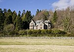
Kirkland Village Cottages 55°11′38″N 3°52′20″W / 55.193758°N 3.872089°W / 55.193758; -3.872089 (Kirkland Village Cottages ) Category B 10322 Upload Photo Kirkland, Signpost At Junction Of A702 And B729 55°11′33″N 3°51′59″W / 55.192506°N 3.86639°W / 55.192506; -3.86639 (Kirkland, Signpost At Junction Of A702 And B729 ) Category B 50010 Upload Photo Maxwelton House Summerhouse To South West Of House 55°11′13″N 3°51′10″W / 55.187058°N 3.852909°W / 55.187058; -3.852909 (Maxwelton House Summerhouse To South West Of House ) Category B 10328 Upload Photo Moniaive Village Broomfield House And Gatepiers 55°11′57″N 3°55′46″W / 55.199093°N 3.929378°W / 55.199093; -3.929378 (Moniaive Village Broomfield House And Gatepiers ) Category B 10332 Upload Photo Craigdarroch House Garden Building (To North Of House) 55°11′48″N 3°58′45″W / 55.196605°N 3.979175°W / 55.196605; -3.979175 (Craigdarroch House Garden Building (To North Of House) ) Category B 10341 Upload Photo Moniaive Village High Street George Hotel 55°11′51″N 3°55′08″W / 55.197524°N 3.918884°W / 55.197524; -3.918884 (Moniaive Village High Street George Hotel ) Category B 10296 Upload Photo Glenluiart Lodge, Outbuildings & Former Stables 55°11′47″N 3°56′38″W / 55.196291°N 3.943949°W / 55.196291; -3.943949 (Glenluiart Lodge, Outbuildings & Former Stables ) Category B 10308 Upload Photo Moniave Village North Street Cottages (Formerly Maccreary's Workshop:/Corner With High Street 55°11′51″N 3°55′16″W / 55.197616°N 3.921041°W / 55.197616; -3.921041 (Moniave Village North Street Cottages (Formerly Maccreary's Workshop:/Corner With High Street ) Category B 10314 Upload Photo Moniaive Village Broomfield Bank 55°11′59″N 3°55′46″W / 55.199768°N 3.929347°W / 55.199768; -3.929347 (Moniaive Village Broomfield Bank ) Category B 10331 Upload Photo Auchenchyne Bridge (Drive To Auchenchyne House Over Castlefairn Water) 55°10′01″N 3°57′46″W / 55.167049°N 3.962763°W / 55.167049; -3.962763 (Auchenchyne Bridge (Drive To Auchenchyne House Over Castlefairn Water) ) Category C(S) 10335 Upload Photo Caitloch House And Gatepiers 55°12′19″N 3°56′37″W / 55.205292°N 3.94368°W / 55.205292; -3.94368 (Caitloch House And Gatepiers ) Category B 10338 Upload Photo Moniaive Village, Dunreggan: Inver Cottage And W. Glencross 55°11′49″N 3°55′00″W / 55.197036°N 3.91674°W / 55.197036; -3.91674 (Moniaive Village, Dunreggan: Inver Cottage And W. Glencross ) Category B 10292 Upload Photo Dungalston Farmhouse (Caigdarroch Estate) 55°11′48″N 3°56′50″W / 55.196578°N 3.947341°W / 55.196578; -3.947341 (Dungalston Farmhouse (Caigdarroch Estate) ) Category B 10305 Upload Photo Tererran Bridge Over Dalwhat Water 55°12′34″N 3°57′37″W / 55.209378°N 3.960147°W / 55.209378; -3.960147 (Tererran Bridge Over Dalwhat Water ) Category C(S) 10319 Upload Photo Craigdarroch, Sawmill Cottage 55°11′44″N 3°57′16″W / 55.195539°N 3.954423°W / 55.195539; -3.954423 (Craigdarroch, Sawmill Cottage ) Category B 6771 Upload Photo Maxwelton House Episcopal Chapel And Lych Gate 55°11′10″N 3°50′48″W / 55.186155°N 3.846725°W / 55.186155; -3.846725 (Maxwelton House Episcopal Chapel And Lych Gate ) Category B 10325 Upload Photo Maxwelton House Summer House Beside Cairn Water 55°10′47″N 3°51′12″W / 55.179689°N 3.853462°W / 55.179689; -3.853462 (Maxwelton House Summer House Beside Cairn Water ) Category B 10329 Upload Photo Moniaive Village Ayr Street Carradale 55°11′51″N 3°55′18″W / 55.197436°N 3.921614°W / 55.197436; -3.921614 (Moniaive Village Ayr Street Carradale ) Category C(S) 10330 Upload Photo Moniaive Village Dunreggan Glen Afton Clochnaben Hillview And Cottages Between And Adjoining 55°11′50″N 3°55′00″W / 55.197308°N 3.916611°W / 55.197308; -3.916611 (Moniaive Village Dunreggan Glen Afton Clochnaben Hillview And Cottages Between And Adjoining ) Category C(S) 10334 Upload Photo Barbuie Farmhouse And Steading 55°12′13″N 3°55′48″W / 55.20366°N 3.929881°W / 55.20366; -3.929881 (Barbuie Farmhouse And Steading ) Category C(S) 10336 Upload Photo Craigdarroch House Lodge Cottage And Gatepiers 55°11′48″N 3°58′12″W / 55.196583°N 3.969982°W / 55.196583; -3.969982 (Craigdarroch House Lodge Cottage And Gatepiers ) Category C(S) 10342 Upload Photo Ewanston House 55°11′49″N 3°56′09″W / 55.196843°N 3.935821°W / 55.196843; -3.935821 (Ewanston House ) Category B 10306 Upload Photo Glenluiart House 55°11′48″N 3°56′34″W / 55.196569°N 3.942878°W / 55.196569; -3.942878 (Glenluiart House ) Category A 10307 Upload another image
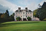
Kirkland Village Glencairn Parish Churchyard Including Gillespie Of Peelton Monument 55°11′39″N 3°52′21″W / 55.194112°N 3.872404°W / 55.194112; -3.872404 (Kirkland Village Glencairn Parish Churchyard Including Gillespie Of Peelton Monument ) Category B 10313 Upload Photo Shankfoot Bridge (Loch Urr Road Over Castlefairn Water) 55°09′48″N 3°58′06″W / 55.163338°N 3.968264°W / 55.163338; -3.968264 (Shankfoot Bridge (Loch Urr Road Over Castlefairn Water) ) Category B 10317 Upload Photo Snade Mill 55°09′52″N 3°48′48″W / 55.164527°N 3.813447°W / 55.164527; -3.813447 (Snade Mill ) Category B 10318 Upload Photo Crawfordton School (Main Block) 55°11′42″N 3°53′33″W / 55.194889°N 3.892551°W / 55.194889; -3.892551 (Crawfordton School (Main Block) ) Category B 10343 Upload Photo Moniaive Village Dunreggan Former F.C. Manse And Stables 55°11′42″N 3°54′40″W / 55.195058°N 3.911098°W / 55.195058; -3.911098 (Moniaive Village Dunreggan Former F.C. Manse And Stables ) Category B 10294 Upload Photo Kirkland Village Cairnside 55°11′34″N 3°52′15″W / 55.192754°N 3.870753°W / 55.192754; -3.870753 (Kirkland Village Cairnside ) Category C(S) 10311 Upload Photo Maxwelton House North Gatepiers 55°11′20″N 3°50′55″W / 55.188848°N 3.848688°W / 55.188848; -3.848688 (Maxwelton House North Gatepiers ) Category C(S) 10326 Upload Photo Moniaive Village Chapel Street Bank, Bank House And Gatepiers 55°11′49″N 3°55′12″W / 55.196977°N 3.919942°W / 55.196977; -3.919942 (Moniaive Village Chapel Street Bank, Bank House And Gatepiers ) Category B 10333 Upload Photo Moniaive Village High Street Bridge A702 Over Dalwhat Water 55°11′52″N 3°55′07″W / 55.197763°N 3.918519°W / 55.197763; -3.918519 (Moniaive Village High Street Bridge A702 Over Dalwhat Water ) Category B 10295 Upload Photo Moniaive Village High Street/Ayr Street Tower House 55°11′51″N 3°55′17″W / 55.197602°N 3.921339°W / 55.197602; -3.921339 (Moniaive Village High Street/Ayr Street Tower House ) Category C(S) 10297 Upload Photo Moniaive Village Kilneiss House 55°11′53″N 3°55′41″W / 55.19816°N 3.928138°W / 55.19816; -3.928138 (Moniaive Village Kilneiss House ) Category A 10298 Upload Photo Ingleston Martyrs' Monument 55°11′07″N 3°53′28″W / 55.185329°N 3.891218°W / 55.185329; -3.891218 (Ingleston Martyrs' Monument ) Category B 10309 Upload Photo Moniaive Village Renwick Monument 55°11′54″N 3°55′53″W / 55.198376°N 3.931496°W / 55.198376; -3.931496 (Moniaive Village Renwick Monument ) Category C(S) 10315 Upload Photo Kirkland Village Glencairn Parish Manse And Gatepiers 55°11′37″N 3°52′13″W / 55.193696°N 3.870263°W / 55.193696; -3.870263 (Kirkland Village Glencairn Parish Manse And Gatepiers ) Category B 10321 Upload Photo Lower Ingleston Gatepiers 55°11′14″N 3°53′36″W / 55.187352°N 3.893466°W / 55.187352; -3.893466 (Lower Ingleston Gatepiers ) Category B 10323 Upload Photo Maxwelton House 55°11′15″N 3°51′06″W / 55.187393°N 3.851573°W / 55.187393; -3.851573 (Maxwelton House ) Category B 10324 Upload Photo Maxwelton House South Gatepiers 55°11′05″N 3°51′04″W / 55.18464°N 3.85121°W / 55.18464; -3.85121 (Maxwelton House South Gatepiers ) Category C(S) 10327 Upload Photo Blackstone Bridge (Glenwhisk-Blackstone Road Over Castlefairn Water) 55°11′23″N 3°55′13″W / 55.189844°N 3.92029°W / 55.189844; -3.92029 (Blackstone Bridge (Glenwhisk-Blackstone Road Over Castlefairn Water) ) Category C(S) 10337 Upload Photo Craigdarroch House 55°11′47″N 3°58′44″W / 55.196315°N 3.978784°W / 55.196315; -3.978784 (Craigdarroch House ) Category A 10340 Upload another image See more images
Old Crawfordton Farmhouse And Adjoining Vaulted Structure 55°10′47″N 3°51′40″W / 55.17978°N 3.861083°W / 55.17978; -3.861083 (Old Crawfordton Farmhouse And Adjoining Vaulted Structure ) Category B 10316 Upload Photo Waulkmill Bridge A702 Over Craigdarroch Water 55°11′41″N 3°55′16″W / 55.194755°N 3.921218°W / 55.194755; -3.921218 (Waulkmill Bridge A702 Over Craigdarroch Water ) Category B 10320 Upload Photo Castlefairn Bridge (A702 Over Castlefairn Water) 55°09′42″N 3°59′16″W / 55.161574°N 3.987832°W / 55.161574; -3.987832 (Castlefairn Bridge (A702 Over Castlefairn Water) ) Category B 10339 Upload Photo Moniaive Village Dunreggan Shell Of Former Free Church 55°11′43″N 3°54′40″W / 55.195345°N 3.911096°W / 55.195345; -3.911096 (Moniaive Village Dunreggan Shell Of Former Free Church ) Category C(S) 10293 Upload Photo