List
| Name | Location | Date Listed | Grid Ref. [note 1] | Geo-coordinates | Notes | LB Number [note 2] | Image |
|---|---|---|---|---|---|---|---|
| Clarencefield Village Whitegate And Outbuilding To North, Farmer's Inn And Mr Hair | 55°00′09″N3°25′13″W / 55.00253°N 3.420359°W | Category B | 17214 |  | |||
| Comlongon Castle And Mansion House | 55°00′24″N3°26′27″W / 55.006566°N 3.440923°W | Category A | 17245 | | |||
| Ruthwell Village Rivel Cottage And Outbuildings | 54°59′36″N3°24′30″W / 54.993343°N 3.408201°W | Category B | 17248 | | |||
| Ruthwell Village Ruthwell Museum Henry Duncan Savings Bank And Museum | 54°59′35″N3°24′19″W / 54.992936°N 3.405311°W | Category A | 17249 | 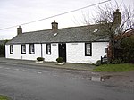 | |||
| Brow Well | 54°59′37″N3°25′54″W / 54.993725°N 3.43163°W | Category C(S) | 17212 | | |||
| Summerfield Farmhouse And Steading | 54°59′54″N3°23′27″W / 54.998233°N 3.390863°W | Category C(S) | 17250 | | |||
| Ruthwell Parish Church And Churchyard | 55°00′01″N3°24′27″W / 55.00028°N 3.407459°W | Category B | 17247 |  | |||
| Aiket Farmhouse And Flanking Wings | 54°59′59″N3°24′52″W / 54.999777°N 3.414446°W | Category C(S) | 17210 | | |||
| Margaretsfield Cottages | 55°00′45″N3°25′44″W / 55.012575°N 3.429002°W | Category C(S) | 17246 | | |||
| Clarencefield Solway View, Mr D Graham And Roadside Cottage | 55°00′10″N3°25′14″W / 55.002842°N 3.420573°W | Category C(S) | 17213 | |