List
| Name | Location | Date Listed | Grid Ref. [note 1] | Geo-coordinates | Notes | LB Number [note 2] | Image |
|---|---|---|---|---|---|---|---|
| Kildrochet House Including Gates And Gatepiers | 54°51′53″N4°59′34″W / 54.864587°N 4.992762°W | Category B | 16712 |  Upload Photo | |||
| Windmill Plantation, Old Windmill | 54°49′42″N4°58′05″W / 54.828209°N 4.96797°W | Category B | 16731 | Upload Photo | |||
| Clachanmore Gallery, Former School And Schoolhouse, Including Boundary Walls, Gatepiers, Gates And Ancillary Structures | 54°46′43″N4°58′54″W / 54.778504°N 4.981746°W | Category C(S) | 16738 | Upload Photo | |||
| Ardwell, Ardwell House, Walled Garden Including Gardener's Cottage And Owl Statue | 54°46′00″N4°57′06″W / 54.766571°N 4.951729°W | Category C(S) | 46697 | Upload Photo | |||
| Ardwell, Bowling Hall, Ivy And Shore Cottages Including Boundary Walls And Gates | 54°46′14″N4°56′27″W / 54.770555°N 4.940948°W | Category C(S) | 46698 | Upload Photo | |||
| Stoneykirk Parish Church Graveyard Including Boundary Walls, Gatepiers And Gates | 54°50′14″N4°58′39″W / 54.837289°N 4.977515°W | Category B | 16729 | Upload Photo | |||
| Kirkmabreck Farmhouse Including Farmhouse, Cottage, Steading, Boundary Walls And Gate | 54°47′28″N4°57′30″W / 54.791042°N 4.958399°W | Category B | 16732 | Upload Photo | |||
| Drumbreddan Including Walled Garden, Steading, Farm Cottage, Boundary Walls And Gatepiers | 54°45′17″N4°58′39″W / 54.754692°N 4.97757°W | Category B | 16737 | Upload Photo | |||
| Balgreggan, Walled Garden To Former Balgreggan House | 54°48′34″N4°58′21″W / 54.809579°N 4.97244°W | Category C(S) | 46699 | Upload Photo | |||
| Balgreggan, Kennels And Barn To Former Balgreggan House, Including Boundary Walls And Gatepiers | 54°48′36″N4°58′36″W / 54.809917°N 4.976636°W | Category C(S) | 46700 | Upload Photo | |||
| Ringuinea Moss | 54°47′06″N4°59′30″W / 54.785087°N 4.991534°W | Category C(S) | 46704 | Upload Photo | |||
| Garthland Mains Including Farmhouse, Steading, Farm Cottage, Bridge, Tower, Boundary Walls And Gatepiers | 54°51′25″N4°59′53″W / 54.85706°N 4.997939°W | Category B | 16714 | Upload Photo | |||
| Mains Of Caldons Farmhouse | 54°50′29″N4°59′21″W / 54.841515°N 4.989199°W | Category C(S) | 46703 | Upload Photo | |||
| Ardwell, Ardwell Mains | 54°46′15″N4°57′04″W / 54.770896°N 4.950987°W | Category C(S) | 16735 | Upload Photo | |||
| Ardwell, Ardwell House, East Lodge Including Boundary Walls, Gatepiers And Gate | 54°46′25″N4°56′29″W / 54.77359°N 4.941479°W | Category C(S) | 46696 | Upload Photo | |||
| Ardwell, Ardwell House Including Lamp Standards, Gatepiers, Gate, Sundial And Owl Statue | 54°46′07″N4°57′06″W / 54.768488°N 4.951651°W | Category B | 16733 | Upload Photo | |||
| Ardwell, Ardwell Church (Church Of Scotland) Including Boundary Walls, Gatepiers And Gates | 54°46′12″N4°57′16″W / 54.770054°N 4.954549°W | Category B | 16734 | Upload Photo | |||
| Cairnhandy Farmhouse, Steading And Cottage, Including Boundary Walls | 54°45′59″N4°57′58″W / 54.76625°N 4.965995°W | Category C(S) | 16736 | Upload Photo | |||
| Ardwell, Ardwell House, Boundary Walls, Gates And Gatepiers | 54°46′11″N4°57′01″W / 54.769744°N 4.950265°W | Category C(S) | 46695 | Upload Photo | |||
| Lake Cottage Including Boundary Walls, Gatepiers And Outhouse | 54°47′48″N4°57′43″W / 54.796677°N 4.961814°W | Category C(S) | 46702 | Upload Photo | |||
| Gruesey, Former United Free Manse, Including Boundary Walls And Gatepiers | 54°47′50″N4°57′44″W / 54.797145°N 4.962175°W | Category B | 16717 | Upload Photo | |||
| Ardwell, Ardwell Mill | 54°47′45″N4°57′17″W / 54.79593°N 4.954835°W | Category C(S) | 16718 | Upload Photo | |||
| East Cairnwell Including Farmhouse, Steading, Boundary Walls, Gates And Gatepiers | 54°47′52″N4°58′10″W / 54.797803°N 4.969428°W | Category C(S) | 46701 | Upload Photo | |||
| Stoneykirk Parish Church (Church Of Scotland) And Railings | 54°50′14″N4°58′37″W / 54.837264°N 4.977077°W | Category B | 16728 | Upload Photo | |||
| Kirkmadrine Church Including Graveyard, Mctaggart Memorial, Boundary Walls, Gatepiers And Gates | 54°47′37″N4°59′16″W / 54.793539°N 4.987833°W | Category A | 16739 | 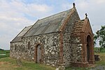 |