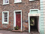
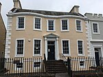
Name Location Date Listed Grid Ref. [note 1] Geo-coordinates Notes LB Number [note 2] Image 15 And 17 Millburn Street 54°50′17″N 4°02′46″W / 54.838009°N 4.046064°W / 54.838009; -4.046064 (15 And 17 Millburn Street ) Category C(S) 36565 9 St Cuthbert's Street 54°50′13″N 4°03′00″W / 54.837068°N 4.050127°W / 54.837068; -4.050127 (9 St Cuthbert's Street ) Category C(S) 36571 38 St Cuthbert's Street 54°50′12″N 4°03′02″W / 54.836801°N 4.050503°W / 54.836801; -4.050503 (38 St Cuthbert's Street ) Category C(S) 36590 15 St Mary's Place, Townend 54°50′05″N 4°03′03″W / 54.834639°N 4.050814°W / 54.834639; -4.050814 (15 St Mary's Place, Townend ) Category C(S) 36595 21, 23 And 25 St Mary's Place, Townend 54°50′05″N 4°03′02″W / 54.834813°N 4.050605°W / 54.834813; -4.050605 (21, 23 And 25 St Mary's Place, Townend ) Category C(S) 36598 35 And 37 St Mary's Street, Royal Bank Of Scotland And Royal Hotel 54°50′12″N 4°02′56″W / 54.836737°N 4.049005°W / 54.836737; -4.049005 (35 And 37 St Mary's Street, Royal Bank Of Scotland And Royal Hotel ) Category C(S) 36611 9 Union Street 54°50′10″N 4°03′14″W / 54.836°N 4.053764°W / 54.836; -4.053764 (9 Union Street ) Category C(S) 36630 23 Union Street 54°50′10″N 4°03′16″W / 54.836151°N 4.054379°W / 54.836151; -4.054379 (23 Union Street ) Category C(S) 36634 4 Union Street 54°50′10″N 4°03′12″W / 54.836087°N 4.053426°W / 54.836087; -4.053426 (4 Union Street ) Category C(S) 36637 Castle Street, Maclellan's Castle 54°50′13″N 4°03′11″W / 54.837045°N 4.053116°W / 54.837045; -4.053116 (Castle Street, Maclellan's Castle ) Category A 36484 Upload another image
14 Castle Street 54°50′11″N 4°03′11″W / 54.836463°N 4.052947°W / 54.836463; -4.052947 (14 Castle Street ) Category C(S) 36489 22 Castle Street 54°50′10″N 4°03′12″W / 54.836036°N 4.053205°W / 54.836036; -4.053205 (22 Castle Street ) Category B 36491 13 And 15 Church Place 54°50′08″N 4°02′57″W / 54.835654°N 4.049246°W / 54.835654; -4.049246 (13 And 15 Church Place ) Category C(S) 36500 3, 5 High Street And Gazebo 54°50′13″N 4°03′14″W / 54.836942°N 4.05389°W / 54.836942; -4.05389 (3, 5 High Street And Gazebo ) Category B 36502 7, 9 High Street 54°50′12″N 4°03′13″W / 54.836801°N 4.053727°W / 54.836801; -4.053727 (7, 9 High Street ) Category B 36503 Upload another image
17, 19 And 21 High Street 54°50′12″N 4°03′14″W / 54.836545°N 4.053978°W / 54.836545; -4.053978 (17, 19 And 21 High Street ) Category B 36505 Upload another image
27 And 29 High Street 54°50′11″N 4°03′16″W / 54.836466°N 4.054395°W / 54.836466; -4.054395 (27 And 29 High Street ) Category B 36507 39, 41 And 43 High Street 54°50′10″N 4°03′17″W / 54.836081°N 4.054827°W / 54.836081; -4.054827 (39, 41 And 43 High Street ) Category C(S) 36510 81 High Street 54°50′08″N 4°03′18″W / 54.835477°N 4.054936°W / 54.835477; -4.054936 (81 High Street ) Category C(S) 36516 109 And 111 High Street 54°50′06″N 4°03′11″W / 54.835042°N 4.05303°W / 54.835042; -4.05303 (109 And 111 High Street ) Category C(S) 36521 8 High Street, Blair House And Summer House And Walls To Castle Dykes 54°50′13″N 4°03′16″W / 54.837042°N 4.054315°W / 54.837042; -4.054315 (8 High Street, Blair House And Summer House And Walls To Castle Dykes ) Category A 36529 Upload another image
54 And 56 High Street, The Rectory 54°50′08″N 4°03′21″W / 54.835651°N 4.055786°W / 54.835651; -4.055786 (54 And 56 High Street, The Rectory ) Category B 36541 High Street, Tolbooth , Market Cross And Well 54°50′08″N 4°03′20″W / 54.835458°N 4.055543°W / 54.835458; -4.055543 (High Street, Tolbooth, Market Cross And Well ) Category A 36542 Upload another image
64 High Street (Milroys House) And The Cottage, Steeple Close, 64A High Street 54°50′07″N 4°03′20″W / 54.835251°N 4.055501°W / 54.835251; -4.055501 (64 High Street (Milroys House) And The Cottage, Steeple Close, 64A High Street ) Category B 36544 74 High Street And Cannon's Close 54°50′07″N 4°03′19″W / 54.835222°N 4.055141°W / 54.835222; -4.055141 (74 High Street And Cannon's Close ) Category A 36546 76-82 (Even) High Street (82 In Police Close) 54°50′06″N 4°03′18″W / 54.835117°N 4.054965°W / 54.835117; -4.054965 (76-82 (Even) High Street (82 In Police Close) ) Category B 36547 110 High Street 54°50′06″N 4°03′13″W / 54.834949°N 4.053726°W / 54.834949; -4.053726 (110 High Street ) Category B 36554 140 High Street 54°50′05″N 4°03′09″W / 54.834682°N 4.052498°W / 54.834682; -4.052498 (140 High Street ) Category C(S) 36560 Castlebank, Harbour Cottage Gallery 54°50′15″N 4°03′10″W / 54.837427°N 4.05284°W / 54.837427; -4.05284 (Castlebank, Harbour Cottage Gallery ) Category B 36456 Upload another image
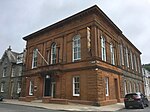
1 And 3 Castle Street 54°50′12″N 4°03′08″W / 54.836725°N 4.052352°W / 54.836725; -4.052352 (1 And 3 Castle Street ) Category C(S) 36461 34 St Cuthbert's Street 54°50′12″N 4°03′03″W / 54.836797°N 4.050752°W / 54.836797; -4.050752 (34 St Cuthbert's Street ) Category C(S) 36588 St Mary's Street, Town Hall 54°50′10″N 4°03′00″W / 54.835992°N 4.049964°W / 54.835992; -4.049964 (St Mary's Street, Town Hall ) Category B 36604 Upload another image
49 St Mary's Street 54°50′14″N 4°02′54″W / 54.837288°N 4.048285°W / 54.837288; -4.048285 (49 St Mary's Street ) Category C(S) 36613 St Mary's Street, St Mary's Church 54°50′16″N 4°02′50″W / 54.83788°N 4.047319°W / 54.83788; -4.047319 (St Mary's Street, St Mary's Church ) Category B 36616 Upload another image
St Mary's Street, Selkirk Memorial 54°50′13″N 4°02′58″W / 54.836811°N 4.049367°W / 54.836811; -4.049367 (St Mary's Street, Selkirk Memorial ) Category C(S) 36622 34, 36, 38 And 40 St Mary's Street 54°50′15″N 4°02′55″W / 54.837536°N 4.0485°W / 54.837536; -4.0485 (34, 36, 38 And 40 St Mary's Street ) Category C(S) 36624 St Mary's Wynd And 60 High Street, Anchorage 54°50′08″N 4°03′21″W / 54.835424°N 4.05593°W / 54.835424; -4.05593 (St Mary's Wynd And 60 High Street, Anchorage ) Category B 36625 27 Castle Street 54°50′09″N 4°03′11″W / 54.835924°N 4.052919°W / 54.835924; -4.052919 (27 Castle Street ) Category C(S) 36471 39 Castle Street 54°50′08″N 4°03′12″W / 54.835497°N 4.053209°W / 54.835497; -4.053209 (39 Castle Street ) Category B 36477 32 Castle Street 54°50′09″N 4°03′12″W / 54.835781°N 4.053426°W / 54.835781; -4.053426 (32 Castle Street ) Category C(S) 36494 15A High Street And 1 Gordon Place 54°50′12″N 4°03′14″W / 54.836701°N 4.053784°W / 54.836701; -4.053784 (15A High Street And 1 Gordon Place ) Category C(S) 36504 23 And 25 High Street 54°50′12″N 4°03′16″W / 54.836566°N 4.054307°W / 54.836566; -4.054307 (23 And 25 High Street ) Category B 36506 High Street, Selkirk Arms Hotel And Close And 127 High Street 54°50′05″N 4°03′07″W / 54.834771°N 4.052051°W / 54.834771; -4.052051 (High Street, Selkirk Arms Hotel And Close And 127 High Street ) Category B 36524 Upload another image
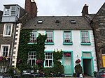
66 (Wynd End) W. Side Of Close, 68 E. Side Of Close And 70 High Street 54°50′07″N 4°03′20″W / 54.835343°N 4.055428°W / 54.835343; -4.055428 (66 (Wynd End) W. Side Of Close, 68 E. Side Of Close And 70 High Street ) Category A 36545 138 High Street 54°50′05″N 4°03′09″W / 54.834716°N 4.052609°W / 54.834716; -4.052609 (138 High Street ) Category C(S) 36559 Castlebank, The Old Studio 54°50′13″N 4°03′13″W / 54.836984°N 4.053534°W / 54.836984; -4.053534 (Castlebank, The Old Studio ) Category C(S) 36454 1-9 (Odd Nos) Castle Gardens 54°50′12″N 4°03′11″W / 54.836679°N 4.052926°W / 54.836679; -4.052926 (1-9 (Odd Nos) Castle Gardens ) Category B 36458 5 Castle Street 54°50′12″N 4°03′09″W / 54.836643°N 4.052442°W / 54.836643; -4.052442 (5 Castle Street ) Category C(S) 36462 Galloway Hydroelectric Power Scheme, Tongland Dam 54°52′09″N 4°01′28″W / 54.869032°N 4.024336°W / 54.869032; -4.024336 (Galloway Hydroelectric Power Scheme, Tongland Dam ) Category B 51698 8 St Cuthbert's Street 54°50′12″N 4°03′07″W / 54.836795°N 4.051904°W / 54.836795; -4.051904 (8 St Cuthbert's Street ) Category C(S) 36581 14 St Cuthbert's Street 54°50′12″N 4°03′06″W / 54.836799°N 4.051671°W / 54.836799; -4.051671 (14 St Cuthbert's Street ) Category C(S) 36583 20 And 22 St Cuthbert's Street 54°50′12″N 4°03′05″W / 54.836768°N 4.051389°W / 54.836768; -4.051389 (20 And 22 St Cuthbert's Street ) Category C(S) 36585 10 St Mary's Place, Saddler's Croft 54°50′04″N 4°03′04″W / 54.834348°N 4.051017°W / 54.834348; -4.051017 (10 St Mary's Place, Saddler's Croft ) Category B 36602 23 And 25 St Mary's Street 54°50′11″N 4°02′57″W / 54.836526°N 4.049259°W / 54.836526; -4.049259 (23 And 25 St Mary's Street ) Category B 36608 51 St Mary's Street 54°50′14″N 4°02′54″W / 54.837316°N 4.048225°W / 54.837316; -4.048225 (51 St Mary's Street ) Category C(S) 36614 St Mary's Street, Kirkcudbright Parish Church 54°50′11″N 4°03′03″W / 54.836293°N 4.050758°W / 54.836293; -4.050758 (St Mary's Street, Kirkcudbright Parish Church ) Category B 36621 Upload another image
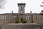
30 And 32 St Mary's Street 54°50′15″N 4°02′55″W / 54.83737°N 4.048741°W / 54.83737; -4.048741 (30 And 32 St Mary's Street ) Category B 36623 St Mary's Wynd, Kirkcudbright Academy And Cochran Memorial Gymnasium 54°50′06″N 4°03′25″W / 54.835083°N 4.056972°W / 54.835083; -4.056972 (St Mary's Wynd, Kirkcudbright Academy And Cochran Memorial Gymnasium ) Category C(S) 36626 1 Union Street 54°50′09″N 4°03′12″W / 54.835916°N 4.053433°W / 54.835916; -4.053433 (1 Union Street ) Category C(S) 36627 15, 17 And 19 Union Street 54°50′10″N 4°03′15″W / 54.835984°N 4.054152°W / 54.835984; -4.054152 (15, 17 And 19 Union Street ) Category C(S) 36632 14 And 16 Union Street 54°50′10″N 4°03′14″W / 54.836187°N 4.053851°W / 54.836187; -4.053851 (14 And 16 Union Street ) Category B 36640 35 Castle Street 54°50′08″N 4°03′11″W / 54.835624°N 4.053122°W / 54.835624; -4.053122 (35 Castle Street ) Category C(S) 36475 55 Castle Street (Through Cobbled Pend) 54°50′06″N 4°03′12″W / 54.835118°N 4.053314°W / 54.835118; -4.053314 (55 Castle Street (Through Cobbled Pend) ) Category C(S) 36482 Castle Street, War Memorial, 1st And 2nd World Wars 54°50′13″N 4°03′09″W / 54.83691°N 4.052564°W / 54.83691; -4.052564 (Castle Street, War Memorial, 1st And 2nd World Wars ) Category C(S) 36485 16 Castle Street, Castle Guest House 54°50′11″N 4°03′11″W / 54.83639°N 4.053036°W / 54.83639; -4.053036 (16 Castle Street, Castle Guest House ) Category B 36490 28, 30 Castle Street 54°50′09″N 4°03′12″W / 54.835845°N 4.053367°W / 54.835845; -4.053367 (28, 30 Castle Street ) Category C(S) 36493 46, 48 Castle Street 54°50′08″N 4°03′13″W / 54.835508°N 4.053645°W / 54.835508; -4.053645 (46, 48 Castle Street ) Category C(S) 36496 3, 5, 7 And 9 Church Place 54°50′09″N 4°02′59″W / 54.835827°N 4.049613°W / 54.835827; -4.049613 (3, 5, 7 And 9 Church Place ) Category C(S) 36498 1 High Street 54°50′14″N 4°03′14″W / 54.837086°N 4.053835°W / 54.837086; -4.053835 (1 High Street ) Category B 36501 33 High Street 54°50′11″N 4°03′17″W / 54.836363°N 4.054592°W / 54.836363; -4.054592 (33 High Street ) Category C(S) 36508 77 High Street 54°50′08″N 4°03′18″W / 54.835502°N 4.055016°W / 54.835502; -4.055016 (77 High Street ) Category C(S) 36515 105 High Street 54°50′06″N 4°03′12″W / 54.835038°N 4.053248°W / 54.835038; -4.053248 (105 High Street ) Category B 36520 High Street, Cannonwalls 54°50′06″N 4°03′10″W / 54.834957°N 4.052699°W / 54.834957; -4.052699 (High Street, Cannonwalls ) Category B 36522 2 High Street, Moatwell 54°50′15″N 4°03′14″W / 54.837366°N 4.053802°W / 54.837366; -4.053802 (2 High Street, Moatwell ) Category B 36526 4 High Street 54°50′14″N 4°03′14″W / 54.837155°N 4.054025°W / 54.837155; -4.054025 (4 High Street ) Category B 36527 16 High Street 54°50′12″N 4°03′17″W / 54.836596°N 4.054682°W / 54.836596; -4.054682 (16 High Street ) Category B 36533 18 High Street 54°50′11″N 4°03′17″W / 54.836477°N 4.0548°W / 54.836477; -4.0548 (18 High Street ) Category B 36534 46 High Street, Greengate House 54°50′09″N 4°03′20″W / 54.835899°N 4.055487°W / 54.835899; -4.055487 (46 High Street, Greengate House ) Category B 36538 Upload another image
62 High Street, Tolbooth Gallery And Steeple Close 54°50′07″N 4°03′20″W / 54.83534°N 4.055568°W / 54.83534; -4.055568 (62 High Street, Tolbooth Gallery And Steeple Close ) Category B 36543 94 High Street 54°50′06″N 4°03′16″W / 54.83498°N 4.054569°W / 54.83498; -4.054569 (94 High Street ) Category B 36549 100A, B And C High Street 54°50′06″N 4°03′15″W / 54.835057°N 4.054261°W / 54.835057; -4.054261 (100A, B And C High Street ) Category C(S) 36551 106 And 108 High Street 54°50′06″N 4°03′15″W / 54.83498°N 4.054039°W / 54.83498; -4.054039 (106 And 108 High Street ) Category B 36553 1 and 3 Castle Bank 54°50′14″N 4°03′13″W / 54.837179°N 4.053668°W / 54.837179; -4.053668 (1 and 3 Castle Bank ) Category B 36453 Upload another image
Millburn Street, Former Cornmill 54°50′19″N 4°02′44″W / 54.838566°N 4.045516°W / 54.838566; -4.045516 (Millburn Street, Former Cornmill ) Category B 36563 19 Millburn Street 54°50′17″N 4°02′46″W / 54.837926°N 4.046153°W / 54.837926; -4.046153 (19 Millburn Street ) Category C(S) 36566 17 And 19 St Cuthbert's Street 54°50′13″N 4°02′59″W / 54.837048°N 4.049722°W / 54.837048; -4.049722 (17 And 19 St Cuthbert's Street ) Category C(S) 36574 St Cuthbert's Street, The Commercial Hotel 54°50′13″N 4°02′57″W / 54.837047°N 4.049254°W / 54.837047; -4.049254 (St Cuthbert's Street, The Commercial Hotel ) Category C(S) 36577 4 And 6 St Cuthbert's Street 54°50′13″N 4°03′08″W / 54.83681°N 4.052092°W / 54.83681; -4.052092 (4 And 6 St Cuthbert's Street ) Category C(S) 36580 1 St Mary's Place 54°50′05″N 4°03′06″W / 54.834627°N 4.05153°W / 54.834627; -4.05153 (1 St Mary's Place ) Category C(S) 36594 9, 11 And 13 St Mary's Street 54°50′10″N 4°02′59″W / 54.836085°N 4.049813°W / 54.836085; -4.049813 (9, 11 And 13 St Mary's Street ) Category B 36605 19 And 21 St Mary's Street 54°50′11″N 4°02′58″W / 54.836443°N 4.049379°W / 54.836443; -4.049379 (19 And 21 St Mary's Street ) Category B 36607 53, 55 And 57 St Mary's Street 54°50′14″N 4°02′53″W / 54.837354°N 4.048117°W / 54.837354; -4.048117 (53, 55 And 57 St Mary's Street ) Category C(S) 36615 St Mary's Street, Johnston's Free School 54°50′18″N 4°02′48″W / 54.83823°N 4.046791°W / 54.83823; -4.046791 (St Mary's Street, Johnston's Free School ) Category B 36617 Upload another image
7 Union Street 54°50′10″N 4°03′13″W / 54.835975°N 4.053622°W / 54.835975; -4.053622 (7 Union Street ) Category C(S) 36629 26 Union Street 54°50′11″N 4°03′16″W / 54.836295°N 4.054371°W / 54.836295; -4.054371 (26 Union Street ) Category C(S) 36643 37 Castle Street 54°50′08″N 4°03′12″W / 54.835578°N 4.053197°W / 54.835578; -4.053197 (37 Castle Street ) Category B 36476 49, 51 Castle Street 54°50′07″N 4°03′12″W / 54.835242°N 4.053414°W / 54.835242; -4.053414 (49, 51 Castle Street ) Category B 36480 12 Castle Street 54°50′12″N 4°03′10″W / 54.836536°N 4.052872°W / 54.836536; -4.052872 (12 Castle Street ) Category C(S) 36488 37 High Street 54°50′10″N 4°03′17″W / 54.836181°N 4.054754°W / 54.836181; -4.054754 (37 High Street ) Category C(S) 36509 45 And 45A High Street 54°50′10″N 4°03′18″W / 54.836043°N 4.054934°W / 54.836043; -4.054934 (45 And 45A High Street ) Category C(S) 36511 67A And 67B High Street 54°50′08″N 4°03′19″W / 54.835633°N 4.055287°W / 54.835633; -4.055287 (67A And 67B High Street ) Category C(S) 36514 83 High Street 54°50′08″N 4°03′17″W / 54.835442°N 4.054841°W / 54.835442; -4.054841 (83 High Street ) Category C(S) 36517 High Street, Stewartry District Council Offices 54°50′06″N 4°03′09″W / 54.834935°N 4.052448°W / 54.834935; -4.052448 (High Street, Stewartry District Council Offices ) Category B 36523 Upload another image
12 High Street, With 10 High Street, Broughton House And Walls To Castle Dykes 54°50′13″N 4°03′16″W / 54.83686°N 4.054446°W / 54.83686; -4.054446 (12 High Street, With 10 High Street, Broughton House And Walls To Castle Dykes ) Category A 36530 Upload another image
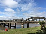
96 And 98 High Street 54°50′06″N 4°03′16″W / 54.835072°N 4.054417°W / 54.835072; -4.054417 (96 And 98 High Street ) Category B 36550 104 High Street 54°50′06″N 4°03′15″W / 54.835006°N 4.054087°W / 54.835006; -4.054087 (104 High Street ) Category B 36552 1 Castle Street And 2 St Cuthbert's Close 54°50′12″N 4°03′08″W / 54.836779°N 4.052355°W / 54.836779; -4.052355 (1 Castle Street And 2 St Cuthbert's Close ) Category C(S) 36460 15 Castle Street 54°50′11″N 4°03′09″W / 54.836415°N 4.052586°W / 54.836415; -4.052586 (15 Castle Street ) Category C(S) 36465 21 St Cuthbert's Street 54°50′13″N 4°02′59″W / 54.83705°N 4.049613°W / 54.83705; -4.049613 (21 St Cuthbert's Street ) Category C(S) 36575 28 And 30 St Cuthbert's Street 54°50′12″N 4°03′04″W / 54.836801°N 4.051017°W / 54.836801; -4.051017 (28 And 30 St Cuthbert's Street ) Category C(S) 36586 40 And 40A St Cuthbert's Street 54°50′12″N 4°03′01″W / 54.836794°N 4.050378°W / 54.836794; -4.050378 (40 And 40A St Cuthbert's Street ) Category C(S) 36591 50 St Cuthbert's Street 54°50′12″N 4°02′53″W / 54.836786°N 4.048182°W / 54.836786; -4.048182 (50 St Cuthbert's Street ) Category C(S) 36593 17 St Mary's Place, Townend 54°50′05″N 4°03′03″W / 54.834703°N 4.050755°W / 54.834703; -4.050755 (17 St Mary's Place, Townend ) Category C(S) 36596 4 St Mary's Place 54°50′04″N 4°03′05″W / 54.834388°N 4.051315°W / 54.834388; -4.051315 (4 St Mary's Place ) Category C(S) 36601 St Mary's Street, Church Hall 54°50′08″N 4°03′02″W / 54.835479°N 4.05053°W / 54.835479; -4.05053 (St Mary's Street, Church Hall ) Category C(S) 36603 27 St Mary's Street 54°50′12″N 4°02′57″W / 54.83659°N 4.049169°W / 54.83659; -4.049169 (27 St Mary's Street ) Category B 36609 St Mary's Street, Atkinson's Place 54°50′21″N 4°02′47″W / 54.839047°N 4.046334°W / 54.839047; -4.046334 (St Mary's Street, Atkinson's Place ) Category C(S) 36618 3 Union Street 54°50′09″N 4°03′13″W / 54.835941°N 4.053558°W / 54.835941; -4.053558 (3 Union Street ) Category C(S) 36628 11 And 13 Union Street 54°50′10″N 4°03′14″W / 54.836015°N 4.053967°W / 54.836015; -4.053967 (11 And 13 Union Street ) Category C(S) 36631 20 And 22 Union Street 54°50′10″N 4°03′15″W / 54.836246°N 4.054119°W / 54.836246; -4.054119 (20 And 22 Union Street ) Category C(S) 36641 21 Castle Street 54°50′10″N 4°03′10″W / 54.836143°N 4.052743°W / 54.836143; -4.052743 (21 Castle Street ) Category B 36468 25 Castle Street 54°50′10″N 4°03′10″W / 54.835981°N 4.052735°W / 54.835981; -4.052735 (25 Castle Street ) Category C(S) 36470 29 Castle Street 54°50′09″N 4°03′11″W / 54.83586°N 4.052978°W / 54.83586; -4.052978 (29 Castle Street ) Category C(S) 36472 33 Castle Street 54°50′09″N 4°03′11″W / 54.835706°N 4.053095°W / 54.835706; -4.053095 (33 Castle Street ) Category C(S) 36474 53 Castle Street 54°50′07″N 4°03′13″W / 54.835196°N 4.053474°W / 54.835196; -4.053474 (53 Castle Street ) Category B 36481 57, 59 Castle Street 54°50′06″N 4°03′13″W / 54.835114°N 4.053516°W / 54.835114; -4.053516 (57, 59 Castle Street ) Category C(S) 36483 6, 8 Castle Street 54°50′12″N 4°03′10″W / 54.836608°N 4.052876°W / 54.836608; -4.052876 (6, 8 Castle Street ) Category C(S) 36487 11 Church Place 54°50′09″N 4°02′58″W / 54.835731°N 4.049452°W / 54.835731; -4.049452 (11 Church Place ) Category C(S) 36499 57, 59 And 61 High Street 54°50′09″N 4°03′19″W / 54.835788°N 4.055155°W / 54.835788; -4.055155 (57, 59 And 61 High Street ) Category C(S) 36512 44 High Street, Greengate Close 54°50′10″N 4°03′21″W / 54.835976°N 4.055709°W / 54.835976; -4.055709 (44 High Street, Greengate Close ) Category B 36537 122 High Street 54°50′06″N 4°03′11″W / 54.834868°N 4.053193°W / 54.834868; -4.053193 (122 High Street ) Category C(S) 36557 Castlebank, Shorehouse 54°50′15″N 4°03′11″W / 54.837551°N 4.052924°W / 54.837551; -4.052924 (Castlebank, Shorehouse ) Category C(S) 36457 Castle Mains 54°50′07″N 4°03′33″W / 54.835326°N 4.059071°W / 54.835326; -4.059071 (Castle Mains ) Category C(S) 36459 9 And 11 Castle Street 54°50′11″N 4°03′09″W / 54.836479°N 4.052527°W / 54.836479; -4.052527 (9 And 11 Castle Street ) Category B 36464 Kirkcudbright Bridge 54°50′20″N 4°03′01″W / 54.83879°N 4.050339°W / 54.83879; -4.050339 (Kirkcudbright Bridge ) Category B 9712 Upload another image
St Cuthbert's Churchyard (Formerly Old Kirkyard), Including Boundary Wall 54°50′16″N 4°02′24″W / 54.837803°N 4.040136°W / 54.837803; -4.040136 (St Cuthbert's Churchyard (Formerly Old Kirkyard), Including Boundary Wall ) Category B 36567 1 And 2 St Cuthbert's Place, The Steam Packet Inn 54°50′14″N 4°03′01″W / 54.837156°N 4.050241°W / 54.837156; -4.050241 (1 And 2 St Cuthbert's Place, The Steam Packet Inn ) Category C(S) 36569 27 St Cuthbert's Street 54°50′13″N 4°02′57″W / 54.83705°N 4.049099°W / 54.83705; -4.049099 (27 St Cuthbert's Street ) Category C(S) 36578 36 St Cuthbert's Street 54°50′12″N 4°03′02″W / 54.836799°N 4.050612°W / 54.836799; -4.050612 (36 St Cuthbert's Street ) Category C(S) 36589 15 And 17 St Mary's Street, Bank Of Scotland and Manager's House 54°50′11″N 4°02′58″W / 54.836368°N 4.049531°W / 54.836368; -4.049531 (15 And 17 St Mary's Street, Bank Of Scotland and Manager's House ) Category B 36606 29 And 31 St Mary's Street 54°50′12″N 4°02′57″W / 54.836672°N 4.049095°W / 54.836672; -4.049095 (29 And 31 St Mary's Street ) Category B 36610 St Mary's Street, Museum 54°50′07″N 4°03′06″W / 54.835256°N 4.05153°W / 54.835256; -4.05153 (St Mary's Street, Museum ) Category C(S) 36620 2 Union Street 54°50′10″N 4°03′12″W / 54.836053°N 4.053315°W / 54.836053; -4.053315 (2 Union Street ) Category B 36636 24 Union Street 54°50′11″N 4°03′16″W / 54.836278°N 4.054307°W / 54.836278; -4.054307 (24 Union Street ) Category C(S) 36642 2 Castle Street 54°50′12″N 4°03′10″W / 54.836673°N 4.052786°W / 54.836673; -4.052786 (2 Castle Street ) Category B 36486 34, 34A And 36 Castle Street 54°50′09″N 4°03′13″W / 54.835716°N 4.053563°W / 54.835716; -4.053563 (34, 34A And 36 Castle Street ) Category C(S) 36495 50, 52 Castle Street 54°50′08″N 4°03′13″W / 54.835453°N 4.053658°W / 54.835453; -4.053658 (50, 52 Castle Street ) Category C(S) 36497 High Street, Sheriff Court House And Public Library 54°50′07″N 4°03′16″W / 54.835412°N 4.054513°W / 54.835412; -4.054513 (High Street, Sheriff Court House And Public Library ) Category C(S) 36518 103 High Street 54°50′06″N 4°03′12″W / 54.835071°N 4.053405°W / 54.835071; -4.053405 (103 High Street ) Category C(S) 36519 34 High Street 54°50′10″N 4°03′18″W / 54.836211°N 4.055129°W / 54.836211; -4.055129 (34 High Street ) Category C(S) 36535 52 High Street 54°50′09″N 4°03′21″W / 54.835743°N 4.055697°W / 54.835743; -4.055697 (52 High Street ) Category C(S) 36540 118 High Street 54°50′06″N 4°03′12″W / 54.834874°N 4.053364°W / 54.834874; -4.053364 (118 High Street ) Category B 36556 142 High Street 54°50′05″N 4°03′09″W / 54.834666°N 4.052404°W / 54.834666; -4.052404 (142 High Street ) Category C(S) 36561 Castlebank, Harbour Cottage 54°50′15″N 4°03′11″W / 54.837369°N 4.053039°W / 54.837369; -4.053039 (Castlebank, Harbour Cottage ) Category C(S) 36455 Ellenbank 54°50′59″N 4°02′22″W / 54.849794°N 4.039526°W / 54.849794; -4.039526 (Ellenbank ) Category B 9711 Cannee Farm Steading 54°49′41″N 4°02′42″W / 54.828148°N 4.045036°W / 54.828148; -4.045036 (Cannee Farm Steading ) Category B 9713 St Cuthbert's Street, Greyfriars Church (Episcopal Church) 54°50′14″N 4°03′09″W / 54.837129°N 4.052373°W / 54.837129; -4.052373 (St Cuthbert's Street, Greyfriars Church (Episcopal Church) ) Category B 36568 11 And 13 St Cuthbert's Street 54°50′13″N 4°03′00″W / 54.837061°N 4.050003°W / 54.837061; -4.050003 (11 And 13 St Cuthbert's Street ) Category C(S) 36572 15 St Cuthbert's Street 54°50′13″N 4°02′59″W / 54.837073°N 4.049847°W / 54.837073; -4.049847 (15 St Cuthbert's Street ) Category C(S) 36573 2 St Cuthbert's Street 54°50′13″N 4°03′08″W / 54.836816°N 4.052279°W / 54.836816; -4.052279 (2 St Cuthbert's Street ) Category C(S) 36579 St Cuthbert's Street Well 54°50′13″N 4°03′00″W / 54.836835°N 4.050069°W / 54.836835; -4.050069 (St Cuthbert's Street Well ) Category C(S) 36592 2 St Mary's Place 54°50′04″N 4°03′05″W / 54.834429°N 4.051504°W / 54.834429; -4.051504 (2 St Mary's Place ) Category B 36600 47 St Mary's Street 54°50′14″N 4°02′54″W / 54.837215°N 4.04836°W / 54.837215; -4.04836 (47 St Mary's Street ) Category C(S) 36612 10 And 12 Union Street 54°50′10″N 4°03′13″W / 54.836163°N 4.053694°W / 54.836163; -4.053694 (10 And 12 Union Street ) Category B 36639 30 Union Street 54°50′11″N 4°03′16″W / 54.836356°N 4.054498°W / 54.836356; -4.054498 (30 Union Street ) Category C(S) 36644 Castle Street, Masonic Arms 54°50′10″N 4°03′10″W / 54.836243°N 4.052702°W / 54.836243; -4.052702 (Castle Street, Masonic Arms ) Category B 36467 23 Castle Street 54°50′10″N 4°03′10″W / 54.836034°N 4.052831°W / 54.836034; -4.052831 (23 Castle Street ) Category B 36469 24, 26 Castle Street 54°50′09″N 4°03′12″W / 54.8359°N 4.053307°W / 54.8359; -4.053307 (24, 26 Castle Street ) Category C(S) 36492 63 High Street 54°50′08″N 4°03′19″W / 54.835662°N 4.055148°W / 54.835662; -4.055148 (63 High Street ) Category C(S) 36513 129 High Street 54°50′05″N 4°03′07″W / 54.834755°N 4.051925°W / 54.834755; -4.051925 (129 High Street ) Category C(S) 36525 14 And 14A High Street 54°50′12″N 4°03′17″W / 54.836731°N 4.054673°W / 54.836731; -4.054673 (14 And 14A High Street ) Category B 36532 84 High Street 54°50′06″N 4°03′17″W / 54.835056°N 4.054837°W / 54.835056; -4.054837 (84 High Street ) Category B 36548 Upload another image
116 High Street, Gordon House Hotel 54°50′06″N 4°03′13″W / 54.834872°N 4.053489°W / 54.834872; -4.053489 (116 High Street, Gordon House Hotel ) Category C(S) 36555 134 And 136 High Street 54°50′05″N 4°03′10″W / 54.83475°N 4.052751°W / 54.83475; -4.052751 (134 And 136 High Street ) Category C(S) 36558 9 Millburn Street 54°50′18″N 4°02′45″W / 54.838227°N 4.045888°W / 54.838227; -4.045888 (9 Millburn Street ) Category C(S) 36564 3 And 3A St Cuthbert's Street 54°50′13″N 4°03′01″W / 54.837075°N 4.050252°W / 54.837075; -4.050252 (3 And 3A St Cuthbert's Street ) Category C(S) 36570 23 St Cuthbert's Street 54°50′13″N 4°02′58″W / 54.837052°N 4.049488°W / 54.837052; -4.049488 (23 St Cuthbert's Street ) Category C(S) 36576 10 And 12 St Cuthbert's Street 54°50′13″N 4°03′07″W / 54.836806°N 4.051812°W / 54.836806; -4.051812 (10 And 12 St Cuthbert's Street ) Category C(S) 36582 16 And 18 St Cuthbert's Street, Solway Tide 54°50′12″N 4°03′06″W / 54.836747°N 4.051575°W / 54.836747; -4.051575 (16 And 18 St Cuthbert's Street, Solway Tide ) Category C(S) 36584 32 And 32A St Cuthbert's Street 54°50′12″N 4°03′03″W / 54.836795°N 4.050877°W / 54.836795; -4.050877 (32 And 32A St Cuthbert's Street ) Category C(S) 36587 19 St Mary's Place, Townend 54°50′02″N 4°03′02″W / 54.833851°N 4.050618°W / 54.833851; -4.050618 (19 St Mary's Place, Townend ) Category C(S) 36597 31 St Mary's Place, Townend 54°50′06″N 4°03′01″W / 54.834997°N 4.050334°W / 54.834997; -4.050334 (31 St Mary's Place, Townend ) Category C(S) 36599 St Mary's Street. Oakley And Wester Oakley 54°50′02″N 4°03′09″W / 54.833953°N 4.052585°W / 54.833953; -4.052585 (St Mary's Street. Oakley And Wester Oakley ) Category B 36619 21 Union Street 54°50′10″N 4°03′15″W / 54.836135°N 4.054285°W / 54.836135; -4.054285 (21 Union Street ) Category C(S) 36633 25 Union Street 54°50′10″N 4°03′16″W / 54.836176°N 4.054505°W / 54.836176; -4.054505 (25 Union Street ) Category C(S) 36635 6 And 8 Union Street 54°50′10″N 4°03′13″W / 54.836112°N 4.05352°W / 54.836112; -4.05352 (6 And 8 Union Street ) Category C(S) 36638 31 Castle Street 54°50′09″N 4°03′11″W / 54.835778°N 4.053052°W / 54.835778; -4.053052 (31 Castle Street ) Category B 36473 41, 43 Castle Street 54°50′07″N 4°03′12″W / 54.835415°N 4.053298°W / 54.835415; -4.053298 (41, 43 Castle Street ) Category B 36478 47 Castle Street 54°50′07″N 4°03′12″W / 54.835342°N 4.053341°W / 54.835342; -4.053341 (47 Castle Street ) Category C(S) 36479 6 High Street 54°50′14″N 4°03′15″W / 54.8371°N 4.054116°W / 54.8371; -4.054116 (6 High Street ) Category C(S) 36528 36 High Street 54°50′10″N 4°03′19″W / 54.836155°N 4.055204°W / 54.836155; -4.055204 (36 High Street ) Category B 36536 48 And 48A High Street 54°50′09″N 4°03′20″W / 54.835843°N 4.055578°W / 54.835843; -4.055578 (48 And 48A High Street ) Category B 36539 Millburn Street, Millburn House 54°50′20″N 4°02′45″W / 54.838767°N 4.045853°W / 54.838767; -4.045853 (Millburn Street, Millburn House ) Category C(S) 36562 7 Castle Street 54°50′12″N 4°03′09″W / 54.836571°N 4.052438°W / 54.836571; -4.052438 (7 Castle Street ) Category B 36463 17 Castle Street 54°50′11″N 4°03′09″W / 54.836361°N 4.05263°W / 54.836361; -4.05263 (17 Castle Street ) Category C(S) 36466