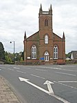
Name Location Date Listed Grid Ref. [note 1] Geo-coordinates Notes LB Number [note 2] Image Castle Street, Bruce Arms 55°07′43″N 3°26′31″W / 55.128499°N 3.441908°W / 55.128499; -3.441908 (Castle Street, Bruce Arms ) Category B 37538 Upload another image
High Street, Lochmaben Parish Church Boundary Wall and Gatepiers (St Magdalene's) 55°07′35″N 3°26′19″W / 55.126283°N 3.438566°W / 55.126283; -3.438566 (High Street, Lochmaben Parish Church Boundary Wall and Gatepiers (St Magdalene's) ) Category A 37539 Upload another image
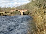
61 (Castle Grove), 63, 65 High Street (also known as 1, 2, 3 Church Place) 55°07′36″N 3°26′21″W / 55.126617°N 3.439237°W / 55.126617; -3.439237 (61 (Castle Grove), 63, 65 High Street (also known as 1, 2, 3 Church Place) ) Category B 37548 34 High Street, The Old Schoolhouse 55°07′41″N 3°26′24″W / 55.128143°N 3.440123°W / 55.128143; -3.440123 (34 High Street, The Old Schoolhouse ) Category B 37553 Corncockle Farmhouse 55°09′57″N 3°26′27″W / 55.165961°N 3.440811°W / 55.165961; -3.440811 (Corncockle Farmhouse ) Category B 9968 5, 7 High Street 55°07′44″N 3°26′31″W / 55.12894°N 3.441877°W / 55.12894; -3.441877 (5, 7 High Street ) Category B 37542 4 High Street 55°07′45″N 3°26′30″W / 55.129112°N 3.441742°W / 55.129112; -3.441742 (4 High Street ) Category B 37549 6 High Street, Balcarres 55°07′45″N 3°26′28″W / 55.129084°N 3.441129°W / 55.129084; -3.441129 (6 High Street, Balcarres ) Category B 37550 Halleaths Lodge at Stables 55°07′35″N 3°25′05″W / 55.126453°N 3.417949°W / 55.126453; -3.417949 (Halleaths Lodge at Stables ) Category C(S) 9972 Kinnel Bridge 55°09′04″N 3°25′50″W / 55.151021°N 3.430433°W / 55.151021; -3.430433 (Kinnel Bridge ) Category A 9950 Upload another image
Lochmaben Market Cross 55°07′44″N 3°26′37″W / 55.128929°N 3.443586°W / 55.128929; -3.443586 (Lochmaben Market Cross ) Category B 37554 Upload another image
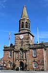
St Mary Magdalene's Churchyard 55°07′42″N 3°26′33″W / 55.128366°N 3.442499°W / 55.128366; -3.442499 (St Mary Magdalene's Churchyard ) Category B 37555 9 Bruce Street including Oliver's Shop 55°07′45″N 3°25′49″W / 55.129132°N 3.430199°W / 55.129132; -3.430199 (9 Bruce Street including Oliver's Shop ) Category B 37533 Woodfoot Farmhouse 55°05′04″N 3°25′45″W / 55.084306°N 3.429288°W / 55.084306; -3.429288 (Woodfoot Farmhouse ) Category C(S) 9967 Elshieshields Tower and adjoining House, Walled Garden and Gatepiers at South 55°09′03″N 3°27′47″W / 55.150814°N 3.462973°W / 55.150814; -3.462973 (Elshieshields Tower and adjoining House, Walled Garden and Gatepiers at South ) Category A 9970 41 High Street 55°07′40″N 3°26′26″W / 55.127868°N 3.440599°W / 55.127868; -3.440599 (41 High Street ) Category C(S) 37546 High Street, Victoria House (Former Free Church Manse) 55°07′37″N 3°26′24″W / 55.127005°N 3.439863°W / 55.127005; -3.439863 (High Street, Victoria House (Former Free Church Manse) ) Category C(S) 37547 Heck Village Lake House and detached Outbuilding 55°06′28″N 3°25′11″W / 55.107749°N 3.4197°W / 55.107749; -3.4197 (Heck Village Lake House and detached Outbuilding ) Category C(S) 9948 High Street, Tolbooth including Iron Lamps 55°07′44″N 3°26′30″W / 55.129016°N 3.44155°W / 55.129016; -3.44155 (High Street, Tolbooth including Iron Lamps ) Category A 37541 Upload another image
17, 19 High Street 55°07′43″N 3°26′29″W / 55.128578°N 3.441315°W / 55.128578; -3.441315 (17, 19 High Street ) Category C(S) 37544 21 High Street, Royal Bank Of Scotland 55°07′43″N 3°26′29″W / 55.128498°N 3.441281°W / 55.128498; -3.441281 (21 High Street, Royal Bank Of Scotland ) Category C(S) 37545 12 (Kismet), 14 Bruce Street 55°07′43″N 3°26′37″W / 55.128604°N 3.443684°W / 55.128604; -3.443684 (12 (Kismet), 14 Bruce Street ) Category B 37536 Bruce Street, Old Bank House 55°07′43″N 3°26′38″W / 55.128609°N 3.444014°W / 55.128609; -3.444014 (Bruce Street, Old Bank House ) Category B 37537 Halleaths Home Farm, House and Steading 55°07′38″N 3°25′08″W / 55.127251°N 3.418855°W / 55.127251; -3.418855 (Halleaths Home Farm, House and Steading ) Category B 9944 Heck Village, Heck Hill Farm Steading Row to Roadside including Cottages 55°06′27″N 3°25′07″W / 55.107555°N 3.418612°W / 55.107555; -3.418612 (Heck Village, Heck Hill Farm Steading Row to Roadside including Cottages ) Category C(S) 9947 Kinnel Bridge, Todhillmuir Cottage 55°09′05″N 3°25′49″W / 55.151354°N 3.430414°W / 55.151354; -3.430414 (Kinnel Bridge, Todhillmuir Cottage ) Category C(S) 9951 Upload another image
Shaw Bridge 55°09′46″N 3°26′52″W / 55.162769°N 3.447791°W / 55.162769; -3.447791 (Shaw Bridge ) Category B 9956 Mayfield House and Outbuildings 55°07′38″N 3°25′53″W / 55.127088°N 3.431302°W / 55.127088; -3.431302 (Mayfield House and Outbuildings ) Category C(S) 9953 10 High Street, Dalveen 55°07′44″N 3°26′28″W / 55.128995°N 3.441048°W / 55.128995; -3.441048 (10 High Street, Dalveen ) Category C(S) 37551 6 Bruce Street. Former Manse and Walled Garden 55°07′44″N 3°26′35″W / 55.128801°N 3.442954°W / 55.128801; -3.442954 (6 Bruce Street. Former Manse and Walled Garden ) Category B 37534 8 Bruce Street, Crown Hotel 55°07′43″N 3°26′36″W / 55.12868°N 3.443373°W / 55.12868; -3.443373 (8 Bruce Street, Crown Hotel ) Category C(S) 37535 Spedlins Tower 55°10′26″N 3°25′06″W / 55.174017°N 3.418271°W / 55.174017; -3.418271 (Spedlins Tower ) Category A 9965 Upload another image See more images
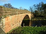
Elshieshields Bridge 55°09′09″N 3°27′50″W / 55.152458°N 3.46377°W / 55.152458; -3.46377 (Elshieshields Bridge ) Category B 9969 Upload another image
Millhouse Bridge Village, Millhouse Bridge 55°09′21″N 3°24′24″W / 55.155918°N 3.40658°W / 55.155918; -3.40658 (Millhouse Bridge Village, Millhouse Bridge ) Category A 9954 Moss-Side Cottages 55°07′09″N 3°25′02″W / 55.119082°N 3.417296°W / 55.119082; -3.417296 (Moss-Side Cottages ) Category C(S) 9955 High Street, Statue of Robert Bruce 55°07′44″N 3°26′29″W / 55.128812°N 3.441261°W / 55.128812; -3.441261 (High Street, Statue of Robert Bruce ) Category B 37540 Upload another image
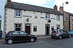
15 High Street, Kings Arms Hotel 55°07′43″N 3°26′29″W / 55.128702°N 3.441445°W / 55.128702; -3.441445 (15 High Street, Kings Arms Hotel ) Category C(S) 37543 Upload another image
14 High Street, Library and Freemason's Hall 55°07′44″N 3°26′28″W / 55.128905°N 3.440997°W / 55.128905; -3.440997 (14 High Street, Library and Freemason's Hall ) Category C(S) 37552 Vendaceburn 55°07′03″N 3°26′24″W / 55.117412°N 3.440129°W / 55.117412; -3.440129 (Vendaceburn ) Category B 9966 Halleaths former Stables (Houses and SSEB Stores and Workshops) 55°07′37″N 3°25′02″W / 55.127029°N 3.417107°W / 55.127029; -3.417107 (Halleaths former Stables (Houses and SSEB Stores and Workshops) ) Category A 9971 Halleaths, Lodge at Innerfield 55°07′26″N 3°25′09″W / 55.123985°N 3.419194°W / 55.123985; -3.419194 (Halleaths, Lodge at Innerfield ) Category B 9973