
Rhineland-Palatinate is a western state of Germany. It covers 19,846 km2 (7,663 sq mi) and has about 4.05 million residents. It is the ninth largest and sixth most populous of the sixteen states. Mainz is the capital and largest city. Other cities are Ludwigshafen am Rhein, Koblenz, Trier, Kaiserslautern, Worms and Neuwied. It is bordered by North Rhine-Westphalia, Saarland, Baden-Württemberg and Hesse and by France, Luxembourg and Belgium.

The Rhineland is a loosely defined area of Western Germany along the Rhine, chiefly its middle section.
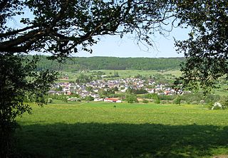
The Westerwald is a low mountain range on the right bank of the river Rhine in the German federal states of Rhineland-Palatinate, Hesse and North Rhine-Westphalia. It is a part of the Rhenish Massif. Its highest elevation, at 657 m above sea level, is the Fuchskaute in the High Westerwald.

The Taunus is a mountain range in Hesse, Germany, located north west of Frankfurt and north of Wiesbaden. The tallest peak in the range is Großer Feldberg at 878 m; other notable peaks are Kleiner Feldberg and Altkönig.
The Westerwaldkreis is a district (Kreis) in the north-east of Rhineland-Palatinate, Germany. Neighbouring districts are Altenkirchen, Lahn-Dill, Limburg-Weilburg, Rhein-Lahn, the district-free city Koblenz, Mayen-Koblenz and Neuwied.

The Lahn is a 245.6-kilometre-long (152.6 mi), right tributary of the Rhine in Germany. Its course passes through the federal states of North Rhine-Westphalia (23.0 km), Hesse (165.6 km), and Rhineland-Palatinate (57.0 km).
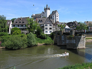
Diez an der Lahn is a town in Germany's Rhein-Lahn district in Rhineland-Palatinate, on the borders of Hesse. Diez is the administrative seat of the municipality of Diez.

Breitscheid is a municipality in the Lahn-Dill-Kreis in Hesse, Germany.
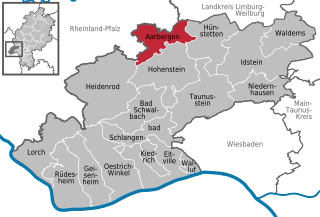
Aarbergen is a municipality in the Rheingau-Taunus-Kreis in the Regierungsbezirk of Darmstadt in Hesse, Germany.

Langenaubach is a village and a Stadtteil of Haiger in the Lahn-Dill-Kreis district in Hesse in Germany.
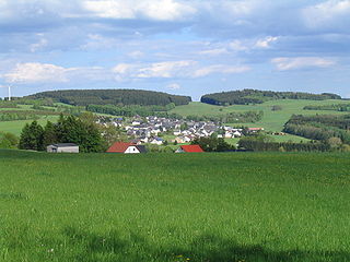
The Fuchskaute is an extinct volcano and, at 657.3 m above sea level (NHN), the highest mountain of the Westerwald and the county of Westerwaldkreis in the German state of Rhineland-Palatinate.
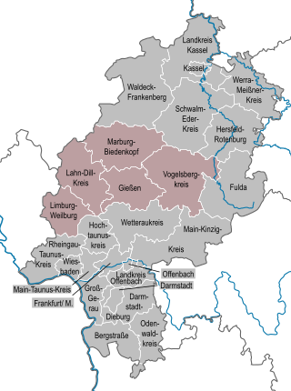
The region of Middle Hesse is one of three planning regions in the German state of Hesse, alongside North and South Hesse. Its territory is identical with that of the administrative province of Gießen and covers the counties of Limburg-Weilburg, Lahn-Dill-Kreis, Gießen, Marburg-Biedenkopf and Vogelsbergkreis. The Middle Hesse Regional Assembly, which decides on the regional plan, currently consists of 31 members chosen by the five counties and the three towns with special status: Gießen, Marburg and Wetzlar. The regional assembly has tasked the governing president (Regierungspräsident) with delivering regional management. The Mid-Hesse Regional Management Association was founded on 22 January 2003.
Alte Burg, Alteburg or Burgstall Alte Burg refers to the name or nickname of various castles, castle ruins, castle sites and hillforts or ringworks:
As well as being a low mountain range, the Westerwald is also a natural region in the system of natural regional division of Germany. Within that it is a major unit group with the number "32". According to this system the major unit group of the Westerwald belongs to the basement plate (Grundgebirgsschollenland), which describes the type of mountain-building process by which it was formed. The major unit group extends across the states of Hesse, North Rhine-Westphalia and Rhineland-Palatinate. It is roughly bounded by the valleys of the Lahn, Rhine and Sieg, whereby the hills immediately south of the Heller and Sieg are not considered to be part of it.
This page is based on this
Wikipedia article Text is available under the
CC BY-SA 4.0 license; additional terms may apply.
Images, videos and audio are available under their respective licenses.


