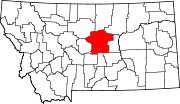
There are at least 60 named mountains in Fergus County, Montana .
- Bald Butte, 47°12′48″N109°18′04″W / 47.21333°N 109.30111°W , el. 5,111 feet (1,558 m) [1]
- Bald Butte, 46°47′29″N108°58′57″W / 46.79139°N 108.98250°W , el. 5,607 feet (1,709 m) [2]
- Bald Butte, 46°54′51″N108°38′25″W / 46.91417°N 108.64028°W , el. 4,055 feet (1,236 m) [3]
- Bald Butte, 47°36′57″N109°10′23″W / 47.61583°N 109.17306°W , el. 3,478 feet (1,060 m) [4]
- Big Grassy Peak, 47°12′14″N109°13′04″W / 47.20389°N 109.21778°W , el. 5,899 feet (1,798 m) [5]
- Black Butte, 47°14′08″N108°58′13″W / 47.23556°N 108.97028°W , el. 5,535 feet (1,687 m) [6]
- Black Butte, 47°28′40″N109°45′00″W / 47.47778°N 109.75000°W , el. 3,487 feet (1,063 m) [7]
- Bloomfield Butte, 47°33′18″N109°15′43″W / 47.55500°N 109.26194°W , el. 3,435 feet (1,047 m) [8]
- Burnette Peak, 47°09′03″N109°21′13″W / 47.15083°N 109.35361°W , el. 5,830 feet (1,780 m) [9]
- Button Butte, 47°30′13″N108°30′21″W / 47.50361°N 108.50583°W , el. 2,966 feet (904 m) [10]
- Button Butte, 46°57′25″N108°42′55″W / 46.95694°N 108.71528°W , el. 4,501 feet (1,372 m) [11]
- Castle Butte, 46°58′22″N109°24′06″W / 46.97278°N 109.40167°W , el. 4,947 feet (1,508 m) [12]
- Cherry Top, 47°37′52″N109°47′12″W / 47.63111°N 109.78667°W , el. 3,514 feet (1,071 m) [13]
- Clagget Hill, 47°43′06″N109°37′56″W / 47.71833°N 109.63222°W , el. 2,648 feet (807 m) [14]
- Coal Hill, 47°22′22″N108°47′18″W / 47.37278°N 108.78833°W , el. 3,465 feet (1,056 m) [15]
- Collar Peak, 47°12′07″N109°11′41″W / 47.20194°N 109.19472°W , el. 5,964 feet (1,818 m) [16]
- Cone Butte, 47°15′31″N109°04′19″W / 47.25861°N 109.07194°W , el. 5,807 feet (1,770 m) [17]
- Crystal Peak, 47°11′09″N109°11′40″W / 47.18583°N 109.19444°W , el. 5,942 feet (1,811 m) [18]
- Elk Peak, 47°13′36″N109°08′40″W / 47.22667°N 109.14444°W , el. 5,919 feet (1,804 m) [19]
- Flat Mountain, 47°05′23″N109°14′09″W / 47.08972°N 109.23583°W , el. 5,479 feet (1,670 m) [20]
- Gold Hill, 47°10′42″N109°12′55″W / 47.17833°N 109.21528°W , el. 5,410 feet (1,650 m) [21]
- Greathouse Peak, 46°46′07″N109°21′21″W / 46.76861°N 109.35583°W , el. 8,658 feet (2,639 m) [22]
- Haystack Butte, 47°21′52″N108°30′10″W / 47.36444°N 108.50278°W , el. 3,369 feet (1,027 m) [23]
- Indian Butte, 47°33′43″N108°45′22″W / 47.56194°N 108.75611°W , el. 3,045 feet (928 m) [24]
- Indian Graves Butte, 47°16′14″N109°37′50″W / 47.27056°N 109.63056°W , el. 3,904 feet (1,190 m) [25]
- Judith Peak, 47°13′00″N109°13′19″W / 47.21667°N 109.22194°W , el. 6,293 feet (1,918 m) [26]
- Jump Off Peak, 46°48′21″N109°27′00″W / 46.80583°N 109.45000°W , el. 7,510 feet (2,290 m) [27]
- Kelly Hill, 47°05′52″N109°16′20″W / 47.09778°N 109.27222°W , el. 5,351 feet (1,631 m) [28]
- Lewis Peak, 47°13′56″N109°07′04″W / 47.23222°N 109.11778°W , el. 5,600 feet (1,700 m) [29]
- Lime Cave Peak, 46°49′15″N109°26′21″W / 46.82083°N 109.43917°W , el. 7,018 feet (2,139 m) [30]
- Lookout Peak, 47°14′43″N109°02′05″W / 47.24528°N 109.03472°W , el. 5,312 feet (1,619 m) [31]
- Lyons Butte, 46°53′50″N109°07′50″W / 46.89722°N 109.13056°W , el. 5,469 feet (1,667 m) [32]
- Maginnis Mountain, 47°12′54″N109°10′18″W / 47.21500°N 109.17167°W , el. 5,810 feet (1,770 m) [33]
- Maiden Peak, 47°11′23″N109°13′37″W / 47.18972°N 109.22694°W , el. 5,620 feet (1,710 m) [34]
- McDonald Butte, 46°59′11″N109°01′05″W / 46.98639°N 109.01806°W , el. 4,288 feet (1,307 m) [35]
- Mount Harlow, 46°47′47″N109°29′42″W / 46.79639°N 109.49500°W , el. 7,106 feet (2,166 m) [36]
- New Year Peak, 47°09′20″N109°20′22″W / 47.15556°N 109.33944°W , el. 5,879 feet (1,792 m) [37]
- Oil Well Hill, 47°38′16″N109°28′28″W / 47.63778°N 109.47444°W , el. 3,337 feet (1,017 m) [38]
- Old Baldy, 46°45′08″N109°18′50″W / 46.75222°N 109.31389°W , el. 8,671 feet (2,643 m) [39]
- Peck Hills, 47°32′36″N109°04′20″W / 47.54333°N 109.07222°W , el. 3,120 feet (950 m) [40]
- Pekay Peak, 47°09′44″N109°13′40″W / 47.16222°N 109.22778°W , el. 5,997 feet (1,828 m) [41]
- Porphyry Peak, 47°12′48″N109°15′56″W / 47.21333°N 109.26556°W , el. 5,997 feet (1,828 m) [42]
- Pyramid Peak, 47°08′37″N109°17′53″W / 47.14361°N 109.29806°W , el. 6,033 feet (1,839 m) [43]
- Rattlesnake Butte, 47°16′21″N108°58′14″W / 47.27250°N 108.97056°W , el. 3,953 feet (1,205 m) [44]
- Red Mountain, 47°13′31″N109°11′30″W / 47.22528°N 109.19167°W , el. 6,122 feet (1,866 m) [45]
- Reed Hill, 47°40′46″N109°38′03″W / 47.67944°N 109.63417°W , el. 2,825 feet (861 m) [46]
- Reppe Butte, 47°43′45″N109°00′35″W / 47.72917°N 109.00972°W , el. 3,228 feet (984 m) [47]
- Rocky Butte, 47°11′00″N109°29′34″W / 47.18333°N 109.49278°W , el. 4,842 feet (1,476 m) [48]
- Sand Rock Hill, 47°17′34″N109°39′20″W / 47.29278°N 109.65556°W , el. 3,730 feet (1,140 m) [49]
- Seventynine Hill, 47°38′01″N109°37′44″W / 47.63361°N 109.62889°W , el. 2,769 feet (844 m) [50]
- Seventytwo Hills, 47°19′33″N109°36′08″W / 47.32583°N 109.60222°W , el. 3,835 feet (1,169 m) [51]
- Sheep Mountain, 47°10′02″N109°12′53″W / 47.16722°N 109.21472°W , el. 5,840 feet (1,780 m) [52]
- Sheepherder Peak, 47°22′55″N109°17′36″W / 47.38194°N 109.29333°W , el. 3,953 feet (1,205 m) [53]
- Smoky Johnson Hill, 47°34′47″N108°30′14″W / 47.57972°N 108.50389°W , el. 2,766 feet (843 m) [54]
- The Peak, 47°38′05″N109°44′02″W / 47.63472°N 109.73389°W , el. 3,353 feet (1,022 m) [55]
- Three Buttes, 46°54′05″N108°39′38″W / 46.90139°N 108.66056°W , el. 4,114 feet (1,254 m) [56]
- Twin Buttes, 47°25′23″N109°41′20″W / 47.42306°N 109.68889°W , el. 3,599 feet (1,097 m) [57]
- West Peak, 46°46′47″N109°32′11″W / 46.77972°N 109.53639°W , el. 8,186 feet (2,495 m) [58]
- White Horse Butte, 47°41′53″N109°09′21″W / 47.69806°N 109.15583°W , el. 3,255 feet (992 m) [59]
- Woodhawk Hill, 47°42′51″N109°12′32″W / 47.71417°N 109.20889°W , el. 3,524 feet (1,074 m) [60]
