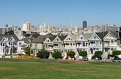
This is a List of parks in San Francisco
United States Fish and Wildlife Service
National Oceanic and Atmospheric Administration
California Department of Parks & Recreation
San Francisco Recreation & Parks Department
Mini Parks [1]
Port of San Francisco
Office of Community Investment and Infrastructure (former San Francisco Redevelopment Agency)
In certain districts, private developers must account for and maintain public spaces within their facilities. These Privately-Owned Public Open Spaces (POPOS) take many forms and have varying hours of operation. [3]
The Golden Gate is a strait on the west coast of North America that connects San Francisco Bay to the Pacific Ocean. It is defined by the headlands of the San Francisco Peninsula and the Marin Peninsula, and, since 1937, has been spanned by the Golden Gate Bridge. The entire shoreline and adjacent waters throughout the strait are managed by the Golden Gate National Recreation Area.
The Richmond District is a neighborhood in the northwest corner of San Francisco, California, developed initially in the late 19th century. It is sometimes confused with the city of Richmond, which is 20 miles (32 km) northeast of San Francisco; accordingly, the neighborhood usually is referred to as "the Richmond."
The Sunset District is a neighborhood located in the southwest quadrant of San Francisco, California, United States.
Grandview Park, also referred to as Turtle Hill by local residents, is a small, elevated park in the Sunset District, San Francisco, California. It is surrounded by 14th and 15th Avenues, as well as Noriega Street.
The Sutro Baths was a large, privately owned public saltwater swimming pool complex in the Lands End area of the Outer Richmond District in western San Francisco, California.
Bernal Heights is a residential neighborhood in southeastern San Francisco, California. The prominent Bernal Heights hill overlooks the San Francisco skyline and features a microwave transmission tower. The nearby Sutro Tower can be seen from the Bernal Heights neighborhood.
Geary Boulevard is a major east–west 5.8-mile-long (9 km) thoroughfare in San Francisco, California, United States, beginning downtown at Market Street near Market Street's intersection with Kearny Street, and running westbound through downtown, the Civic Center area, the Western Addition, and running for most of its length through the predominantly residential Richmond District. Geary Boulevard terminates near Sutro Heights Park at 48th Avenue, close to the Cliff House above Ocean Beach at the Pacific Ocean. At 42nd Avenue, Geary intersects with Point Lobos Avenue, which takes through traffic to the Cliff House, Ocean Beach and the Great Highway. It is a major commercial artery through the Richmond District; it is lined with stores and restaurants, many of them catering to the various immigrant groups who live in the area. The boulevard borders Japantown between Fillmore and Laguna Streets.
Crissy Field is a public recreation area on the northern shore of the San Francisco Peninsula in California, United States, located just east of the Golden Gate Bridge. It includes restored tidal marsh and beaches.
The Cliff House is a neo-classical style building perched on the headland above the cliffs just north of Ocean Beach, in the Outer Richmond neighborhood of San Francisco, California. The building overlooks the site of the Sutro Baths ruins, Seal Rocks, and is part of the Golden Gate National Recreation Area, operated by the National Park Service (NPS). The Cliff House is owned by the NPS; the building's terrace hosts a room-sized camera obscura.
Seal Rock is a group of small rock formation islands in the Lands End area of the Outer Richmond District in western San Francisco, California. They are located just offshore in the Pacific Ocean, at the north end of the Ocean Beach, near the Cliff House and Sutro Baths ruins.
The Golden Gate Biosphere Network is a voluntary coalition of federal, state and local government agencies, nonprofit organizations, universities, and private partners within the Golden Gate Biosphere region. The Network aims to protect the region's biodiversity and conserve its natural resources. The Network has been part of the UNESCO Man and Biosphere Programme since 1988.GGBN is also part of the US Biosphere Network as well as EuroMAB. It is recognized by UNESCO for its "significance for biological diversity conversation" and organizational efforts involving municipal authorities and private interests.
The Golden Gate National Recreation Area (GGNRA) is a U.S. National Recreation Area protecting 82,116 acres (33,231 ha) of ecologically and historically significant landscapes surrounding the San Francisco Bay Area. Much of the park is land formerly used by the United States Army. GGNRA is managed by the National Park Service and is the second-most visited unit of the National Park system in the United States, with more than 15.6 million visitors in 2022. It is also one of the largest urban parks in the world, with a size two-and-a-half times that of the consolidated city and county of San Francisco.
Sutro Heights Park is an historic public park in the Outer Richmond District of western San Francisco, California. It is within the Golden Gate National Recreation Area and the Sutro Historic District.
Fort Baker is one of the components of California's Golden Gate National Recreation Area. The Fort, which borders the City of Sausalito in Marin County and is connected to San Francisco by the Golden Gate Bridge, served as an Army post until the mid-1990s, when the headquarters of the 91st Division moved to Parks Reserve Forces Training Area. It is located opposite Fort Point at the entrance to the San Francisco Bay.
The 49-Mile Scenic Drive is a designated scenic road tour highlighting much of San Francisco, California. It was created in 1938 by the San Francisco Down Town Association to showcase the city's major attractions and natural beauty during the 1939 Golden Gate International Exposition.
The Golden Gate National Parks Conservancy is a nonprofit cooperating association that supports park stewardship and conservation in the Golden Gate National Recreation Area—the most visited national park in the U.S.
The Camera Obscura is a large-scale camera obscura, in the Lands End area of the Outer Richmond District in western San Francisco, California.
The Sutro Historic District is a National Park Service historic district in the Lands End area of the Outer Richmond District in western San Francisco, California. It is within the Golden Gate National Recreation Area, since being acquired by the National Park Service in 1977.
Lands End is a park in San Francisco within the larger Golden Gate National Recreation Area. It is also the geographic name of a specific promontory next to the Pacific Ocean on the northwest side of the park. The park is in large part a rocky and windswept shoreline at the mouth of the Golden Gate, situated between the Sutro District and Lincoln Park and abutting Fort Miley Military Reservation. Numerous hiking trails follow the former railbeds of the Ferries and Cliff House Railway along the cliffs and also down to the shore.