The Presidio of San Francisco is a park and former U.S. Army post on the northern tip of the San Francisco Peninsula in San Francisco, California, and is part of the Golden Gate National Recreation Area.
Fort Hamilton is a United States Army installation in the southwestern corner of the New York City borough of Brooklyn, surrounded by the communities of Bay Ridge and Dyker Heights. It is one of several posts that are part of the region which is headquartered by the Military District of Washington. Its mission is to provide the New York metropolitan area with military installation support for the Army National Guard and the United States Army Reserve. The original fort was completed in 1831, with major additions made in the 1870s and 1900s. However, all defenses except about half of the original fort have been demolished or buried.

Fort Adams is a former United States Army post in Newport, Rhode Island that was established on July 4, 1799 as a First System coastal fortification, named for President John Adams who was in office at the time. Its first commander was Captain John Henry who was later instrumental in starting the War of 1812. The current Fort Adams was built 1824–57 under the Third System of coastal forts; it is part of Fort Adams State Park today.

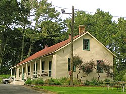
Joint Expeditionary Base-Fort Story, commonly called simply Fort Story is a sub-installation of Joint Expeditionary Base Little Creek–Fort Story, which is operated by the United States Navy. Located in the independent city of Virginia Beach, Virginia at Cape Henry at the entrance of the Chesapeake Bay, it offers a unique combination of features including dunes, beaches, sand, surf, deep-water anchorage, variable tide conditions, maritime forest and open land. The base is the prime location and training environment for both U.S. Army amphibious operations and Joint Logistics-Over-the-Shore (LOTS) training events.

Fort Mason, in San Francisco, California originated as a coastal defense site during the American Civil War. The nucleus of the property was owned by John C. Frémont and disputes over compensation by the United States continued into 1968. In 1882 the defenses were named for Richard Barnes Mason, a military governor before statehood. Fort Mason became the headquarters for an Army command that included California and the Hawaiian Islands from 1904 to 1907. In 1912 the Army began building a port facility with piers and warehouses to be a home base for ships of the Army Transport Service serving Alaska, Hawaii, the Philippines and other Pacific Army posts and focus of Army supply for the Pacific.

The Golden Gate National Recreation Area (GGNRA) is a U.S. National Recreation Area protecting 82,116 acres (33,231 ha) of ecologically and historically significant landscapes surrounding the San Francisco Bay Area. Much of the park is land formerly used by the United States Army. GGNRA is managed by the National Park Service and is the most visited unit of the National Park system in the United States, with more than 15 million visitors a year. It is also one of the largest urban parks in the world, with a size two-and-a-half times that of the consolidated city and county of San Francisco.

Fort Baker is one of the components of California's Golden Gate National Recreation Area. The Fort, which borders the City of Sausalito in Marin County and is connected to San Francisco by the Golden Gate Bridge, served as an Army post until the mid-1990s, when the headquarters of the 91st Division moved to Parks Reserve Forces Training Area. It is located opposite Fort Point at the entrance to the San Francisco Bay.

Several boards have been appointed by US presidents or Congress to evaluate the US defensive fortifications, primarily coastal defenses near strategically important harbors on the US shores, its territories, and its protectorates.
Fort Crockett is a government reservation on Galveston Island overlooking the Gulf of Mexico originally built as a defense installation to protect the city and harbor of Galveston and to secure the entrance to Galveston Bay, thus protecting the commercial and industrial ports of Galveston and Houston and the extensive oil refineries in the bay area. The facility is now managed by the US NOAA National Marine Fisheries Service, and hosts the Bureau of Commercial Fisheries Laboratory, the Texas Institute of Oceanography, as well as some university facilities. The area still contains several historical buildings and military fortifications.

Fort Funston is a former harbor defense installation located in the southwestern corner of San Francisco. Formerly known as the Lake Merced Military Reservation, the fort is now a protected area within the Golden Gate National Recreation Area (GGNRA). It was named in honor of Frederick N. Funston (1865–1917), a Major General in the United States Army with strong connections to San Francisco, and included several artillery batteries. The fort is located on Skyline Boulevard at John Muir Drive, west of Lake Merced.
Seacoast defense was a major concern for the United States from its independence until World War II. Before airplanes, many of America's enemies could only reach it from the sea, making coastal forts an economical alternative to standing armies or a large navy. After the 1940s, it was recognized that fixed fortifications were obsolete and ineffective against aircraft and missiles. However, in prior eras foreign fleets were a realistic threat, and substantial fortifications were built at key locations, especially protecting major harbors.

Fort Wetherill is a former coast artillery fort that occupies the southern portion of the eastern tip of Conanicut Island in Jamestown, Rhode Island. It sits atop high granite cliffs, overlooking the entrance to Narragansett Bay. Fort Dumpling from the American Revolutionary War occupied the site until it was built over by Fort Wetherill. Wetherill was deactivated and turned over to the State of Rhode Island after World War II and is now operated as Fort Wetherill State Park, a 51-acre (210,000 m2) reservation managed by the Rhode Island Department of Environmental Management.

Fort Taber District or the Fort at Clark's Point is a historic American Civil War-era military fort on Wharf Road within the former Fort Rodman Military Reservation in New Bedford, Massachusetts. The fort is now part of Fort Taber Park, a 47-acre town park located at Clark's Point. Fort Taber was an earthwork built nearby with city resources and garrisoned 1861-1863 until Fort Rodman was ready for service.

Fort Williams is a former United States Army fort in Cape Elizabeth, Maine which operated from 1872 to 1964. It was part of the Coast Defenses of Portland, later renamed the Harbor Defenses of Portland, a command which protected Portland's port and naval anchorage 1904–1950. After its closure, it was redeveloped into Fort Williams Park.

Fort Revere is an 8-acre (3.2 ha) historic site situated on a small peninsula located in Hull, Massachusetts. It is situated on Telegraph Hill in Hull Village and contains the remains of two seacoast fortifications, one from the American Revolution and one that served 1898–1947. There are also a water tower with an observation deck, a military history museum and picnic facilities. It is operated as Fort Revere Park by the Metropolitan Park System of Greater Boston.

Battery Steele is a United States military fortification on Peaks Island, Portland, Maine in Casco Bay. Completed in 1942 as part of World War II, it is located on 14 acres (5.7 ha) on the oceanside area of the island, formerly part of the Peaks Island Military Reservation. It is named for Harry L. Steele, who was a Coast Artillery officer during World War I. It was armed with two 16-inch MkIIMI guns and, with a 12-inch gun battery at Fort Levett on Cushing Island, replaced all previous heavy guns in the Harbor Defenses of Portland. It was built to protect Casco Bay, particularly Portland harbor, from Kennebunk to Popham Beach in Phippsburg. According to Kim MacIsaac and historian Joel Eastman in An Island at War, “Battery Steele is not only the largest gun battery built on Peaks Island, but also an example of the largest battery ever built anywhere in the United States.” In 1995, after decades of non-use, the Peaks Island Land Preserve, a community land preservation group, formed to purchase the area and forever preserve it as a public space. On October 20, 2005, the property was listed on the National Register of Historic Places. Other coast defense structures on the island include fire control towers and the counterweight for a disappearing searchlight tower.
Fort Standish was a coastal fort completed in 1907 and located on Lovell's Island in Massachusetts. Named after Myles Standish, the fort would serve to host up to 7 batteries until it was disarmed and deactivated in 1947. It was also named Lovell's Island Military Reservation during the early part of its existence. It was part of the Coast Defenses of Boston.
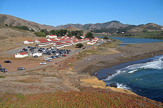
Fort Cronkhite is one of the components of California's Golden Gate National Recreation Area. Today part of the National Park Service, Fort Cronkhite is a former US Army post that served as part of the coastal artillery defenses of the San Francisco Bay Area during World War II. The soldiers at Cronkhite manned gun batteries, radar sites, and other fortifications on the high ridges overlooking the fort.

The 5-inch gun M1897 (127 mm) and its variant the M1900 were coastal artillery pieces installed to defend major American seaports between 1897 and 1920. For most of their history they were operated by the United States Army Coast Artillery Corps. They were installed on balanced pillar or pedestal mountings; generally the M1897 was on the balanced pillar mounting and the M1900 was on the pedestal mounting. All of these weapons were scrapped within a few years after World War I.

The Harbor Defenses of Boston was a United States Army Coast Artillery Corps harbor defense command. It coordinated the coast defenses of Boston, Massachusetts from 1895 to 1950, beginning with the Endicott program. These included both coast artillery forts and underwater minefields. The command originated circa 1895 as the Boston Artillery District, was renamed Coast Defenses of Boston in 1913, and again renamed Harbor Defenses of Boston in 1925.