Related Research Articles

The Feather River is the principal tributary of the Sacramento River, in the Sacramento Valley of Northern California. The river's main stem is about 73 miles (117 km) long. Its length to its most distant headwater tributary is just over 210 miles (340 km). The main stem Feather River begins in Lake Oroville, where its four long tributary forks join—the South Fork, Middle Fork, North Fork, and West Branch Feather Rivers. These and other tributaries drain part of the northern Sierra Nevada, and the extreme southern Cascades, as well as a small portion of the Sacramento Valley. The total drainage basin is about 6,200 square miles (16,000 km2), with approximately 3,604 square miles (9,330 km2) above Lake Oroville.
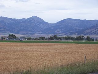
The Bridger Range, also known as the Bridger Mountains, is a subrange of the Rocky Mountains in southwestern Montana in the United States. The range runs mostly in a north–south direction between Bozeman and Maudlow. It is separated from the Gallatin Range to the south by Bozeman Pass; from the Horseshoe Hills to the west by Dry Creek; from the Crazy Mountains to the east by the Shields River valley; and from the Big Belt Mountains to the north by Sixteen Mile Creek. The highest point in the Bridger Range is Sacagawea Peak, which is visible to the northeast from Bozeman.

The Chippewa River is a stream in Michigan, United States, that runs 91.8 miles (147.7 km) through the central Lower Peninsula. The Chippewa is a tributary of the Tittabawassee River and is thus part of the Saginaw River drainage basin. The river is named after the Chippewa people.

The San Jacinto River is a 42-mile-long (68 km) river in Riverside County, California. The river's headwaters are in Santa Rosa and San Jacinto Mountains National Monument. The lower portion of the 765-square-mile (1,980 km2) watershed is urban and agricultural land. As a partially endorheic watershed that is contiguous with other Great Basin watersheds, the western side of the San Jacinto Basin is a portion of the Great Basin Divide.

Redwood Estates is a rural unincorporated community along State Route 17 in the coastal Santa Cruz Mountains in Los Gatos, California, United States. The Census Bureau includes it in a census-designated place named Lexington Hills. It lies inside the confines of Santa Clara County. The area is about eight miles from downtown Los Gatos and nine miles from the Santa Cruz County community of Scotts Valley.

The Dowagiac River is a southwesterly flowing 30.9-mile-long (49.7 km) stream in the Lower Peninsula of the U.S. state of Michigan. It is tributary to the St. Joseph River which flows, in turn, into eastern Lake Michigan.

The Cedar River is a 29.0-mile-long (46.7 km) river in the U.S. state of Michigan, flowing through Clare County and Gladwin County.
Copper Mine Gulch is a valley in Marin County, California, United States, which is associated with a small stream.

Wilkins Gulch is a valley in western Marin County, California, United States, located northwest of Pike County Gulch. It is associated with a small stream.
Pike County Gulch is a coastal valley in Marin County, California, United States, which is associated with a small stream. It is located between Wilkins Gulch and Audubon Canyon.

Morses Gulch is a coastal valley in Marin County, California, United States.
McKinnan Gulch is a valley in Marin County, California, United States.

Stinson Gulch is a valley in Marin County, California, United States which is associated with a small stream.

Bolinas Ridge is a north-south ridge in southwestern Marin County, California. Much of the western side of the ridge is protected parkland in the Golden Gate National Recreation Area, and the eastern side is watershed lands of the Marin Municipal Water District.
Rodgers Gulch is a valley in San Mateo County, California. It contains a small stream which is a tributary of San Gregorio Creek. The stream flows about 1.5 miles (2 km) from its source on Mindego Hill to its confluence with Alpine Creek, just east (upstream) of the boundary of the Heritage Grove Redwood Preserve.
Pine Tree Gulch is a valley in San Mateo County, California. It contains a small stream which is a tributary of San Gregorio Creek. The stream flows about 0.5 miles (1 km) from its source to its confluence with El Corte de Madera Creek.
Dairy Gulch is a valley in San Mateo County, California. It contains a stream which is a tributary of San Gregorio Creek.
Shaw Gulch is a valley in San Mateo County, California. It contains a stream which flows about 1.5 miles (2 km) from its source. The stream's waters drain into Bradley Creek about 1.5 miles (2 km) north of the town of Pescadero.
Pine Gulch Creek is a 7.6-mile-long (12.2 km) south-flowing stream in western Marin County, California, United States which empties into Bolinas Lagoon.

The Pine River is a 103-mile-long (166 km) river in the Lower Peninsula of the U.S. state of Michigan. The Pine River is a tributary of the Chippewa River and is thus part of the Saginaw River drainage basin.
References
- ↑ Olema Valley, National Park Service, retrieved 9 December 2017
- ↑ "Olema Creek". Geographic Names Information System . United States Geological Survey, United States Department of the Interior.
- ↑ "Pine Gulch Creek". Geographic Names Information System . United States Geological Survey, United States Department of the Interior.
Coordinates: 37°59′41″N122°45′14″W / 37.99481°N 122.75402°W
| | This Marin County, California–related article is a stub. You can help Wikipedia by expanding it. |