Tamalpais-Homestead Valley is a census-designated place (CDP) in Marin County, California, United States. The population was 11,492 at the 2020 census.

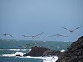
Point Reyes National Seashore is a 71,028-acre (287.44 km2) park preserve located on the Point Reyes Peninsula in Marin County, California. As a national seashore, it is maintained by the US National Park Service as an important nature preserve. Some existing agricultural uses are allowed to continue within the park. Clem Miller, a US Congressman from Marin County wrote and introduced the bill for the establishment of Point Reyes National Seashore in 1962 to protect the peninsula from development which was proposed at the time for the slopes above Drake's Bay. All of the park's beaches were listed as the cleanest in the state in 2010.
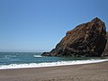
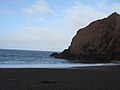
New Albion, also known as Nova Albion, was the name of the continental area north of Mexico claimed by Sir Francis Drake for England when he landed on the North American west coast in 1579. This claim became the justification for English charters across America to the Atlantic coast and soon influenced further national expansion projects on the continent. Drake's landing site has been identified as Drake's Cove, which is part of Point Reyes National Seashore.

Drakes Estero is an expansive estuary in the Point Reyes National Seashore of Marin County on the Pacific coast of northern California in the United States, approximately 25 miles (40 km) northwest of San Francisco.
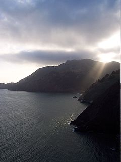
The Marin Headlands is a hilly peninsula at the southernmost end of Marin County, California, United States, located just north of San Francisco across the Golden Gate Bridge, which connects the two counties and peninsulas. The entire area is part of the Golden Gate National Recreation Area. The Headlands are famous for their views of the Bay Area, especially of the Golden Gate Bridge.
Point Richmond, also sometimes referred to locally as The Point, is a neighborhood in Richmond, California, United States, near the eastern end of the Richmond-San Rafael Bridge, between Interstate 580 and the San Francisco Bay.

Cove Lake State Park is a state park in Campbell County, Tennessee, in the southeastern United States. The park consists of 673 acres (2.72 km2) situated around Cove Lake, an impoundment of Cove Creek created by the completion of Caryville Dam in 1936. The park's location is adjacent to the town of Caryville and just west of Jacksboro.

Point San Pablo Harbor is a marina and small community at the far end of Point San Pablo in San Pablo Bay, within Richmond, in Contra Costa County, California. It is located at 1900 Stenmark Drive, Richmond CA 94801.

Bolinas Ridge is a north-south ridge in southwestern Marin County, California. Much of the western side of the ridge is protected parkland in the Golden Gate National Recreation Area, and the eastern side is watershed lands of the Marin Municipal Water District.
Olema Valley is a gorge formed by the San Andreas Fault in rural west Marin County, Northern California. The valley runs from the southern end of Tomales Bay through Point Reyes Station, the town of Olema, and Dogtown, to the Bolinas Lagoon, which lies between Bolinas and Stinson Beach. It is part of the Golden Gate National Recreation Area.

Pirates Cove is an embayment in Marin County, California, United States, between Muir Beach and Tennessee Cove. A trail leads from the terminus of the California Coastal Trail to a small beach area, surrounded by steep hills and coastal scrub.
The Raccoon Strait is a waterway of the San Francisco Bay between Angel Island and the Tiburon Peninsula, mainland Marin County, California, United States. During the ice ages, when sea levels were considerably lower and San Francisco Bay was a grassy valley, the combined Sacramento-San Joaquin river flowed through what is now Raccoon Strait before flowing through the canyon at the Golden Gate.

Yerba Buena was the original name of the settlement that later became San Francisco, California. Located near the northeastern end of the San Francisco Peninsula, between the Presidio of San Francisco and the Mission San Francisco de Asís, it was originally intended as a trading post for ships visiting San Francisco Bay. The settlement was arranged in the Spanish style around a plaza that remains as the present day Portsmouth Square.

Grassy Cove is an enclosed valley in Cumberland County, Tennessee, United States. The valley is notable for its karst formations, which have been designated a National Natural Landmark. Grassy Cove is also home to a small unincorporated community.
Tamalpais Valley is an unincorporated community in Marin County, California.

Arch Cape is an unincorporated community in Clatsop County, Oregon, United States. Named for the natural arch in the coastal rocks and the headland (cape) that extends into the Pacific Ocean, it is located along the Pacific coast, approximately four miles south of Cannon Beach, between Hug Point State Recreation Site to the north and Oswald West State Park to the south.
The Marin Municipal Water District is the government agency that provides drinking water to southern and central Marin County, California. Chartered in 1912, it became California's first municipal water district. It serves 191,000 customers in a 147-square-mile (380 km2) area that includes ten towns and cities.

The Tennessee Valley is a small, undeveloped part of Marin County, near Mill Valley. Historically home to ranches and threatened with the development of a new city, the valley was incorporated into the Golden Gate National Recreation Area in 1972, with additional sections added to the park in 1974. The park contains horse stables, a native-plant nursery, and numerous trails for hiking, biking, and horse riding, including a 1.7-mile, handicap-accessible trail that leads to Tennessee Cove and its beach.
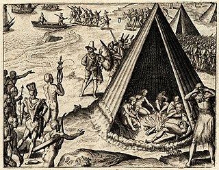
From 1577 to 1580 Sir Francis Drake circumnavigated the world. In 1579 as part of this voyage he landed on the west coast of North America which consequently has drawn the attention of scores of historians, geographers, linguists, anthropologists and other professionals. In addition, many history buffs have sought to locate Drake's New Albion. The accepted site for Drake's 1579 landing at New Albion is at Drake's Cove in Drakes Bay in Marin County, California. More than a score of ideas for an alternative to Drake's New Albion claim have been put forth which cover the coast from Alaska to Baja California Sur, Mexico. These ideas span the eighteenth through the early twenty-first centuries.

Yerba Buena Cove was a cove on San Francisco Bay where the Mexican pueblo of Yerba Buena was located. It lay between Clarks Point to the north and Rincon Point to the south. The beach of the cove was set back as far as what is now Montgomery Street between Clay and Washington Streets.