Llanddewi Skirrid

Last updated

Llanddewi Skirrid
Village Hall, Llanddewi Skirrid - geograph.org.uk - 215799.jpg
Llanddewi Skirrid Village Hall
Monmouthshire UK location map.svg
Red pog.svg
Llanddewi Skirrid
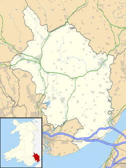
Location within Monmouthshire
Principal area
Ceremonial county
Country Wales
Sovereign state United Kingdom
Post town USK
Postcode district NP
Police Gwent
Fire South Wales
Ambulance Welsh
UK Parliament
List of places
UK
Wales
Monmouthshire
51°50′52″N2°57′31″W / 51.84778°N 2.95861°W / 51.84778; -2.95861 Coordinates: 51°50′52″N2°57′31″W / 51.84778°N 2.95861°W / 51.84778; -2.95861

Llanddewi Skirrid (Welsh : Llanddewi Ysgyryd) is a village in Monmouthshire, south east Wales, United Kingdom.
Contents

Location

Llanddewi Skirrid is located 3 miles (4.8 km) north east of Abergavenny on the old B4521 road to Ross-on-Wye. [1]

History and amenities

The Skirrid mountain overlooks the village and parish. The Skirrid is a stand-alone mountain, an outlier of the Black Mountains, Wales and the most easterly mountain within the Brecon Beacons National Park.

The Walnut Tree restaurant was opened in the early 1960s, and eventually became Michelin starred for its Italian/Welsh fusion cuisine. After the original owner retired, it was taken over by his son. After losing its Michelin rating it was featured on the Channel 4 television show Ramsay's Kitchen Nightmares. It closed in 2007 before reopening with new owners, and was later named the best restaurant in Britain, [2] and was awarded a fresh Michelin star in 2010. [3]

Related Research Articles

Abergavenny Market town in Monmouthshire, Wales

Abergavenny is a market town and community in Monmouthshire, Wales. Abergavenny is promoted as a Gateway to Wales; it is approximately 6 miles (10 km) from the border with England and is located where the A40 trunk road and the A465 Heads of the Valleys road meet.

Kilpeck Human settlement in England

Kilpeck Welsh: Llanddewi Cil Pedeg is a village and civil parish in the county of Herefordshire, England. It is about nine miles (14 km) southwest of Hereford, just south of the A465 road and Welsh Marches Line to Abergavenny, and about five miles (8 km) from the border with Wales. On the 1st of April 2019 the parishes of Kenderchurch, St Devereux, Treville and Wormbridge were merged with Kilpeck.

Ysgyryd Fawr

Ysgyryd Fawr is an easterly outlier of the Black Mountains in Wales, and forms the easternmost part of the Brecon Beacons National Park. The mountain is often referred to locally as just The Skirrid. The smaller hill of Ysgyryd Fach or "Little Skirrid" (270m) lies about 4.5 km / 2.5 mi to the south.

A40 road

The A40 is a major road which runs between London and Goodwick (Fishguard), Wales, and officially called The London to Fishguard Trunk Road (A40) in all legal documents and Acts. Much of its length within England has been superseded by motorways, such as the M4 and M40, and has lost its trunk road status, though it retains it west of Gloucester, including its length within Wales. It is approximately 260 miles (420 km) long. The eastern section from Denham, Buckinghamshire to Wheatley, Oxfordshire is better served by the M40 and its former function of linking London with Cheltenham and Gloucester has been taken by the M4, A419 and A417 via Swindon.

Monmouthshire County

Monmouthshire is a principal area in Wales. The name derives from the historic county of Monmouthshire of which it covers the eastern three-fifths. The largest town is Abergavenny. Other towns and large villages are Caldicot, Chepstow, Monmouth, Magor and Usk. It borders Torfaen, Newport and Blaenau Gwent to the west; Herefordshire and Gloucestershire to the east; and Powys to the north.

Llanfoist

Llanfoist is both a village near Abergavenny, in Monmouthshire, Wales, and the community of Llanfoist Fawr. Llanfoist derives from Ffwyst, an early Christian Welsh saint, although the anglicised version of the church patron is Saint Faith. The population was 1,228 in 2011.

Llanddewi Brefi Human settlement in Wales

Llanddewi Brefi is a village, parish and community of approximately 500 people in Ceredigion, Wales.

Sugar Loaf, Monmouthshire

Sugar Loaf, sometimes called The Sugar Loaf, is a mountain situated 2 miles (3.2 km) north-west of Abergavenny in Monmouthshire, Wales and sits within the Brecon Beacons National Park. It is the southernmost of the summit peaks of the Black Mountains, with a height of 1,955 feet (596 metres).

Llanthony Priory Grade I listed priory in the United Kingdom

Llanthony Priory is a partly ruined former Augustinian priory in the secluded Vale of Ewyas, a steep-sided once-glaciated valley within the Black Mountains area of the Brecon Beacons National Park in Monmouthshire, south east Wales. It lies seven miles north of Abergavenny on an old road to Hay-on-Wye at Llanthony. The priory ruins lie to the west of the prominent Hatterrall Ridge, a limb of the Black mountains. The main ruins are under the care of Cadw and entrance is free.

Llanddewi Rhydderch

Llanddewi Rhydderch is a village in Monmouthshire, Wales at OS grid reference SO 351130. It is off the B4233 road, roughly five miles from Abergavenny, lying within the administrative community of Llanover.

Llanvihangel Crucorney Human settlement in Wales

Llanvihangel Crucorney is a small village in the community (parish) of Crucorney, Monmouthshire, Wales. It is located 5 miles (8.0 km) north of Abergavenny and 18 miles (29 km) south-west of Hereford, England on the A465 road.

Llantilio Pertholey Human settlement in Wales

Llantilio Pertholey is a small village and community (parish) in Monmouthshire, south east Wales. It is located 1.5 miles (2.4 km) to the north-east of the market town of Abergavenny, which it is part of, just off the A465 road to Hereford. The parish covers a large area beneath the Skirrid, an outlier of the Black Mountains; much of the parish lies within the easternmost part of the Brecon Beacons National Park.

Pandy, Monmouthshire

Pandy is a hamlet in Monmouthshire, south east Wales, United Kingdom.

Ysgyryd Fach is a hill one mile east of Abergavenny in the county of Monmouthshire, south Wales. It is often referred to in English as 'Little Skirrid' or sometimes as 'Skirrid Fach'. Its summit height is just over 270m. A conifer plantation extends over much of the hill including its summit; prior to felling of trees on the upper slopes in 2012 outward views were therefore restricted. The hill is considered to be one of the 'seven hills of Abergavenny'.

Stephen Terry is a professional chef from Wales, who was taught by Marco Pierre White in his kitchen "Harvey's" and currently owns, and is Head Chef at, the Hardwick Restaurant in Abergavenny, Wales. The Hardwick was awarded a Michelin Bib Gourmand rating in 2011, which was lost in the same year.

The Whitebrook Restaurant in the United Kingdom

The Whitebrook, formerly known as The Crown at Whitebrook, is a restaurant with rooms in Whitebrook, 6 miles (9.7 km) south-south-east of Monmouth, Monmouthshire, Wales, near the River Wye and the border with England. The building is thought to date from the 17th century and by the 19th century it was used as a roadside inn. Its restaurant was run by Chef Patron James Sommerin until 2013; it gained a Michelin star in 2007. It contains eight double rooms and a 2-acre (0.81 ha) garden. On 7 March 2013, it closed because of financial difficulties; at the time it had the longest held Michelin star in Wales. Critics praised the food under Sommerin, but have criticised the difficulty in finding the restaurant. It re-opened in October 2013 under new chef and owner Chris Harrod, and regained the Michelin star in 2014. Harrod serves a menu using locally produced meat and vegetables along with foraged ingredients such as charlock, hedge bedstraw and pennywort.

The Angel Hotel, Abergavenny

The Angel Hotel is an AA 4-star Grade II listed hotel and inn at 15 Cross Street, in Abergavenny, Wales. It lies on the corner with Lower Castle Street and the main commercial street, Cross Street.

The Checkers (restaurant) Restaurant in Montgomery, UK

The Checkers, is a restaurant with rooms in Montgomery, Powys, Wales. Historically, the building was used as a coaching inn dating from the 17th century. Until the 2000s, it was used as a pub/hotel. It was converted into a French restaurant in 2012 and under chef Stephane Borie, it was awarded a Michelin star later that year. There are two main rooms in the restaurant, and three hotel rooms. It has received a mixed reception from critics, who have praised particular dishes but criticised the atmosphere. It serves both modern and classic French dishes, and in 2016, switched to only using set menus. In 2018, The Checkers moved away from their Michelin star and opened a breakfast and lunch restaurant renamed Checkers Pantry.

The Walnut Tree (restaurant)

The Walnut Tree is a restaurant in Llanddewi Skirrid, Monmouthshire, Wales, run by chef Shaun Hill and holds a Michelin star. It was previously owned by Franco Taruschio for more than 30 years, and had previously held a star when Stephen Terry was head chef there. It closed briefly in 2007, which the owners blamed on an appearance on Ramsay's Kitchen Nightmares three years earlier. It regained its Michelin star in 2010 and continues to hold it.

References