Lofthouse, West Yorkshire

Last updated

Lofthouse
Lofthouse, Christ Church - geograph.org.uk - 228040.jpg
Christ Church, Lofthouse
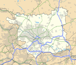
Leeds UK location map.svg
Red pog.svg
Lofthouse
West Yorkshire UK location map.svg
Red pog.svg
Lofthouse
Location within West Yorkshire
OS grid reference SE332257
Metropolitan borough
Metropolitan county
Region
Country England
Sovereign state United Kingdom
Post town WAKEFIELD
Postcode district WF3
Dialling code 01924
Police West Yorkshire
Fire West Yorkshire
Ambulance Yorkshire
List of places
UK
England
Yorkshire
53°43′36″N1°29′54″W / 53.72665°N 1.49829°W / 53.72665; -1.49829 Coordinates: 53°43′36″N1°29′54″W / 53.72665°N 1.49829°W / 53.72665; -1.49829

Lofthouse is a village between the cities of Wakefield and Leeds in West Yorkshire, England. [1] The village falls within the Ardsley and Robin Hood ward of the City of Leeds Council. It is in the City of Leeds metropolitan borough but with a Wakefield postal address (WF3). It is mentioned as Locthuse, also as Loftose in the 1086 Domesday Book. [2]

Contents

Lofthouse has good road connections to its nearby boroughs as well as to the rest of Northern England. It can be found on the main A61 Leeds-Wakefield road and off junction 29 of the M62 and junction 42 of the M1, known locally as the Lofthouse interchange. Lofthouse Gate and Outwood are neighbouring villages on the A61 towards Wakefield and are in the Wakefield Metropolitan Area. Towards Leeds there is the village of Robin Hood.

There are two churches, Christ Church (Church of England) and Lofthouse Methodist Church, [3] a doctor's surgery [4] and the Rodillian Academy. Lofthouse Children's Centre [5] is located in the Rodillian Academy grounds. [6] The old co-operative building, just off the main A61 on Co-operative Street, is now occupied by Chill Beauty. [7]

Lofthouse is often erroneously believed to be the scene of the Lofthouse Colliery disaster, which took place in 1973. The disaster actually took place beneath a field near the village of Kirkhamgate, where a new coalface was being worked.
See also

Related Research Articles

Pontefract Market town in West Yorkshire, England

Pontefract is a historic market town in the Metropolitan Borough of Wakefield in West Yorkshire, England, east of Wakefield and south of Castleford. Historically part of the West Riding of Yorkshire, it is one of the towns in the City of Wakefield District and had a population of 30,881 at the 2011 Census. Pontefract's motto is Post mortem patris pro filio, Latin for "After the death of the father, support the son", a reference to the town's Royalist sympathies in the English Civil War.

Rothwell, West Yorkshire Market Town in West Yorkshire, England

Rothwell is a town in the south-east of the City of Leeds metropolitan borough in West Yorkshire, England. It is situated between Leeds and Wakefield.

Morley, West Yorkshire Market town and civil parish in West Yorkshire, England

Morley is a market town and a civil parish within the City of Leeds metropolitan borough, in West Yorkshire, England. Morley is the largest town in the Borough of Leeds after Leeds itself. Morley forms part of the Heavy Woollen District.

Barnsley Town in South Yorkshire, England

Barnsley is a market town in South Yorkshire, England. As the main settlement of the Metropolitan Borough of Barnsley and the fourth largest settlement in South Yorkshire, the 2011 Census gave the town a population of 91,297 compared to the wider borough which had a population of 246,866. Historically in the West Riding of Yorkshire, it is located between the cities of Sheffield, Manchester, Wakefield, and Leeds. The larger towns of Rotherham, Huddersfield and Doncaster are nearby.

Bramley, Leeds Area of Leeds, West Yorkshire, England

Bramley is a district in west Leeds, West Yorkshire, England. It is part of the City of Leeds Ward of Bramley and Stanningley with a population of 21,334 at the 2011 Census. The area is an old industrial area with much 19th century architecture and 20th century council housing in the east and private suburban housing in the west.

Tingley Village and suburb in West Yorkshire, England

Tingley is a suburban village in the City of Leeds in West Yorkshire, Northern England, forming part of the parish of West Ardsley. Tingley forms part of the Heavy Woollen District. It is situated between the cities of Leeds and Wakefield.

East Ardsley Village in West Yorkshire, England

East Ardsley is a village in the City of Leeds metropolitan borough, in West Yorkshire, England. East Ardsley forms part of the Heavy Woollen District.

The Wakefield line is a railway line and service in the West Yorkshire Metro and South Yorkshire Passenger Transport Executive areas of northern England. The Wakefield line is coloured yellow on maps and publications by West Yorkshire Metro. The line was electrified in 1989, between Leeds & Wakefield Westgate, as part of the programme to electrify the East Coast Main Line.

Birstall, West Yorkshire Village in West Yorkshire, England

Birstall is a large village in the metropolitan borough of Kirklees, West Yorkshire, England. It is part of Birstall and Birkenshaw ward which had a population of 16,298 at the 2011 census. Historically in the West Riding of Yorkshire, and part of the Heavy Woollen District, the town is approximately 6 miles (10 km) south-west of Leeds and situated close to the M62 motorway. The village is situated between Leeds, Bradford, Huddersfield and Wakefield.

Stanley, West Yorkshire Village in West Yorkshire, England

Stanley is a village in the Metropolitan Borough of Wakefield in West Yorkshire, England. It is about 2.5 miles (4.0 km) north-east of Wakefield city centre. Stanley was an Urban District in the West Riding of Yorkshire before 1974, being made up the four electoral wards of Lake Lock, Outwood, Stanley and Wrenthorpe. The Lofthouse / Stanley area of West Yorkshire has a combined population of 22,947. The ward remaining at the 2011 Census was called Stanley and Outwood East. The population of this ward at the 2011 Census was 15,314.

Drighlington Village and civil parish in West Yorkshire, England

Drighlington is a village and civil parish in the City of Leeds metropolitan district, West Yorkshire, England. Historically part of the West Riding of Yorkshire, the village lies 5 miles (9 km) south-west of Leeds and 4 miles (6 km) south-east of Bradford. The name of the village is often shortened to Drig. The population of the civil parish as of the 2011 census was 5,528.

West Ardsley Area of Leeds, West Yorkshire, England

West Ardsley is a settlement on the south-west edge of the City of Leeds metropolitan borough. Historically part of the West Riding of Yorkshire, it roughly approximates to an amalgamation of Tingley, Woodkirk, Hill Top, Upper Green, Common Side, Beggarington Hill and a number of other hamlets. The parish church is situated at Woodkirk and Methodist church on Haigh Moor Road. Being in the middle of several towns, West Ardsley has become a dormitory settlement.

Outwood, Wakefield Settlement in West Yorkshire, England

Outwood is a district to the north of Wakefield, a city in West Yorkshire, England. The district is centred on the A61 Leeds Road south of Lofthouse. It grew up as a pit village and was only a small settlement until the 1970s, when construction of new houses caused it to grow and merge with neighbouring settlements such as Wrenthorpe and Stanley. In 2001, it had a population of 7,623.

Collingham, West Yorkshire Village and civil parish in West Yorkshire, England

Collingham is a village and civil parish 2 miles (3 km) south-west of Wetherby in West Yorkshire, England. It is in the City of Leeds metropolitan borough. The population of the civil parish as of the 2011 census was 2,991.

Thorpe on the Hill, West Yorkshire Human settlement in England

Thorpe on the Hill is a small village in West Yorkshire, England. The village falls within the Ardsley and Robin Hood ward of the Leeds Metropolitan Council. It was mentioned as "Torp" in the Domesday Book together with neighbouring Carlton, Lofthouse, Middleton, and Rothwell as part of the Morley Hundred in the West Riding.

Robin Hood is a village in West Yorkshire, England, within the City of Leeds metropolitan borough, with Wakefield WF3, and Leeds LS26 postcodes. It is situated on the A61 and A654 between Leeds and Wakefield, close to Rothwell and Lofthouse.

The Rodillian Academy Academy in Lofthouse, West Yorkshire, England

The Rodillian Academy is a mixed secondary School and sixth form with academy status located in Lofthouse, West Yorkshire, England. The school has 1,556 pupils aged between 11 and 18. The school also has Specialist Arts College status. The name 'Rodillian' is derived from the name that was given to former pupils of the Rothwell Grammar School.

Steeton, West Yorkshire Village in West Yorkshire, England

Steeton is a village in the City of Bradford metropolitan borough, West Yorkshire, England. Historically part of the West Riding of Yorkshire, it is situated approximately 5 miles (8 km) south-east from Skipton, 3 miles (5 km) north-west from Keighley and just south of the A629 road. The village is part of Steeton with Eastburn civil parish.

The East and West Yorkshire Union Railway was promoted in 1883 to connect the Hull and Barnsley Railway at Drax with Leeds. The company was unable to raise the money it needed to build the line, and it substantially reduced its scope to connecting collieries around Rothwell with the existing main line network nearby. This was successful, with trains running from 1890, but the company decided it would find a way to connect to Leeds and operate a much truncated passenger service, from Rothwell. It sponsored the South Leeds Junction Railway to make a connection from Rothwell to the Midland Railway at Stourton; the SLJR was soon re-absorbed by the E&WYUR. The passenger service started on 4 January 1904 but it was a disastrous failure, and it was soon withdrawn from 1 October 1904.

Ardsley and Robin Hood is a ward in the metropolitan borough of the City of Leeds, West Yorkshire, England. It contains 16 listed buildings that are recorded in the National Heritage List for England. Of these, three are listed at Grade II*, the middle of the three grades, and the others are at Grade II, the lowest grade. The ward contains the settlements of East Ardsley, Lofthouse, Robin Hood, Thorpe on the Hill, and West Ardsley, and the surrounding area. Most of the listed buildings are houses and cottages, farm houses and farm buildings, and the others are a church, memorials in the churchyard, and a former textile mill.

References

  1. Ordnance Survey: Landranger map sheet 104 Leeds & Bradford (Harrogate & Ilkley) (Map). Ordnance Survey. 2014. ISBN   9780319231654.
  2. Loftose in the Domesday Book . Retrieved 30 April 2019.
  3. Lofthouse Methodist Church
  4. Lofthouse Surgery
  5. Lofthouse Children's Centre
  6. Leeds City Council, [https://familyinformation.leeds.gov.uk/childrens-centres/south-leeds-childrens-centres/lofthouse-childrens-centre Lofthouse Children's Centre, accessed 17 March 2022
  7. Chill Beauty