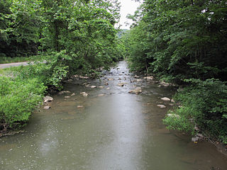
The East River is a tributary of the New River, 24 miles (39 km) long, in southern West Virginia and southwestern Virginia in the United States. Via the New, Kanawha and Ohio rivers, it is part of the watershed of the Mississippi River, draining an area of 76.4 square miles (198 km2) in the Ridge-and-Valley Appalachians.

Reedy Creek is a tributary of the Little Kanawha River in western West Virginia in the United States. Via the Little Kanawha and Ohio rivers, it is part of the watershed of the Mississippi River, draining an area of 133 square miles (340 km2) in a rural region on the unglaciated portion of the Allegheny Plateau. It is 22.6 miles (36.4 km) long, or 38.5 miles (62.0 km) long including its Left Fork.

Walker Creek is a tributary of the Little Kanawha River, 15.6 miles (25.1 km) long, in western West Virginia in the United States. Via the Little Kanawha and Ohio rivers, it is part of the watershed of the Mississippi River, draining an area of 32 square miles (83 km2) on the unglaciated portion of the Allegheny Plateau.
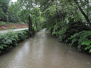
Cabin Creek is a tributary of the Kanawha River, 22.7 miles (36.5 km) long, in West Virginia in the United States. Via the Kanawha and Ohio rivers, it is part of the watershed of the Mississippi River, draining an area of 72.6 square miles (188 km2) in a coal mining region on the unglaciated portion of the Allegheny Plateau.

Armstrong Creek is a tributary of the Kanawha River, 8.6 miles (13.8 km) long, in southern West Virginia in the United States. Via the Kanawha and Ohio rivers, it is part of the watershed of the Mississippi River, draining an area of 22.8 square miles (59 km2) on the unglaciated portion of the Allegheny Plateau. The creek flows for its entire length in western Fayette County; its tributaries additionally drain a small portion of eastern Kanawha County.
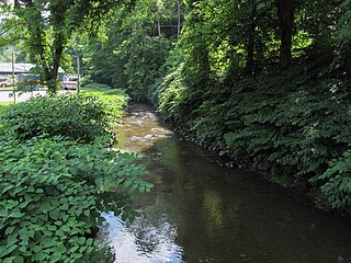
Smithers Creek is a tributary of the Kanawha River, 7 miles (11 km) long, in southern West Virginia in the United States. Via the Kanawha and Ohio rivers, it is part of the watershed of the Mississippi River, draining an area of 18.1 square miles (47 km2) on the unglaciated portion of the Allegheny Plateau. The creek flows for its entire length in western Fayette County; its tributaries additionally drain a portion of eastern Kanawha County.

Kellys Creek is a tributary of the Kanawha River, 6.5 miles (10.5 km) long, in West Virginia in the United States. Via the Kanawha and Ohio rivers, it is part of the watershed of the Mississippi River, draining an area of 24.7 square miles (64 km2) in a coal mining region on the unglaciated portion of the Allegheny Plateau.

Witcher Creek is a tributary of the Kanawha River, 6.8 miles (10.9 km) long, in West Virginia in the United States. Via the Kanawha and Ohio rivers, it is part of the watershed of the Mississippi River, draining an area of 20.8 square miles (54 km2) on the unglaciated portion of the Allegheny Plateau.
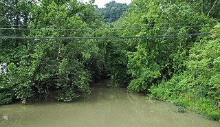
Lens Creek is a tributary of the Kanawha River, 6.4 miles (10.3 km) long, in West Virginia in the United States. Via the Kanawha and Ohio rivers, it is part of the watershed of the Mississippi River, draining an area of 19.9 square miles (52 km2) on the unglaciated portion of the Allegheny Plateau, in the Charleston metropolitan area.
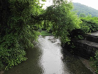
Campbells Creek is a tributary of the Kanawha River, 18.5 miles (29.8 km) long, in West Virginia in the United States. Via the Kanawha and Ohio rivers, it is part of the watershed of the Mississippi River, draining an area of 39.3 square miles (102 km2) on the unglaciated portion of the Allegheny Plateau, in the Charleston metropolitan area.

Twomile Creek is a tributary of the Kanawha River, 4.7 miles (7.6 km) long, in West Virginia in the United States. Via the Kanawha and Ohio rivers, it is part of the watershed of the Mississippi River, draining an area of 24.4 square miles (63 km2) on the unglaciated portion of the Allegheny Plateau, in the city of Charleston and its vicinity.
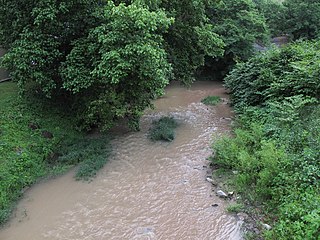
Davis Creek is a tributary of the Kanawha River, 9.4 miles (15.1 km) long, in West Virginia in the United States. Via the Kanawha and Ohio rivers, it is part of the watershed of the Mississippi River, draining an area of 47.1 square miles (122 km2) on the unglaciated portion of the Allegheny Plateau, in the Charleston metropolitan area.

Buckeye Creek is a tributary of Middle Island Creek, 12.7 miles (20.4 km) long, in north-central West Virginia in the United States. Via Middle Island Creek and the Ohio River, it is part of the watershed of the Mississippi River, draining an area of 39.1 square miles (101 km2) in a rural region on the unglaciated portion of the Allegheny Plateau.

The Meathouse Fork is a tributary of Middle Island Creek, 19.7 miles (31.7 km) long, in north-central West Virginia in the United States. Via Middle Island Creek and the Ohio River, it is part of the watershed of the Mississippi River, draining an area of 64.6 square miles (167 km2) in a rural region on the unglaciated portion of the Allegheny Plateau.

Arnold Creek is a tributary of Middle Island Creek, 10.9 miles (17.5 km) long, in West Virginia in the United States. Via Middle Island Creek and the Ohio River, it is part of the watershed of the Mississippi River, draining an area of 34.7 square miles (90 km2) in a rural region on the unglaciated portion of the Allegheny Plateau.
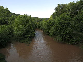
McElroy Creek is a tributary of Middle Island Creek, 22.1 miles (35.6 km) long, in northern West Virginia in the United States. Via Middle Island Creek and the Ohio River, it is part of the watershed of the Mississippi River, draining an area of 106.2 square miles (275 km2) in a rural region on the unglaciated portion of the Allegheny Plateau.

Flint Run is a tributary of McElroy Creek, 7.5 miles (12.1 km) long, in northern West Virginia in the United States. Via McElroy Creek, Middle Island Creek, and the Ohio River, it is part of the watershed of the Mississippi River, draining an area of 25.6 square miles (66 km2) in a rural region on the unglaciated portion of the Allegheny Plateau.

Indian Creek is a tributary of Middle Island Creek, 14.8 miles (23.8 km) long, in northern West Virginia in the United States. Via Middle Island Creek and the Ohio River, it is part of the watershed of the Mississippi River, draining an area of 32.3 square miles (84 km2) in a rural region on the unglaciated portion of the Allegheny Plateau.
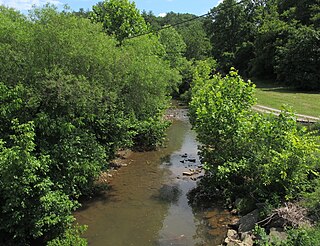
The Elk Fork is a tributary of Point Pleasant Creek, 14.8 miles (23.8 km) long, in northwestern West Virginia in the United States. Via Point Pleasant Creek, Middle Island Creek, and the Ohio River, it is part of the watershed of the Mississippi River, draining an area of 21.1 square miles (55 km2) in a rural region on the unglaciated portion of the Allegheny Plateau.

McKim Creek is a tributary of Middle Island Creek, 20.4 miles (32.8 km) long, in northwestern West Virginia in the United States. Via Middle Island Creek and the Ohio River, it is part of the watershed of the Mississippi River, draining an area of 37.3 square miles (97 km2) in a rural region on the unglaciated portion of the Allegheny Plateau.


