Deep Water, West Virginia

Last updated
Deep Water, West Virginia
Virginian Railway.jpg
Virginian Railway bridge in Deepwater
USA West Virginia location map.svg
Red pog.svg
Deep Water
Location within the state of West Virginia
Usa edcp location map.svg
Red pog.svg
Deep Water
Deep Water (the United States)
Coordinates: 38°7′36″N81°15′49″W / 38.12667°N 81.26361°W / 38.12667; -81.26361 Coordinates: 38°7′36″N81°15′49″W / 38.12667°N 81.26361°W / 38.12667; -81.26361
Country United States
State West Virginia
County Fayette
Area
[1]
  Total0.993 sq mi (2.57 km2)
  Land0.882 sq mi (2.28 km2)
  Water0.111 sq mi (0.29 km2)
Population
 (2010) [2]
  Total280
  Density280/sq mi (110/km2)
Time zone UTC-5 (Eastern (EST))
  Summer (DST) UTC-4 (EDT)
ZIP codes
25057
GNIS feature ID1554279 [3]

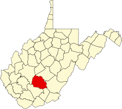
Deep Water, also known historically as Deepwater, [3] is a census-designated place on the Kanawha River in Fayette County, West Virginia, United States. As of the 2010 census, its population was 280. [2] It is best known as the starting point of the Deepwater Railway founded in 1898 by William N. Page, which was merged to create the Virginian Railway in 1907.

Located near the head of navigation of the Kanawha River just a short distance downstream from Kanawha Falls, it may have been named for that reason. [4] However, according to local legend, as recounted by H. Reid in The Virginian Railway (Kalmbach, 1961), it was named by Squire James Galsepy Kincaid and other locals on a rainy day in 1871 as a commentary on the standing groundwater outside the new post office along Loup Creek.

Related Research Articles

<span class="mw-page-title-main">Brookneal, Virginia</span> Town in Virginia, United States

Brookneal is an incorporated town in Campbell County, Virginia, United States. The population was 1,112 as of the 2010 census. It is part of the Lynchburg Metropolitan Statistical Area.

<span class="mw-page-title-main">East Bank, West Virginia</span> Town in West Virginia, United States

East Bank is a town in Kanawha County, West Virginia, United States, situated along the Kanawha River. The population was 820 at the 2020 census. East Bank was incorporated in 1889 by special charter enacted by the West Virginia Legislature. It is so named on account of the town's location on the east side of the Kanawha River.

<span class="mw-page-title-main">Alum Creek, West Virginia</span> Census-designated place in West Virginia, United States

Alum Creek is a census-designated place (CDP) in Kanawha and Lincoln counties along the Coal River in the U.S. state of West Virginia. It includes the unincorporated communities of Alum Creek, Forks of Coal, and Priestley. The CDP had a population of 1,749 at the 2010 census, down from 1,839 at the 2000 census.

<span class="mw-page-title-main">Leon, West Virginia</span> Town in West Virginia, United States

Leon is a town in Mason County, West Virginia, United States, situated along the Kanawha River. The population was 137 at the 2020 census. It is part of the Point Pleasant, WV–OH Micropolitan Statistical Area.

<span class="mw-page-title-main">Princeton, West Virginia</span> City in West Virginia, United States

Princeton, is a city in and the county seat of Mercer County, West Virginia, United States. The city is coined the "Heart of Mercer County" or the "Jewel of the South" in past decades. The population was 6,432 at the 2010 census with approximately 35,000 residents living in the greater Princeton area. It is part of the Bluefield, WV-VA micropolitan area which has a population of 107,342. The city hosts the Princeton WhistlePigs baseball club of the Appalachian League. A main tourist destination of the city is the Mercer Street Grassroots District located in Downtown Princeton. This area has been revitalized and is now home to cafes, restaurants, shops, and artistic venues.

<span class="mw-page-title-main">Montgomery, West Virginia</span> City in West Virginia

Montgomery is a city in West Virginia, along the Kanawha River. Most of the city is in Fayette County, with the remainder in Kanawha County. The population was 1,280 at the 2020 census.

<span class="mw-page-title-main">Tornado, West Virginia</span> Census-designated place in West Virginia, United States

Tornado, also called Upper Falls, is a census-designated place (CDP) in Kanawha County, West Virginia, United States.

<span class="mw-page-title-main">Kanawha River</span> Tributary of the Ohio River in West Virginia, United States

The Kanawha River is a tributary of the Ohio River, approximately 97 mi (156 km) long, in the U.S. state of West Virginia. The largest inland waterway in West Virginia, its watershed has been a significant industrial region of the state since early in the 19th century.

Page is a census-designated place (CDP) and coal town in Fayette County, West Virginia, United States. As of the 2010 census, its population was 224. It was named for William Nelson Page (1854-1932), a civil engineer and industrialist who lived in nearby Ansted, where he managed Gauley Mountain Coal Company and many iron, coal, and railroad enterprises.

<span class="mw-page-title-main">Glen Ferris, West Virginia</span> Census-designated place in West Virginia, United States

Glen Ferris is a census-designated place (CDP) on the western bank of the Kanawha River in Fayette County, West Virginia, United States. It is situated approximately one mile south of the town of Gauley Bridge and adjacent to Kanawha Falls. The sole highway linking Glen Ferris to the area is U.S. Route 60, known also as the Midland Trail. As of the 2010 census, its population was 203; the community had 104 housing units, 87 of which were occupied. The village is roughly a mile and a half in length. Glen Ferris is home to two churches, one Apostolic and one Methodist. A railway owned by Norfolk Southern runs parallel to US Route 60 through the village.

<span class="mw-page-title-main">Eagle Rock, Virginia</span> CDP in Virginia, United States

Eagle Rock is a census-designated place (CDP) in Botetourt County, Virginia, United States, located along the James River between Iron Gate and Buchanan. It was first listed as a CDP in the 2020 census with a population of 209.

<span class="mw-page-title-main">Chelyan, West Virginia</span> Census-designated place in West Virginia, United States

Chelyan is a census-designated place (CDP) in Kanawha County, West Virginia, United States. Chelyan is located on the south bank of the Kanawha River, southeast of Chesapeake. It is served by Exit 85 of the West Virginia Turnpike. As of the 2010 census, its population was 776.

<span class="mw-page-title-main">Shrewsbury, West Virginia</span> Census-designated place in West Virginia, United States

Shrewsbury is a census-designated place (CDP) and unincorporated community in Kanawha County, West Virginia, United States. Shrewsbury is located on the north bank of the Kanawha River along U.S. Route 60. As of the 2010 census, its population was 652.

<span class="mw-page-title-main">Mount Carbon, West Virginia</span> Census-designated place in West Virginia, United States

Mount Carbon is a census-designated place (CDP) in Fayette County, West Virginia, United States. Mount Carbon is located along West Virginia Route 61, 3 miles (4.8 km) southeast of Montgomery, on the south bank of the Kanawha River at the mouth of Armstrong Creek. Mount Carbon has a post office with ZIP code 25139. As of the 2010 census, its population was 428.

<span class="mw-page-title-main">Boomer, West Virginia</span> Census-designated place in West Virginia, United States

Boomer is a census-designated place (CDP) in Fayette County, West Virginia, United States. Boomer is located on the north bank of the Kanawha River, 2 miles (3.2 km) southeast of Smithers. Boomer has a post office with ZIP code 25031. As of the 2010 census, its population was 615.

Charlton Heights is a census-designated place (CDP) in Fayette County, West Virginia, United States. Charlton Heights is located on the north bank of the Kanawha River, 4 miles (6.4 km) southwest of Gauley Bridge. Charlton Heights has a post office with ZIP code 25040. As of the 2010 census, its population was 406.

Falls View is a census-designated place (CDP) in Fayette County, West Virginia, United States. Falls View is located 4 miles (6.4 km) southwest of Gauley Bridge, on the north bank of the Kanawha River. As of the 2010 census, its population was 238. Falls View was established in the early 20th century as a residential village for managers from the Electro Metallurgical Co., part of the Union Carbide and Carbon Corporation. Electro Metallurgical operated four ferroalloy plants in the area, powered by hydroelectricity generated at the dam on Kanawha Falls.

River Bend is an unincorporated area in Kanawha County, West Virginia, United States.

<span class="mw-page-title-main">Loop Creek (West Virginia)</span> River in West Virginia, United States

Loop Creek, also known by the spelling Loup Creek, is a tributary of the Kanawha River, 20 miles (32 km) long, in southern West Virginia in the United States. Via the Kanawha and Ohio rivers, it is part of the watershed of the Mississippi River, draining an area of 49.6 square miles (128 km2) in a coal mining region on the unglaciated portion of the Allegheny Plateau.

Kanauga is an unincorporated community and census-designated place (CDP) in Gallia County, Ohio, United States. As of the 2010 census it had a population of 175.

References

  1. "US Gazetteer files: 2010, 2000, and 1990". United States Census Bureau. 2011-02-12. Retrieved 2011-04-23.
  2. 1 2 "U.S. Census website". United States Census Bureau . Retrieved 2011-05-14.
  3. 1 2 Geographic Names Information System. "Geographic Names Information System entry for Deep Water (Feature ID #1554279)" . Retrieved 2007-03-09.
  4. Kenny, Hamill (1945). West Virginia Place Names: Their Origin and Meaning, Including the Nomenclature of the Streams and Mountains. Piedmont, WV: The Place Name Press. p. 204.