Beards Fork, West Virginia

Last updated

Beards Fork, West Virginia
USA West Virginia location map.svg
Red pog.svg
Beards Fork
Location of Beards Fork in West Virginia
Usa edcp location map.svg
Red pog.svg
Beards Fork
Beards Fork (the United States)
Coordinates: 38°03′49″N81°13′38″W / 38.06361°N 81.22722°W / 38.06361; -81.22722
Country United States
State West Virginia
County Fayette
Area
[1]
  Total1.684 sq mi (4.36 km2)
  Land1.682 sq mi (4.36 km2)
  Water0.002 sq mi (0.005 km2)
Elevation
[2]
1,253 ft (382 m)
Population
 (2010) [3]
  Total199
  Density120/sq mi (46/km2)
Time zone UTC-5 (Eastern (EST))
  Summer (DST) UTC-4 (EDT)
ZIP code
25014
Area code 304
FIPS code 54-54109
GNIS feature ID1553820 [2]
[4]

Beards Fork is a census-designated place (CDP) and coal town in Fayette County, West Virginia, United States that was founded as a coal town. As of the 2010 census, its population was 199. [3]

Contents

Geography

Beards Fork is located at 38°03′49″N81°13′38″W / 38.063720°N 81.227329°W / 38.063720; -81.227329 (38.063720, -81.227329). [2] Its elevation is 1,253 feet (382 m).

Beards Fork is situated between two mountain ridges in central Fayette County, and is closest to the unincorporated town of Robson. The Post Office in Robson handles the mail for Beards Fork.

History

The community takes its name from nearby Beards Fork creek. [5]

Transportation

Beards Fork is served by WV 61 via Beards Fork Road, a paved one-lane road maintained by the state; a creek runs parallel to the road throughout most of the inhabited portion of the valley (known locally as the 'hollow' or 'holler').

Economy

The only entity of any kind to have offices in Beards Fork is the Southern Appalachian Labor School's Community Center, a non-profit organization that primarily provides housing services and children's programs to area residents. [6] [7]

Demographics

2020 census

Beards Fork CDP, West Virginia – Racial and Ethnic Composition
(NH = Non-Hispanic)
Note: the US Census treats Hispanic/Latino as an ethnic category. This table excludes Latinos from the racial categories and assigns them to a separate category. Hispanics/Latinos may be of any race.
Race / EthnicityPop 2010 [8] Pop 2020 [9] % 2010% 2020
White alone (NH)1167858.29%61.42%
Black or African American alone (NH)804140.20%32.28%
Native American or Alaska Native alone (NH)000.00%0.00%
Asian alone (NH)000.00%0.00%
Pacific Islander alone (NH)000.00%0.00%
Some Other Race alone (NH)000.00%0.00%
Mixed Race/Multi-Racial (NH)261.01%4.72%
Hispanic or Latino (any race)120.50%1.57%
Total199127100.00%100.00%

Related Research Articles

<span class="mw-page-title-main">Keystone, West Virginia</span> City in West Virginia, United States

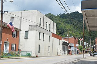
Keystone is a city in McDowell County, West Virginia, United States. Per the 2020 census, the population was 176. Keystone is one of the few municipalities in West Virginia with an African-American majority, with 65 percent of the residents being black.

<span class="mw-page-title-main">Tazewell County, Virginia</span> County in Virginia, United States

Tazewell County is a county located in the southwestern portion of the U.S. state of Virginia. As of the 2020 census, the population was 40,429. Its county seat is Tazewell.

<span class="mw-page-title-main">Charles City, Virginia</span> Census-designated place in Virginia, United States

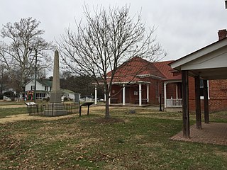
Charles City is a census-designated place (CDP) in Charles City County, Virginia, United States. It is the county seat of Charles City County. The population as of the 2020 census was 104.

<span class="mw-page-title-main">Tasley, Virginia</span> Census-designated place in Virginia, United States

Tasley is a census-designated place (CDP) in Accomack County, Virginia, United States. It was first listed as a CDP in 2010. Per the 2020 census, the population was 222.

<span class="mw-page-title-main">Temperanceville, Virginia</span> Census-designated place in Virginia, United States

Temperanceville is a census-designated place (CDP) in Accomack County, Virginia, United States. It was first listed as a CDP in 2010. As of the 2020 census, it had a population of 308.

<span class="mw-page-title-main">Deep Creek, Accomack County, Virginia</span> Census-designated place in Virginia, United States

Deep Creek is a census-designated place (CDP) in Accomack County, Virginia, United States. Per the 2020 census, the population was 94.

<span class="mw-page-title-main">Gargatha, Virginia</span> Census-designated place in Virginia, United States

Gargatha is a census-designated place (CDP) in Accomack County, Virginia, United States. Per the 2020 census, the population was 415.

<span class="mw-page-title-main">Mappsburg, Virginia</span> Census-designated place in Virginia, United States

Mappsburg is a census-designated place (CDP) in Accomack County, Virginia, United States. Per the 2020 census, the population was 51.

<span class="mw-page-title-main">Nelsonia, Virginia</span> Census-designated place in Virginia, United States

Nelsonia is a census-designated place (CDP) in Accomack County, Virginia, United States. Per the 2020 census, the population was 451.

<span class="mw-page-title-main">Quinby, Virginia</span> Census-designated place in Virginia, United States

Quinby is a census-designated place (CDP) in Accomack County, Virginia, United States. It was first listed as a CDP in 2010. Per the 2020 census, the population was 285.

<span class="mw-page-title-main">Bayside, Accomack County, Virginia</span> Census-designated place in Accomack County, Virginia, United States

Bayside is a census-designated place (CDP) in Accomack County, Virginia, United States. It was first listed as a CDP in 2010. Per the 2020 census, the population was 107.

<span class="mw-page-title-main">Boston, Accomack County, Virginia</span> Census-designated place in Virginia, United States

Boston is a census-designated place (CDP) in Accomack County, Virginia, United States. Per the 2020 census, the population was 454.

<span class="mw-page-title-main">Cats Bridge, Virginia</span> Census-designated place in Virginia, United States

Cats Bridge is a census-designated place (CDP) in Accomack County, Virginia, United States. Per the 2020 census, the population was 184.

<span class="mw-page-title-main">Metompkin, Virginia</span> Census-designated place in Virginia, United States

Metompkin is a census-designated place (CDP) in Accomack County, Virginia, United States. Per the 2020 census, the population was 490.

Locust Mount is an unincorporated community and census-designated place (CDP) in Accomack County, Virginia, United States. It was first listed as a CDP in the 2020 census with a population of 52. The CDP is in southeastern Accomack County, on the north side of Virginia State Route 180, which leads east 1.1 kilometres (0.7 mi) to Wachapreague and west 3.5 miles (5.6 km) to U.S. Route 13 at Keller.

<span class="mw-page-title-main">Savage Town, Virginia</span> Census-designated place in Virginia, United States

Savage Town is a census-designated place (CDP) in Accomack County, Virginia, United States. It was first listed as a CDP in 2010. Per the 2020 census, the population was 72.

<span class="mw-page-title-main">Whitesville, Virginia</span> Census-designated place in Virginia, United States

Whitesville is a census-designated place (CDP) in Accomack County, Virginia, United States. It was first listed as a CDP in 2010. As of the 2020 census, it had a population of 241.

<span class="mw-page-title-main">Boomer, West Virginia</span> Census-designated place in West Virginia, United States

Boomer is a census-designated place (CDP) in Fayette County, West Virginia, United States. Boomer is located on the north bank of the Kanawha River, 2 miles (3.2 km) southeast of Smithers. Boomer has a post office with ZIP code 25031. As of the 2010 census, its population was 615.

<span class="mw-page-title-main">Captains Cove, Virginia</span> Census-designated place in Virginia, United States

Captains Cove is a census-designated place in Accomack County, Virginia. Per the 2020 census, the population was 1,544. Known as Captain's Cove Golf & Yacht Club, it is a recreational community located on the west shore of Chincoteague Bay, bordering Maryland to the north. While numerous families with children live here, it's largely a retirement community, with a median age of 51 and the largest age group being 60–64.

<span class="mw-page-title-main">Makemie Park, Virginia</span> Census-designated place in Virginia, United States

Makemie Park is a census-designated place in Accomack County, Virginia. Per the 2020 census, the population was 138.

References

  1. "US Gazetteer files: 2010, 2000, and 1990". United States Census Bureau. February 12, 2011. Retrieved April 23, 2011.
  2. 1 2 3 U.S. Geological Survey Geographic Names Information System: Beards Fork, West Virginia. Retrieved on 2008-08-10.
  3. 1 2 "U.S. Census website". United States Census Bureau . Retrieved May 14, 2011.
  4. Beards Fork WV Archived June 15, 2011, at the Wayback Machine . Zip Code Lookup. Retrieved on 2008-08-10.
  5. Kenny, Hamill (1945). West Virginia Place Names: Their Origin and Meaning, Including the Nomenclature of the Streams and Mountains. Piedmont, WV: The Place Name Press. p. 99.
  6. Keenan, Steve (July 4, 2023). "Visiting groups aid SWV housing effort". Beckley Register-Herald. Retrieved August 11, 2023.
  7. Keenan, Steve (July 7, 2022). "Volunteers again assisting with local home repairs". Fayette Tribune. Retrieved August 11, 2023.
  8. "P2 HISPANIC OR LATINO, AND NOT HISPANIC OR LATINO BY RACE – 2010: DEC Redistricting Data (PL 94-171) – Beards Fork CDP, West Virginia". United States Census Bureau .
  9. "P2 HISPANIC OR LATINO, AND NOT HISPANIC OR LATINO BY RACE - 2020: DEC Redistricting Data (PL 94-171) - Beards Fork CDP, West Virginia". United States Census Bureau .