Concho, West Virginia

Last updated

Concho, West Virginia
USA West Virginia location map.svg
Red pog.svg
Concho
Usa edcp location map.svg
Red pog.svg
Concho
Coordinates: 37°58′1″N81°5′16″W / 37.96694°N 81.08778°W / 37.96694; -81.08778
Country United States
State West Virginia
County Fayette
Elevation
1,686 ft (514 m)
Time zone UTC-5 (Eastern (EST))
  Summer (DST) UTC-4 (EDT)
GNIS ID 1554181 [1]

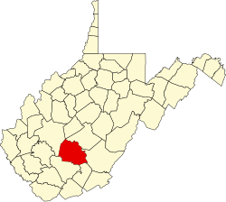
Concho is an unincorporated community and coal town in Fayette County, West Virginia, United States. It used to be known as Thurmond Mountain. The name Concho is derived from the Concho River, in Texas. [2]

See also

Related Research Articles

<span class="mw-page-title-main">Tom Green County, Texas</span> County in Texas, United States

Tom Green County is a county located on the Edwards Plateau in the U.S. state of Texas. As of the 2020 census, its population was 120,003. Its county seat is San Angelo. The county was created in 1874 and organized the following year. It is named for Thomas Green, who was a Confederate soldier and lawyer. Tom Green County is included in the San Angelo metropolitan statistical area; the county is home to Goodfellow Air Force Base, as well as Angelo State University, part of the Texas Tech University System.

<span class="mw-page-title-main">Concho County, Texas</span> County in Texas, United States

Concho County is a county located on the Edwards Plateau in the U.S. state of Texas. At the 2020 census, the population was 3,303. Its county seat is Paint Rock. The county was founded in 1858 and later organized in 1879. It is named for the Concho River.

<span class="mw-page-title-main">San Angelo, Texas</span> City in Texas, United States

San Angelo is a city in and the county seat of Tom Green County, Texas, United States. Its location is in the Concho Valley, a region of West Texas between the Permian Basin to the northwest, Chihuahuan Desert to the southwest, Osage Plains to the northeast, and Central Texas to the southeast. According to the 2020 United States Census, San Angelo had a total population of 99,893. It is the principal city and center of the San Angelo metropolitan area, which had a population of 121,516.

<span class="mw-page-title-main">West Texas</span> Region in Texas, United States

West Texas is a loosely defined region in the U.S. state of Texas, generally encompassing the arid and semiarid lands west of a line drawn between the cities of Wichita Falls, Abilene, and Del Rio.

<span class="mw-page-title-main">Fort Concho</span> US Army fort in Texas, used 1867–1889

Fort Concho is a former United States Army installation and National Historic Landmark District located in San Angelo, Texas. It was established in November 1867 at the confluence of the North and South Concho Rivers, on the routes of the Butterfield Overland Mail Route and Goodnight–Loving Trail, and was an active military base for the next 22 years. Fort Concho was the principal base of the 4th Cavalry from 1867 to 1875 and then the "Buffalo Soldiers" of the 10th Cavalry from 1875 to 1882. The troops stationed at Fort Concho participated in Ranald S. Mackenzie's 1872 campaign, the Red River War in 1874, and the Victorio Campaign of 1879–1880.

<span class="mw-page-title-main">Camargo, Chihuahua</span> City in the Mexican state of Chihuahua

Santa Rosalía de Camargo, originally called Santa Rosalía, and now known as "Ciudad Camargo", is a city in the eastern part of the Mexican state of Chihuahua, located at the confluence of the Rio Parral and the Rio Conchos in the Allende Valley. It serves as the municipal seat of Camargo municipality and also serves as an important agricultural and livestock center for the area. Ciudad Camargo was originally founded in 1740 and refounded in 1792.

<span class="mw-page-title-main">Fort Davis National Historic Site</span> National Historic Site of the United States

Fort Davis National Historic Site is a United States National Historic Site located in the unincorporated community of Fort Davis, Jeff Davis County, Texas. Located within the Davis Mountains of West Texas, the historic site was established in 1961 to protect one of the best remaining examples of a United States Army fort in the southwestern United States.

<span class="mw-page-title-main">Three Churches, West Virginia</span> Unincorporated community in West Virginia, United States

Three Churches is an unincorporated community in Hampshire County in the U.S. state of West Virginia. The town is located north of Romney along Jersey Mountain Road at a crossroads with Three Churches Hollow Road. Originally known as Jersey Mountain, Three Churches was renamed for the three historic white wooden churches located there: Mount Bethel Church, Mount Bethel Primitive Baptist Church, and Branch Mountain United Methodist Church. The Three Churches Post Office is no longer in service.

<span class="mw-page-title-main">Delicias, Chihuahua</span> City in the Mexican state of Chihuahua

Delicias is a city in the Mexican state of Chihuahua and serves as the seat of the municipality of the same name. The current president of this town is Mr. Leonardo Jiménez, who has also been a participant in the creation of first-level cities. It is located southeast of the state capital, Chihuahua. Delicias was declared an official municipality of the state of Chihuahua on January 7, 1935. Delicias is a small industrial city and a major agricultural center located in the Conchos River Valley. As of 2015, the city of Delicias had a population of 148,045 inhabitants, while the metropolitan area had a population of 223,993 inhabitants. It was founded on 30 April 1933, making it one of Mexico's youngest cities. The municipality of Delicias is one of the smallest in the state in terms of size area.

Concho may refer to:

<span class="mw-page-title-main">Concho River</span> River in Texas, United States

The Concho River is a river in the U.S. state of Texas. Concho is Spanish for "shell"; the river was so named due to its abundance of freshwater mussels, such as the Tampico pearly mussel.

Antonio de Espejo (1540–1585) was a Spanish explorer who led an expedition, accompanied by Diego Perez de Luxan, into New Mexico and Arizona in 1582–83. The expedition created interest in establishing a Spanish colony among the Pueblo Indians of the Rio Grande valley.

Droop Mountain is a small mountain in the Allegheny Mountains on the border of Greenbrier and Pocahontas counties in southeastern West Virginia. It was the scene of one of West Virginia's most important battles during the American Civil War—the Battle of Droop Mountain.

<span class="mw-page-title-main">Concho, Arizona</span> CDP in Apache County, Arizona

Concho is an unincorporated community and census-designated place (CDP) in Apache County, Arizona, United States. Concho is located on Arizona State Route 61, 14 miles (23 km) west of St. Johns. Concho was the original site for the state capital, due to its prosperous farming. As of the 2010 census, the Concho CDP had a population of 38.

Dillon is an unincorporated community in Raleigh County, West Virginia, United States. It was also known as Irish Mountain and is the location of St. Colman's Roman Catholic Church and Cemetery, which is on the National Register of Historic Places.

<span class="mw-page-title-main">Darlington Agency</span> United States historic place

The Darlington Agency was an Indian agency on the Cheyenne and Arapaho Indian Reservation prior to statehood in present-day Canadian County, Oklahoma. The agency was established in 1870. The agency established at Fort Supply the previous year was moved to a more accessible location for the tribes. Brinton Darlington, a Quaker for whom the agency was named, was the first United States Indian agent at the agency, a position he held until his death in 1872.

<span class="mw-page-title-main">Concho Valley</span> Region in Texas, United States

The Concho Valley is a region in West Texas. The region takes its name from the Concho River, named due to its abundance of freshwater mussels in the river.

Burner Mountain is a summit in West Virginia, in the United States. With an elevation of 4,295 feet (1,309 m), it is the 56th highest summit in the state of West Virginia.

References

  1. U.S. Geological Survey Geographic Names Information System: Concho, West Virginia
  2. Kenny, Hamill (1945). West Virginia Place Names: Their Origin and Meaning, Including the Nomenclature of the Streams and Mountains. Piedmont, WV: The Place Name Press. p. 182.