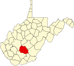
Fire Creek, West Virginia

Last updated

Fire Creek, West Virginia
USA West Virginia location map.svg
Red pog.svg
Fire Creek
Usa edcp location map.svg
Red pog.svg
Fire Creek
Coordinates: 37°57′30″N81°1′44″W / 37.95833°N 81.02889°W / 37.95833; -81.02889
Country United States
State West Virginia
County Fayette
Elevation
1,033 ft (315 m)
Time zone UTC-5 (Eastern (EST))
  Summer (DST) UTC-4 (EDT)
GNIS ID 1556100 [1]

Fire Creek is a ghost town in Fayette County, West Virginia, United States. [1] It was located on the New River Gorge.

Notable people

Related Research Articles

<span class="mw-page-title-main">Cripple Creek, Colorado</span> City in Colorado, United States

Cripple Creek is a statutory city that is the county seat of Teller County, Colorado, United States. The city population was 1,155 at the 2020 United States Census. Cripple Creek is a former gold mining camp located 20 miles (32 km) southwest of Colorado Springs near the base of Pikes Peak. The Cripple Creek Historic District, which received National Historic Landmark status in 1961, includes part or all of the city and the surrounding area. The city is now a part of the Colorado Springs, CO Metropolitan Statistical Area and the Front Range Urban Corridor.

<span class="mw-page-title-main">Limekiln State Park</span> State historic park in California, United States

Limekiln State Park is a California state park on the Big Sur coast. It contains four lime kilns from an 1887–1890 lime-calcining operation, plus a beach, redwood forest, and 100-foot (30 m) Limekiln Falls. It is located 2 miles (3.2 km) south of Lucia on Big Sur Coast Highway. The 711-acre (288 ha) park was established in 1994.

<span class="mw-page-title-main">Big Basin Redwoods State Park</span> State park in Santa Cruz County, California, United States

Big Basin Redwoods State Park is a state park in the U.S. state of California, located in Santa Cruz County, about 36 km (22 mi) northwest of Santa Cruz. The park contains almost all of the Waddell Creek watershed, which was formed by the seismic uplift of its rim, and the erosion of its center by the many streams in its bowl-shaped depression.

<span class="mw-page-title-main">Sequoia National Forest</span> National forest in the U.S. state of California

Sequoia National Forest is located in the southern Sierra Nevada mountains of California. The U.S. National Forest is named for the majestic Giant Sequoia trees which populate 38 distinct groves within the boundaries of the forest.

<span class="mw-page-title-main">The Forest of Nisene Marks State Park</span> State park in Santa Cruz County, California, United States

The Forest of Nisene Marks State Park is a state park of California, United States, protecting a secondary forest in the watershed of Aptos Creek and Soquel Creek within the Santa Cruz Mountains. It is located outside Aptos, California, and contains over 40 miles (64 km) of hiking trails and fire roads through 10,223 acres (4,137 ha) of variable terrain.

<span class="mw-page-title-main">Green Corn Ceremony</span> Native American custom

The Green Corn Ceremony (Busk) is an annual ceremony practiced among various Native American peoples associated with the beginning of the yearly corn harvest. Busk is a term given to the ceremony by white traders, the word being a corruption of the Creek word puskita (pusketv) for "a fast". These ceremonies have been documented ethnographically throughout the North American Eastern Woodlands and Southeastern tribes. Historically, it involved a first fruits rite in which the community would sacrifice the first of the green corn to ensure the rest of the crop would be successful. These Green Corn festivals were practiced widely throughout southern North America by many tribes evidenced in the Mississippian people and throughout the Mississippian Ideological Interaction Sphere. Green Corn festivals are still held today by many different Southeastern Woodland tribes. The Green Corn Ceremony typically occurs in late June or July, determined locally by the developing of the corn crops. The ceremony is marked with dancing, feasting, fasting and religious observations.

<span class="mw-page-title-main">French Creek State Park</span> State park in Pennsylvania, United States

French Creek State Park is a 7,977-acre (3,228 ha) Pennsylvania state park in North Coventry and Warwick Townships in Chester County and Robeson and Union Townships in Berks County, Pennsylvania. It straddles northern Chester County and southern Berks County along French Creek. It is located in the Hopewell Big Woods. The park is the home of two lakes: Hopewell Lake, a 68-acre (28 ha) warm water lake, and Scotts Run Lake, a 22-acre (8.9 ha) cold water lake. The state record smallmouth bass was caught in Scotts Run Lake. There are extensive forests, and almost 40 miles (64 km) of hiking and equestrian trails. The park is also friendly to mountain bikers, having some renowned technical trails. Hopewell Furnace National Historic Site, which features a cold blast furnace restored to its 1830s appearance, is surrounded by the park. The Six Penny Day Use Area and Group Camp are listed on the National Register of Historic Places. French Creek State Park is located off of Pennsylvania Route 345 to the south of Birdsboro.

<span class="mw-page-title-main">Oak Creek Canyon</span> River gorge located in northern Arizona between the cities of Flagstaff and Sedona

Oak Creek Canyon is a river gorge located in northern Arizona between the cities of Flagstaff and Sedona. The canyon is often described as a smaller cousin of the Grand Canyon because of its scenic beauty. State Route 89A enters the canyon on its north end via a series of hairpin turns before traversing the bottom of the canyon for about 13 miles (21 km) until the highway enters the town of Sedona.

<span class="mw-page-title-main">Oil Creek State Park</span> Former oilfield in Pennsylvania

Oil Creek State Park is a Pennsylvania state park on 6,250 acres (2,529 ha) in Cherrytree, Cornplanter and Oil Creek Townships, Venango County, Pennsylvania in the United States. The park is adjacent to Drake Well Museum, the site of the first successful commercial oil well in the United States, that was drilled under the direction of Colonel Edwin Drake. Oil Creek State Park follows Oil Creek, between Titusville and Oil City, and is on Pennsylvania Route 8. While the creek is the park's main recreational attraction, it also contains the sites of the first oil boomtown and much of Pennsylvania's original oil industry. The park contains a museum, tableaux, and trails to help visitors understand the history of the oil industry there, and an excursion train.

<span class="mw-page-title-main">Opal Creek Wilderness</span> Wilderness area in the Willamette National Forest

The Opal Creek Wilderness is a wilderness area located in the Willamette National Forest in the U.S. state of Oregon, on the border of the Mount Hood National Forest. It has the largest uncut watershed in Oregon.

<span class="mw-page-title-main">Lytle Creek, California</span> Community in San Bernardino County, California

Lytle Creek is a census-designated place in the San Gabriel Mountains, within San Bernardino County.

<span class="mw-page-title-main">Boulder Creek Wilderness</span>

The Boulder Creek Wilderness is a wilderness area located in the Umpqua National Forest in the southern Cascade Range of Oregon, United States. It was designated by the United States Congress in 1984 and comprises 19,100 acres (7,729 ha).

<span class="mw-page-title-main">Witch Fire</span> 2007 wildfire in Southern California

The Witch Creek Fire, also known as the Witch Fire, was the second-largest wildfire of the 2007 California wildfire season, burning 197,990 acres (801 km2) of land in San Diego County. Fanned by powerful Santa Ana winds, the Witch Creek Fire rapidly spread westward and consumed large portions of San Diego County. During its duration, flames reached 80 to 100 feet high, and the Witch Fire exhibited the characteristics of a firestorm at its height.

Gore Mountain is a mountain located near the village of North Creek in Warren County, New York, of which its peak is the highest point. Gore is flanked to the north by South Mountain, and to the southwest by Height of Land Mountain. The mountain is the site of the popular Gore Mountain ski resort. The mountain is the site of the Gore Mountain Fire Observation Station which was built in 1918.

Soquel Demonstration State Forest is one of eight Cal Fire–operated Demonstration State Forests, which total 71,000 acres (29,000 ha).

<span class="mw-page-title-main">Solomon Creek</span> River of the Susquehanna River, Pennsylvania

Solomon Creek is a tributary of the Susquehanna River in Luzerne County, Pennsylvania, in the United States. It is approximately 8.8 miles (14.2 km) long and flows through Fairview Township, Hanover Township, and Wilkes-Barre. The creek is affected by acid mine drainage and has significant loads of iron, aluminum, and manganese. The creek's named tributaries are Spring Run, Sugar Notch Run, and Pine Creek. The Solomon Creek watershed is located in the Anthracite Valley section of the ridge-and-valley geographical province. Major rock formations in the watershed include the Mauch Chunk Formation, the Spechty Kopf Formation, and the Catskill Formation.

<span class="mw-page-title-main">Creek Fire (2017)</span> 2017 wildfire in Southern California

The Creek Fire was a large wildfire that burned in Kagel Canyon and the Angeles National Forest north of Sylmar, a neighborhood in Los Angeles, California, United States, and one of multiple wildfires that broke out across Southern California in December 2017. The Creek Fire burned 15,619 acres (63 km2) and destroyed 123 structures, including 60 homes, before being contained on January 9, 2018, following heavy rainfall from a winter storm. The fire threatened the communities of Santa Clarita, Glendale, Olive View, Lake View Terrace, Sunland-Tujunga, Shadow Hills, Sylmar, Pacoima, Lopez Canyon, and Kagel Canyon, as well as the Olive View–UCLA Medical Center. During the wildfire, 115,000 residents were forced to evacuate their homes.

The Matilija Wilderness is a 29,207-acre (11,820 ha) wilderness area in Ventura and Santa Barbara Counties, Southern California. It is managed by the U.S. Forest Service, being situated within the Ojai Ranger District of the Los Padres National Forest. It is located adjacent to the Dick Smith Wilderness to the northwest and the Sespe Wilderness to the northeast, although it is much smaller than either one. The Matilija Wilderness was established in 1992 in part to protect California condor habitat.

<span class="mw-page-title-main">Taboose Fire</span> 2019 wildfire in Eastern California

The Taboose Fire was a wildfire burning in Inyo National Forest, southwest of Big Pine and northwest of Aberdeen in Inyo County in the state of California, in the United States. The fire started September 4, 2019 and on October 7, it had burned 10,296 acres (4,167 ha) and was 75 percent contained. The cause of the fire was lightning. Select trails, campgrounds and roads in Inyo National Forest, Sequoia National Park and Kings Canyon National Park had been closed due to the fire. The community of Baxter Ranch was under mandatory evacuation.

<span class="mw-page-title-main">Creek Fire (2020)</span> 2020 wildfire in Central California

The 2020 Creek Fire was a very large wildfire in central California's Sierra National Forest, in Fresno and Madera counties. One of the most significant fires of California's record-setting 2020 wildfire season, it began on September 4, 2020, and burned 379,895 acres (153,738 ha) over several months until it was declared 100% contained on December 24, 2020. The Creek Fire is the sixth-largest wildfire in recorded California history and the third-largest single fire—i.e. not part of a larger wildfire complex—following the 2021 Dixie Fire.

References