Fayette County is a county in the U.S. state of West Virginia. As of the 2020 census, the population was 40,488. Its county seat is Fayetteville. It is part of the Beckley, WV Metropolitan Statistical Area in Southern West Virginia.

Fayette County is a county in the Commonwealth of Pennsylvania. It is located in southwestern Pennsylvania, adjacent to Maryland and West Virginia. As of the 2020 census, the population was 128,804. Its county seat is Uniontown. The county was created on September 26, 1783, from part of Westmoreland County and named after the Marquis de Lafayette.
Fayette County May refer to one of several counties in the United States, each named for the Marquis de Lafayette, a Frenchman who served in the American Revolution:
The Mon–Fayette Expressway is a partially-completed tolled freeway that is planned to eventually link Interstate 68 near Morgantown, West Virginia with Interstate 376 near Monroeville, Pennsylvania. The ultimate goal of the highway is to provide a high speed north–south connection between Morgantown and the eastern side of Pittsburgh while revitalizing economically distressed Monongahela River Valley towns in Fayette and Washington counties, serving as an alternative to Interstate 79 to the west, as well as relieving the PA 51 alignment from Pittsburgh to Uniontown.

Laurel Summit State Park is a 6-acre (2.4 ha) Pennsylvania state park in Cook Township, Westmoreland County, Pennsylvania in the United States. It is also a picnic area with a scenic view of Linn Run on the summit of Laurel Mountain. The temperatures at Laurel Summit State Park are generally several degrees cooler than the surrounding towns in the valleys. The elevation of the park is 2,739 feet (835 m) above sea level.

Laurel Hill State Park is a 3,935-acre (1,592 ha) Pennsylvania state park in Jefferson and Middlecreek Townships, Somerset County, Pennsylvania in the United States. Laurel Hill Lake is a 63-acre (25 ha) man-made lake with a dam that was constructed during the Great Depression by the young men of CCC camps SP-8-PA and SP-15-PA. Laurel Hill State Park is 8 miles (13 km) from Interstate 76 just off Pennsylvania Route 31 near Bakersville and on Pennsylvania Route 653 near Trent.

Linn Run State Park is a Pennsylvania state park on 612 acres (248 ha) in Cook and Ligonier Townships, Westmoreland County, Pennsylvania in the United States. The park borders Forbes State Forest. Two smaller streams, Grove Run and Rock Run, join in Linn Run State Park to form Linn Run which has a waterfall, Adams Falls, which can be seen at the park. This state park is just off Pennsylvania Route 381 near the small town of Rector.
Fayette is an unincorporated community in Fayette County, West Virginia, United States. Its elevation is 919 feet (280 m).
Belva is an unincorporated community and census-designated place in west Nicholas County and north Fayette County, West Virginia, United States; while the CDP only includes the Nicholas County portion, the Fayette County portion is considered part of the community. The town is situated at the bottomland surrounding the convergence of Bells Creek with Twentymile Creek and, subsequently, Twenty Mile Creek with the Gauley River. Belva is also the location of the convergence of two state highways: West Virginia Route 16 and West Virginia Route 39.

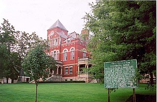
This is a list of the National Register of Historic Places listings in Fayette County, West Virginia.
Hopewell is an unincorporated community in Fayette County, West Virginia, United States. It lies at an elevation of 1480 feet.
Dixie is a census-designated place (CDP) in Fayette and Nicholas counties, West Virginia, United States. Dixie is located on West Virginia Route 16, 5.5 miles (8.9 km) north of Gauley Bridge. Dixie has a post office with ZIP code 25059. As of the 2010 census, its population was 291, with 202 residents in Nicholas County and 89 in Fayette County.
Mount Olive is an unincorporated community in Fayette County, West Virginia, United States. Mount Olive is 5.5 miles (8.9 km) north-northwest of Gauley Bridge. The town itself has no ZIP code; however, Mount Olive Correctional Complex, West Virginia's maximum-security state prison, is located near the town and has a post office with ZIP code 25185.
Beckwith is an unincorporated community in Fayette County, West Virginia, United States. Beckwith is located on West Virginia Route 16 and Laurel Creek, 4.1 miles (6.6 km) northwest of Fayetteville. Beckwith had a post office, which closed on October 3, 1998. The community has the name of P. D. Beckwith.
Hemlock is an unincorporated community in Jackson County, West Virginia, United States.
Brooklyn is an unincorporated community in Fayette County, West Virginia, United States. Their post office closed in 1966.
Sunnyside was an unincorporated community and coal town in Fayette County, West Virginia, United States.
Salem is an unincorporated community in Fayette County, West Virginia, United States. It was also known as New Salem or Oneal.


