
Harpers Ferry is a historic town in Jefferson County, West Virginia, in the lower Shenandoah Valley. The town's population was 269 at the 2020 United States census. Situated at the confluence of the Potomac and Shenandoah rivers, where Maryland, Virginia, and West Virginia meet, it is the easternmost town in West Virginia.

Charleston is the capital and most populous city of the U.S. state of West Virginia and the seat of Kanawha County. Located at the confluence of the Elk and Kanawha rivers, the city had a population of 48,864 at the 2020 census and an estimated population of 48,018 in 2021. The Charleston metropolitan area had 308,248 residents in 2020.

Jefferson County is located in the Shenandoah Valley in the Eastern Panhandle of West Virginia. It is the easternmost county of the U.S. state of West Virginia. As of the 2020 census, the population was 57,701. Its county seat is Charles Town. The county was founded in 1801, and today is part of the Washington metropolitan area.

Bluefield is a town in Tazewell County, Virginia, United States, located along the Bluestone River. The population was 5,096 at the 2020 census. It is part of the Bluefield WV-VA micropolitan area which has a population of 106,363 in 2020.

Hedgesville is a town in Berkeley County, West Virginia, United States, in the state's Eastern Panhandle region. The population was 318 at the 2010 census. The town sits on WV 9, roughly 13 miles east of Berkeley Springs. In addition to its legal definition, Hedgesville has come to be the common name for the large and sparsely inhabited area of West Virginia's Eastern Panhandle bordered by the Potomac River to the North and East, a southern border defined roughly by an imaginary line from the city of Martinsburg to the tip of Virginia, and Berkeley Springs to the West.

Romney is a town in and the county seat of Hampshire County, West Virginia, United States. The population was 1,722 at the 2020 census. It is part of the Winchester, Virginia metropolitan area. The town was established in 1762 along with Shepherdstown; together, they are the two oldest towns in West Virginia.

Moorefield is a town and the county seat of Hardy County, West Virginia, United States. It is located at the confluence of the South Branch Potomac River and the South Fork South Branch Potomac River. Moorefield was originally chartered in 1777; it was named for Conrad Moore, who owned the land upon which the town was laid out. The population was 2,527 at the 2020 census.
Charles Town is a city in and the county seat of Jefferson County, West Virginia, United States. The population was 6,534 at the 2020 census. The city is named for its founder Charles Washington, youngest brother of President George Washington. It is part of the northwestern fringes of the Washington metropolitan area.

Shepherdstown is a town in Jefferson County, West Virginia, United States, located in the lower Shenandoah Valley along the Potomac River. Home to Shepherd University, the town's population was 1,531 at the time of the 2020 census. The town was established in 1762 along with Romney; they are the oldest towns in West Virginia.

The eastern panhandle is one of the two panhandles in the U.S. state of West Virginia; the other is the northern panhandle. It is a small stretch of territory in the northeast of the state, bordering Maryland and Virginia. Some sources and regional associations only identify the eastern panhandle as being composed of Morgan, Berkeley, and Jefferson Counties. Berkeley and Jefferson Counties are geographically located in the Shenandoah Valley. West Virginia is the only U.S. state with two panhandles.
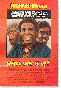
Which Way is Up? is a 1977 American comedy film starring Richard Pryor and directed by Michael Schultz. It is an American version of the 1972 Italian comedy film The Seduction of Mimi. Richard Pryor plays three roles: an orange picker who has two women at the same time, the orange picker's father, and a reverend who gets the orange picker's wife pregnant.

WMRE is a sports radio formatted broadcast radio station licensed to Charles Town, West Virginia, serving Charles Town and Jefferson County, West Virginia. WMRE is owned and operated by iHeartMedia.
Matteo Vanetta is a Swiss football coach and a former player. He was most recently head coach of Swiss Super League side BSC Young Boys.
Oliver Vanetta Lynn Jr., commonly known as Doolittle Lynn, was an American talent manager and country music figure, known as the husband of country music legend Loretta Lynn. Over the course of their often-tumultuous 48-year marriage, Lynn was instrumental in developing his wife's musical talent and country music career, purchasing her first guitar, lining up her first radio appearances, and serving as her de facto talent manager for many years. Lynn was also the President of Loretta Lynn Enterprises, Inc., a company formed in 1973 to take care of Lynn's businesses. He also worked on the farm he and his wife bought in 1966 and eventually opened as a tourist attraction. Lynn worked the land, and developed the first Loretta Lynn Rodeo in Goodlettsville in the early 1960s
Summertree is a 1971 American drama film directed by Anthony Newley, about a young man who drops out of university, falls in love with an older married woman, and contemplates dodging the draft to avoid serving in the Vietnam War. The screenplay was written by Edward Hume and Stephen Yafa, based on the 1967 play of the same name by Ron Cowen.
The coal towns, or "coal camps" of Fayette County, West Virginia were situated to exploit the area's rich coal seams. Many of these towns were located in deep ravines that afforded direct access to the coal through the hillsides, allowing mined coal to be dropped or conveyed downhill to railway lines at the valley floor. Many of these encampments were set up as company towns, and when their mines closed, the towns vanished. A few, like Thurmond, West Virginia, have survived in a reduced state. Fayette County covers portions of three coalfields: the New River Coalfield, the Kanawha Coalfield and the Greenbrier Coalfield. Below is a partial list of known coal towns within the three coalfields: the New River Coalfield, the Kanawha Coalfield and the Greenbrier Coalfield. More may be found here
The Lynden–Aldergrove Border Crossing connects the town of Lynden, Washington and Aldergrove, British Columbia on the Canada–US border. Washington State Route 539 on the American side joins British Columbia Highway 13 on the Canadian side.

Bowerstown is an unincorporated community in Washington Township, Warren County, New Jersey near the Morris Canal and the Pohatcong Creek. It was founded in 1829 by Jesse Vanetta and Michael B. Bowers with the building of an iron foundry. The Bowerstown Historic District, encompassing the village, was listed on the state and national registers of historic places in 1996.


