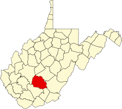
Glen Jean, West Virginia

Last updated
Glen Jean, West Virginia
USA West Virginia location map.svg
Red pog.svg
Glen Jean
Location within the state of West Virginia
Usa edcp location map.svg
Red pog.svg
Glen Jean
Glen Jean (the United States)
Coordinates: 37°55′35″N81°09′00″W / 37.92639°N 81.15000°W / 37.92639; -81.15000 Coordinates: 37°55′35″N81°09′00″W / 37.92639°N 81.15000°W / 37.92639; -81.15000
Country United States
State West Virginia
County Fayette
Area
[1]
  Total0.226 sq mi (0.59 km2)
  Land0.226 sq mi (0.59 km2)
  Water0 sq mi (0 km2)
Population
 (2010) [2]
  Total210
  Density930/sq mi (360/km2)
Time zone UTC-5 (Eastern (EST))
  Summer (DST) UTC-4 (EDT)

Glen Jean is a census-designated place (CDP) in Fayette County, West Virginia, United States, near Oak Hill. As of the 2010 census, its population is 210. [2]

The area had been known as White Oaks, but when the town was founded in the early 1870s the community was named for Jean McKell, the wife of landowner Thomas G. McKell. The town was a center for the coal mining industry and a railroad junction, formerly boasting an opera house, hotels and a company store. Much of the town has disappeared since the end of the coal boom. The chief remaining structure is the Bank of Glen Jean, listed on the National Register of Historic Places. [3] Glen Jean is the headquarters of New River Gorge National Park and Preserve, located across the street from the bank building, which now functions as a visitor contact center. Glen Jean is also home to the Boy Scouts of America's national high adventure base, The Summit Bechtel Reserve. [4]

The latitude of Glen Jean is 37.926 N. The longitude is 81.15 W. It is in the Eastern Time Zone. The elevation is 1,627 feet.

Nearby parks and recreation sites include the Bluestone National Scenic River, the Gauley River National Recreation Area, and the New River Gorge National Park and Preserve.

Related Research Articles

Raleigh County, West Virginia County in West Virginia, United States

Raleigh County is a county in the U.S. state of West Virginia. As of the 2010 census, the population was 78,859. Its county seat is Beckley. The county was founded in 1850 and is named for Sir Walter Raleigh. Raleigh County is included in the Beckley, West Virginia Metropolitan Statistical Area.

Fayette County, West Virginia County in West Virginia, United States

Fayette County is a county in the U.S. state of West Virginia. As of the 2010 census, the population was 46,039. Its county seat is Fayetteville. It is part of the Beckley, WV Metropolitan Statistical Area in Southern West Virginia.

Cañon City, Colorado City in Colorado, United States

The City of Cañon City is the home rule municipality that is the county seat and the most populous municipality of Fremont County, Colorado, United States. The city population was 17,141 at the 2020 United States Census. Cañon City is the principal city of the Cañon City, CO Micropolitan Statistical Area and is a part of the Front Range Urban Corridor. Cañon City straddles the easterly flowing Arkansas River and is a popular tourist destination for sightseeing, whitewater rafting, and rock climbing. The city is known for its many public parks, fossil discoveries, Skyline Drive, The Royal Gorge railroad, the Royal Gorge, and extensive natural hiking paths. In 1994, the United States Board on Geographic Names approved adding the tilde to the official name of Cañon City, a change from Canon City as the official name in its decisions of 1906 and 1975. It is one of the few U.S. cities to have the Spanish Ñ in its name, others being La Cañada Flintridge, California; Española, New Mexico; Peñasco, New Mexico; and Cañones, New Mexico.

Pocahontas, Virginia Town in Virginia, United States

Pocahontas is a town in Tazewell County, Virginia, United States. It was named for Chief Powhatan's daughter, Pocahontas, who lived in the 17th-century Jamestown Settlement. She married John Rolfe, and they were among the ancestors of many of the First Families of Virginia.

Madison, West Virginia City in West Virginia, United States

Madison is a city and former coal town in Boone County, West Virginia, United States. The population was 3,076 at the 2010 census. It is the county seat of Boone County.

Fayetteville, West Virginia Town in West Virginia, United States

Fayetteville is a town in and the county seat of Fayette County, West Virginia, United States. The population was 2,892 at the 2010 census.

Thurmond, West Virginia Town in West Virginia, United States

Thurmond is a town in Fayette County, West Virginia, United States, on the New River. The population was five at the 2010 census. During the heyday of coal mining in the New River Gorge, Thurmond was a prosperous town with a number of businesses and facilities for the Chesapeake and Ohio Railway.

East Bank, West Virginia Town in West Virginia, United States

East Bank is a town in Kanawha County, West Virginia, United States, situated along the Kanawha River. The population was 959 at the 2010 census. East Bank was incorporated in 1889 by special charter enacted by the West Virginia Legislature. It is so named on account of the town's location on the east side of the Kanawha River.

Alum Creek, West Virginia Census-designated place in West Virginia, United States

Alum Creek is a census-designated place (CDP) in Kanawha and Lincoln counties along the Coal River in the U.S. state of West Virginia. It includes the unincorporated communities of Alum Creek, Forks of Coal, and Priestley. The CDP had a population of 1,749 at the 2010 census, down from 1,839 at the 2000 census.

Richwood, West Virginia City in West Virginia, United States

Richwood is a city in Nicholas County, West Virginia, United States. In 2010, the census showed Richwood with a population of 2,051. During the 19th and early 20th century Richwood was a booming coal and lumber town. Richwood has a very rich history, including the formation of the Cherry River Navy civic organization to draw attention to issues important to the community. Richwood has also become known statewide as the "Ramp Capital of the World". Each year, in April, the city hosts a large festival that draws visitors from around the country.

New River Gorge Bridge

The New River Gorge Bridge is a steel arch bridge 3,030 feet (924 m) long over the New River Gorge near Fayetteville, West Virginia, in the Appalachian Mountains of the eastern United States. With an arch 1,700 feet (518 m) long, the New River Gorge Bridge was the world's longest single-span arch bridge for 26 years; it is now the fifth longest. Part of U.S. Route 19, its construction marked the completion of Corridor L of the Appalachian Development Highway System. An average of 16,200 motor vehicles cross the bridge each day.

New River (Kanawha River tributary) River in the Eastern United States

The New River is a river which flows through the U.S. states of North Carolina, Virginia, and West Virginia before joining with the Gauley River to form the Kanawha River at the town of Gauley Bridge, West Virginia. Part of the Ohio River watershed, it is about 360 miles (580 km) long.

New River Gorge National Park and Preserve American national park and nature preserve

The New River Gorge National Park and Preserve is a unit of the United States National Park Service (NPS) designed to protect and maintain the New River Gorge in southern West Virginia in the Appalachian Mountains. Established in 1978 as a national river and redesignated in 2020, the park and preserve stretches for 53 miles (85 km) from just downstream of Hinton to Hawks Nest State Park near Ansted. The park is rich in cultural and natural history, and offers an abundance of scenic and recreational opportunities. New River Gorge is home to some of the country's best whitewater rafting, mainly from the Cunard put-in to the Fayette Station take-out, and is also one of the most popular climbing areas on the East Coast.

Glen Ferris, West Virginia Census-designated place in West Virginia, United States

Glen Ferris is a census-designated place (CDP) on the western bank of the Kanawha River in Fayette County, West Virginia, United States. It is situated approximately one mile south of the town of Gauley Bridge. The sole highway linking Glen Ferris to the area is U.S. Route 60, known also as the Midland Trail. As of the 2010 census, its population was 203; the community had 104 housing units, 87 of which were occupied. The village is roughly a mile and a half in length. Glen Ferris is home to two churches, one Apostolic and one Methodist. A railway owned by Norfolk Southern runs parallel to US Route 60 through the village.

Kay Moor, West Virginia United States historic place

Kay Moor, also known as Kaymoor, is the site of an abandoned coal mine, coal-processing plant, and coal town near Fayetteville, West Virginia. The town site is located in the New River Gorge at Kaymoor Bottom (38°03′00″N81°03′17″W). It is linked to the mine portal 560 feet (170 m) above on Sewell Bench (38°02′52″N81°03′58″W) in the wall of the Gorge by conveyors.

Bank of Glen Jean United States historic place

The Bank of Glen Jean is located in the unincorporated community of Glen Jean, West Virginia. The bank was the financial center of a railroading, mining and financial conglomerate belonging to William McKell, son of Thomas G. and Jean McKell, the town's namesake. Built in 1909, the bank operated until 1939. It is now a visitor contact center for New River Gorge National Park and Preserve.

Nuttallburg Coal Mining Complex and Town Historic District United States historic place

The Nuttallburg Coal Mining Complex and Town Historic District is located near Winona, West Virginia in New River Gorge National Park and Preserve. The townsite is almost directly across from the Kay Moor mine and townsite, now abandoned. Like Kay Moor, the town is built around the railroad line at the bottom of the gorge, with an array of coke ovens and mining structures, as well as a bridge across the New River to South Nuttall.

Oak Hill Railroad Depot United States historic place

The Oak Hill Railroad Depot is a historic depot in Oak Hill, West Virginia, United States. The depot is located on the southwest corner of Virginia Avenue and Central Avenue. It opened as a station on the White Oak Railway in 1903 and later became part of the Virginian Railway, which it served until 1957. From this year until closure in 1983, it operated as a depot for the Norfolk and Western Railway. The depot now serves as the meeting place for the White Oak chapter of the National Railway Historical Society. It is the only remaining Virginian Railway depot in West Virginia.

Nuttallburg, West Virginia Unincorporated community in West Virginia, United States

Nuttallburg was an unincorporated community located in Fayette County, West Virginia, named by English pioneer John Nuttall who discovered coal in the area. Nuttallburg had a post office until 1955. It is no longer inhabited and is just outside Winona.

References

  1. "US Gazetteer files: 2010, 2000, and 1990". United States Census Bureau. February 12, 2011. Retrieved April 23, 2011.
  2. 1 2 "U.S. Census website". United States Census Bureau . Retrieved May 14, 2011.
  3. James C. Blankenship III and Michael J. Pauley (December 15, 1982). "National Register of Historic Places Inventory-Nomination: Bank of Glen Jean" (pdf). National Park Service.Cite journal requires |journal= (help)
  4. Chambers, S. Allen (2004). "Capital Center and South Central West Virginia". Buildings of West Virginia. Oxford University Press. p. 114. ISBN   0-19-516548-9.