
Independence is a town located in and the county seat of Grayson County, Virginia. At the 2020 U.S. census, it had a population of 1,001. It is situated on Virginia's Crooked Road, a heritage trail celebrating the musical heritage of Southwest Virginia.

Bluefield is a town in Tazewell County, Virginia, United States, located along the Bluestone River. The population was 5,096 at the 2020 census. It is part of the Bluefield WV-VA micropolitan area which has a population of 106,363 in 2020.
The following is a set–index article, providing a list of lists, for the cities, towns and villages within the jurisdictional United States. It is divided, alphabetically, according to the state, territory, or district name in which they are located.
Belva is an unincorporated community and census-designated place in west Nicholas County and north Fayette County, West Virginia, United States; while the CDP only includes the Nicholas County portion, the Fayette County portion is considered part of the community. The town is situated at the bottomland surrounding the convergence of Bells Creek with Twentymile Creek and, subsequently, Twenty Mile Creek with the Gauley River. Belva is also the location of the convergence of two state highways: West Virginia Route 16 and West Virginia Route 39.

Frank Pierce Milburn was a prolific American architect of the late 19th and early 20th centuries. His practice was primarily focused on public buildings, particularly courthouses and legislative buildings, although he also designed railroad stations, commercial buildings, schools and residences. Milburn was a native of Bowling Green, Kentucky who practiced as an architect in Louisville from 1884 to 1889; Kenova, West Virginia 1890–1895; Charlotte, North Carolina; Columbia, South Carolina; and Washington, D.C. after 1904. From 1902 Milburn was architect for the Southern Railway.
Dickinson, also known as Quincy, is an unincorporated community in Kanawha County, West Virginia, United States. Dickinson is located on the north bank of the Kanawha River, 3 miles (4.8 km) southeast of Belle. The community is served by U.S. Route 60.
Beury is an unincorporated community and coal town in Fayette County, West Virginia, United States.
Gamoca is an unincorporated community and coal town in Fayette County, West Virginia, United States.
Concho is an unincorporated community and coal town in Fayette County, West Virginia, United States. It used to be known as Thurmond Mountain. The name Concho is derived from the Concho River, in Texas.
Carbondale is an unincorporated community and coal town in Fayette County, West Virginia, United States.
Rush Run was an unincorporated community and coal town in Fayette County, West Virginia, United States.
Dimmock is an unincorporated community and coal town in Fayette County, West Virginia, United States.
Caperton is an unincorporated community and coal town in Fayette County, West Virginia, United States. It was also known as Elen.
Ward is an unincorporated community and coal town in Kanawha County, West Virginia, United States. Its post office is closed. Ward is approximately 3 miles (4.8 km) northeast of Cedar Grove, along Kellys Creek.
Dunloup or Dunloop is an unincorporated community and coal town in Fayette County, West Virginia, United States.
Boone was an unincorporated community in Fayette County, West Virginia, United States.
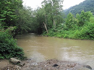
Paint Creek is a 42.1-mile (67.8 km) tributary of the Kanawha River in southern West Virginia. Paint Creek is part of the Mississippi River watershed via the Kanawha and Ohio Rivers and drains an area of 123 square miles (320 km2).
Glade is an unincorporated community in Fayette County, West Virginia, United States. It was also known as Paw Paw.
Milburn Creek is a stream in the U.S. state of West Virginia.


