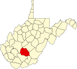
Dunloup, West Virginia | |
|---|---|
| Coordinates: 37°52′27″N81°9′16″W / 37.87417°N 81.15444°W | |
| Country | United States |
| State | West Virginia |
| County | Fayette |
| Elevation | 1,647 ft (502 m) |
| Time zone | UTC-5 (Eastern (EST)) |
| • Summer (DST) | UTC-4 (EDT) |
| GNIS ID | 1554338 [1] |
Dunloup or Dunloop is an unincorporated community and coal town in Fayette County, West Virginia, United States.
The community derives its name from nearby Dunloup Creek. [2]


