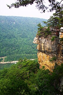
The Potomac River is found within the Mid-Atlantic region of the United States and flows from the Potomac Highlands into the Chesapeake Bay. The river is approximately 405 miles (652 km) long, with a drainage area of about 14,700 square miles (38,000 km2). In terms of area, this makes the Potomac River the fourth largest river along the East Coast of the United States and the 21st largest in the United States. Over 5 million people live within the Potomac watershed.

Sturgeon Township is a township in Saint Louis County, Minnesota, United States. The population was 140 at the 2010 census.

The Souhegan River is a tributary of the Merrimack River in the northeastern United States. It is 33.8 miles (54.4 km) long, with a drainage area of 171 sq mi (440 km2), and flows north and east through southern New Hampshire to the Merrimack River. The river begins in New Ipswich, New Hampshire, at the junction of the river's South Branch and West Branch. Flowing northeast, it passes through the center of Greenville and descends through a narrow valley to Wilton, where it turns east. The river valley broadens below Wilton, and the river passes through the center of Milford, crosses the southern portion of Amherst, and enters the town of Merrimack. Shortly upstream of the town center, the river passes over Wildcat Falls, then crosses under the Everett Turnpike and U.S. Route 3 to reach the Merrimack River.

Sturgeon is the common name for the 27 species of fish belonging to the family Acipenseridae. The earliest sturgeon fossils date to the Late Cretaceous, and are descended from other, earlier acipenseriform fish who date back to the Triassic period some 245 to 208 million years ago. The family is grouped into four genera: Acipenser, Huso, Scaphirhynchus and Pseudoscaphirhynchus. Two species may be extinct in the wild, and one may be entirely extinct. Two closely related species, Polyodon spathula and Psephurus gladius are of the same order, Acipenseriformes, but are in the family Polyodontidae and are not considered to be "true" sturgeons. Both sturgeons and paddlefish have been referred to as "primitive fishes" because their morphological characteristics have remained relatively unchanged since the earliest fossil record. Sturgeons are native to subtropical, temperate and sub-Arctic rivers, lakes and coastlines of Eurasia and North America.

West Nipissing is a municipality in Northeastern Ontario, Canada, on Lake Nipissing in the Nipissing District. It was formed on January 1, 1999, with the amalgamation of seventeen and a half former town, villages, townships and unorganized communities.

Sturgeon County is a municipal district in Alberta's Edmonton Metropolitan Region, Canada.

The Atlantic sturgeon is a member of the family Acipenseridae and along with other sturgeon it is sometimes considered a living fossil. The Atlantic sturgeon is one of two subspecies of A. oxyrinchus, the other being the Gulf sturgeon. The main range of the Atlantic sturgeon is in eastern North America, extending from New Brunswick, Canada, to the eastern coast of Florida, United States. A disjunct population occurs in the Baltic region of Europe. The Atlantic sturgeon was in great abundance when the first European settlers came to North America, but has since declined due to overfishing, water pollution, and habitat impediments such as dams. It is considered threatened, endangered, and even locally extinct in many of its original habitats. The fish can reach 60 years of age, 15 ft (4.6 m) in length and over 800 lb (360 kg) in weight.
The Panhandle Trail is a rail trail in southern Pennsylvania and the Northern Panhandle of West Virginia. It occupies an abandoned railroad corridor that had been known as the Panhandle route which has been converted to a bicycle and walking trail. The rail line between Burgettstown and Weirton was closed in 1991, but Burgettstown to Walkers Mill closed in 1995. The original section of the trail is the West Virginia section, where the trail was called the Harmon Creek Trail, for the adjacent Harmon Creek. When Pennsylvania built its section, both states agreed to call it the Panhandle Trail. Although the Panhandle Trail occupies 29 miles of the Panhandle Route, the remaining portion of the route is owned by the Pittsburgh and Ohio Central Railroad, but it is no longer used.

The life zones of West Virginia allow for a diversity of habitats for fauna, varying from large lowland farming valleys bordered with forest and meadow to highland ridge flats and heavy forestland, some with rocky ridge-line peaks. The "Mountain State" harbors at least 56 species and subspecies of mammals. The state has more than 300 types of birds and more than 100 species of fish.

Center Branch Wildlife Management Area is located on 975 acres (395 ha) in Harrison County near Stonewood, West Virginia. The WMA is located on a former strip mine site, and contains several flat benches and high walls. Second growth oak-hickory and mixed hardwoods forests cover much of the land.

Sturgeon River may refer to any of the following streams in the U.S. state of Michigan:

Sturgeon River is a 40.8-mile-long (65.7 km) river in the U.S. state of Michigan, flowing mostly northward through Otsego and Cheboygan counties.
Sturgeon River is a 63.6-mile-long (102.4 km) river in the U.S. state of Michigan, flowing mostly southward through Alger County and Delta County counties on the Upper Peninsula.

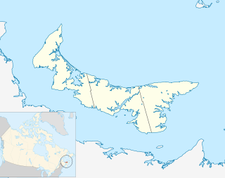
The Sturgeon River is a river in the Atlantic Ocean drainage basin in Kings County in eastern Prince Edward Island, Canada.
Bourbon Township is one of ten townships in Boone County, Missouri, USA. As of the 2012, its population was 2,729. The township's major city is the railroad town of Sturgeon.


