Elverton, West Virginia

Last updated

Elverton, West Virginia
Elverton WV Apr 15 2019 - 00001 47.jpg
USA West Virginia location map.svg
Red pog.svg
Elverton
Usa edcp location map.svg
Red pog.svg
Elverton
Coordinates: 38°1′40″N81°2′4″W / 38.02778°N 81.03444°W / 38.02778; -81.03444
Country United States
State West Virginia
County Fayette
Elevation
1,010 ft (310 m)
Time zone UTC-5 (Eastern (EST))
  Summer (DST) UTC-4 (EDT)
GNIS ID 1554397 [1]

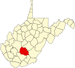
Elverton is an unincorporated community and coal town in Fayette County, West Virginia, United States.

Contents

See also

Related Research Articles

<span class="mw-page-title-main">Harpers Ferry, West Virginia</span> Town in West Virginia, United States

Harpers Ferry is a historic town in Jefferson County, West Virginia, in the lower Shenandoah Valley. The town's population was 269 at the 2020 United States census. Situated at the confluence of the Potomac and Shenandoah rivers, where Maryland, Virginia, and West Virginia meet, it is the easternmost town in West Virginia.

<span class="mw-page-title-main">Charleston, West Virginia</span> Capital city of West Virginia, U.S.

Charleston is the capital and most populous city of the U.S. state of West Virginia and the seat of Kanawha County. Located at the confluence of the Elk and Kanawha rivers, the city had a population of 48,864 at the 2020 census and an estimated population of 48,018 in 2021. The Charleston metropolitan area had 308,248 residents in 2020.

<span class="mw-page-title-main">Jefferson County, West Virginia</span> County in West Virginia, United States

Jefferson County is located in the Shenandoah Valley in the Eastern Panhandle of West Virginia. It is the easternmost county of the U.S. state of West Virginia. As of the 2020 census, the population was 57,701. Its county seat is Charles Town. The county was founded in 1801, and today is part of the Washington metropolitan area.

<span class="mw-page-title-main">Bluefield, Virginia</span> Town in Virginia, United States

Bluefield is a town in Tazewell County, Virginia, United States, located along the Bluestone River. The population was 5,096 at the 2020 census. It is part of the Bluefield WV-VA micropolitan area which has a population of 106,363 in 2020.

<span class="mw-page-title-main">Hedgesville, West Virginia</span> Town in West Virginia, United States

Hedgesville is a town in Berkeley County, West Virginia, United States, in the state's Eastern Panhandle region. The population was 318 at the 2010 census. The town sits on WV 9, roughly 13 miles east of Berkeley Springs. In addition to its legal definition, Hedgesville has come to be the common name for the large and sparsely inhabited area of West Virginia's Eastern Panhandle bordered by the Potomac River to the North and East, a southern border defined roughly by an imaginary line from the city of Martinsburg to the tip of Virginia, and Berkeley Springs to the West.

<span class="mw-page-title-main">Romney, West Virginia</span> Town in West Virginia, United States

Romney is a town in and the county seat of Hampshire County, West Virginia, United States. The population was 1,722 at the 2020 census. It is part of the Winchester, Virginia metropolitan area. The town was established in 1762 along with Shepherdstown; together, they are the two oldest towns in West Virginia.

<span class="mw-page-title-main">Moorefield, West Virginia</span> Town in West Virginia, United States

Moorefield is a town and the county seat of Hardy County, West Virginia, United States. It is located at the confluence of the South Branch Potomac River and the South Fork South Branch Potomac River. Moorefield was originally chartered in 1777; it was named for Conrad Moore, who owned the land upon which the town was laid out. The population was 2,527 at the 2020 census.

<span class="mw-page-title-main">Charles Town, West Virginia</span> City in West Virginia, United States

Charles Town is a city in and the county seat of Jefferson County, West Virginia, United States. The population was 6,534 at the 2020 census. The city is named for its founder Charles Washington, youngest brother of President George Washington. It is part of the northwestern fringes of the Washington metropolitan area.

<span class="mw-page-title-main">Shepherdstown, West Virginia</span> Town in West Virginia, United States

Shepherdstown is a town in Jefferson County, West Virginia, United States, located in the lower Shenandoah Valley along the Potomac River. Home to Shepherd University, the town's population was 1,531 at the time of the 2020 census. The town was established in 1762 along with Romney; they are the oldest towns in West Virginia.

<span class="mw-page-title-main">Chapmanville, West Virginia</span> Town in West Virginia, United States

Chapmanville is a town in Logan County, West Virginia, United States. The population was 1,025 at the 2020 census. Chapmanville is named for Ned Chapman, an early settler who operated a store and post office. It was incorporated in 1947.

<span class="mw-page-title-main">Berkeley Springs, West Virginia</span> Town in West Virginia, United States

Berkeley Springs is a town in, and the county seat of, Morgan County, West Virginia, United States, in the state's eastern panhandle. Berkeley Springs is also commonly used to refer to the area in and around the Town of Bath. In 1776, the Virginia Legislature incorporated a town around the springs and named it Bath. Since 1802, it has been referred to by the name of its original post office, Berkeley Springs. The population was 758 at the 2020 census. It is part of the Hagerstown–Martinsburg metropolitan area.

<span class="mw-page-title-main">Eastern panhandle of West Virginia</span> Place

The eastern panhandle is one of the two panhandles in the U.S. state of West Virginia; the other is the northern panhandle. It is a small stretch of territory in the northeast of the state, bordering Maryland and Virginia. Some sources and regional associations only identify the eastern panhandle as being composed of Morgan, Berkeley, and Jefferson Counties. Berkeley and Jefferson Counties are geographically located in the Shenandoah Valley. West Virginia is the only U.S. state with two panhandles.

<span class="mw-page-title-main">WMRE</span> Radio station in Charles Town, West Virginia

WMRE is a sports radio formatted broadcast radio station licensed to Charles Town, West Virginia, serving Charles Town and Jefferson County, West Virginia. WMRE is owned and operated by iHeartMedia.

<span class="mw-page-title-main">Index of West Virginia–related articles</span>

The following is an alphabetical list of articles related to the U.S. state of West Virginia.

Whipple is an unincorporated community in Fayette County, West Virginia, United States. Whipple is located on West Virginia Route 612, 1.5 miles (2.4 km) southwest of Oak Hill.

<span class="mw-page-title-main">2012 United States presidential election in West Virginia</span>

The 2012 United States presidential election in West Virginia took place on November 6, 2012, as part of the 2012 United States presidential election in which all 50 states plus the District of Columbia participated. West Virginia voters chose five electors to represent them in the Electoral College via a popular vote pitting incumbent Democratic President Barack Obama and his running mate, Vice President Joe Biden, against Republican challenger and former Massachusetts Governor Mitt Romney and his running mate, Congressman Paul Ryan.

The coal towns, or "coal camps" of Fayette County, West Virginia were situated to exploit the area's rich coal seams. Many of these towns were located in deep ravines that afforded direct access to the coal through the hillsides, allowing mined coal to be dropped or conveyed downhill to railway lines at the valley floor. Many of these encampments were set up as company towns, and when their mines closed, the towns vanished. A few, like Thurmond, West Virginia, have survived in a reduced state. Fayette County covers portions of three coalfields: the New River Coalfield, the Kanawha Coalfield and the Greenbrier Coalfield. Below is a partial list of known coal towns within the three coalfields: the New River Coalfield, the Kanawha Coalfield and the Greenbrier Coalfield. More may be found here

<span class="mw-page-title-main">Norton, Buckland and Stone</span> Human settlement in England

Norton, Buckland and Stone is a small rural civil parish 1 mile (1.6 km) east of Teynham and 3 miles (4.8 km) west of the centre of Faversham in the borough of Swale, Kent, England. It is bypassed by the M2 to the south and traverses the historic A2, on the route of the Roman road of Watling Street.

References