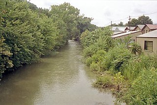
New Creek is an 18.4-mile-long (29.6 km) stream in eastern West Virginia, United States. It is the third major West Virginia tributary to the North Branch Potomac River. Via the Potomac, it is part of the watershed of Chesapeake Bay.

Three Churches is an unincorporated community in Hampshire County in the U.S. state of West Virginia. The town is located north of Romney along Jersey Mountain Road at a crossroads with Three Churches Hollow Road. Originally known as Jersey Mountain, Three Churches was renamed for the three historic white wooden churches located there: Mount Bethel Church, Mount Bethel Primitive Baptist Church, and Branch Mountain United Methodist Church. The Three Churches Post Office is no longer in service.

Wappocomo is an unincorporated community in Hampshire County in the U.S. state of West Virginia. The community is located south of Springfield on West Virginia Route 28 at Hanging Rocks along the South Branch Potomac River. Wappocomo has also historically been referred to as The Rocks, Wapocoma, and Wapocomo.
Vanderlip is an unincorporated community in Hampshire County in the U.S. state of West Virginia. Vanderlip is located west of Romney along the Northwestern Turnpike and the South Branch Valley Railroad. At times the community was referred to as West Romney Station, while its post office used the name Vanderlip, after a Baltimore and Ohio Railroad executive. The "heart" of Vanderlip is centered between Vanderlip Drive and Ozark Hill Road.

Upper Tract is an unincorporated community in Pendleton County, West Virginia, United States.
Barnum is an unincorporated community and coal town in Mineral County, West Virginia, United States. It is part of the Cumberland, MD-WV Metropolitan Statistical Area. Barnum lies on the North Branch Potomac River along a line of the Western Maryland Railroad no longer in operation. Barnum has excellent trout fishing along its banks and offers many opportunities for anglers.
Asco is an unincorporated community located in McDowell County, West Virginia, United States. Asco was originally known as Atlantic. The current name derives from the American Smokeless Coal Company (ASCO). It lies at the end of a line of the Norfolk and Western Railroad in Davy Branch hollow.
Saulsville is an unincorporated community in Wyoming County, West Virginia, United States that has a population of about 140. Saulsville is where Twin Falls State Park is located. Saulsville has a gas station and is also home to the Wyoming County branch of Southern West Virginia Community College, a Logan County based 2 year community college.
Missouri Branch is an unincorporated community in Wayne County, West Virginia, United States. Missouri Branch is located on West Virginia Route 152, 13 miles (21 km) southeast of Fort Gay.
Dry Branch is an unincorporated community in Kanawha County, West Virginia, United States. Dry Branch is 3 miles (4.8 km) southwest of East Bank, along Cabin Creek. Dry Branch has a post office with ZIP code 25061.
Twin Branch is an unincorporated community in McDowell County, West Virginia, United States. Twin Branch is 1 mile (1.6 km) west-southwest of Davy. It was founded by Henry Ford as a mining community.
Pie is an unincorporated community in Mingo County, West Virginia, United States. Pie is located on U.S. Route 52 along Pigeon Creek; the community lies along the road for 3 miles (4.8 km), from Horsepen Mountain to Grants Branch. According to Pie's 1933 postmaster, the community was named for Leander Blankenship, a resident "who really like[d] pie, regardless of kind".
Packsville is an unincorporated community in Raleigh County, West Virginia, United States. Packsville is located on the Little Marsh Fork, 4.4 miles (7.1 km) south-southeast of Sylvester.
Long Branch is an unincorporated community in Fayette County, West Virginia, United States. Long Branch is located near the West Virginia Turnpike, 1.1 miles (1.8 km) northwest of Pax. Long Branch had a post office, which closed on October 3, 1998.
Island Branch is an unincorporated community located in Kanawha County, West Virginia, United States.
Ingram Branch is an unincorporated community located in Fayette County, West Virginia, United States.
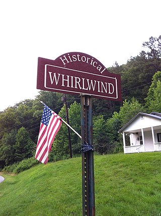
Whirlwind is an unincorporated community on Big Harts Creek in Logan County, West Virginia, United States.
Atenville is an unincorporated community in Lincoln County, West Virginia, United States. It is a residential community located in Harts Creek District and is part of the Harts census-designated place.
Packs Branch may refer to:
Packs Branch is a stream in the U.S. state of West Virginia.


