Donwood, West Virginia

Last updated
Donwood, West Virginia
Unincorporated community
USA West Virginia location map.svg
Red pog.svg
Donwood
Usa edcp location map.svg
Red pog.svg
Donwood
Coordinates: 38°9′44″N81°19′55″W / 38.16222°N 81.33194°W / 38.16222; -81.33194 Coordinates: 38°9′44″N81°19′55″W / 38.16222°N 81.33194°W / 38.16222; -81.33194
Country United States
State West Virginia
Counties Kanawha, Fayette
Elevation 738 ft (225 m)
Time zone Eastern (EST) (UTC-5)
  Summer (DST) EDT (UTC-4)
FIPS code 1554319 [1]

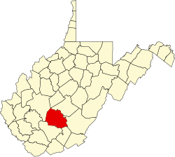
Donwood is an unincorporated community and coal town in Kanawha and Fayette counties, West Virginia, United States.

Unincorporated area Region of land not governed by own local government

In law, an unincorporated area is a region of land that is not governed by a local municipal corporation; similarly an unincorporated community is a settlement that is not governed by its own local municipal corporation, but rather is administered as part of larger administrative divisions, such as a township, parish, borough, county, city, canton, state, province or country. Occasionally, municipalities dissolve or disincorporate, which may happen if they become fiscally insolvent, and services become the responsibility of a higher administration. Widespread unincorporated communities and areas are a distinguishing feature of the United States and Canada. In most other countries of the world, there are either no unincorporated areas at all, or these are very rare; typically remote, outlying, sparsely populated or uninhabited areas.

A coal town, also known as a coal camp or patch is typically situated in a remote place and provides residences for a population of miners to reside near a coal mine. A coal town is a type of company town or mining community established by the employer, a mining company, which imports workers to work the mineral find. The 'town founding' process is not limited to coal mining, nor mining, but is generally found where mineral wealth is located in a remote or undeveloped area, which is then opened for exploitation, normally first by having some transportation infrastructure brought into being first. Often, such minerals were the result of logging operations by pushing into a wilderness forest, which clear-cutting operations then allowed geologists and cartographers, to chart and plot the lands, allowing efficient discovery of natural resources and their exploitation.

Kanawha County, West Virginia County in the United States

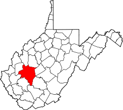
Kanawha County is a county in the U.S. state of West Virginia. As of the 2010 census, the population was 193,063, making it West Virginia's most populous county. Its county seat is Charleston, the state capital.

Related Research Articles

Ohio River river in the midwestern United States

The Ohio River is a 981-mile (1,579 km) long river in the midwestern United States that flows southwesterly from western Pennsylvania south of Lake Erie to its mouth on the Mississippi River at the southern tip of Illinois. It is the second largest river by discharge volume in the United States and the largest tributary by volume of the north-south flowing Mississippi River that divides the eastern from western United States. The river flows through or along the border of six states, and its drainage basin includes parts of 15 states. Through its largest tributary, the Tennessee River, the basin includes several states of the southeastern U.S. It is the source of drinking water for three million people.

Virginia Woolf British writer

Adeline Virginia Woolf was an English writer, considered one of the most important modernist 20th-century authors and also a pioneer in the use of stream of consciousness as a narrative device.

West Virginia State of the United States of America

West Virginia is a state located in the Appalachian region in the Southern United States and is also considered to be a part of the Middle Atlantic States. It is bordered by Pennsylvania to the north, Maryland to the east and northeast, Virginia to the southeast, Kentucky to the southwest, and Ohio to the northwest. West Virginia is the 41st largest state by area, and is ranked 38th in population. The capital and largest city is Charleston.

Charleston, West Virginia Capital of West Virginia

Charleston is the most populous city in, and the capital of, the U.S. state of West Virginia. Located at the confluence of the Elk and Kanawha rivers, the population during the 2017 Census Estimate was 47,929. The Charleston metropolitan area as a whole had 214,406 residents. Charleston is the center of government, commerce, and industry for Kanawha County, of which it is the county seat.

Shenandoah Valley valley and cultural region of western Virginia and the Eastern Panhandle of West Virginia in the United States

The Shenandoah Valley is a geographic valley and cultural region of western Virginia and the Eastern Panhandle of West Virginia in the United States. The valley is bounded to the east by the Blue Ridge Mountains, to the west by the eastern front of the Ridge-and-Valley Appalachians, to the north by the Potomac River and to the south by the James River. The cultural region covers a larger area that includes all of the valley plus the Virginia highlands to the west, and the Roanoke Valley to the south. It is physiographically located within the Ridge and Valley province and is a portion of the Great Appalachian Valley.

West Virginia University public university in Morgantown, West Virginia, United States

West Virginia University (WVU) is a public, land-grant, space-grant, research-intensive university in Morgantown, West Virginia, United States. Its other campuses include the West Virginia University Institute of Technology in Beckley and Potomac State College of West Virginia University in Keyser; and a second clinical campus for the University's medical and dental schools at Charleston Area Medical Center in Charleston. WVU Extension Service provides outreach with offices in all of West Virginia's 55 counties. Since 2001, WVU has been governed by the West Virginia University Board of Governors.

Bendale Neighbourhood in Toronto, Ontario, Canada

Bendale, also called Cedarbrae, is a residential neighbourhood in the eastern part of Toronto, Ontario, Canada. It is located in the former suburb of Scarborough. It is centred on the intersection of Lawrence Avenue East and Brimley Road. Its boundaries, as defined by the City, are Midland Avenue from Lawrence, north to Highway 401, east to McCowan, south to Lawrence, east to West Highland Creek, south-west along West Highland Creek, then follow several side streets parallel to the Creek, north to Midland Avenue. The area north of Ellesmere is typically considered the Scarborough City Centre district, and is not considered in this neighbourhood article.

<i>Com Lag (2plus2isfive)</i> 2004 EP by Radiohead

Com Lag (2plus2isfive) is a compilation EP by the English rock band Radiohead, released in March 2004 in Japan and Australia. It collects many of the B-sides from the singles from their sixth album, Hail to the Thief (2003), along with remixes by Cristian Vogel and Four Tet and a live performance of the 2003 single "2 + 2 = 5".

Stanley Donwood British artist

Stanley Donwood is the pen name of English artist and writer Dan Rickwood. Since 1994, he has created all the artwork for the rock band Radiohead, with singer Thom Yorke. He also creates artwork for Yorke's solo albums and Yorke's band Atoms for Peace.

National Register of Historic Places listings in West Virginia Wikimedia list article

This is a list of properties and historic districts in West Virginia that are listed on the National Register of Historic Places. There are listings in every one of West Virginia's 55 counties.

Huntington–Ashland metropolitan area Metropolitan area in the United States

The Huntington–Ashland metropolitan area is the largest metropolitan statistical area in West Virginia and includes seven counties across three states: West Virginia, Kentucky, and Ohio. New definitions from February 28, 2013 placed the population at 361,580. The MSA is nestled along the banks of the Ohio River within the Appalachian Plateau region. The area is referred to locally as the "Tri-State area". In addition, the three largest cities are referred to as the River Cities.

West Virginia Mountaineers mens basketball

The West Virginia Mountaineers men's basketball team represents West Virginia University in NCAA Division I college basketball competition. They are a member of the Big 12 Conference. WVU has won 13 conference tournament championships, and has 29 appearances in the NCAA Tournament, including two Final Fours, most recently in 2010. The Mountaineers have also appeared in 16 National Invitation Tournaments, and have won two championships, in 1942 and 2007.

<i>Dead Children Playing</i> book by Stanley Donwood

Dead Children Playing is a picture book by Stanley Donwood and Thom Yorke featuring artwork that has been used on English alternative rock band Radiohead's albums between 1996 and 2003, and on Thom Yorke's album The Eraser. The book also contains works of art that have not previously been released, made between 1999 and 2005.

Lucky (Radiohead song) song by Radiohead

"Lucky" is a song by Radiohead from their third studio album OK Computer (1997), released as a single exclusively in France in December 1997.

<i>The King of Limbs</i> 2011 studio album by Radiohead

The King of Limbs is the eighth studio album by the English rock band Radiohead, self-released on 18 February 2011 as a download. CD and 12" vinyl versions were released on 28 March 2011 through XL Recordings in the United Kingdom, TBD Records in the United States, and Hostess Entertainment in Japan.

Donwood may refer to:

References