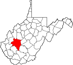
Apgah, West Virginia

Last updated

Apgah, West Virginia
USA West Virginia location map.svg
Red pog.svg
Apgah
Location in West Virginia and the United States
Usa edcp location map.svg
Red pog.svg
Apgah
Apgah (the United States)
Coordinates: 38°25′31″N81°18′9″W / 38.42528°N 81.30250°W / 38.42528; -81.30250
Country United States
State West Virginia
County Kanawha
Elevation
1,289 ft (393 m)
Time zone UTC-5 (Eastern (EST))
  Summer (DST) UTC-4 (EDT)
GNIS ID 1742028 [1]

Apgah was an unincorporated community in Kanawha County, West Virginia, United States. Its post office [2] is closed.

Related Research Articles

<span class="mw-page-title-main">Williams River (West Virginia)</span> River in West Virginia, United States

The Williams River is a tributary of the Gauley River, 33 miles (53 km) long, in east-central West Virginia, USA. Via the Gauley, Kanawha and Ohio Rivers, it is part of the watershed of the Mississippi River, draining an area of 132 square miles (342 km²) in a sparsely populated region of the southern Allegheny Mountains and the unglaciated portion of the Allegheny Plateau.

Jonben is an unincorporated community and coal town within the Winding Gulf Coalfield and is located within Raleigh County, West Virginia, United States.

Rada is an unincorporated community in Hampshire County in the U.S. state of West Virginia. Rada is located on U.S. Highway 220/West Virginia Route 28 between Junction and Purgitsville in southwest Hampshire County along Mill Creek. It lies at an intersection of US 220/WV 28 with Rada Road.

East Beckley was an unincorporated community located in Raleigh County, West Virginia. Its post office was reopened in February 2014. East Beckley comprised parts of the unincorporated communities of Sylvia and Atkinsville.

<span class="mw-page-title-main">Five Forks, Calhoun County, West Virginia</span> Unincorporated community in West Virginia, United States

Five Forks is an unincorporated community in Calhoun County, West Virginia, United States. It lies along West Virginia Route 16 to the north of the town of Grantsville, the county seat of Calhoun County. Its elevation is 1,106 feet (337 m). The Five Forks Post Office is closed.

Dobra is an unincorporated community in Logan County on West Virginia Route 17, West Virginia, United States. Their post office has been closed.

Lico is an unincorporated community and coal town in Kanawha County, West Virginia, United States. It was also known as Meisters and Sequio. Its post office is closed.

Olcott is an unincorporated community and coal town in Kanawha County, West Virginia, United States. Its post office is closed.

Ronda is an unincorporated community and coal town in Kanawha County, West Virginia, United States, along Cabin Creek. Its post office is closed.

Gazil was an unincorporated community in Kanawha County, West Virginia, United States. Its post office has been closed.

Heatherman was an unincorporated community in Kanawha County, West Virginia, United States. Its post office has been closed.

Mound was an unincorporated community in Kanawha County, West Virginia, United States. Its post office is closed.

Pentacre is an unincorporated community in Kanawha County, West Virginia, United States. Its post office is closed.

Rosina was an unincorporated community in Kanawha County, West Virginia, United States. Its post office is closed.

Sattes is an unincorporated community in Kanawha County, West Virginia, United States. Its post office is closed.

Weir is an unincorporated community in Kanawha County, West Virginia, United States. Its post office is called Falling Rock.

Copenhaver was an unincorporated community in Kanawha County, West Virginia, United States. Its post office is closed.

Rensford is an unincorporated community in Kanawha County, West Virginia, United States. Its post office is closed. It was also known as Point Lick.

Wevaco is an unincorporated community and former coal town in Kanawha County, West Virginia, United States. It had a post office but is now closed.

References