Rand, West Virginia

Last updated

Rand
RAND, WV., WITH MUCH OF ITS POPULATION LIVING IN POVERTY, HAS MANY UNPAVED ROADS, SUBSTANDARD HOUSES, AND JUNKED... - NARA - 551001.jpg
Street scene in Rand in the 1970s
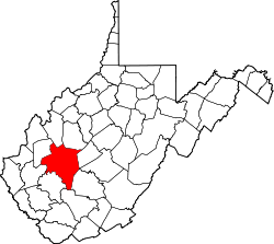
Kanawha County West Virginia incorporated and unincorporated areas Rand highlighted.svg
Location in Kanawha County and state of West Virginia.
Coordinates: 38°16′57″N81°33′44″W / 38.28250°N 81.56222°W / 38.28250; -81.56222
Country United States
State West Virginia
County Kanawha
Area
[1]
  Total0.461 sq mi (1.19 km2)
  Land0.461 sq mi (1.19 km2)
  Water0 sq mi (0 km2)
Population
 (2010) [2]
  Total1,631
  Density3,500/sq mi (1,400/km2)
Time zone UTC-5 (Eastern (EST))
  Summer (DST) UTC-4 (EDT)

Rand is a census-designated place (CDP) on the Kanawha River in Kanawha County, West Virginia, United States. As of the 2010 census, its population was 1,631. [2] It is surrounded by the communities of Malden and DuPont City.
Contents

History

The unincorporated community within the historic Kanawha Salines area, was named after Plus Rand Levi, son of Mordecai Levi, patent holder of the Brick Road. Originally named "Plus" in 1907–1909 when large tract was purchased from Dickinson family. But due to a town already called plus, the community would become known as Levi until around the 1930s or 1940s where it would change again due to a town in Braxton county already named Levi, thus adopting the current name of Rand. [3] [4]

Notable people

Pro Football Hall of Fame wide receiver and ESPN analyst Randy Moss was born and raised in Rand, as well as Samuel Singleton Jr, a former minor league baseball player. [5] [6]

The ESPN Films production Rand University, which chronicled Moss’ journey from Rand to the National Football League, was largely filmed in Rand; the title refers to the area behind the town’s only hangout spot, a 7-Eleven store where many locals openly drink alcohol behind the store’s dumpsters. [6]

Related Research Articles

<span class="mw-page-title-main">Charleston, West Virginia</span> Capital city of West Virginia, U.S.

Charleston is the capital and most populous city of the U.S. state of West Virginia and the seat of Kanawha County. Located at the confluence of the Elk and Kanawha rivers, the city had a population of 48,864 at the 2020 census and an estimated population of 48,018 in 2021. The Charleston metropolitan area as a whole had an estimated 255,020 residents in 2021.

<span class="mw-page-title-main">Mason County, West Virginia</span> County in West Virginia, United States

Mason County is a county in the U.S. state of West Virginia. As of the 2020 census, the population was 25,453. Its county seat and largest city is Point Pleasant. The county was founded in 1804 and named for George Mason, delegate to the U.S. Constitutional Convention. Before the Civil War, the county was in the State of Virginia.

<span class="mw-page-title-main">Kanawha County, West Virginia</span> County in West Virginia, United States

Kanawha County is a county in the U.S. state of West Virginia. As of the 2020 census, the population was 180,745, making it West Virginia's most populous county. The county seat is Charleston, which is also the state capital. Kanawha County is part of the Charleston, WV Metropolitan Statistical Area.

<span class="mw-page-title-main">Fayette County, West Virginia</span> County in West Virginia, United States

Fayette County is a county in the U.S. state of West Virginia. As of the 2020 census, the population was 40,488. Its county seat is Fayetteville. It is part of the Beckley, WV Metropolitan Statistical Area in Southern West Virginia.

<span class="mw-page-title-main">Floyd County, Virginia</span> County in Virginia, United States

Floyd County is a county located in the Commonwealth of Virginia. As of the 2020 census, the population was 15,476. Its county seat is the town of Floyd. Floyd County is included in the Blacksburg-Christiansburg, VA Metropolitan Statistical Area. Named after Virginia politician John Floyd, the county was established in 1831. The county is located on the high plateau of the Blue Ridge Mountains and surrounded by the Little River. In the 1960s and 1970s, Floyd proved popular with people in the era's counterculture, particularly those who wanted to live in closer contact with nature.

<span class="mw-page-title-main">Belle, West Virginia</span> Town in West Virginia, United States

Belle is a town in Kanawha County, West Virginia, United States, situated along the Kanawha River. The population was 1,171 at the 2020 census. Belle was incorporated on December 13, 1958 by the Kanawha County Circuit Court. It is the home of the Belle Bulldogs Elementary School.

<span class="mw-page-title-main">East Bank, West Virginia</span> Town in West Virginia, United States

East Bank is a town in Kanawha County, West Virginia, United States, situated along the Kanawha River. The population was 820 at the 2020 census. East Bank was incorporated in 1889 by special charter enacted by the West Virginia Legislature. It is so named on account of the town's location on the east side of the Kanawha River.

<span class="mw-page-title-main">Sissonville, West Virginia</span> Census-designated place in West Virginia, United States

Sissonville is a census-designated place (CDP) in Kanawha County, West Virginia, United States, along the Pocatalico River. The population was 4,028 at the 2010 census. Sissonville is located within 14 miles of Charleston, the state capital.

<span class="mw-page-title-main">Alum Creek, West Virginia</span> Census-designated place in West Virginia, United States

Alum Creek is a census-designated place (CDP) in Kanawha and Lincoln counties along the Coal River in the U.S. state of West Virginia. It includes the unincorporated communities of Alum Creek, Forks of Coal, and Priestley. The CDP had a population of 1,749 at the 2010 census, down from 1,839 at the 2000 census.

<span class="mw-page-title-main">Parkersburg, West Virginia</span> City in West Virginia, United States

Parkersburg is a city in and the county seat of Wood County, West Virginia. Located at the confluence of the Ohio and Little Kanawha rivers, it is the state's fourth-largest city and the center of the Parkersburg–Vienna metropolitan area. The city's population was 29,749 at the 2020 census, and its metro population was 89,490. The city is about 14 miles (23 km) south of Marietta, Ohio.

<span class="mw-page-title-main">Montgomery, West Virginia</span> City in West Virginia

Montgomery is a city in West Virginia, along the Kanawha River. Most of the city is in Fayette County, with the remainder in Kanawha County. The population was 1,280 at the 2020 census.

<span class="mw-page-title-main">Nitro, West Virginia</span> City in West Virginia, United States

Nitro is a city in Kanawha and Putnam counties in the U.S. state of West Virginia. It takes its name from a World War I era nitrocellulose plant. The population was 6,618 according to the 2020 census. It is part of the Charleston metropolitan area.

<span class="mw-page-title-main">Deep Water, West Virginia</span> Census-designated place in West Virginia, United States

Deep Water, also known historically as Deepwater, is a census-designated place on the Kanawha River in Fayette County, West Virginia, United States. As of the 2010 census, its population was 280. It is best known as the starting point of the Deepwater Railway founded in 1898 by William N. Page, which was merged to create the Virginian Railway in 1907.

Malden — originally called Kanawha Salines — is an unincorporated community in Kanawha County, West Virginia, United States, within the Charleston metro area.

<span class="mw-page-title-main">Big Chimney, West Virginia</span> Census-designated place in West Virginia, United States

Big Chimney is a census-designated place (CDP) located on U.S. Route 119 in Kanawha County, West Virginia, United States. As of the 2010 census, its population was 627. It is accessible by West Virginia Route 114 or exit 5 from I-79. The center of town includes a Hardee's, a Walgreens, Hardware and grocery store, along with a few smaller businesses. The town is named after the tall chimney of the local salt works, which was a prominent landmark.

Lewis Ruffner was an American merchant, magistrate, slaveowner and politician who helped found the state of West Virginia. Originally a salt manufacturer in the Kanawha Salines, Ruffner served several terms in the Virginia House of Delegates representing Kanawha County before resigning as he became the company's agent in Louisville, Kentucky, but returned to Virginia in 1857. Although a slaveowner with relatives who fought for the Confederacy, Ruffner became a prominent Unionist, represented Kanawha County during the Wheeling Conventions, initial West Virginia Constitutional Convention, and first West Virginia House of Delegates during the American Civil War. Fellow legislators named him Major General of the state's militia in 1863, but he declined to accept a commission in the Union Army because salt manufacture was also crucial to the war effort. After the war, General Ruffner suffered a debilitating injury trying to avert a mob attack and became known as a mentor of Booker T. Washington, his former houseboy.

The Kanawha Division was a Union Army division which could trace its origins back to a brigade originally commanded by Jacob D. Cox. This division served in western Virginia and Maryland and was at times led by such famous personalities as George Crook and Rutherford B. Hayes.

<span class="mw-page-title-main">Shrewsbury, West Virginia</span> Census-designated place in West Virginia, United States

Shrewsbury is a census-designated place (CDP) and unincorporated community in Kanawha County, West Virginia, United States. Shrewsbury is located on the north bank of the Kanawha River along U.S. Route 60. As of the 2010 census, its population was 652.

<span class="mw-page-title-main">Cooper District, Mason County, West Virginia</span> Magisterial district in West Virginia, United States

Cooper Magisterial District is one of ten magisterial districts in Mason County, West Virginia, United States. The district was originally established as a civil township in 1863, and converted into a magisterial district in 1872. In 2020, Cooper District was home to 1,700 people.

References

  1. "US Gazetteer files: 2010, 2000, and 1990". United States Census Bureau. February 12, 2011. Retrieved April 23, 2011.
  2. 1 2 "U.S. Census website". United States Census Bureau . Retrieved May 14, 2011.
  3. Kenny, Hamill (1945). West Virginia Place Names: Their Origin and Meaning, Including the Nomenclature of the Streams and Mountains. Piedmont, WV: The Place Name Press. p. 493.
  4. Year: 1940; Census Place: Malden, Kanawha, West Virginia; Roll: T627_4416; Page: 32B; Enumeration District: 20-111
  5. Bieler, Des (November 12, 2014). "What we learned from ESPN's '30 for 30′ on Randy Moss". The Washington Post. Retrieved March 27, 2016.
  6. 1 2 McGarry, Tim (September 17, 2012). "Randy Moss remembers his roots with Rand University". USA Today. Retrieved March 27, 2016.