Coalburg, West Virginia | |
|---|---|
| Coordinates: 38°12′27″N81°27′33″W / 38.20750°N 81.45917°W | |
| Country | United States |
| State | West Virginia |
| County | Kanawha |
| Elevation | 640 ft (200 m) |
| Time zone | UTC-5 (Eastern (EST)) |
| • Summer (DST) | UTC-4 (EDT) |
| Area codes | 304 & 681 |
| GNIS feature ID | 1554162 [1] |
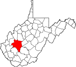
Coalburg is an unincorporated community in Kanawha County, West Virginia, United States. Coalburg is located along the south bank of the Kanawha River, west of East Bank.
The William H. & William S. Edwards House and Good Shepherd Church were listed on the National Register of Historic Places in 1990. [2]


