Standard, West Virginia

Last updated
Standard, West Virginia
USA West Virginia location map.svg
Red pog.svg
Standard
Usa edcp location map.svg
Red pog.svg
Standard
Coordinates: 38°08′10″N81°24′02″W / 38.13611°N 81.40056°W / 38.13611; -81.40056 Coordinates: 38°08′10″N81°24′02″W / 38.13611°N 81.40056°W / 38.13611; -81.40056
Country United States
State West Virginia
County Kanawha
Elevation
686 ft (209 m)
Time zone UTC-5 (Eastern (EST))
  Summer (DST) UTC-4 (EDT)
Area code(s) 304 & 681
GNIS feature ID1547325 [1]

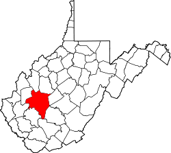
Standard is an unincorporated community in Kanawha County, West Virginia, United States. The community is located near Exit 74 on the West Virginia Turnpike (Interstates 64 and 77) north of the Fayette County line.

Related Research Articles

West Virginia State of the United States of America

West Virginia is a state in the Appalachian and Mid-Atlantic regions of the Southern United States. It is bordered by Pennsylvania to the northeast, Maryland to the east and northeast, Virginia to the southeast, Kentucky to the southwest, and Ohio to the northwest. West Virginia is the 41st-largest state by area and ranks 38th in population, with around 1.791 million residents. The capital and largest city is Charleston.

Summers County, West Virginia U.S. county in West Virginia

Summers County is a county located in the U.S. state of West Virginia. As of the 2010 census, the population was 13,927. Its county seat is Hinton. The county was created by an act of the West Virginia Legislature on February 27, 1871 from parts of Fayette, Greenbrier, Mercer and Monroe counties and named in honor of George W. Summers (1804–68).

Pendleton County, West Virginia U.S. county in West Virginia

Pendleton County is a county located in the U.S. state of West Virginia. As of the 2010 census, the population was 7,695, making it the fifth-least populous county in West Virginia. Its county seat is Franklin. The county was created by the Virginia General Assembly in 1788 from parts of Augusta, Hardy, and Rockingham Counties and was named for Edmund Pendleton (1721–1803), a distinguished Virginia statesman and jurist. Pendleton County was strongly pro-Confederate during the American Civil War; however, there were pockets of Unionists who supported the state government in Wheeling.

Nicholas County, West Virginia U.S. county in West Virginia

Nicholas County is a county located in the central region of U.S. state of West Virginia. As of the 2010 census, the population was 26,233. Its county seat is Summersville. The county was created in 1818 by the Virginia General Assembly and named for Virginia Governor Wilson Cary Nicholas.

McDowell County, West Virginia U.S. county in West Virginia

McDowell County is a county in the U.S. state of West Virginia. As of the 2010 census, the population was 22,113. Its county seat is Welch. McDowell County is the southernmost county in the state. It was created in 1858 by the Virginia General Assembly and named for Virginia Governor James McDowell. It became a part of West Virginia in 1863, when several counties seceded from the state of Virginia during the American Civil War.

Logan County, West Virginia U.S. county in West Virginia

Logan County is a county in the U.S. state of West Virginia. As of the 2010 census, the population was 36,743. Its county seat is Logan. Logan County comprises the Logan, WV Micropolitan Statistical Area, which is also included in the Charleston–Huntington–Ashland, WV–OH–KY Combined Statistical Area.

Greenbrier County, West Virginia U.S. county in West Virginia

Greenbrier County is a county in the U.S. state of West Virginia. As of the 2010 census, the population was 35,480. Its county seat is Lewisburg. The county was formed in 1778 from Botetourt and Montgomery counties in Virginia.

Gilmer County, West Virginia U.S. county in West Virginia

Gilmer County is a county in the U.S. state of West Virginia. As of the 2010 census, the population was 8,693. Its county seat is Glenville. The county was formed in 1845 from parts of Lewis and Kanawha Counties, and named for Thomas Walker Gilmer, Governor of Virginia from 1840 to 1841. Gilmer was later a representative in the United States Congress and Secretary of the Navy in President John Tyler's cabinet.

Winchester, VA–WV MSA

Winchester, VA–WV MSA is a U.S. metropolitan statistical area (MSA) as defined by the United States Office of Management and Budget (OMB) as of June, 2003. This should not be confused with the City of Winchester, Virginia, the most populous community within this MSA. The population of the MSA as the 2015 U.S. Census Bureau estimates is 133,836.

Hot Coal, West Virginia Unincorporated community in West Virginia, United States

Hot Coal or Hotcoal was an unincorporated community and coal town located along the Winding Gulf Creek in Raleigh County, West Virginia, United States. Originally, it was named Patterson and later acquired the name Hot Coal. It was the next community past Big Stick on County Route 3/2. Although, the community now no longer exists, the Winding Gulf Bank, now the National Bank at Beckley, resided at Hot Coal and was moved to Beckley on January 1, 1914. Hot Coal at one time had a Post Office

Belva, West Virginia Census-designated place in West Virginia, United States

Belva is an unincorporated community and census-designated place in west Nicholas County and north Fayette County, West Virginia, United States; while the CDP only includes the Nicholas County portion, the Fayette County portion is considered part of the community. The town is situated at the bottomland surrounding the convergence of Bells Creek with Twentymile Creek and, subsequently, Twenty Mile Creek with the Gauley River. Belva is also the location of the convergence of two state highways: West Virginia Route 16 and West Virginia Route 39.

Amigo, West Virginia Unincorporated community in West Virginia, United States

Amigo is an unincorporated community in Raleigh County, West Virginia, United States. The community is located on West Virginia Route 16 at the confluence of the Guyandotte River and Winding Gulf. The Amigo Post Office closed on 10/22/2011, it was established in 1915

Dixie, Nicholas County, West Virginia Census-designated place in West Virginia, United States

Dixie is a census-designated place (CDP) in Fayette and Nicholas counties, West Virginia, United States. Dixie is located on West Virginia Route 16 5.5 miles (8.9 km) north of Gauley Bridge. Dixie has a post office with ZIP code 25059. As of the 2010 census, its population was 291, with 202 residents in Nicholas County and 89 in Fayette County.

Beckwith, West Virginia Unincorporated community in West Virginia, United States

Beckwith is an unincorporated community in Fayette County, West Virginia, United States. Beckwith is located on West Virginia Route 16 and Laurel Creek 4.1 miles (6.6 km) northwest of Fayetteville. Beckwith had a post office, which closed on October 3, 1998. The community has the name of P. D. Beckwith.

Harvey, West Virginia Unincorporated community in West Virginia, United States

Harvey is an unincorporated community in Fayette County, West Virginia, United States. Harvey is located on County Route 25 2.8 miles (4.5 km) south-southeast of Oak Hill.

Long Branch, Fayette County, West Virginia Unincorporated community in West Virginia, United States

Long Branch is an unincorporated community in Fayette County, West Virginia, United States. Long Branch is located near the West Virginia Turnpike 1.1 miles (1.8 km) northwest of Pax. Long Branch had a post office, which closed on October 3, 1998.

Mead, West Virginia Unincorporated community in West Virginia, United States

Mead is an unincorporated community in Raleigh County, West Virginia, United States. Mead is located on County Route 33 and Stonecoal Creek 2.7 miles (4.3 km) east-northeast of Rhodell. Mead had a post office, which closed on June 10, 1989. It was also known as Vanwood.

Quinnimont, West Virginia Unincorporated community in West Virginia, United States

Quinnimont is an unincorporated community in Fayette County, West Virginia, United States. Quinnimont is located on West Virginia Route 41 near the New River, 7.1 miles (11.4 km) east-southeast of Mount Hope. Quinnimont had a post office, which opened on February 23, 1874, and closed on February 1, 1997.

References

  1. "US Board on Geographic Names". United States Geological Survey. 2007-10-25. Retrieved 2008-01-31.