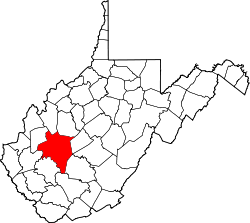
Copenhaver, West Virginia

Last updated

Copenhaver, West Virginia
USA West Virginia location map.svg
Red pog.svg
Copenhaver
Location in West Virginia and the United States
Usa edcp location map.svg
Red pog.svg
Copenhaver
Copenhaver (the United States)
Coordinates: 38°25′52″N81°31′19″W / 38.43111°N 81.52194°W / 38.43111; -81.52194
Country United States
State West Virginia
County Kanawha
Elevation
650 ft (200 m)
Time zone UTC-5 (Eastern (EST))
  Summer (DST) UTC-4 (EDT)
GNIS ID 1741871 [1]

Copenhaver was an unincorporated community in Kanawha County, West Virginia, United States. Its post office [2] is closed.

The community was named after the local Copenhaver family. [3]

References

  1. U.S. Geological Survey Geographic Names Information System: Copenhaver, West Virginia
  2. U.S. Geological Survey Geographic Names Information System: Copenhaver WV post office
  3. Kenny, Hamill (1945). West Virginia Place Names: Their Origin and Meaning, Including the Nomenclature of the Streams and Mountains. Piedmont, WV: The Place Name Press. p. 184.