Hugheston, West Virginia

Last updated

Hugheston, West Virginia
USA West Virginia location map.svg
Red pog.svg
Hugheston
Usa edcp location map.svg
Red pog.svg
Hugheston
Coordinates: 38°12′34″N81°22′21″W / 38.20944°N 81.37250°W / 38.20944; -81.37250
Country United States
State West Virginia
County Kanawha
Area
[1]
  Total15.4 sq mi (40 km2)
  Land15.4 sq mi (40 km2)
  Water0 sq mi (0 km2)
Elevation
636 ft (194 m)
Population
 (2000) [1] [2]
  Total569
  Density36.95/sq mi (14.27/km2)
Time zone UTC-5 (Eastern (EST))
  Summer (DST) UTC-4 (EDT)
ZIP code
25110
Area code(s) 304 & 681
GNIS feature ID1554756 [3]

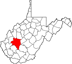
Hugheston is an unincorporated community in Kanawha County, West Virginia, United States. Hugheston is located on the north bank of the Kanawha River across from Pratt. Hugheston has a post office with ZIP code 25110. [4] The average household income is $32,436. [2]

The community most likely derives its name from Robert Hughes, a local pioneer who was kidnapped by Native Americans. [5]

Historian and author Otis K. Rice was born in Hugheston on June 6, 1919. Rice was named West Virginia’s first Historian Laureate in 2003. [6]

Related Research Articles

<span class="mw-page-title-main">Tornado, West Virginia</span> Census-designated place in West Virginia, United States

Tornado, also called Upper Falls, is a census-designated place (CDP) in Kanawha County, West Virginia, United States.

Kimberly is a census-designated place (CDP) in Fayette County, West Virginia, United States. It is located along Armstrong Creek shortly before it enters the Kanawha River. As of the 2010 census, its population was 287. It is in zip code 25118.

Creston is an unincorporated community in southeastern Wirt County, West Virginia, United States. It lies at the confluence of the Little Kanawha River and the West Fork Little Kanawha River on West Virginia Route 5, southeast of the town of Elizabeth, the county seat of Wirt County. Its elevation is 653 feet (199 m). Creston had a post office, which closed on June 25, 2011. The community was named for a drainage divide near the town site.

Advent is an unincorporated community in southeastern Jackson County, West Virginia, United States. It lies along Advent Road southeast of the city of Ripley, the county seat of Jackson County, and near Jackson County's borders with Kanawha and Roane counties. Its elevation is 791 feet (241 m). Advent had a post office, which closed on December 25, 2010.

Scott Depot is an unincorporated community in Putnam County, West Virginia, United States. Located along Crooked Creek, it is part of the census-designated place of Teays Valley, which is a part of the Huntington–Ashland metropolitan area. The ZIP code is 25560.

Cleveland is an unincorporated community in Webster County, West Virginia, United States. Cleveland is located 17 miles (27 km) north of Webster Springs on West Virginia Route 20, along the Right Fork Little Kanawha River. Cleveland has a post office with ZIP code 26215.

Kanawha Head is an unincorporated community in Upshur County, West Virginia, United States. Kanawha Head is located on West Virginia Route 20, 16.5 miles (26.6 km) south-southwest of Buckhannon. Kanawha Head had a post office with ZIP code 26228.

Hansford is an unincorporated community in Kanawha County, West Virginia, United States. Hansford is located along the Kanawha River and West Virginia Route 61, adjacent to Pratt. Hansford has a post office with ZIP code 25103.

<span class="mw-page-title-main">Mount Carbon, West Virginia</span> Census-designated place in West Virginia, United States

Mount Carbon is a census-designated place (CDP) in Fayette County, West Virginia, United States. Mount Carbon is located along West Virginia Route 61, 3 miles (4.8 km) southeast of Montgomery, on the south bank of the Kanawha River at the mouth of Armstrong Creek. Mount Carbon has a post office with ZIP code 25139. As of the 2010 census, its population was 428.

<span class="mw-page-title-main">Boomer, West Virginia</span> Census-designated place in West Virginia, United States

Boomer is a census-designated place (CDP) in Fayette County, West Virginia, United States. Boomer is located on the north bank of the Kanawha River, 2 miles (3.2 km) southeast of Smithers. Boomer has a post office with ZIP code 25031. As of the 2010 census, its population was 615.

Kanawha Falls is an unincorporated community in Fayette County, West Virginia, United States. Kanawha Falls is located on the east bank of the Kanawha River, 2 miles (3.2 km) southwest of Gauley Bridge and 0.6 miles (0.97 km) downstream from the waterfall of the same name. Kanawha Falls had a post office, which opened on March 26, 1856, and closed on November 2, 2002.

Dawes is an unincorporated community in Kanawha County, West Virginia, United States. Dawes is 5 miles (8.0 km) south of East Bank along Cabin Creek. Dawes has a post office with ZIP code 25054.

Miami is an unincorporated community in Kanawha County, West Virginia, United States. Miami is 4.5 miles (7.2 km) south of East Bank along Cabin Creek. Miami has a post office with ZIP code 25134.

Dry Branch is an unincorporated community in Kanawha County, West Virginia, United States. Dry Branch is 3 miles (4.8 km) southwest of East Bank, along Cabin Creek. Dry Branch has a post office with ZIP code 25061.

Falling Rock is an unincorporated community in Kanawha County, West Virginia, United States. Falling Rock is located at the confluence of Falling Rock Creek with the Elk River 3 miles (4.8 km) southwest of Clendenin along US Route 19. Falling Rock has a post office with ZIP code 25079.

Tad is an unincorporated community in Kanawha County, West Virginia, United States. Tad is 7.5 miles (12.1 km) east of Charleston. Tad has a post office with ZIP code 25201.

Hernshaw is an unincorporated community in Kanawha County, West Virginia, United States. Hernshaw is located on West Virginia Route 94, 2.5 miles (4.0 km) southwest of Marmet, along Lens Creek. Hernshaw has a post office with ZIP code 25107.

Pond Gap is an unincorporated community in Kanawha County, West Virginia, United States. Pond Gap is 7 miles (11 km) north-northeast of Smithers. Pond Gap has a post office with ZIP code 25160.

Dixie is a census-designated place (CDP) in Fayette and Nicholas counties, West Virginia, United States. Dixie is located on West Virginia Route 16, 5.5 miles (8.9 km) north of Gauley Bridge. Dixie has a post office with ZIP code 25059. As of the 2010 census, its population was 291, with 202 residents in Nicholas County and 89 in Fayette County.

Winifrede is an unincorporated community in Kanawha County, West Virginia, United States. Winifrede is 2.5 miles (4.0 km) southwest of Chesapeake. Winifrede has a post office with ZIP code 25214. It is home of the Big Eagle Railroad, one of the oldest short-line railroad operations in the United States, having been in existence since 1850. The Winifrede Railroad was incorporated in November 1881 and opened in 1882; the original operation was closed in 1988 and reopened as the Big Eagle Railroad in 2000–01.

References

  1. 1 2 "Hugheston, WV 25110" . Retrieved June 19, 2010.
  2. 1 2 "MCDC Demographic Profile 3, 2000 Census - HUGHESTON (Mo Census Data Center)". Archived from the original on August 27, 2014. Retrieved June 19, 2010.
  3. "US Board on Geographic Names". United States Geological Survey. October 25, 2007. Retrieved January 31, 2008.
  4. ZIP Code Lookup
  5. Kenny, Hamill (1945). West Virginia Place Names: Their Origin and Meaning, Including the Nomenclature of the Streams and Mountains. Piedmont, WV: The Place Name Press. p. 316.
  6. "e-WV | The West Virginia Encyclopedia". www.wvencyclopedia.org. Retrieved September 30, 2021.